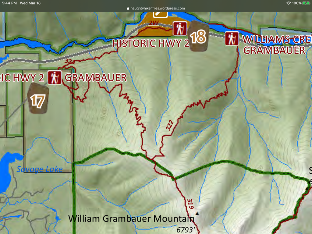
WILLIAM GRAMBAUER MT. 6793’ TRAIL #319
EVENT TYPE: Day hiking, backpacking
DISTANCE: 14 miles RT
ELEVATION: 4900 verts
DIFFICULTY: Very strenuous
MAPS: K.N.F., Kootenai Falls topo
GPS: 48°12’11” N 115°44’66” W
Three Rivers Ranger District 406.295.4693
LINCOLN COUNTY SHERIFF: CALL 911 FIRST or 406.293.4112
DISTANCE: 14 miles RT
ELEVATION: 4900 verts
DIFFICULTY: Very strenuous
MAPS: K.N.F., Kootenai Falls topo
GPS: 48°12’11” N 115°44’66” W
Three Rivers Ranger District 406.295.4693
LINCOLN COUNTY SHERIFF: CALL 911 FIRST or 406.293.4112
DESCRIPTION:
The William Brambauer Mountain sits on the northern edge of the wilderness, and towers over 5300’ above the Kootenai River.
Although the trailhead is on private property, the USFS has an easement so the trail can cross private land.
At about a mile up the trail, there are rock ledges that offer views all around. The trail switchbacks dozens of times on its relentless climb of 3000’ to a ridge that levels out for almost two miles, until the summit comes into view to the south. From here, the trail edges along side a forest burn that occurred in 1994.
Once on top, the views are spectacular all around. One of the advantages to summiting this mountain is the view south down the 35 miles of the Cabinet Mountain Wilderness.
DIRECTIONS:
About 4 miles southeast of Troy near milepost 35 is a turnoff northeast on a gravel road marked “Old Highway 2”. Drive about 1.5 miles to the trailhead.
HAZARDS:
No water source up high.
Did you read that this hike is 4900 vertical feet to the top?
That means its 4900’ down.
Seemingly endless switchbacks on very steep terrain.
Did you read that this hike is 4900 vertical feet to the top?
That means its 4900’ down.
Seemingly endless switchbacks on very steep terrain.
COOL THINGS CLOSE BY:
Cedar Lakes, Kootenai Falls, Ross Creek Cedars, and Scenery Mountain.
R & P:
Henry’s, Rosauers, & Pizza Hut in Libby. Squeeze Inn, Clark Fork Pantry in Clark Fork. Eicharts, Mr. Sub & Jalapeño in Sandpoint
PLAN YOUR TRIP:
Click for Current NOAA Weather Conditions
PHOTO GALLERY