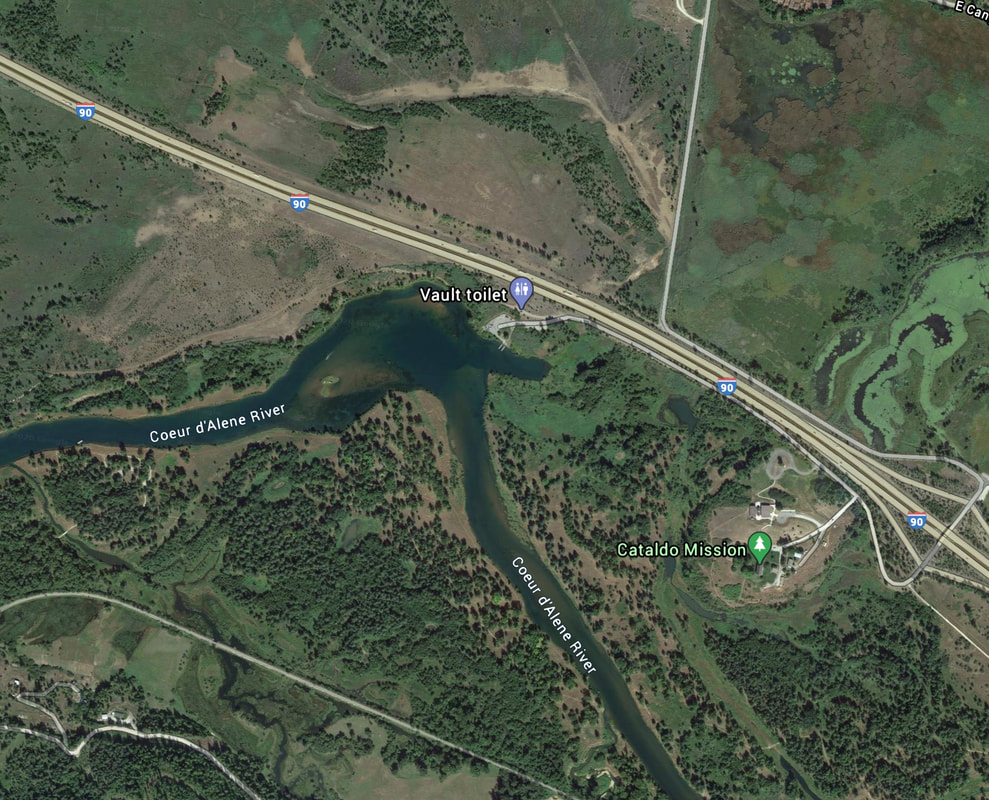
OLD MISSION LAUNCH
PADDLE DISTANCE: varies
ELEVATION: 2133’
LENGTH AND ACREAGE: varies
MAPS: IPNF., Kingston topo
LAUNCH GPS: 47°33’08” NNE 116°22’00” W
ELEVATION: 2133’
LENGTH AND ACREAGE: varies
MAPS: IPNF., Kingston topo
LAUNCH GPS: 47°33’08” NNE 116°22’00” W
DESCRIPTION:
The CDA River Launch is located next to I-90 at the Old Mission S.P. If you paddle up stream, you may run into shallow waters just below the I-90 bridge. If you make it above the rapids, it’s pretty smooth sailing for a mile or more, depending on the water level.
if you paddle down stream, be sure to have a shuttle. Paddling up against the current can take all your energy.
The launch has one ramp and plenty of parking.
Don’t forget to visit the Old Mission while you are in the area.
if you paddle down stream, be sure to have a shuttle. Paddling up against the current can take all your energy.
The launch has one ramp and plenty of parking.
Don’t forget to visit the Old Mission while you are in the area.
ATTRACTIONS
Quiet river paddling with few houses make for a secluded experience. Be aware, the shore line has been eroded to the point that there are few places to land. Most of the beaches are on private property, so please be respectful.
DIRECTIONS:
From CDA, drive east on I-90 to the Old Mission State Park exit. Turn right into the park, and right again onto the Dredge Road, to the end of the road.
COOL THINGS CLOSE BY:
Cataldo, the Old Mission S.P., the Chain Lakes along side the river, all the way to Harrison, Idaho. Rose Lake, Killarney Lake, Swan Lake, Cave Lake, Medicine Lake, Black Lake, Blue Lake, Thompson Lake, Anderson Lake, and the Harrison Slough are all part of the Chain Lakes.
R & P:
Radio Brewery in Kellogg. Moon Time, Mexican Food Factory, Franklins Hoagies, and the Trail’s End Brewery in CDA


