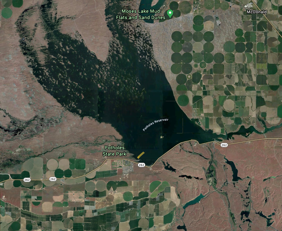
POTHOLES RESERVOIR
PADDLE DISTANCE: varies
ELEVATION: 1041’
LENGTH AND ACREAGE: Varies
MAPS: Moses Lake S.
LAUNCH GPS: Potholes State Park 46°58’54” N 119°20’52” W Perch Point Launch. 46°59’50’ N 119°16’1” W
GRANT COUNTY SHERIFF: 911 or 509.754.2011
ELEVATION: 1041’
LENGTH AND ACREAGE: Varies
MAPS: Moses Lake S.
LAUNCH GPS: Potholes State Park 46°58’54” N 119°20’52” W Perch Point Launch. 46°59’50’ N 119°16’1” W
GRANT COUNTY SHERIFF: 911 or 509.754.2011
DESCRIPTION:
WE HAVE ADDED THE AREAS SHERIFF’S EMERGENCY PHONE NUMBERS FOR EACH TRIP WRITE UP UNDER THE RANGER DISTRICT INFO. IF AN EMERGENCY OCURRS, EVALUATE YOUR CIRCUMSTANCES AND CALL ONLY IF NEEDED.
The Potholes Reservoir has dozens of paddle routes to wonder thru. This area shows the incredible effect that Glacier Lake Missoula Floods has on the landscape.
The Potholes Reservoir has dozens of paddle routes to wonder thru. This area shows the incredible effect that Glacier Lake Missoula Floods has on the landscape.
ATTRACTIONS
All year long this reservoir is a bird watching paradise. White Egrets, when in migration, are everywhere in mass.
DIRECTIONS:
Drive west on I-90 to Moses Lake and turn left (SE) onto Hwy 17 to Hwy 262. Turn right (West) and drive past Mar Don R.V. Resort for about 1 mile to the Blythe Public Access Launch.
COOL THINGS CLOSE BY:
Columbia Wildlife Refuge, Columbia River, and Hanford Reach National Monument.
R & P:
NA


