PADDLE DISTANCE: varies ELEVATION: 2128’ LENGTH AND ACREAGE: varies MAPS: LAUNCH GPS: 47°26’49” N 116°48’53” W
DESCRIPTION:
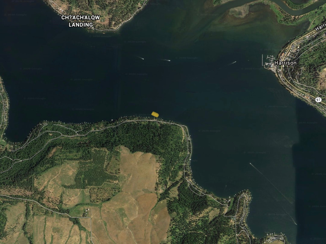
This launch is across the lake from Harrison, Idaho, and offers different views and access to Harrison without all the boats at the Harrison launch. immediately, you are out into the body of the lake.
ATTRACTIONS
Less traffic at the launch, Fast access to the main body of CDA Lake, and the CDA River is directly across the lake.
DIRECTIONS:
Drive south over the Spokane River on Hwy 95 to Worley, Idaho. Turn left at 26.3 miles onto the S. Cave Bay Road, for .5 miles, and turn Right onto W. Cottonwood Road to 1737 W. Cottonwood Road.
COOL THINGS CLOSE BY:
Windy Bay, Harrison, Idaho, the CDA River outlet, and the Chain Lakes up the CDA River
R & P:
Trails End Brewery, Franklins, Moon Time,and Mexican Food Factory