EVENT TYPE: Day hiking, backpacking, scrambling, camping DISTANCE: 2.4 miles RT to Cliff Lake ELEVATION GAIN: From McDonald Lake ( TH) to Cliff Lake is 533 verts. Cliff Lake to Eagle Cliff Peak 1629 verts DIFFICULTY: Easy to Cliff Lake Strenuous to Eagle Cliff Peak MAPS: Lolo N.F., Torino Peak topo GPS: Trailhead...47°08’53” N 115°10’24” W Cliff Lake..47°08’28” N 115°01’12” W Eagle Cliff Peak...47°06’46” N 115°11’09” W Superior Ranger District: 406.822.4233 MINERAL COUNTY SHERIFF: CALL911 FIRST or 406.822.3555
DESCRIPTION:
WE HAVE ADDED THE AREAS SHERIFF’S EMERGENCY PHONE NUMBERS FOR EACH TRIP WRITE UP UNDER THE RANGER DISTRICT INFO. IF AN EMERGENCY OCURRS, EVALUATE YOUR CIRCUMSTANCES AND CALL ONLY IF NEEDED. Whether before or after the hike, be sure to check out the falls below the parking area. Trail #100 follows along side Diamond Lake for one mile to Cliff Lake. About half way up is a foot bridge and a nice cascade to photograph. As you catch the the first views of Cliff Lake and Eagle Cliff Peak, you will be amazed at its sheer mountain face. If you go here in the fall, you will enjoy the bright yellow colors of the Tamaracks on the road to the trailhead.
OPTION #1:
After spending some time enjoying the lake, hike south to a gap to the SE of the peak. The peak is about 1629’ above the lake on a steep“trail" that you should not be miss. The views from atop Eagle Cliff are worth the climb.
DIRECTIONS:
From Interstate 90 take the Dry Creek exit #43 turn south on the Dry Creek Frontage Road 69. Follow Road 69 to the junction of Dry Creek Road 342. Turn west onto the Dry Creek Road and drive 9.5 miles to the junction of Diamond Lake Road 7843. Turn south and drive 4.1 miles to Diamond Lake. There is ample parking in this area. Trail #100 starts on the west side of the bridge.
HAZARDS:
The route to Eagle Cliff Peak is very steep, but way too fun.
COOL THINGS CLOSE BY:
Heart Lake, Little Joe Slide, Ward & Eagle Peaks.
R & P:
Pizza Factory, 1313 Club and Muchaho’s Tacos in Wallacem Radio Brewing in Kellogg
PHOTO GALLERY
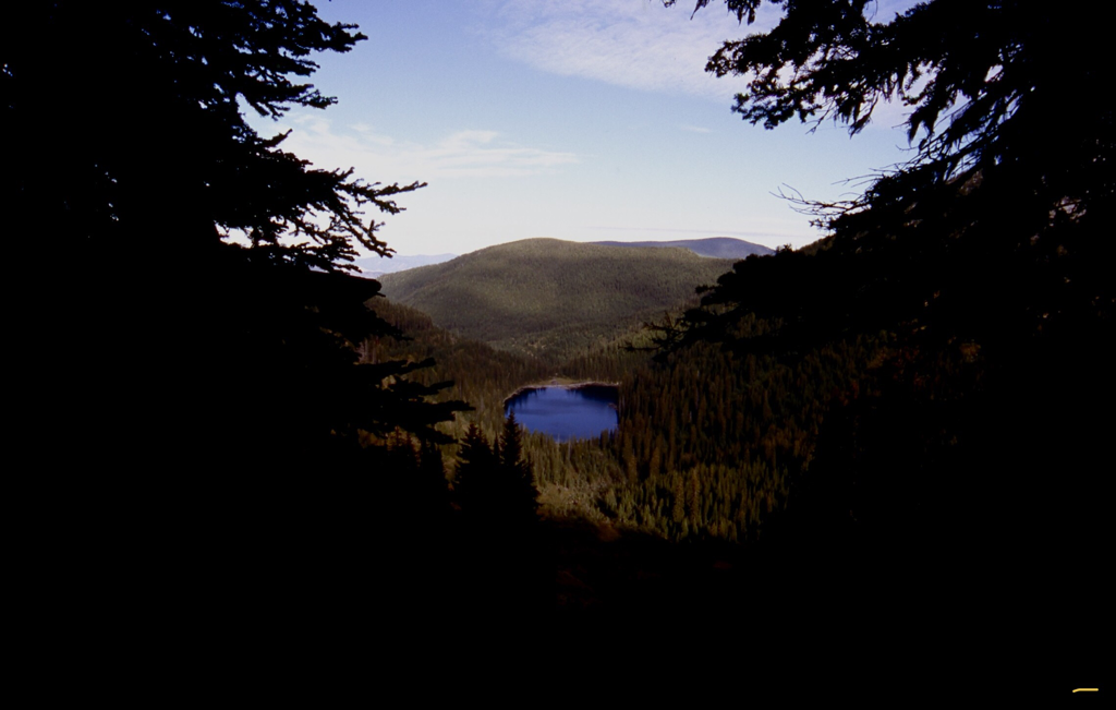
MCDONALD LAKE FROM NEAR CLIFF LAKE THE TRAILHEAD IS THE FAR END OF THE LAKE IN THIS IMAGE.
EAGLE CLIFF PEAK
THE ROUTE TO EAGLE CLIFF PEAK IS UP CENTER GULLY & RIGHT RIDGE LINE
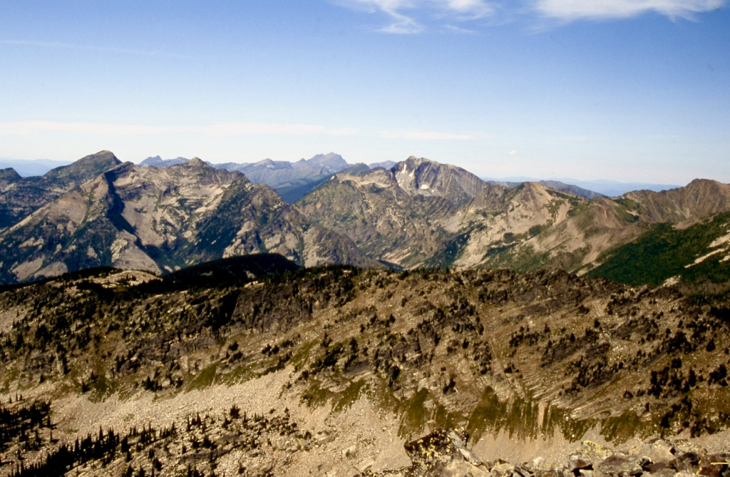
LOOKING EAST FROM EAGLE CLIFF SUMMIT
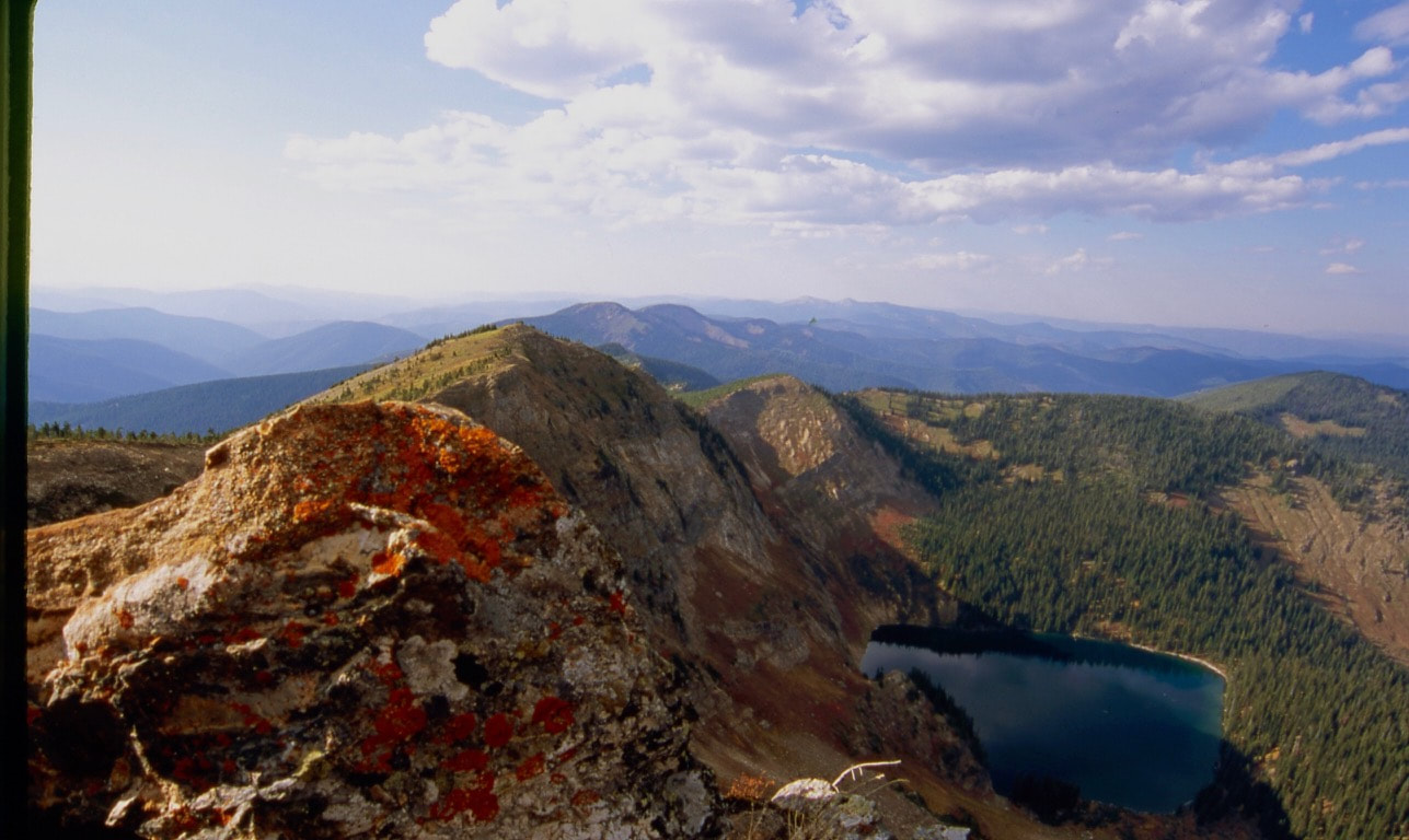
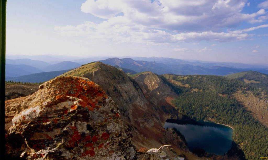
LOOKING NORTH FROM EAGLE CLIFF PEAK WITH CLIFF LAKE BELOW