SHORTY PEAK 6515' TRAIL #95 & LONE TREE PEAK 6732'
EVENT TYPE: Hike, backpack, Fire Lookout Rental DISTANCE: 5 miles RT ELEVATION: 1275' gain to Shorty, about 250' loss and 263' gain to Lone Tree Peak DIFFICULTY: Moderate to both Summits MAPS: IPNF-Kaniksu N. F., Shorty Peak GPS: N48° 57’ 12”W116° 39’ 02“ RANGER DISTRICT: Bonners Ferry R.D. 208.267.5561 BONNERS FERRY COUNTY SHERIFF: 911 or 208.267.3151
DESCRIPTION:
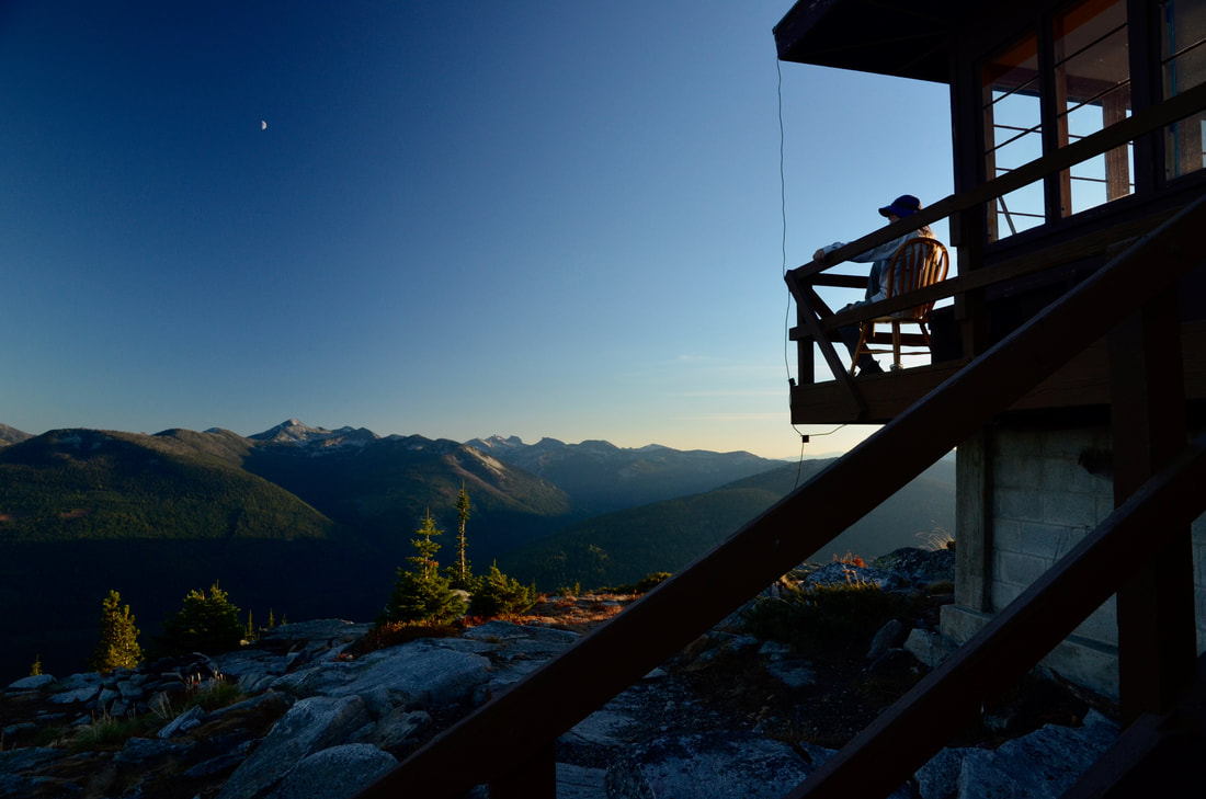
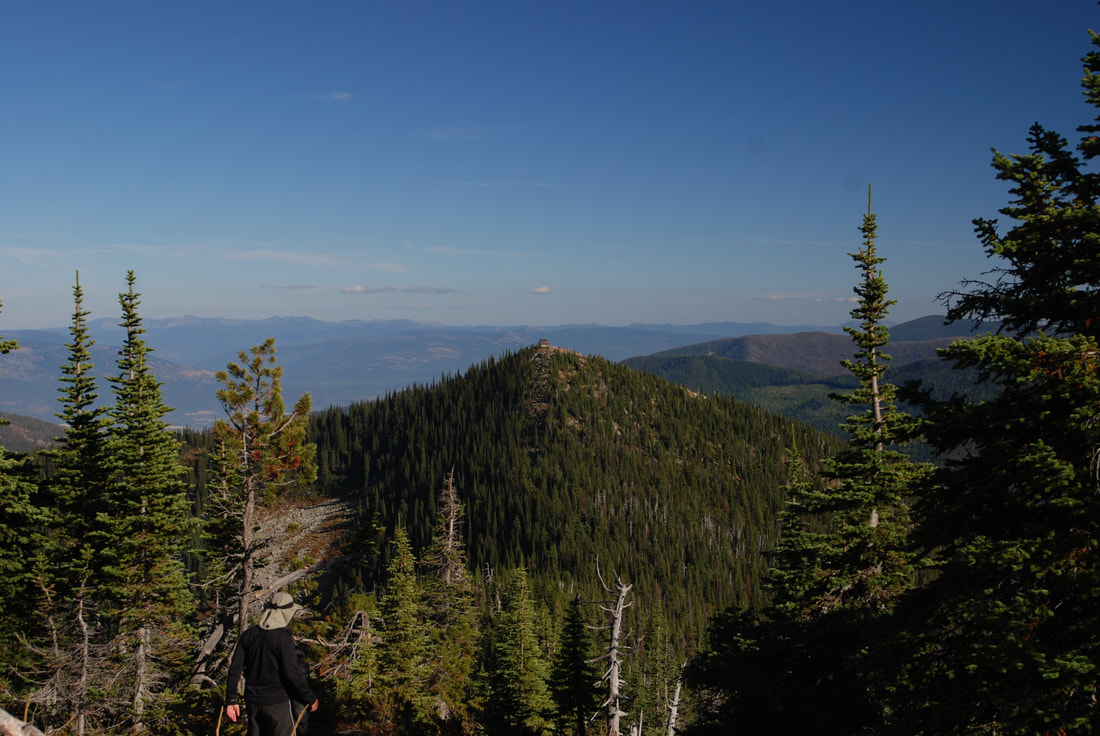
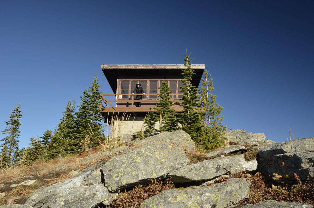
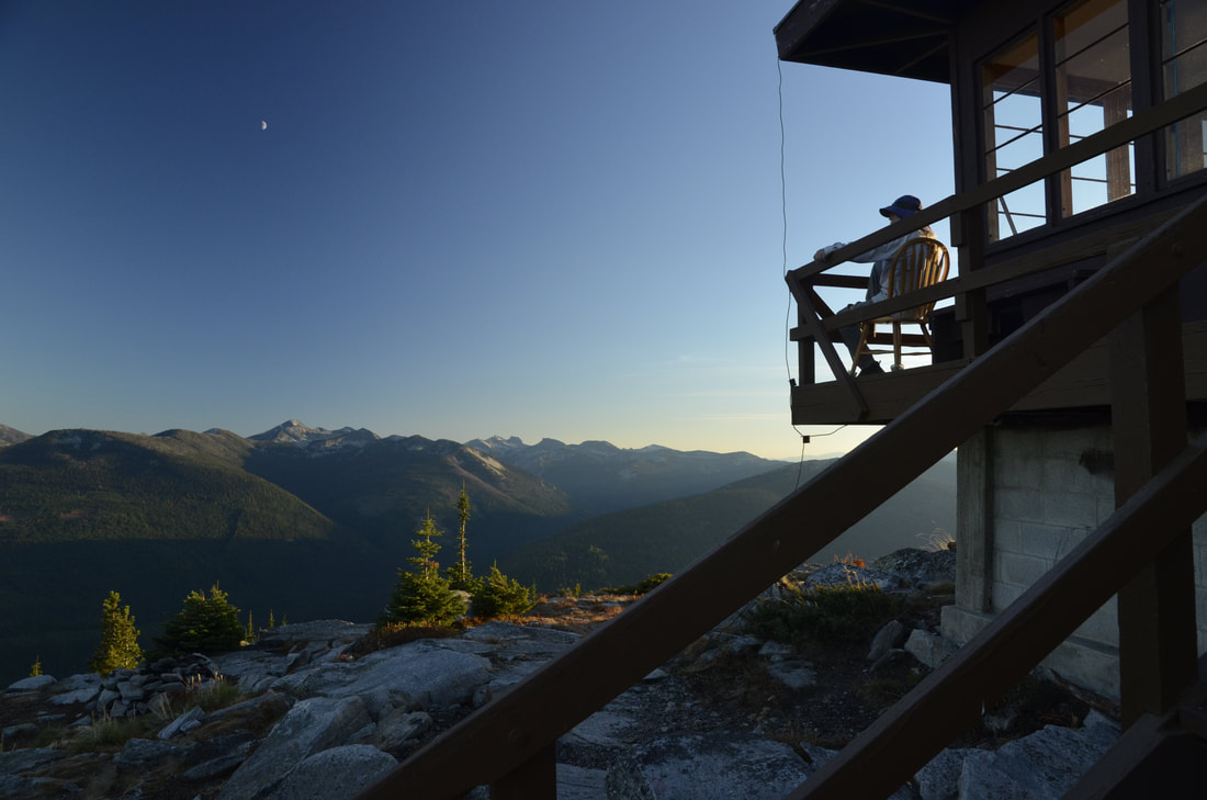
Like several other hikes in this area, the drive is the hard part. Its about 3 hours to the trailhead from Rathdrum. The trail skirts an old clear cut and climbs gently thru a forest where it flattens out a bit and enters a shady forest for about 1/2 a mile. The trail begins to climb again thru a thinning forest until the last walk up a rather steep section that circles to the summit. On top is a cute and clean forest lookout that you can rented. The lookout is a 15x15 structure with two single beds, a cooking area and incredible views. As you sit in a chair on the lookout’s deck, the American Selkirks fill your eastern view. Take a map, and try identifying the many summits. See how many you have stood on. The rental cost is 45$ per night. contact recreation.gov.
OPTION #1:
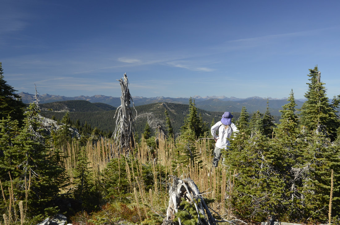
Continue the hike to Lone Tree Peak about 1 mile to the west. From Lone Tree, the higher of the two, the views are spectacular. On top take a nap on the grass and enjoy the views
DIRECTIONS:
From the Bonners Ferry Ranger Station: Take Highway 95 north for 17 miles. Turn left onto Highway 1 and head north for 2 miles. Turn left onto Copeland Road and head west for 4 miles. Stay right at the T junction and continue north on Westside Road for 9 miles. Stay to the left around the switchback, onto Forest Road 281, then drive west for 8 miles. Turn right on Road 655 and drive west 1.5 miles. Stay right again at the switchback, heading east 1 mile on Rd 282. Go straight at the next junction, and continue northeast on Road 282 for 4 miles. Park at the trailhead on top of the saddle before the locked gate. Hike 2.5 miles up the trail to the west to reach the lookout.
HAZARDS:
It’s a long drive, so maybe car camp to get an early start.
COOL THINGS CLOSE BY:
Lone Tree Peak, Canada to the north and the American Selkirks all around you. This is a hike you should not miss.
R & P:
Mr, Sub, Eichardt’s , & Jalapeños, Burger Express in Sandpoint
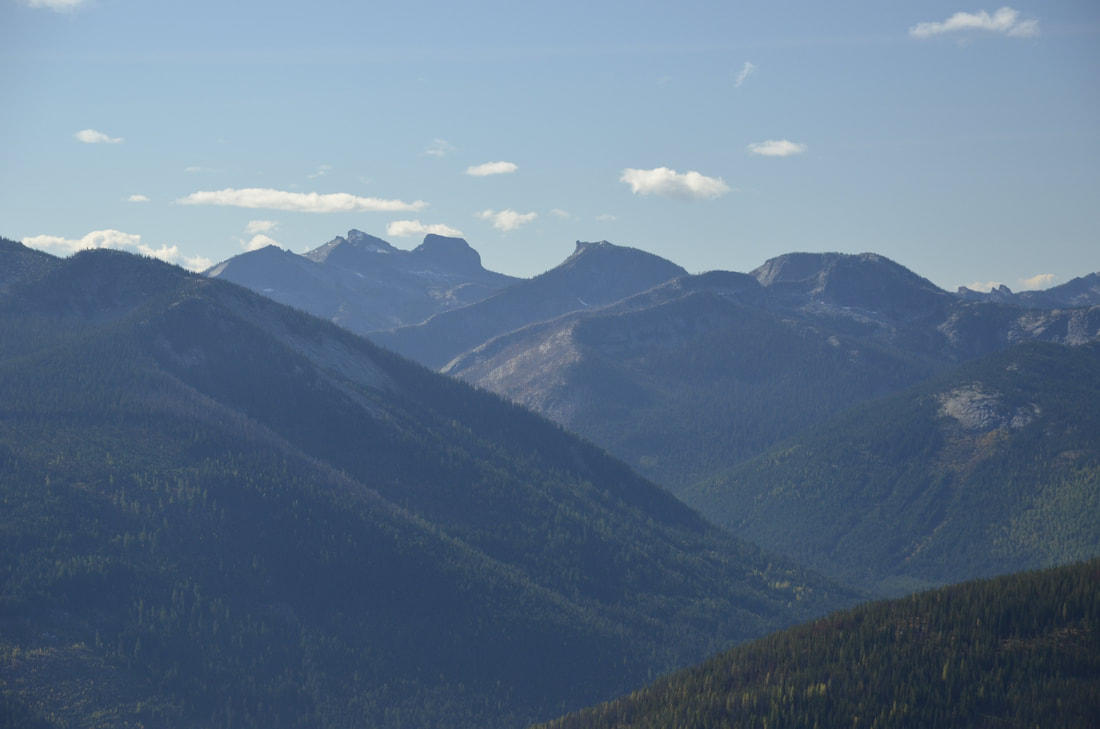
THE VIEW OF THE AMERICAN SELKIRKS FROM THE SHORTY PEAK LOOKOUT. NOTICE THE OUTHOUSE. YA GOTTA PLAN AHEAD AT THIS LOOKOUT.
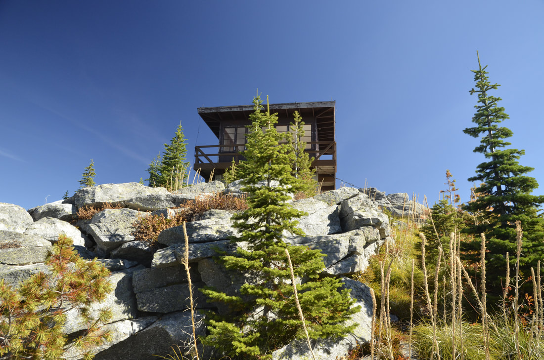
SHORTY PEAK LOOKOUT FROM THE TRAIL.
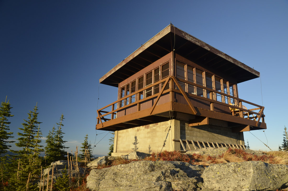
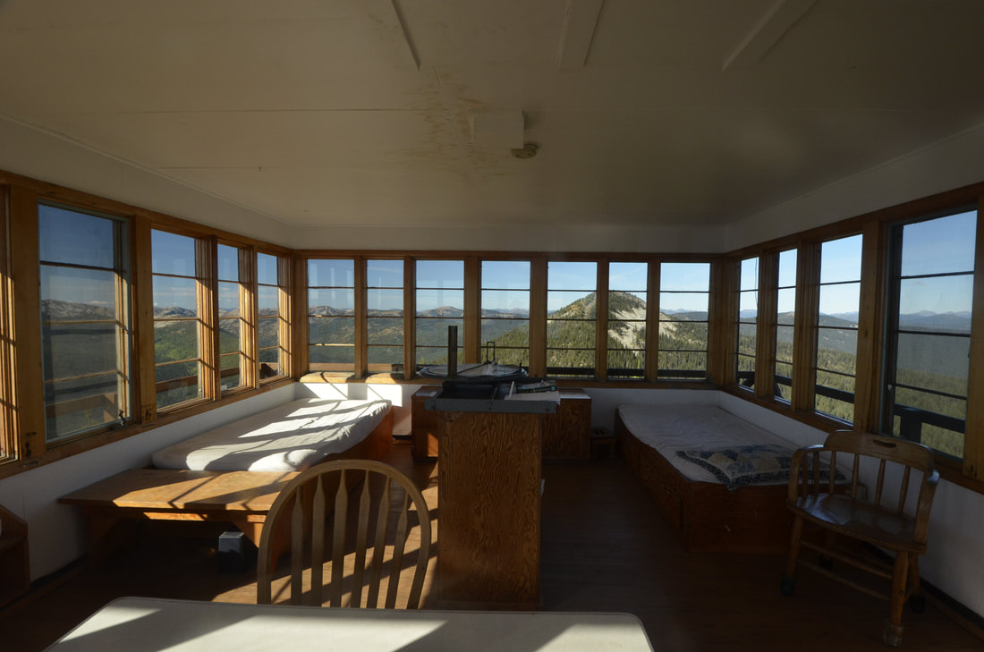
SHORTY PEAK FIRE LOOKOUT RENTAL
THE INSIDE IS PRETTY NICE. BUT WAIT FOR THE VIEWS OUTSIDE.
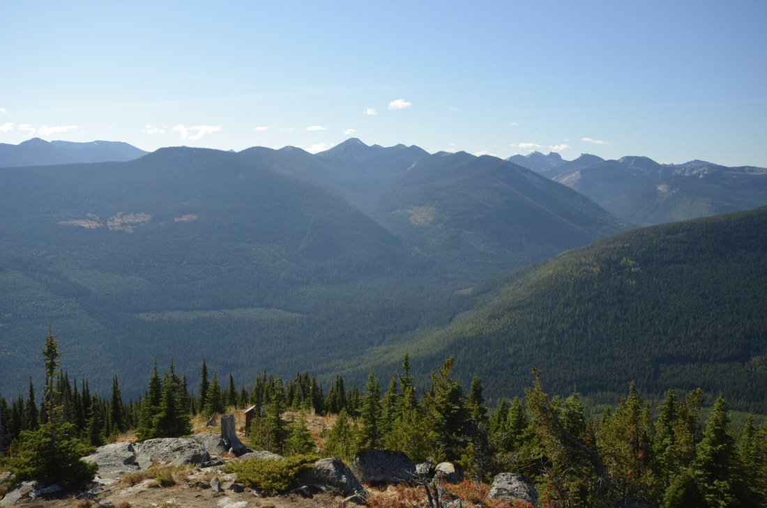
THE THREE TALLEST PEAK ARE IN THE LION HEAD GROUP
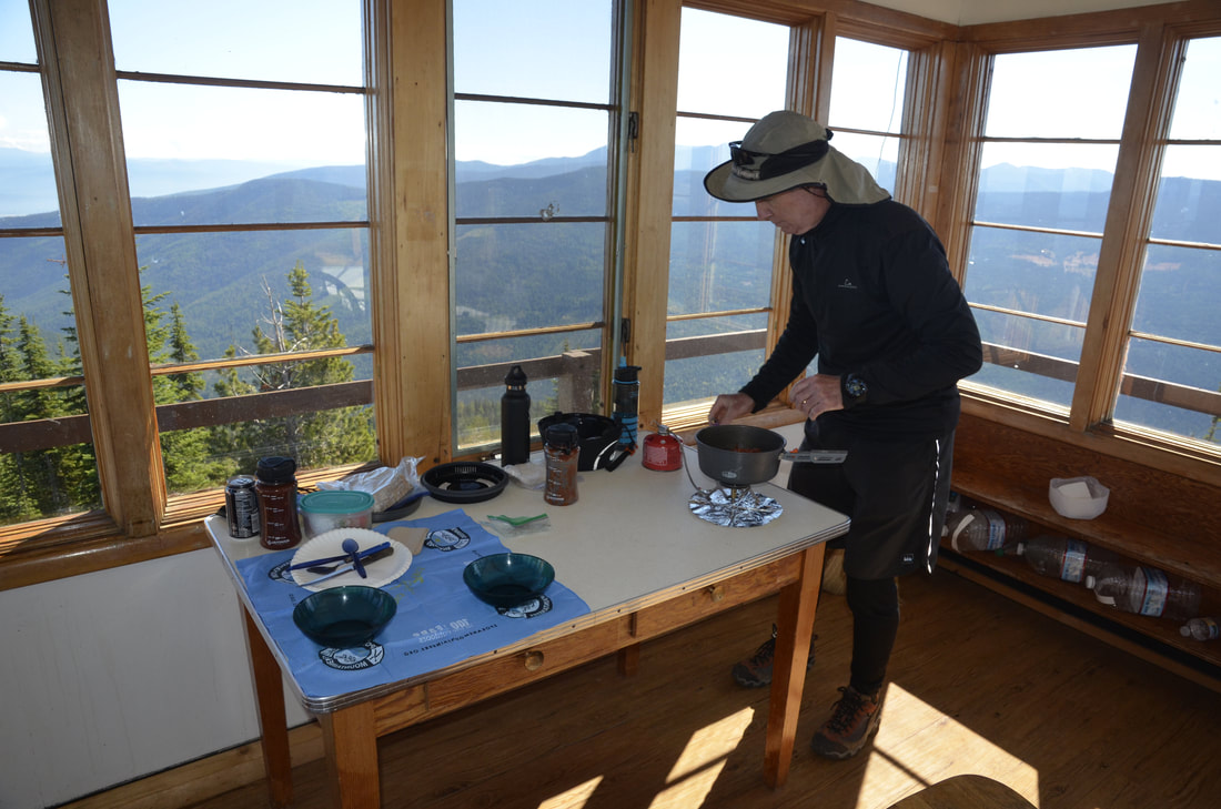
CHRIS HEATING UP MY HOMEMADE CHICKEN & RICE SOUP I MADE
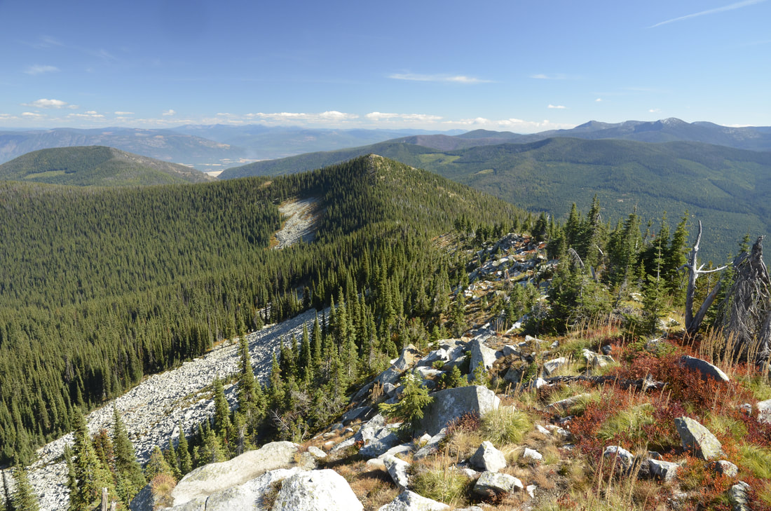
THE SHORT HIKE TO LONE TREE PEAK 6732'. SHORTY PEAK 6515', THE PURCELL TRENCH, AND CASCADE RIDGE
SHORTY PEAK AND LOOKOUT FROM LONE TREE PEAK 6732'.
CHRIS ON THE DECK AFTER VISITING LONE TREE PEAK.
CHIC TAKING IN THE VIEW OF THE AMERICAN SELKIRKS
CHIC SITTING ON THE DECK ADMIRING THE VIEW
Shorty Peak Lookout, 45 miles northwest of Bonners Ferry, sits atop Shorty Peak with views of the Selkirk and Purcell mountain ranges of Northern Idaho, Montana, and British Columbia. The rustic dwelling was once used to patrol forest fires, and is now a unique way for overnight guests to escape the city and become enthralled with 360 degree views of area's magnificence. Access requires a moderate to steep 2.5 mile hike with a 1,300 foot elevation gain. The lookout was refurbished in 2005 and is in excellent condition.
The 15' X 15' cabin sits atop a 5 foot foundation and can accommodate two overnight guests. The look of the interior is modern with hardwood floors. Two twin beds with pads, two chairs, two tables, a historic fire finder, and a district map are included inside the cabin. A pit toilet is within 100 yards of the lookout. No drinking water or electricity is available. Guests are asked to bring plenty of water, food, bedding, a first aid kit and all other basic camp gear. Horses are allowed, but no corrals or hitching racks are available. Hobbles are recommended for horses.
The 2.5 mile hike up to Shorty Peak is part of the fun of staying at the cabin. The trail is also open to horseback riding. While here, landscape photography and wildlife viewing are popular pastimes. Birding is particularly popular and guests may have the chance to look down on some birds of prey. Look for red-tailed hawks, golden eagles, and goshawks soaring over the valleys. Clear nights offer prime stargazing opportunities.
Need to KnowEntry to the cabin is by combination lock; contact the ranger district at (208) 267-5561 for combination 5-10 days prior to visitNo drinking water; bring plenty or properly boil and treat water from stream located a mile from lookoutPlease bring garbage bags; this is a 'pack it in-pack it out' facilityNo off-road vehicles allowedBring bedding, cooking supplies, flashlights, etc.Be bear aware; keep all food out of sight in approved containers or locked inside your vehicle and remove all food from area after eatingClick here for more information on the Idaho Panhandle National ForestsDon't Move Firewood: Prevent the spread of tree-killing pests by obtaining firewood near your destination and burning it on-site. For more information visit dontmovefirewood.org.