PADDLE DISTANCE: varies ELEVATION: 2067’ LENGTH AND ACREAGE: varies MAPS: IPNF, Packsaddle Mountain topo LAUNCH GPS: 48°11’14” N 116°26’15” W BONNER COUNTY SHERIFF: 208.263.8417
DESCRIPTION:
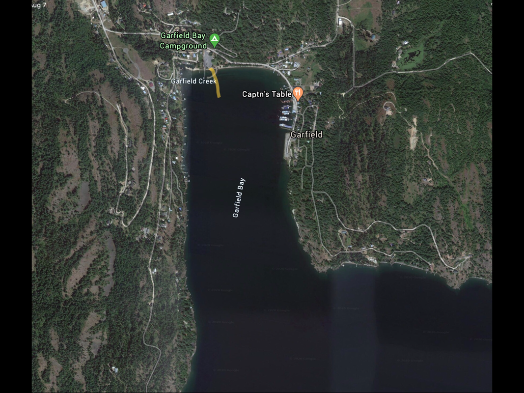
The Garfield Bay Launch is located near the Garfield Bay Camp Ground. Once out of Garfield Bay, to the left is Mineral Point (Trail). To the right is Talache Landing.
ATTRACTIONS
BIG water paddling, Mineral Point Hiking Trail, and Green Bay Boat Camp.
DIRECTIONS:
Drive north on 95 to Sagle and turn right (East) onto the Sagle Road, and drive about 7.5 miles, staying on Garfield Bay Road, to the launch
COOL THINGS CLOSE BY:
Talache Landing, Shepherd Lake, and Mirror Lake. If the winds are up on P.O.Lake, these two small lakes are an option
R & P:
MR. Sub, Eichardt’s, jalapeños, and Burger Express in Sandpoint