DEER CREEK NORDIC SNO-PARK 4,600'
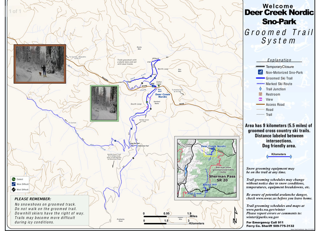
EVENT TYPE: Track Ski, Skate, Hok Ski, Telemark, BC X-Contry, Snowshoe
DISTANCE: Four miles RT
ELEVATION: +/- ~200 ft
DIFFICULTY: Easy
MAPS: Deer Creek Nordic Map - Washington State Parks, Mt. Leona - USGS,
GPS: 48°51'54.3"N 118°23'45.7"W
DISTANCE: Four miles RT
ELEVATION: +/- ~200 ft
DIFFICULTY: Easy
MAPS: Deer Creek Nordic Map - Washington State Parks, Mt. Leona - USGS,
GPS: 48°51'54.3"N 118°23'45.7"W
DESCRIPTION:
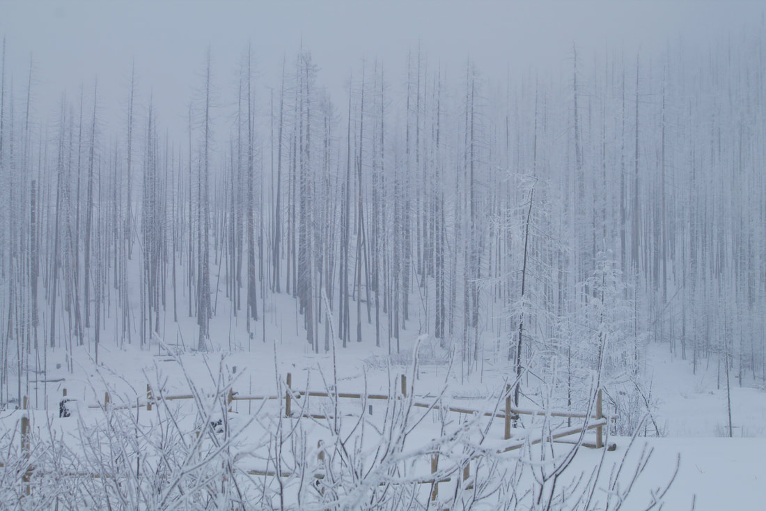
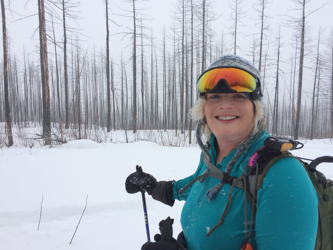
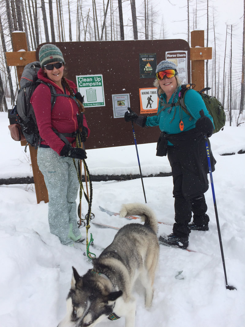
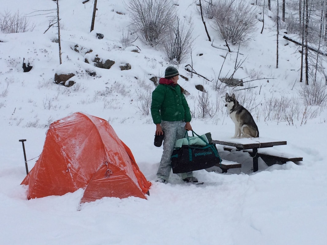
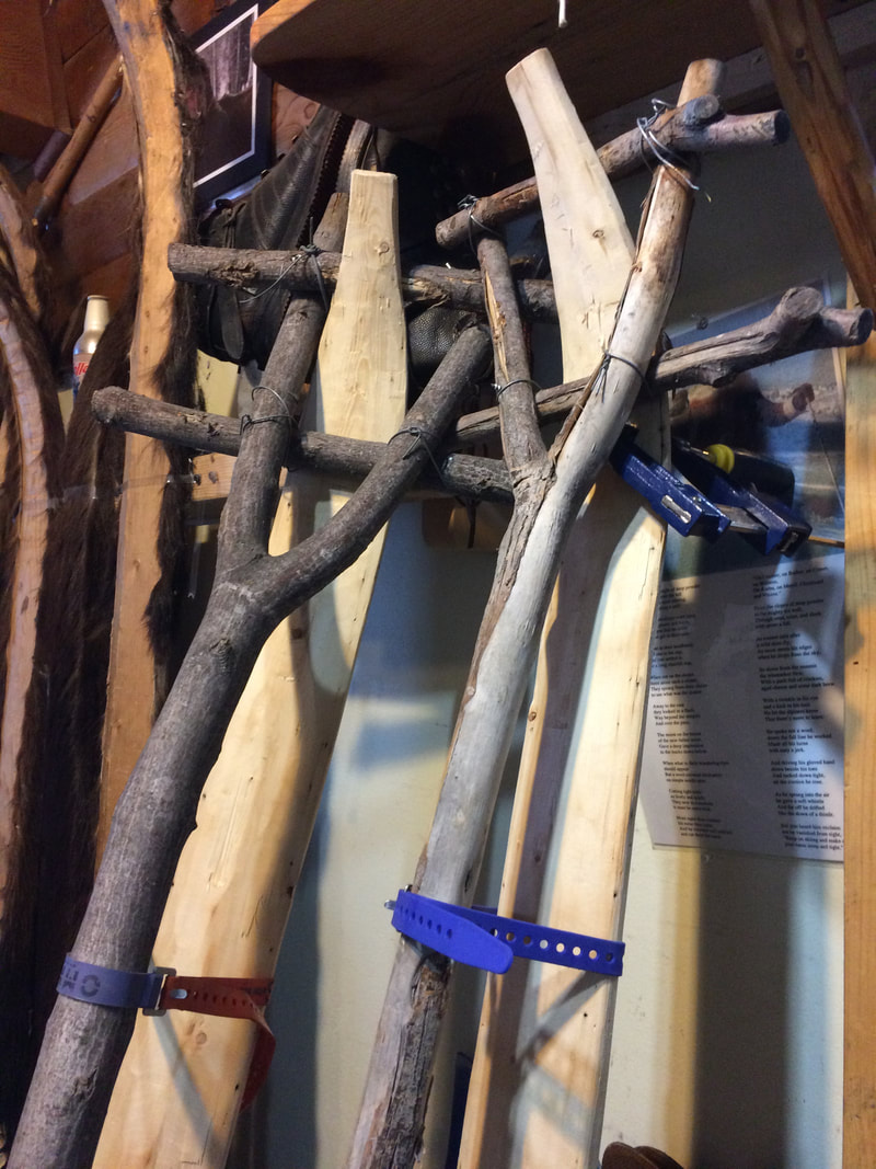
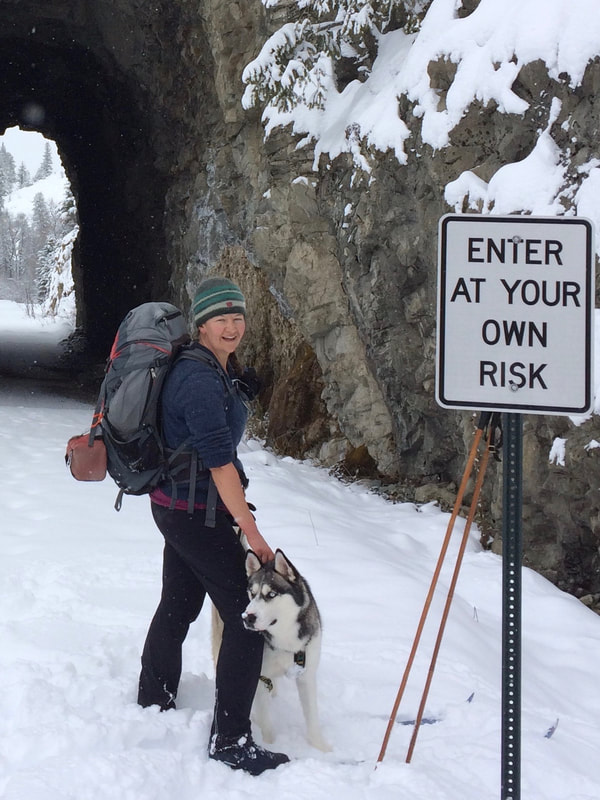
The Deer Creek Nordic Sno-Park is at the pass on Boulder Creek Road on the north end of the Kettle Crest National Scenic Trail #13. There is an outhouse and parking on the south side of the highway and a compground and porta poty on the north side. There are 12 miles of groomed crosscountry ski trails for track and skate skiers along with snowshoers. A fire burned the forest here so the trees are barren and the brush is cleared making for some awesome tele-skiing or Hok-skiing in the trees. The town of Curlew is a short distance down the hill on the west side of the pass. There is a Saloon ran by a woman named Kali and a small fish and chips restraunt named Tug Boat ran by a guy named Dennis. Nils Larsen has his Altai Ski shop in town too. You should stop in and say hi. He is very personable and more than willing to give free advice on the area and his equipment. He spends a bit of time "testing equipment" up at the pass too.
A Washington State Sno-park pass and non-motorized grooming permit is required. https://parks.state.wa.us/134/Sno-Park-non-motorized-Permits
OPTION #1:
Deer Creek Summit North Loop Trail #40
This loop uses 3.5 miles of single lane road, and 1.5 miles of mixed two track and single track. In the winter, the road section is groomed, and makes for an intermediate ski or snowshoe route.
OPTION #2:
Deer Creek Summit South Loop Trail #43
This 3.1 mile route (on forest road 455 for 1.5 miles), leaves from the Deer Creek Summit South Trailhead / Sno-Park, and connects with Kettle Crest (North) National Recreation Trail #13. These two trails can be combined for a 6.5 mile loop back to the trailhead. This route can also be connected with the Long Alec Trail #43.1. There are nice views of the Kettle River Valley along this trail. This trail parallels the Pacific Northwest National Scenic Trail. The trail is groomed cross country ski trail during the winter. This trail is fairly flat--part of it is on an old road.
OPTION #3:
Ferry County Rail Trail
The Ferry County Rail Trail encompasses a 28-mile corridor from the San Poil Mill site ( three miles outside of Republic, WA) north to the Canadian Border. The rail bed, once part of the Great Northern Railroad, is now a beautiful trail that passes through pastoral farm lands and Ponderosa pine forests, and along the shores of Curlew Lake and the Kettle River.
DIRECTIONS:
Take Highway 395 north through the town of Kettle Falls and across the Columbia River. From there continue north about 15 miles to Boulder Creek Rd a few miles before the town of Orient. take it west about 12 miles to the pass.
Note: There are mobile phone friendly maps of the sno-park that you can download to your phone and use off line. The coordinates are embedded in the map and will pin point your location using your phone's GPS receiver even without cell phone service. The map is available here: https://parks.state.wa.us/DocumentCenter/View/8460/Deer-Creek-Nordic-PDF?bidId=
You will need a map viewer like the free Avenza Maps app here: https://www.avenzamaps.com/maps/how-it-works.html
COOL THINGS CLOSE BY:
Ferry County Rail Trail, Altai Skis Shop, Kettle Crest Trail
HAZARDS:
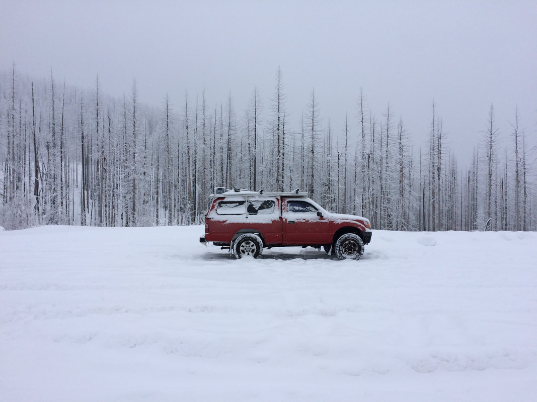
Remote mountain pass with no services. The plows came buy regularly and the deputy too.
R & P:
Curlew Saloon for good beer and food, Tug Boat in Curlew for excellent hand cut and breaded fish and chips, Meyers Falls Market in Kettle Falls for groceries and deli items. I recommend the whole grain bread loaves along with the made from scratch ginger, lemon and honey tea to keep you warm from the inside.