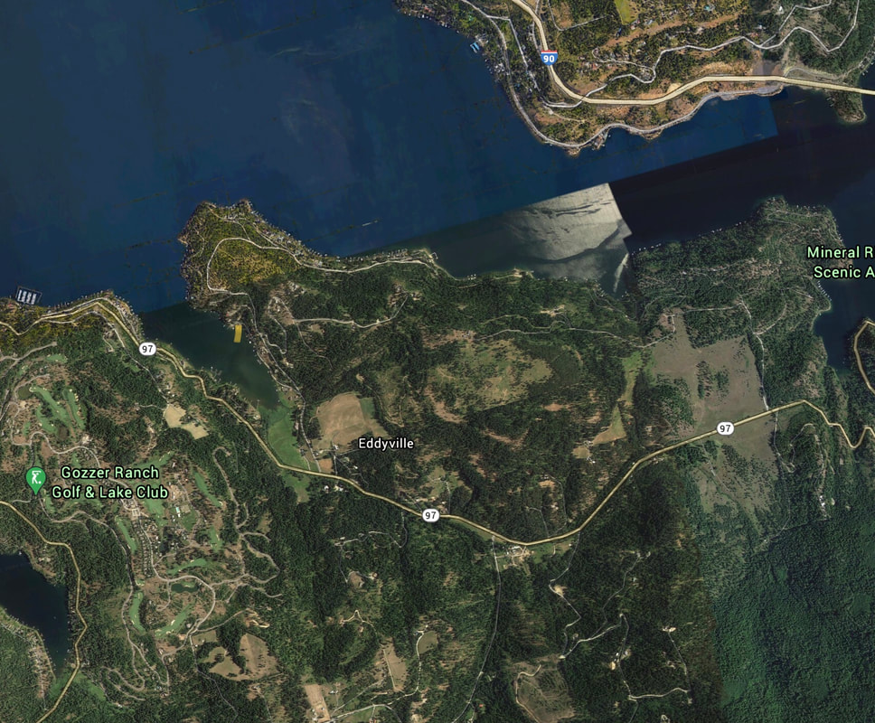
NEACHEN BAY LAUNCH
PADDLE DISTANCE: varies
ELEVATION:2128’
LENGTH AND ACREAGE: varies
MAPS: IPNF. Mt. CDA topo
LAUNCH GPS: 47°37’28” N 116°44’38” W
KOOTENAI COUNTY SHERIFF: 208.446.1300
ELEVATION:2128’
LENGTH AND ACREAGE: varies
MAPS: IPNF. Mt. CDA topo
LAUNCH GPS: 47°37’28” N 116°44’38” W
KOOTENAI COUNTY SHERIFF: 208.446.1300
DESCRIPTION:
Neachen Bay used to be called Squaw Bay if you are looking at older maps.
The launch is located up near Wolf Lodge Bay.
You will feel like you are driving into private residents, but eventually the launch appears.
The launch is located up near Wolf Lodge Bay.
You will feel like you are driving into private residents, but eventually the launch appears.
ATTRACTIONS
This launch gets you out onto the main body of the via Arrow Point.
and has access to Wolf Lodge Bay's west end.
and has access to Wolf Lodge Bay's west end.
DIRECTIONS:
From CDA drive east on I-90 to the Harrison, Idaho exit, onto Hwy 97A.
Drive west o. Hwy 97A above Beauty Bay.
There is a rest area just east of the road to Eddyville.
Turn right (North) onto the Eddyville Road, and stay on this road all the way to then launch.
Drive west o. Hwy 97A above Beauty Bay.
There is a rest area just east of the road to Eddyville.
Turn right (North) onto the Eddyville Road, and stay on this road all the way to then launch.
COOL THINGS CLOSE BY:
the Main body of Lake CDA, Wolf Lodge Bay, Moscow Bay, Arrow Point Resort
R & P:
Trails End Brewery, Franklins, Mexican Food Factory, and Moon Time


