EVENT TYPE: Day hiking, backpacking, scrambling DISTANCE: 4 miles RT ELEVATION GAIN: 500 verts DIFFICULTY: Easy MAPS: IPNF, LOLO N.F., Burke, Thompson Pass topos GPS: 47 °56’09’ N 115°75’10” CDA River Ranger District: 208.752.1221 SHOSHONE COUNTY SHERIFF: CALL 911 FIRST or 208. 556. 1114
DESCRIPTION:
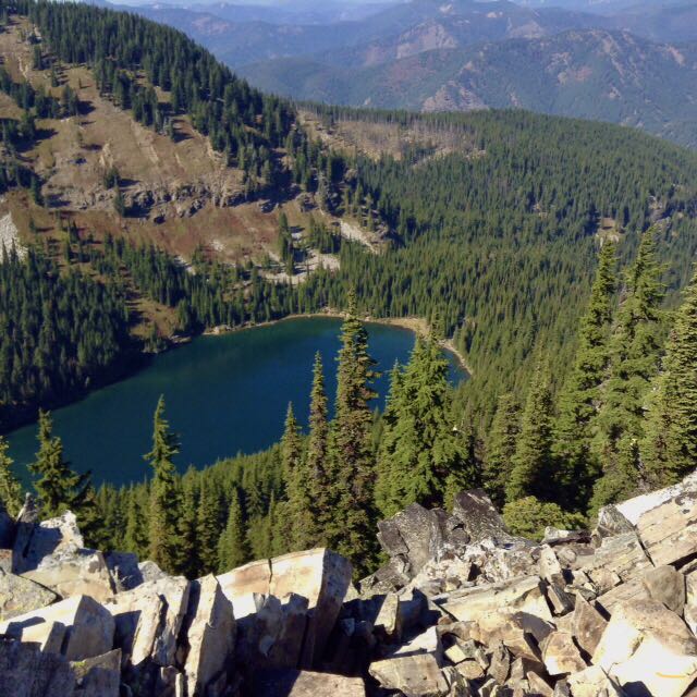
WE HAVE ADDED THE AREAS SHERIFF’S EMERGENCY PHONE NUMBERS FOR EACH TRIP WRITE UP UNDER THE RANGER DISTRICT INFO. IF AN EMERGENCY OCURRS, EVALUATE YOUR CIRCUMSTANCES AND CALL ONLY IF NEEDED. This short hike is great for families. From the trailhead, hike a mellow trail SW to a where the trail crosses Cascade Creek. Look for up to 4 12' waterfall early in the year, on your left (SW). The trail above does a single switchback before descending 30' to the lake. You can walk the shore line all the way around the lake for views. From the SE shore, there is a good view of Granite Peak 6814' to the west towering above the lake. There are a few campsites off to the NE shore.
OPTION #1:
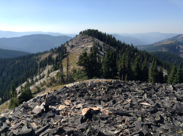
Granite Peak. (See Granite Peak write up) BE AWARE, THIS IS STEEP AND EXPOSED There are three main routes to the summit. The first is a serious scramble up from the NE corner of the lake. The terrain looks like stepped rock shelves. Above the scramble the terrain is grassy and not as steep. In about 200' you will access a ridge and turn left to the top. The summit is about 20' wide and 50' long. The first thing you see as you approach the top, are two very tall rock cairns. One is about 14' tall. To the SE of the larger cairn, there are slabs of rock made into lounge chairs. Have a seat and relax during lunch. Off the SE in the distance the view of Upper & Lower Stevens Lakes is head on. To the north is the massive mountains of the Cabinet Mountain Wilderness and the Proposed Scotchman Peak’s Wilderness. The easiest and safest descent is down the scree slope on the SW end of the lake. There is an 8 foot cliff band about 1/3 the way down to navigate.
OPTION #2:
Barton Creek Trail #140 starts up Granite Gulch about .1 miles along Forest Road #9 about 3.4 miles past the east end of Murray, Idaho. It intersects with Trail #137 at the summit of Granite Peak. Its a rarely used trail, but if solitude is your goal, this trail is for you. However, during hunting season, you might encounter hunters. The trail is 4.25 miles with about 3540 verts.
OPTION #3:
As described in the Blossom Lakes write up, you can climb the saddle between the Revett & Blossom Lakes and descend to the trailhead. It makes a good loop hike.
OPTION #4:
There's a cool loop hike you can do to get great views of the whole area. After climbing Granite Peak from Revett Lake, head SW to a low ridge that leads you over to the Idaho/Montana boarder. Turn right(S) down the boarder, and you find yourself above Pear Lake, walk about .3 of a mile to the Idaho Centennial Trail, and drop down to Pear Lake. Once at Pear Lake you can take one of two trails/routes to Blossom Lakes If you follow the Idaho Centennial Trail, you will get to Lower Blossom Lake. But if you do a bit of Chicwackin' you can get to Upper Blossom Lake.
OPTION #5:
Starting at Revett Lake, scramble up to Granite Peak, and follow the route in OPTION #4, until you get to the Boarder, and turn left NE to the ridge between Revett and Blossom Lakes. Stay up on the ridge until you get even with the NE end of Revett Lake. Here, drop down the scree slopes to Trail #9 (Revett Lake Trail), and out to the parking area.
DIRECTIONS:
Drive I-90 east to the Kingston exit # 43, and turn left (north) over the freeway and up FR #9, also known as the Coeur d'Alene River Road. Drive north for about 21 miles and bear right (east) at Pritchard, continue for about 16 miles to Thompson Pass at the Idaho Montana boarder. Off to the right at the summit of the road, you will see a parking area. The trailhead is up a short road near the south corner of the parking area.
HAZARDS:
None to the lake. BE EXTRA CAUTIOUS ON ALL ROUTE TO GRANITE PEAK, AND HIGH OPTIONS.
COOL THINGS CLOSE BY:
U & L Blossom Lakes, Pear Lake, the CDA River, and The Snake Pit.
R & P:
Pizza Factory, 1313 Club, Brooks Hotel & Restaurant, City Limits Brew Pub, Fainting Goat, Smoke House BBQ & Saloon, Muchacho’s Tacos, Wallace Brewing Co., Radio Brewing, the Snake Pit, and Moon Time.
PHOTO GALLERY
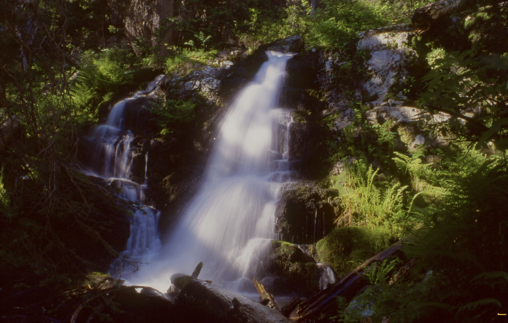
ONE OF FOUR REVETT CREEK FALLS
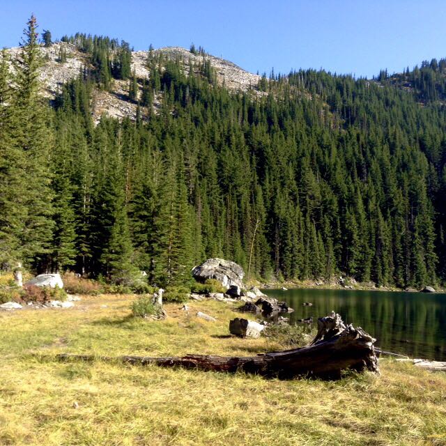
REVETT LAKE EAST SHORE LINE
CHRIS NAPPING ON GRANITE PEAK
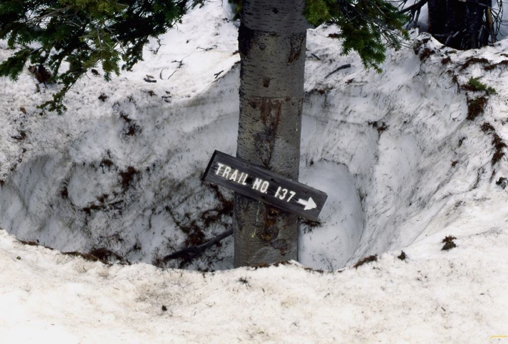
GRANITE PEAK TRAIL IN SNOW
THE HIGH TRAIL #7 TOWARDS BURKE CANYON
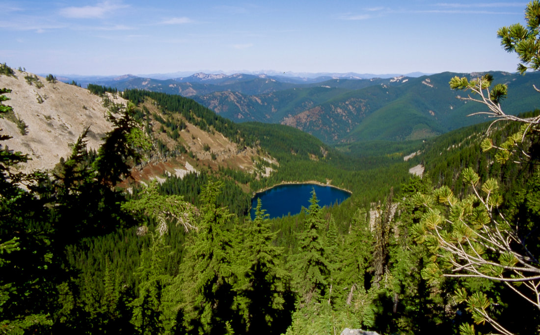
REVETT LAKE FROM RIDGE BETWEEN REVETT & BLOSSOM LAKES