WATERFALL : Upper & Lower Palouse Falls DROP: 185' WATERFALL TYPE: Plunge Pool DISTANCE CAR TO FALLS: To view point is about 100' MAPS: Washington Scablands, Palouse Falls State Park GPS: 46°39’48” N 118°13’25” W
DESCRIPTION:
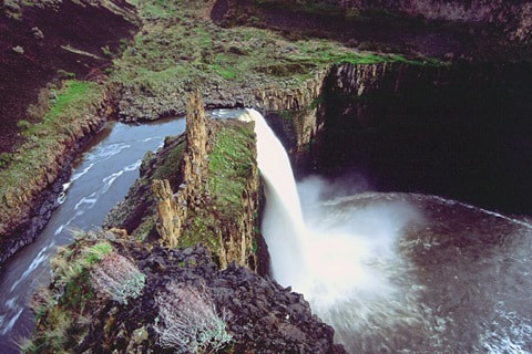
Palouse Falls was designated as the Offical Washington State Waterfall on 3.18.2014. And rightly so. The falls sits amid the Washington Scablands near Washtucna. It drops 185' in a single plunge. There is a fenced viewing area, that overlooks the falls and the Stony Canyon that eventually leads to Lyons Ferry State Park about 7 miles down stream. Contact the park by calling 509.646.3229.
FOR A SPECTACULAR FILM OF TYLER BRADT, KAYAKING OVER PALOUSE FALLS, GOOGLE Palouse Falls KAYAKER.
OPTION #1:
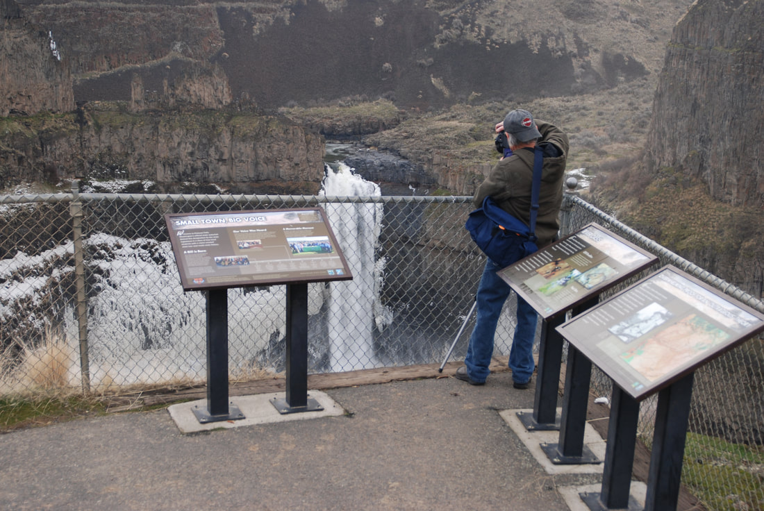
From the main view point, walk south to the Palouse Falls Fryxell Overlook. This view point offers a different view of the falls. It has a covered shelter to get out of the sun. This area is fenced , and PLEASE do not climb over the fencing.
PLEASE READ THE "HAZARD" SECTION BELOW, FOR SAFETY INFO.
OPTION #2:
To view the Upper Palouse Falls, head north from the pit toilets. The trail skirts the railroad tracks, then drops down to the tracks before descending to the rivers level on a graveled slope. There is a rugged path that follows river to the SE, and eventually takes you to the "Castle", and the very top of the falls. PLEASE BE VERY CAREFUL HERE. As you walk along the cliffs, notice the huge rock wall on your right. If you look real close, you maybe able to spot bolts used to provide protection for rock climbers.
PLEASE READ THE "HAZARD" SECTION BELOW, FOR SAFETY INFO.
DIRECTIONS:
From Spokane, drive west on I-90 to Ritzville. At Ritzville turn S onto Hwy 261 to Washtucna. At Washtucna continue SW on Hwy 261 for 7 miles to the Palouse Falls sign. From here its a gravel road to the falls.
COOL THINGS CLOSE BY:
Lyons Ferry State Park, the mighty Snake River, and the Potholes Reservoir.
HAZARDS:
ALL WATERFALLS ARE A HAZARD, DUE TO THEIR SLIPPERY NATURE. ALWAYS BE EXTRA CAREFUL NEAR ANY WATERFALL. A SPECIAL WARNING ABOUT HIKING IN THE PALOUSE FALLS AREA. ONCE YOU LEAVE THE FENCED VIEWING AREA, THE VIEWING OF THE FALLS BECOMES VERY DANGEROUS. PLEASE, PLEASE USE EXTRA CAUTION EVERYWHERE IN THE PALOUSE FALLS STATE PARK.
R & P:
NA
PLAN YOUR TRIP:
Click for Current NOAA Weather Conditions
PHOTO GALLERY
PALOUSE FALLS FROM THE FRYXELL TRAIL
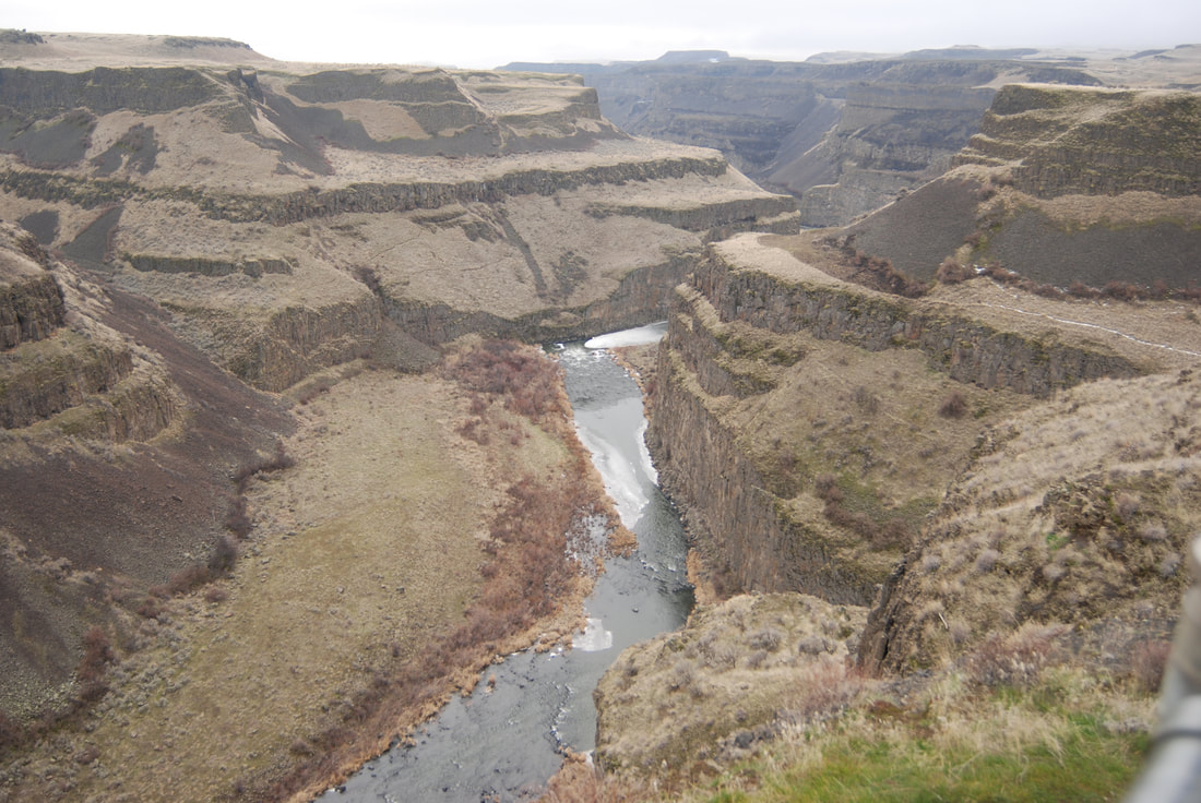
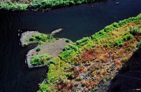
THE PALOUSE RIVER CANYON FROM ALONG THE FRYXELL TRAIL
THE PALOUSE CANYON VIEW POINT TOWARDS THE FRYXELL OVERLOOK
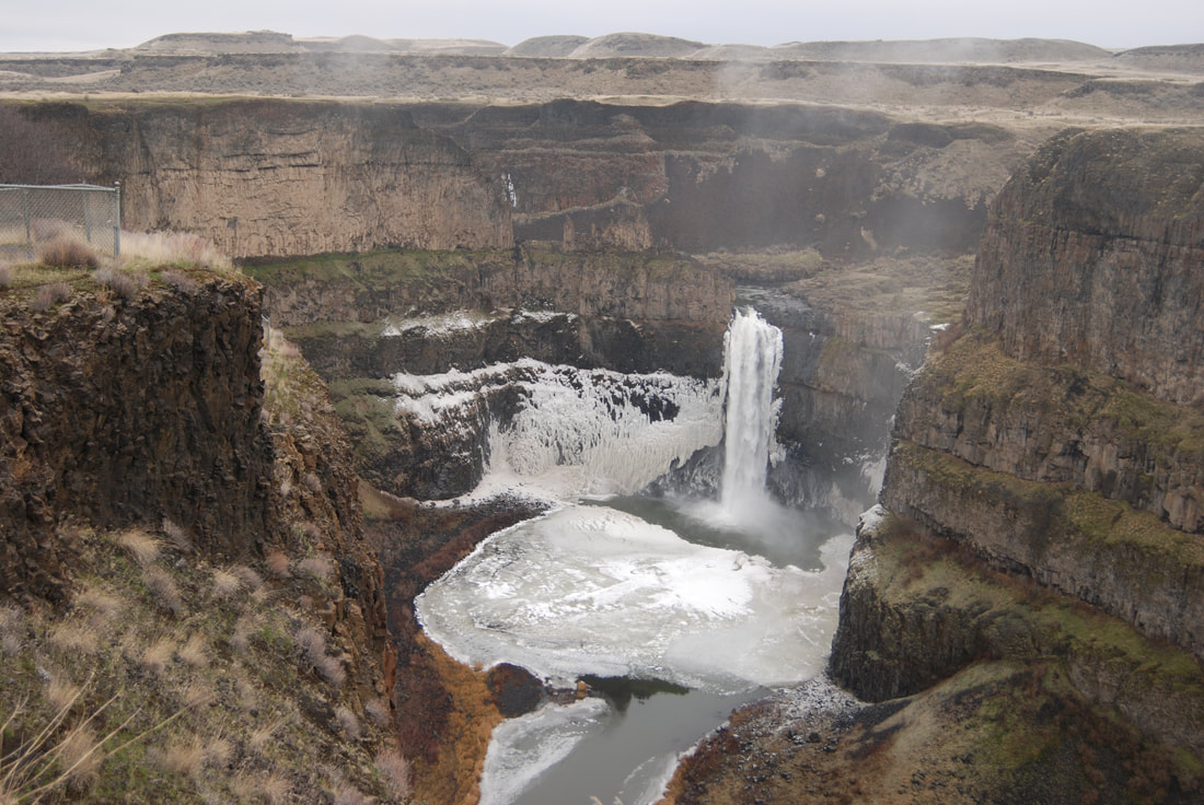
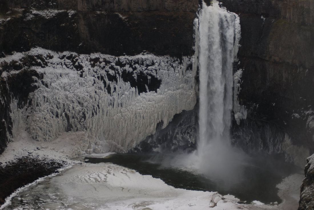
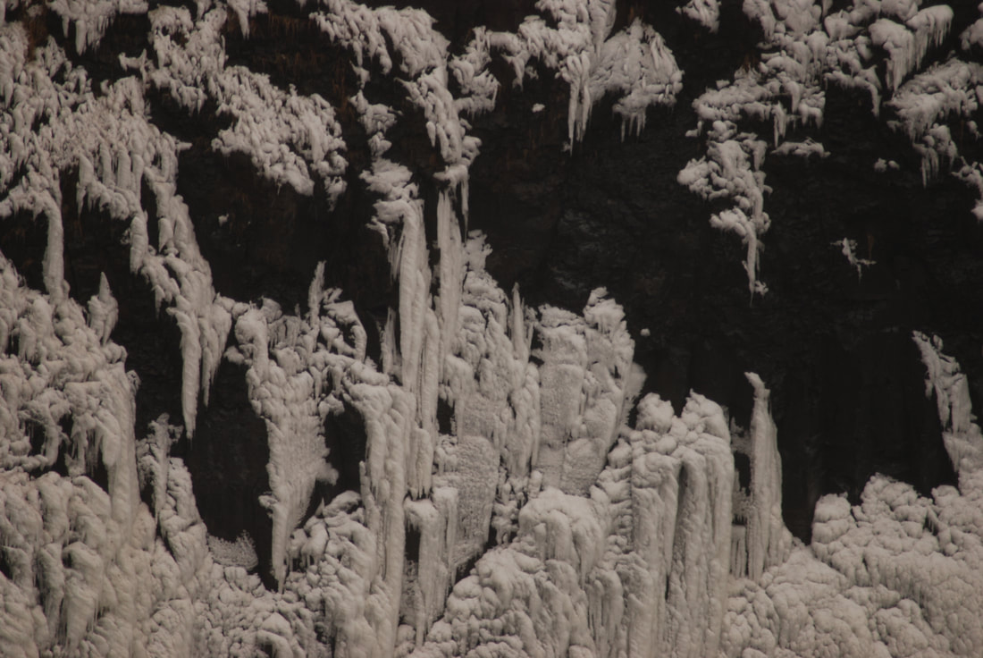
ON THE COLDEST DAY OF WINTER, THE FALLS TAKE ON A NEW LOOK
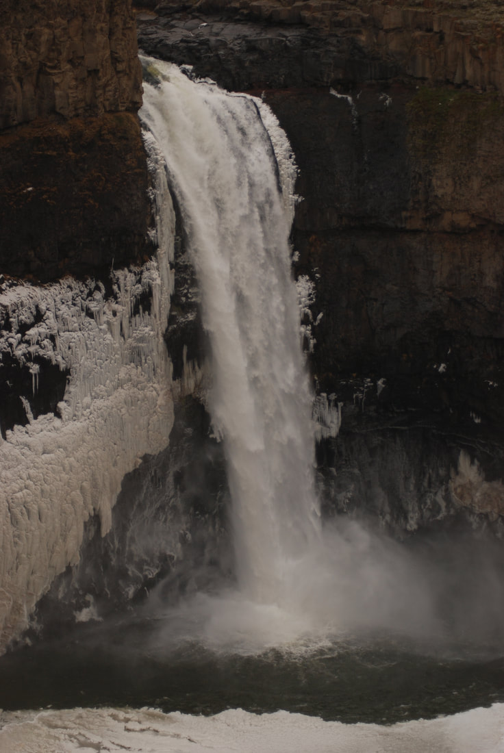
THE FALLS FROM THE FENCED AREA
PHOTOGRAPHY IN THE WINTER CAN BE VERY PRODUCTIVE
ON ONE OF MY "PHOTO FUN DAY TRIPS" I SPOTTED THE ENERGIZER BUNNY VISITING THE FALLS
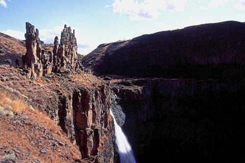
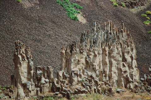
THE "CASTLES" FR0M NEAR THE VIEWING AREA
THE "CASTLES" ABOVE THE FALLS. YEARS AGO, SOMEONE GRAFFITIED THE "CASTLES". THE SPOKANE MOUNTAINEERS CAME OUT WITH A PORTABLE SAND BLASTER TO CLEAN THE GRAFFITI OFF
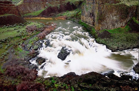
THE UPPER FALLS FROM ABOVE. WHILE THE LOWER FALLS LOOK THE SAME YEAR ROUND, THE UPPER FALLS CHANGES DUE TO RIVER FLOW