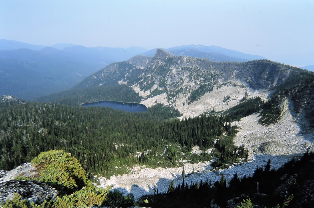
MYRTLE LAKE 5950' & MYRTLE PEAK 7122' Trail #286
EVENT TYPE: Hike, backpack, mt biking
DISTANCE: 6 miles RT to the peak and 9.6 mikes RT to the lake
ELEVATION GAIN: 1682' gain to the peak 1172' loss to the lake
DIFFICULTY: Moderately difficult
MAPS: IPNF-Kaniksu N. F., USGS-Roman Nose, The Wigwams, Smith Peak
GPS: N48° 44’ 12.4” W116° 36’ 19.0”
RANGER DISTRICT: Bonners Ferry R.D. 208.267.5561
BOUNDARY COUNTY SHERIFF: CALL 911 FIRST or 208.267.3151
DESCRIPTION:
WE HAVE ADDED THE AREAS SHERIFF’S EMERGENCY PHONE NUMBERS FOR EACH TRIP WRITE UP UNDER THE RANGER DISTRICT INFO. IF AN EMERGENCY OCURRS, EVALUATE YOUR CIRCUMSTANCES AND CALL ONLY IF NEEDED.
Trail #286 begins on private timberland that has been heavily logged, but soon enters the forest and climbs steadily for 3 miles to the summit of Myrtle Peak Trail. Because this section of the trail is on a southern aspect, in summer it's very hot for most of the 3 miles. As you approach the corner, the trail circles the summit on the SW side. From the summit the views all around of the American Selkirks are outstanding. Kent Peak 7243' and especially Kent Lake is rarely seen in all its glory.
To get to Myrtle Lake, drop down the north side of the peak as the trail drops 1172' to the lake. Myrtle Lake is one of the largest in the American Selkirks, and directly above the lake is a memorable pyramid shaped peak.
DIRECTIONS:
From the Kootenai Wildlife Refuge drive 1.3 miles to the Myrtle Creek Road #633. Turn left (west) onto FR 633 for 10 miles to FR 2406 and turn right (NW) for 3 miles to the end of the road. Along the road to the trailhead, there are two tight switchbacks. Stop here and take in the views of the Kootenai National Wildlife Refuge, and the spectacular Purcell Trench.
HAZARDS:
A 1172 verts drop to the lake.
The trail from the start is relentless. Then add the sun. Please take extra caution, and water, as it’s hot in the summer.
The trail from the start is relentless. Then add the sun. Please take extra caution, and water, as it’s hot in the summer.
COOL THINGS CLOSE BY:
Burton Peak, Myrtle Creek Game Preserve, Two Mouth Lakes, Cooks Peak & Lake, the Kootenai National Wildlife Refuge, and the northern trail to Harrison Lake.
R & P:
Jalapeños, Mr. Sub, Burger Express, Eichardt’s n Sandpoint


