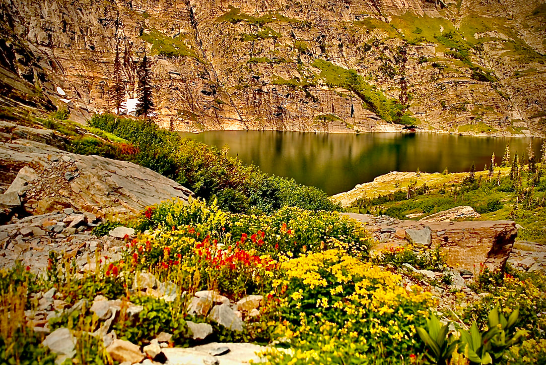
SKY LAKES 6230’ & HANGING VALLEY UPPER LAKE 5966’
EVENT TYPE: Hiking, backpacking, fishing, scrambling, and camping.
DISTANCE: 12 miles RT
ELEVATION GAIN: 3700 verts
DIFFICULTY: Difficult
MAPS: Kootenai N. F., Treasure Mountain
GPS: Upper Sky Lake. 48°19’12” N 115°42’55” W Hanging Valley. (Lake). 48°19’04” N 115°41’18” W.
LIBBY RANGER DISTRICT 406.293.7773
LINCOLN COUNTY SHERIFF: CALL 911 FIRST, or 406.293.4112
DISTANCE: 12 miles RT
ELEVATION GAIN: 3700 verts
DIFFICULTY: Difficult
MAPS: Kootenai N. F., Treasure Mountain
GPS: Upper Sky Lake. 48°19’12” N 115°42’55” W Hanging Valley. (Lake). 48°19’04” N 115°41’18” W.
LIBBY RANGER DISTRICT 406.293.7773
LINCOLN COUNTY SHERIFF: CALL 911 FIRST, or 406.293.4112
DESCRIPTION:
HANGING VALLEY
From the Sky Lakes- Hanging Valley trailhead # 137 on F.R.128, hike SW for about 1.5 miles and cross into the wilderness. In about .3 of a mile, Trail #135 splits off to the left (south) to Hanging Valley.
Hike another 1.8 miles and notice Treasure Mountain towering above. The lakes of Hanging Valley sit below to the west.
SKY LAKES
From the Sky Lakes- Hanging Valley trailhead # 137 on F.R.128, hike SW for about 1.5 miles and cross into the wilderness. In about .3 of a mile Trail #137 continues to the right. In 3 miles you will come to the junction with Trail #360. Bear left (south) for about a mile, You are at the Lower Sky Lake.
OPTION #1
To extend your trip, you can access the ridge to the south of Sky Lakes and walk east and drop down to the Hanging Valley Lake, where there is a very primitive Trail #135 back to Trial #137, and to the parking area.
PLEASE BE AWARE...this route above Sky Lake to Hanging Valley, is rugged, off trail, and Trail #135 is tough.
PLEASE BE AWARE...this route above Sky Lake to Hanging Valley, is rugged, off trail, and Trail #135 is tough.
DIRECTIONS:
A half a mile south of Libby, turn right (west) off of Hwy 2 onto Shaughnessy Hill Road. At the top of the hill go south .5 miles to Flower Creek Road #128 and turn west. Drive 6 miles to the trailhead
HAZARDS:
Many creek crossings.
Trail #135 is steep and rugged, with a poorly maintained trail.
Trail #135 is steep and rugged, with a poorly maintained trail.
COOL THINGS CLOSE BY:
Ross Creek Cedars, Cedar Lakes, Dome Mountain, Kootenai Falls, the Proposed Scotchman Peaks Wilderness, Granite Lake, and Leigh Lake.
R & P:
Henry’s, Pizza Hut, The Shed, Rosaeurs in Libby. Clark Fork Pantry & Squeeze Inn in Clark Fork. Eicharts, Mr Sub, Burger Express, Jalapeños in Sandpoint


