EVENT TYPE: day hiking, backpacking, and equestrian. DISTANCE: 3.6 miles RT ELEVATION GAIN: 1295’ DIFFICULTY: moderately difficult MAPS: Priest Lake NW, Upper Priest Lake GPS: 48°42’43” N 116°55’05” RANGER DISTRICT: Priest River R.D. 208.443.2512 BONNER COUNTY SHERIFF: CALL 911 FIRST or 208.263.8417
DESCRIPTION:
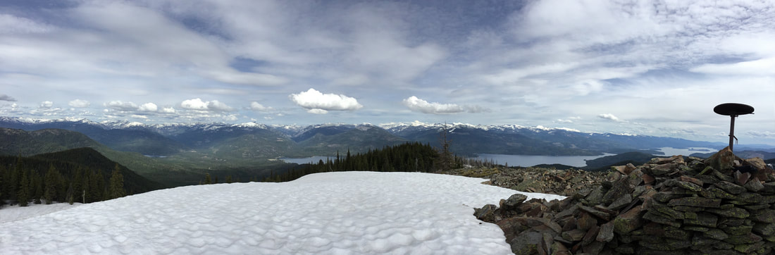
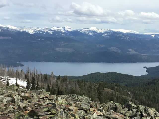
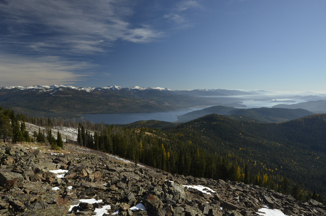
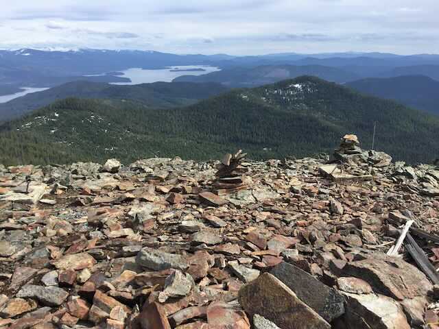
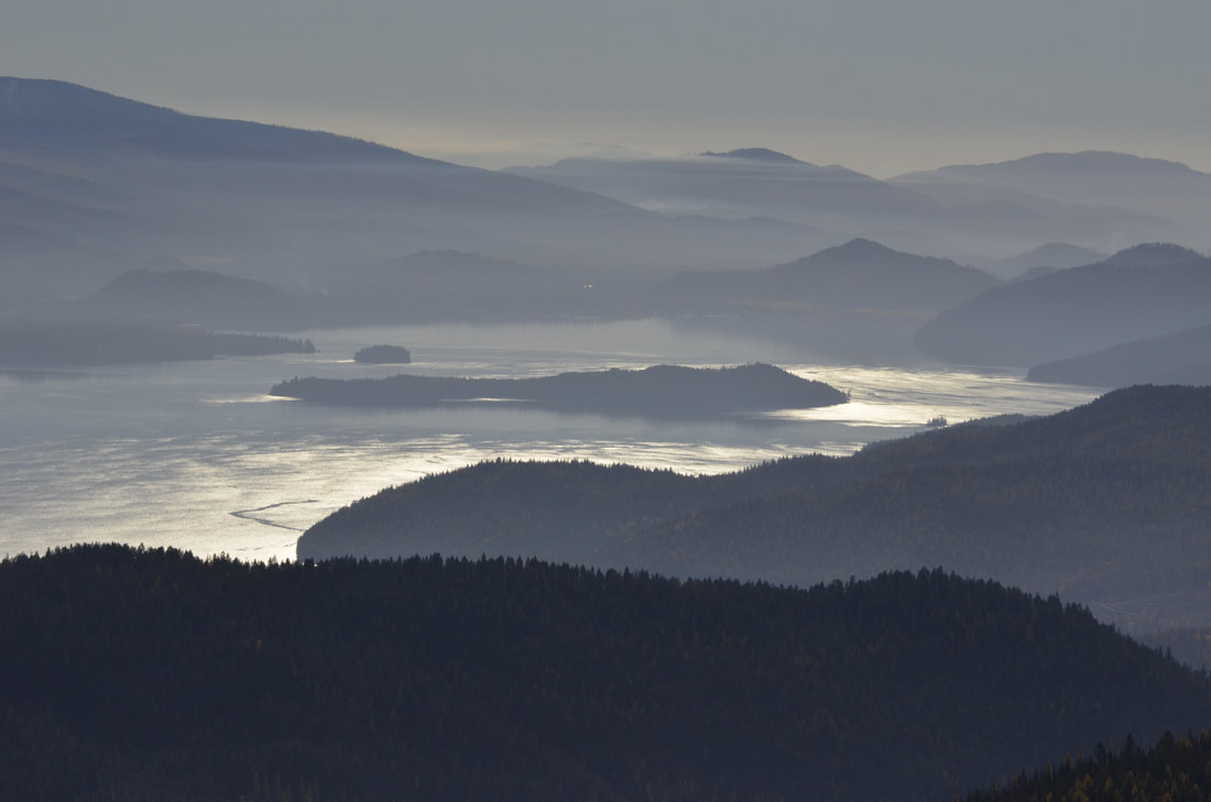
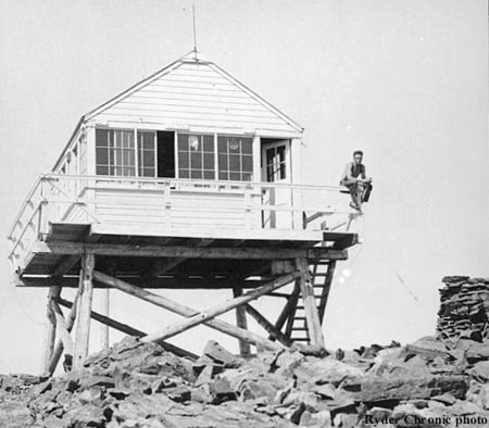
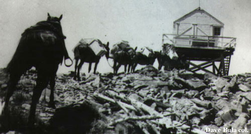
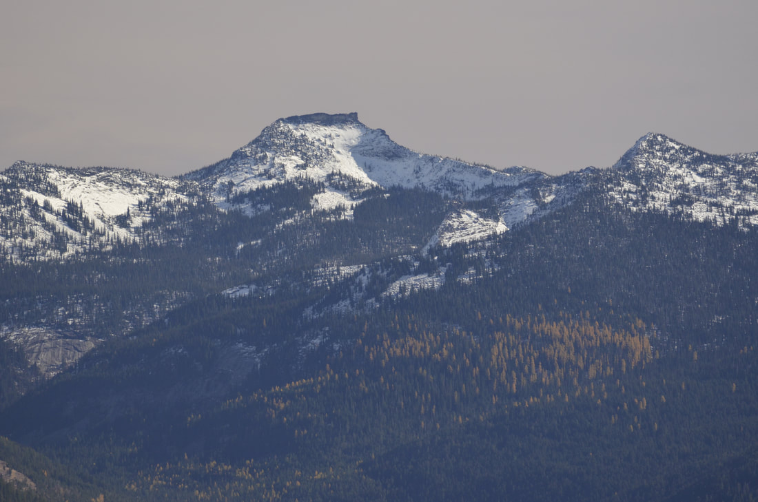
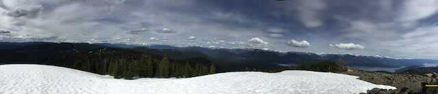
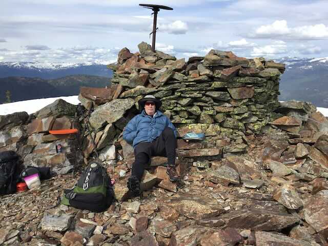
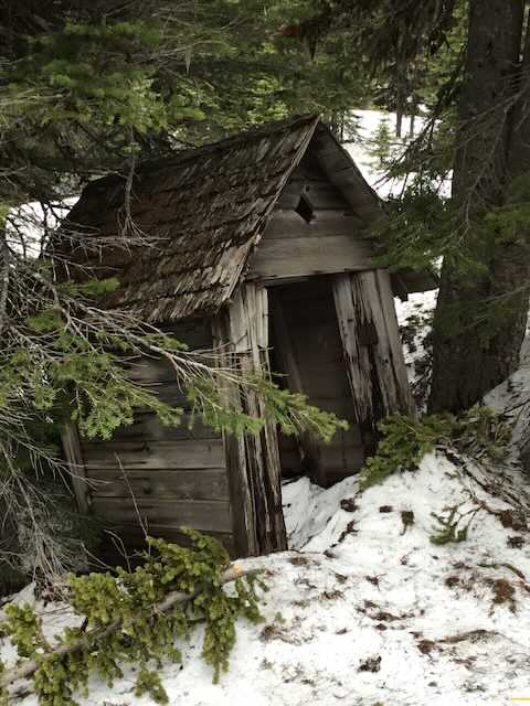
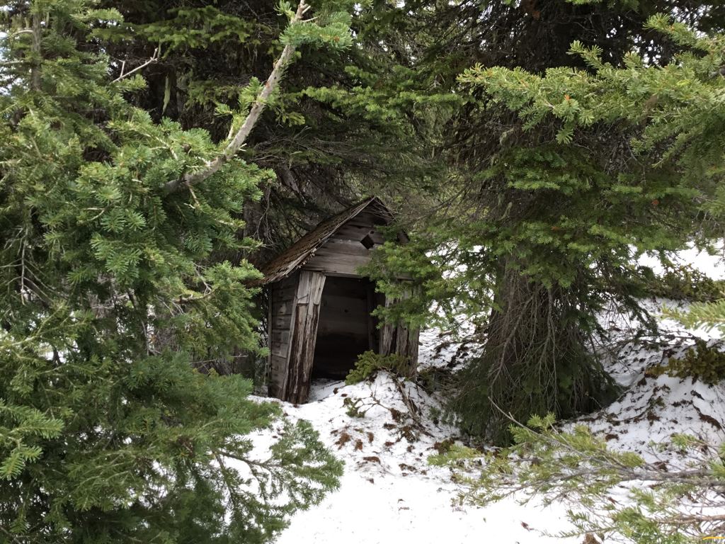
WE HAVE ADDED THE AREAS SHERIFF’S EMERGENCY PHONE NUMBERS FOR EACH TRIP WRITE UP UNDER THE RANGER DISTRICT INFO. IF AN EMERGENCY OCURRS, EVALUATE YOUR CIRCUMSTANCES AND CALL ONLY IF NEEDED. The trail starts down road about .1 miles from the pullout and fire ring. Looks for a memorial sign on a tree, on the uphill side. Trail #292 starts out moderately steep, up thru a thick forest with several benches that allow a bit of rest before climbing again. The higher you get on this trail, the more open spaces occur. At about 1.6 miles, you have an option to stay on the USFS trail, or walk up a ridge where a fire burned years ago. This route is warmer on cold days, where the USFS trail is in the trees on hot sunny days. Closer to the summit, the trees thin, and a meadows or two allows for views and wildflowers. Huckleberries flank the trail on the upper slopes. As you get closer the the summit, the views west open up. Within 10 or 15 minutes, the trail turns to light rock hopping, then you are on top. And the views are spectacular. Off to the E and SE, the full length of the American Selkirks is your view. And what a view it is. The old lookout tower is long gone, but the fire finder, or alidade, still stands. The alidade is a round platter in which the map of the area was on. It rotated like a compass, to allow the staffer to pin point the fires direction. When the fire lookout person spotted a fire, they called in the angle from their location. Other lookouts would do the same, and eventually the exact location was fixed. Altho there isn’t a map left, it is a very cool tool to look at. Like all fire lookouts, there was always an outhouse. A little NE of the summit, is a dilapidated outhouse. It’s leaning and not useable, but is a very photogenic artifact. The trail may be a little steep, but it’s only 3.6 miles RT. Take your kids with you. It’s a great learning experience, and offers great views.
DIRECTIONS:
From Priest River, drive north on Hwy 57 past Nordman where it merges with FR #302 at about 37 miles. After about 3 miles on 302 the pavement ends. Turn right (North) onto Tango Creek Road F.R. #638. At about a mile, there’s a “Y” in the road, bear left, staying on 638 up to the saddle in about 4.2 miles where you can park. If you get to a sharp right turn, you've gone .1 miles too far. The parking area is on the right as the road drops towards the hairpin turn. There are two 638. its a loop road. Drive past the first 638 to a road sign says #638 to the right. Be aware, the last mile of 638 is rough to the saddle. THE ACTUAL TRAIL #292 IS .1 OF A MILE WEST, DOWN THE ROAD FROM THE PARKING AREA. IT IS NOT BY THE SADDLE OR PARKING AREA.
COOL THINGS CLOSE BY:
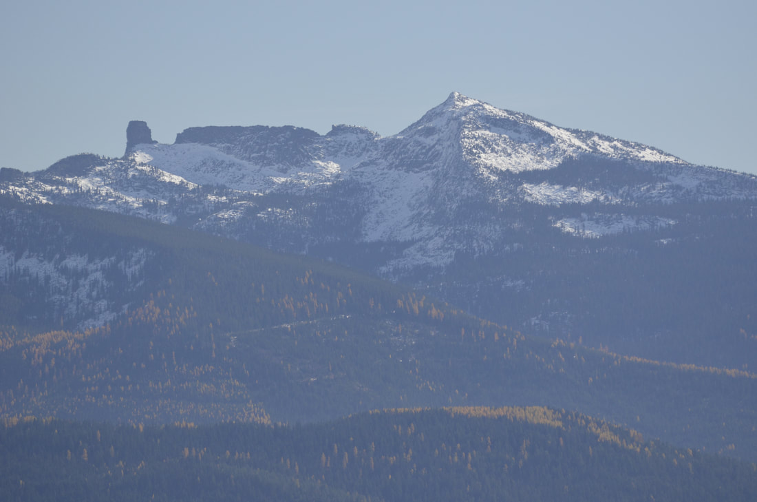
Upper Priest Lake, Beaver Creek Launch on the north end of Lower Priest Lake, Granite Falls& LaSota Falls, and the Roosevelt Grove of Ancient Cedars, and the Salmo-Priest Wilderness across the boarder in Washington.
HAZARDS:
The trail is semi steep, and the top section of the trail is rocky. The last mile of Road 638, is rocky and rough. Please use caution.