PADDLE DISTANCE: varies ELEVATION: 2030' LENGTH AND ACREAGE: varies MAPS: Spokane County Conservation Futures LAUNCH GPS: 47°41'53" N 117°02'29" W SPOKANE COUNTY SHERIFF: 509.477.2240
DESCRIPTION:
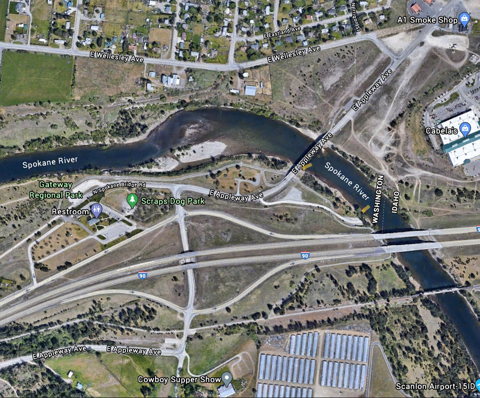
WE HAVE ADDED THE AREAS SHERIFF’S EMERGENCY PHONE NUMBERS FOR EACH TRIP WRITE UP UNDER THE RANGER DISTRICT INFO. IF AN EMERGENCY OCURRS, EVALUATE YOUR CIRCUMSTANCES AND CALL ONLY IF NEEDED. The Gateway Landing is located between the Spokane Bridge and I-90 at the state line, on the Washington side. You do have to carry your boats down to the water. This whole area is within the Spokane County's Gateway Regional Park.
ATTRACTIONS
This landing is along the Washington side of the Spokane River, and allows for paddling the river in both directions
DIRECTIONS:
Take I-90 to the last Washington State exit just past the Liberty Lake exit. Turn left (N) onto Spokane Bridge Road, and then right onto E. Appleway Ave. Take the first right turn into the parking area.
COOL THINGS CLOSE BY:
Spokane River Washington & Idaho, Scraps Dog Park, Liberty Lake -State Line Trail, the Washington Centennial Trail, Liberty Lake, Q'emlin Park, Post Falls, and Hauser Lake.