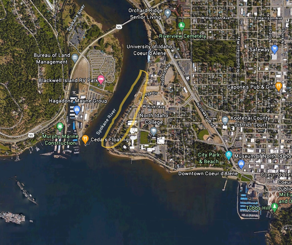
N.I.C. DIKE ROAD LANDING
PADDLE DISTANCE: varies
ELEVATION: 2128’
LENGTH AND ACREAGE: varies
MAPS: IPNF., Mica Bay topo
LAUNCH GPS: 47°40’30” N 116°48’07” W
KOOTENAI COUNTY SHERIFF: 208.446.1300
ELEVATION: 2128’
LENGTH AND ACREAGE: varies
MAPS: IPNF., Mica Bay topo
LAUNCH GPS: 47°40’30” N 116°48’07” W
KOOTENAI COUNTY SHERIFF: 208.446.1300
DESCRIPTION:
Altho there is not an actual launch here, the N.I.C. Beach is long and has several paths down to the waters edge.Be aware of lots of Goose poop on the beach
ATTRACTIONS
Access to the Spokane River, the main body of the lake, City Beach, Tubbs Hill, Casco Bay, and Cougar Bay.
DIRECTIONS:
Drive east on I-90 to Exit 11 or Northwest Blvd, in CDA.
Continue SE on Northwest Blvd to just past the Hwwy 95 bridge, and turn r4ight at the signs to NIC.
From downtown CDA, drive NW on Northwest Blvd. Turn left onto W. Fort Grounds Dr. which turns into Park Road, to W. River Ave.
Turn left and drive thrun the Round About, staying on W. River Ave to the next Round About, to the NIC Dyke Road.
Finding a parking spot is the most difficult part of the launch. You can remove your kayak or canoe here and find a parking space down off the Dyke Road.
COOL THINGS CLOSE BY:
Cougar Bay, Casco Bay, the Spokane River, City Beach, Tubbs Hill, and Sanders Beach.
R & P:
Trails End Brewery, Moon Time, Franklins, Mexican Food Factory


