EVENT TYPE: Hiking, backpacking, camping, scrambling, and photography DISTANCE: 3.7 miles RT to Lower Stevens, 5 miles RT to Upper Stevens Lake. ELEVATION: 1580, gain to Lower, 1780 to Upper DIFFICULTY: Moderate to Moderately Difficult MAPS: IPNF, LOLO N.F., IPNF, Stevens Lakes topo GPS: Lower 47°43’36” N -115°75’96” W Upper 47°42’80” N -115°76’25” W RANGER DISTRICT: CDA River R.D. 208.769.3000 SHOSHONE COUNTY SHERIFF: CALL 911 FIRST or 208.556.1114
DESCRIPTION:
WE HAVE ADDED THE AREAS SHERIFF’S EMERGENCY PHONE NUMBERS FOR EACH TRIP WRITE UP UNDER THE RANGER DISTRICT INFO. IF AN EMERGENCY OCURRS, EVALUATE YOUR CIRCUMSTANCES AND CALL ONLY IF NEEDED. This trail starts south above Mullan, Idaho where the trailhead sits on an old railroad bed. Stevens Lakes trail goes up the left (east) side of Willow Creek on an old mining road. A short distance up the road, off to the right (west), is an old mine tunnel tucked onto the mountain. In the last 8 months I have been building a water diversion trench to drain the 50' of trail that's always wet from a near by spring. The road dwindles down to a trail that switchbacks a few times and becomes steep as it makes its way into a forest. The terrain flattens out where there used to be some plywood shacks the miner stayed in. Just past this forest, the trail breaks out into a clearing that offers great views of the cliffs above and a nice waterfall above the trails crossing. In the spring, look for a narrow section of the creek, about 50’ below the falls to cross. Once past the creek, the trail heads west on a large scree slope to a switchback that takes you back to the creek higher up. At this switchback, look to the east where the creek falls thru a split rock. Look closer up above and there are two more waterfalls.From here the trail steepens and often is slippery with mud. In about 10 minutes the trail mellows thru a small forest until it pops out at the lake. There are camp site all along the north end of the lake. To get to the upper upper lake, hike the right (west) shore line to the back of the lake. Look for a path near the rock outcropping that works its way up 300verts to the lake. Off to the east along the shore line, is a photo op in every season, especially fall. All the slopes above the lakes to the west, are slopes the Spokane Mountaineers instruct their students in glacier travel and ice axe arrest practice. After the instruction on Sunday, the instructors take the student south on the knife edge ridge to the summit.
OPTION #1:
SUMMIT HIKE From the upper lake, walk the right shore line, bearing right up hill. There is no trail, and be aware, this route is about 1400 verts on nearly a 47% slope. Once on the ridge top, turn left (south) staying on the spine all the way to the summit. There are three descent routes. 1st is the way you ascended the peak. But please be aware, this is the most dangerous part of descending. DO NOT GO DOWN TO THE UPPER LAKE ON THIS SLOPE. 2nd is to circle around west above Lone Lake, and descend into the Upper Santuary on the west side. 3rd is to follow the old road on West Willow Ridge side of Lone Lake down to where the road drops East down to the trail to Lone Lake. Be safe and do this hike/scramble clockwise only. DO NOT DO THE LOOP COUNTER CLOCKWISE
OPTION #2:
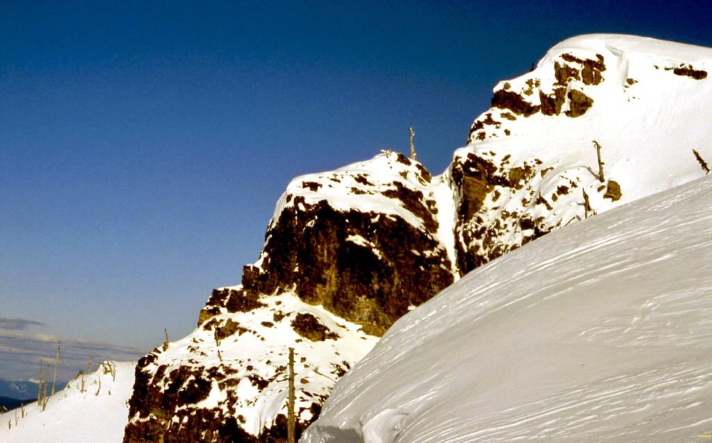
THE SUMMIT FROM UPPER STEVENS LAKE. From the upper lake, hike up to a low laying bench that heads towards the peak. Scramble up under Stevens Peak in an obvious chute. Once up under the peak, turn right up a the knife edge ridge. Turn left on the ridge and scramble to the summit. BE AWARE..in early spring, these chutes can be avalanche chutes. This is a summer, fall route only. SEE IMAGE BELOW TO FOR THIS ROUTE.
OPTION #3:
ST. REGIS, STEVENS LAKES, AND STATE LINE RIDGE How many times have you hiked onto Stevens Lakes, and wondered where the road goes as you enter the forest onto a trail, below the old mine site. I did for years, but changed that n 4.17.2020. Armed with a google map of the route, I turned up the road for 6 easy switchbacks from a logging operation. I was surprised at how quickly the switchbacks were behind me. If you stay on the logging road, it skirts a clearcut and enters a forest that eventually leads you to the open State Line Ridge to Stevens Peak. Or about the time you enter the forest mentioned above, you can cut up thru the clearcut to the west. At the top of the clear cut, enter the forest and head south for about .5 miles, where the terrain opens up.
From these options, you will come out of the forest along a long ridge to the CDA River District and the St. Joe River District. DO NOT ATTEMPT TO HIKE THIS KNIFE EDGE RIDGE TO THE BACK DIVIDE. ITS WAY TOO DANGEROUS. Instead, drop down below, to skirt the dangerous terrain. About .75 miles from the forest, you will come to the rock prominence you see above Upper Stevens Lake. This is a great spot for lunch.
If you decide to head to Stevens Peak, USE EXTREME CAUTION.
DIRECTIONS:
Drive east on I-90 to exit #69, and turn left (north) over the freeway to the stop. Turn right (east) past Lucky Friday Mine on SH 10 for about .75 miles and bear right until the road crosses over the freeway. Continue up Willow Creek Road for about a mile to the trailhead. Do not turn towards the Shoshone Park, go right.
COOL THINGS CLOSE BY:
Lone Lake, Stevens Peak, Gold Hill, St. Regis Lakes, Cooper Lake, Shoshone Park and historical Mullan, Idaho
HAZARDS:
Some of the trail to Lower Stevens Lake is very slippery in wet conditions. The trail from Upper Stevens Lake, up to the summit and down to Lone Lake are hazardous. USE EXTREME CAUTION. In OPTION #3, you should use EXTREME CAUTION PAST THE ROCK PROMINENCE ALONG THIS RIDGE.
R & P:
Pizza Factory, 1313 Club, Brooks Hotel & Restaurant, City Limits Brew Pub, Fainting Goat, Smoke House BBQ & Saloon, Wallace Brewing Co., and Muchacho’s Tacis in Wallace. Radio Brewing, the Snake Pit, and Moontime.
HIKING TRAIL #16A, NEAR GOLD HILL, STEVENS PEAK IN DISTANCE, A.L.R.
IN THE MID TO LATE 80’S, THE USFS DESIGNATED THE STEVENS PEAK AREA, THE “ALPINE LAKES REGION” BUT NEVER FOLLOWED THRU WITH ITS POSSIBLE WILDERNESS DESIGNATION.
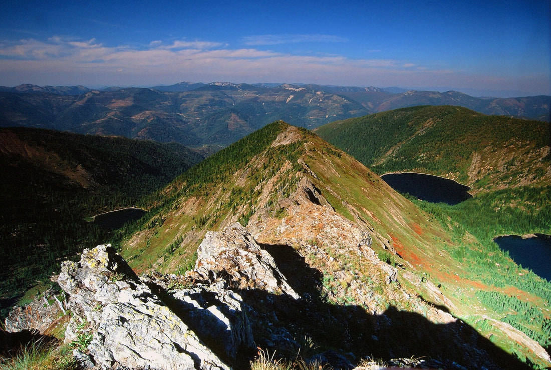
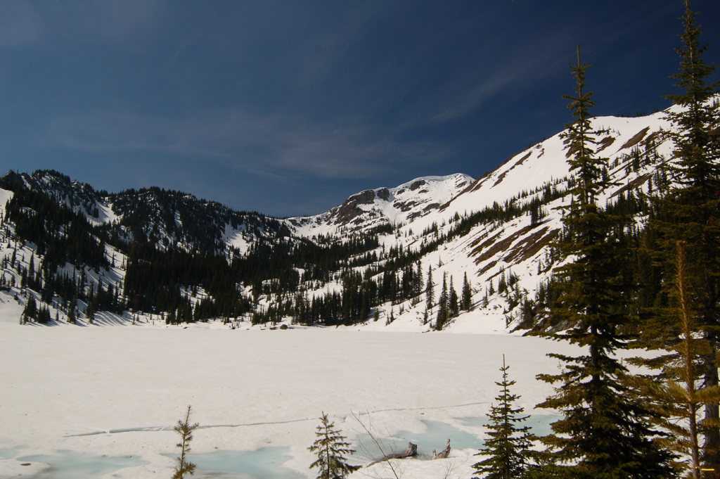
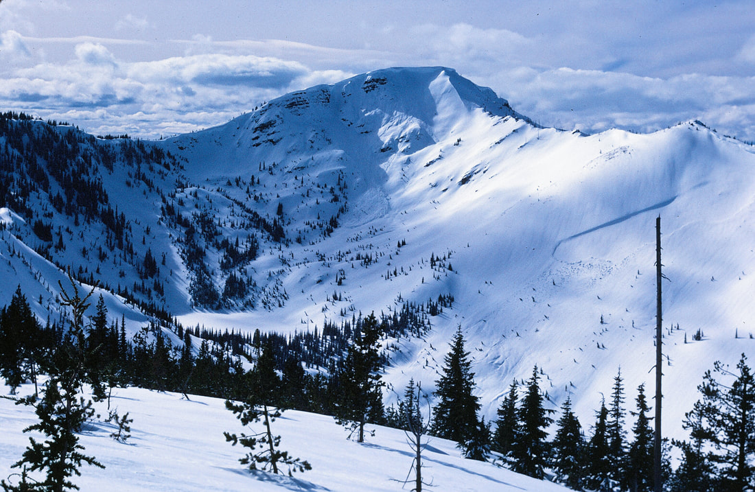
STEVENS LAKES FROM STEVENS PEAK 6838’
THIS ROUTE IS LESS STEEP AND SAFER IN NONE SNOW CONDITIONS
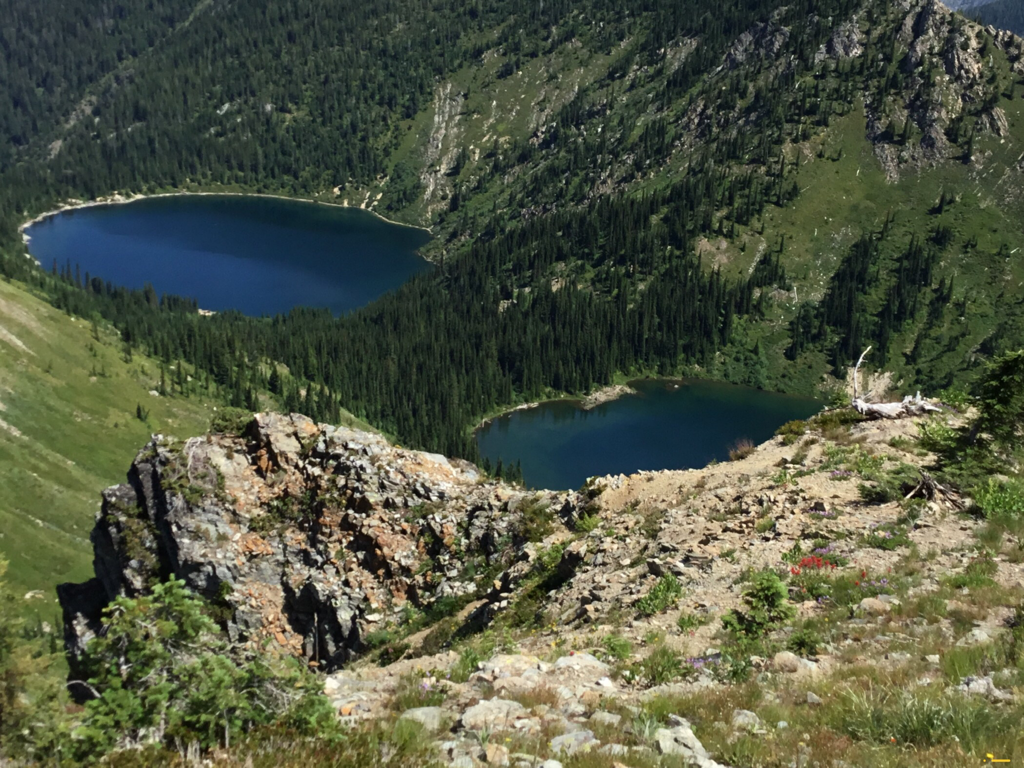
LONE LAKE ON THE LEFT & U. & L. STEVENS LAKES ON RIGHT SPLIT BY THE WILLOW RIDGE
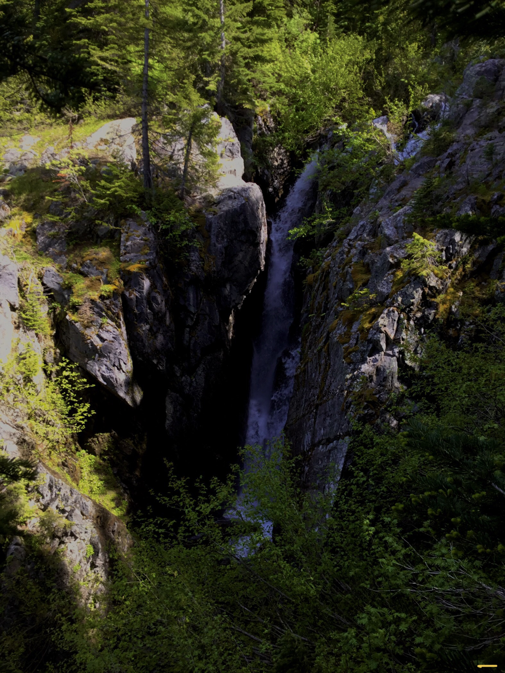
EAST WILLOW CREEK’S MIDDLE HEADWALL FALLS
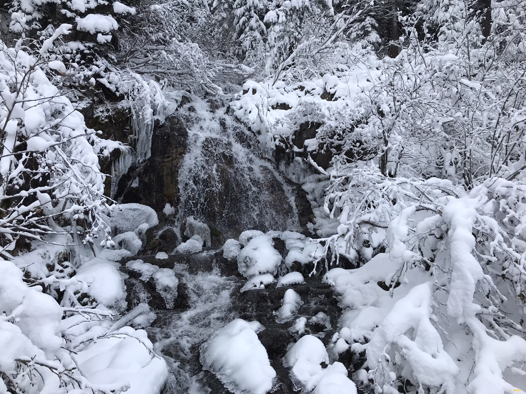
WILLOW CREEK WATERFALLS 11.9.2020
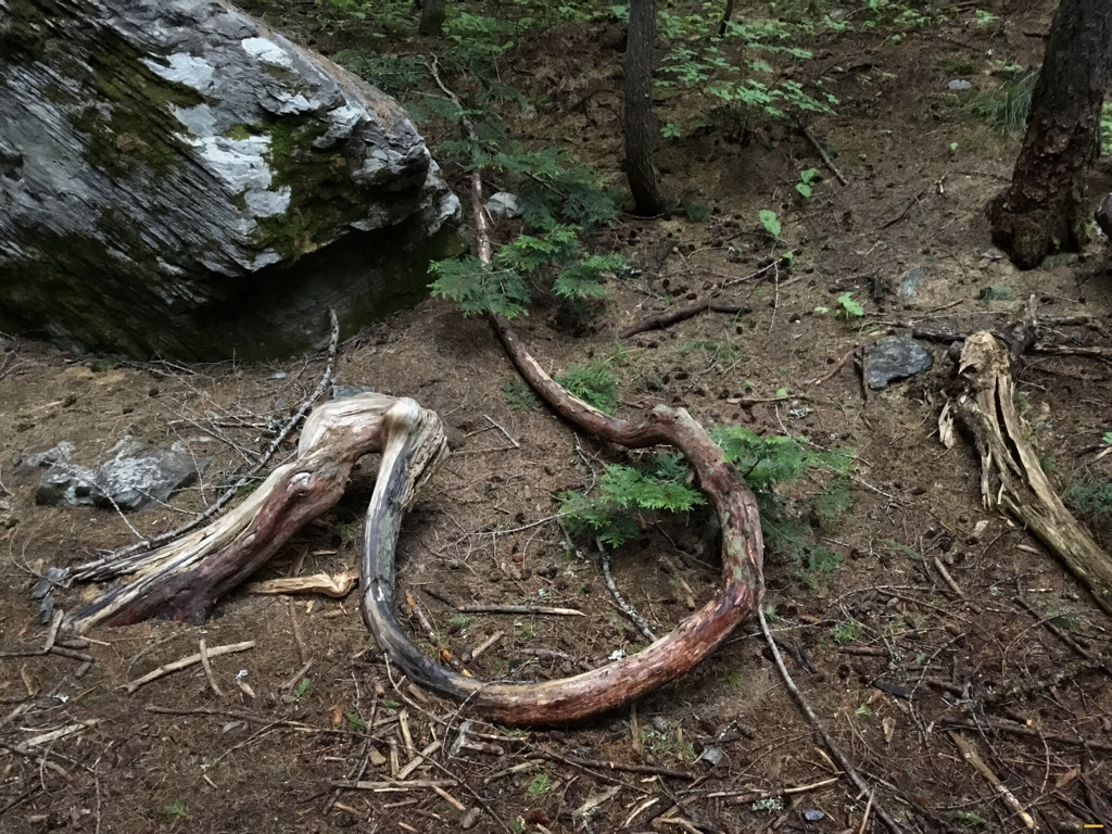
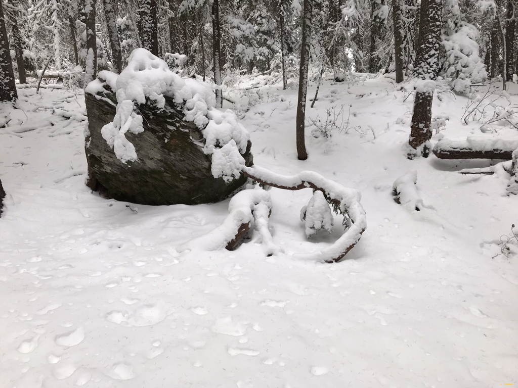
I HAVE PHOTOGRAPHED THIS CEDAR TREE (CIRCLING CEDAR) FOR OVER 50 YEARS. IT STANDS/LIES ABOUT HALF WAY TO THE LOWER STEVENS LAKE.
I MUST TELL YOU ALL….SOME DO GOODER TRIED TO PUT THE GREEN END ON THE ROCK FOR THE WINTER, AND BROKE IT’S CORE. THE CIRCLING CEDAR HAS DIED FROM IT’S INJURIES. HOW SAD.
THE OLD CIRCLNG CEDAR TREE ALONG TRAIL #168. SHOT 11.9.2020
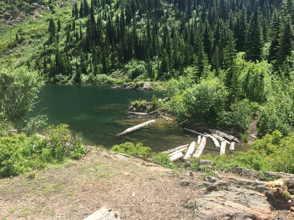
LOWER STEVENS LAKE IN EARLY SPRING
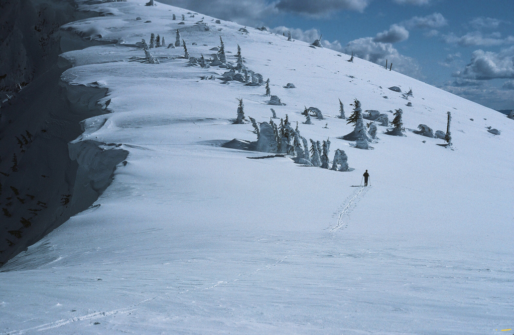
SKIING TO STEVENS PEAK IN 1984
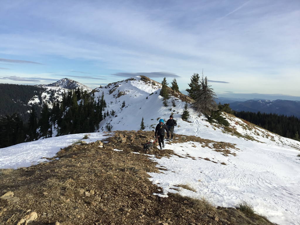
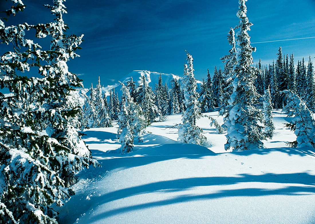
THE TRAIL TO THE UPPER LAKE SHOWS ON THE RIGHT IN SUMMER & FALL IN THE SPRING THIS AREA IS TOO WET. FOLLOW THE BRAIDED TRAIL UP ON THE HILL SIDE. IN 2024 AN AVALANCHE BROUGHT DOWN DOZENS OF TREES.
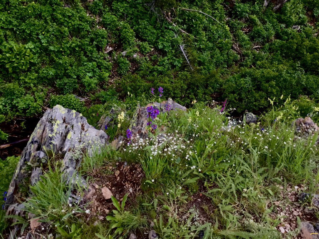
WILDFLOWERS ALONG THE TRAIL TO THE UPPER LAKE
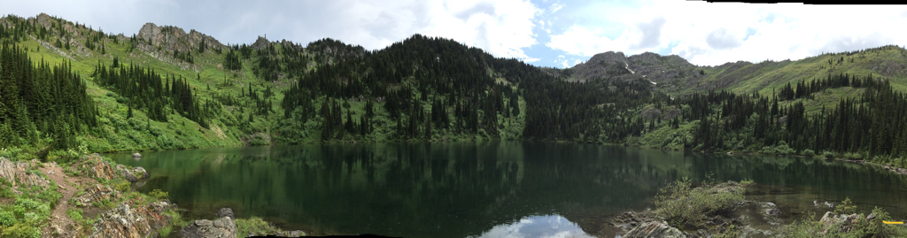
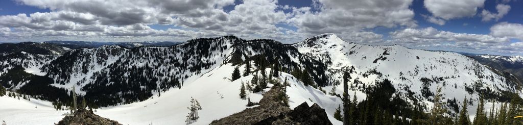
PANO OF UPPER STEVENS LAKE
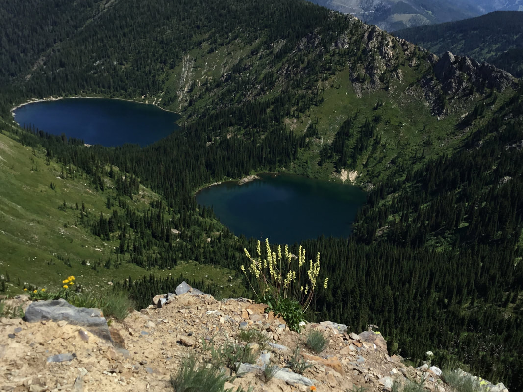
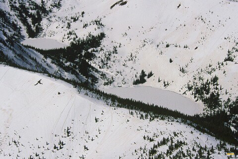
AERIAL VIEW OF UPPER & LOWER STEVENS LAKES, 300VERTS DIFFERENCE
UPPER STEVENS LAKE FALL COLORS
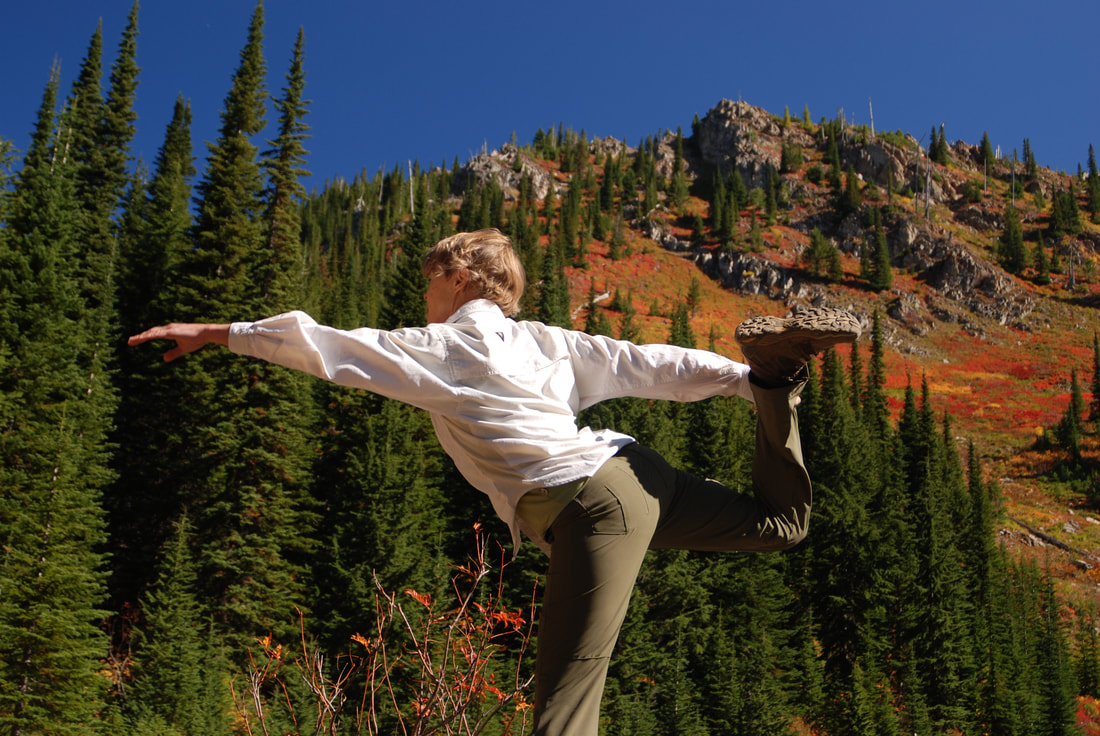
NANCY DOING YOGA AT LOWER STEVENS LAKE
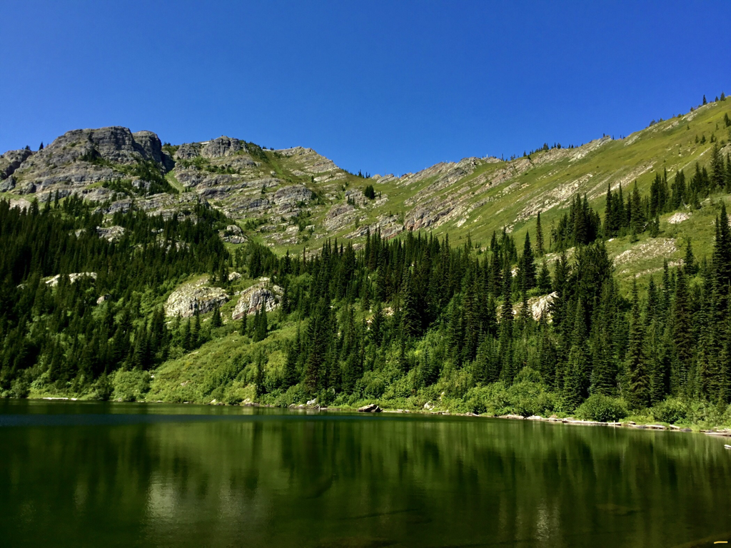
UPPER STEVENS LAKE BELOW STEVENS PEAK IN MID SUMMER
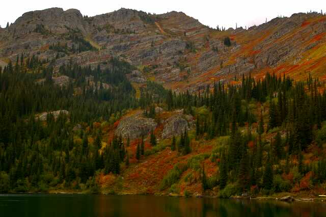
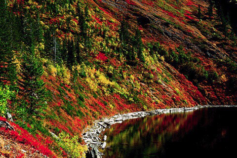
UPPER STEVENS LAKE IN PRIME FALL COLOR
BACKCOUNTRY SKIER CURT ALMLI ON WAY TO STEVEN’S SUMMIT, FROM WEST WILLOW RIDGE. 1983
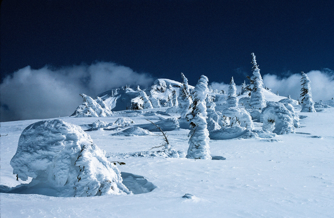
SNOW GHOSTS ALONG WEST WILLOW RIDGE TO STEVENS PEAK
UPPER STEVENS LAKE FROM STATE LINE RIDGE 1984
DOES ANYONE SEE THE IMAGE OF A LADY LEANING BACK AGAINST THE PEAK, HOLDING A BABY? OR IS IT JUST ME?
THIS IMAGE WAS TAKEN 4.27.20 ON THE RIDGE BETWEEN ST. REGIS LAKES & STEVENS LAKES. STEVENS PEAK, TOP RIGHT CENTER. 8 MILES RT, 2700 VERTS TO THIS POINT.
THE BELOW ARE SOME HISTORICAL IMAGES ON THE STEVENS PEAK AREA. USUALLY I PUT HISTORICAL INFORMATION BEHIND SUBTITLES THAT YOU CAN DOUBLE CLICK ON. BUT THE FOLLOWING INFORMATION IS TOO INTERESTING, AND NEEDS TO BE READ BY ALL STEVENS LAKES VISITORS, TO ENHANCE THIER VISIT.
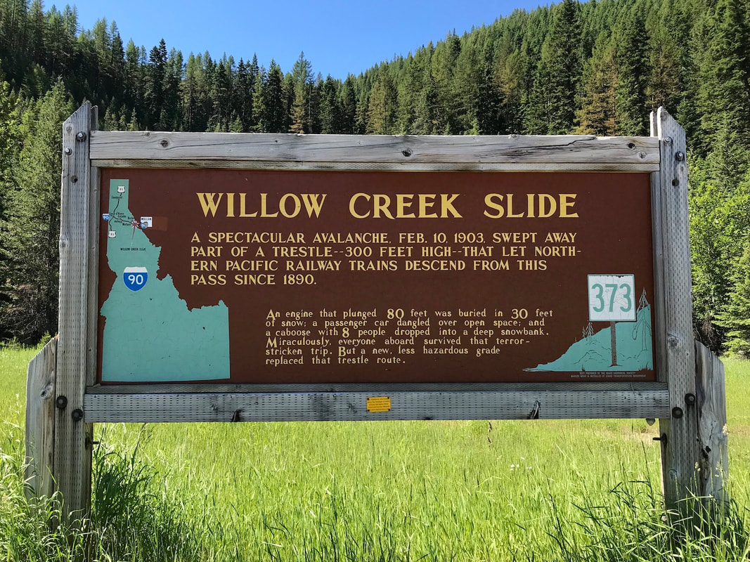
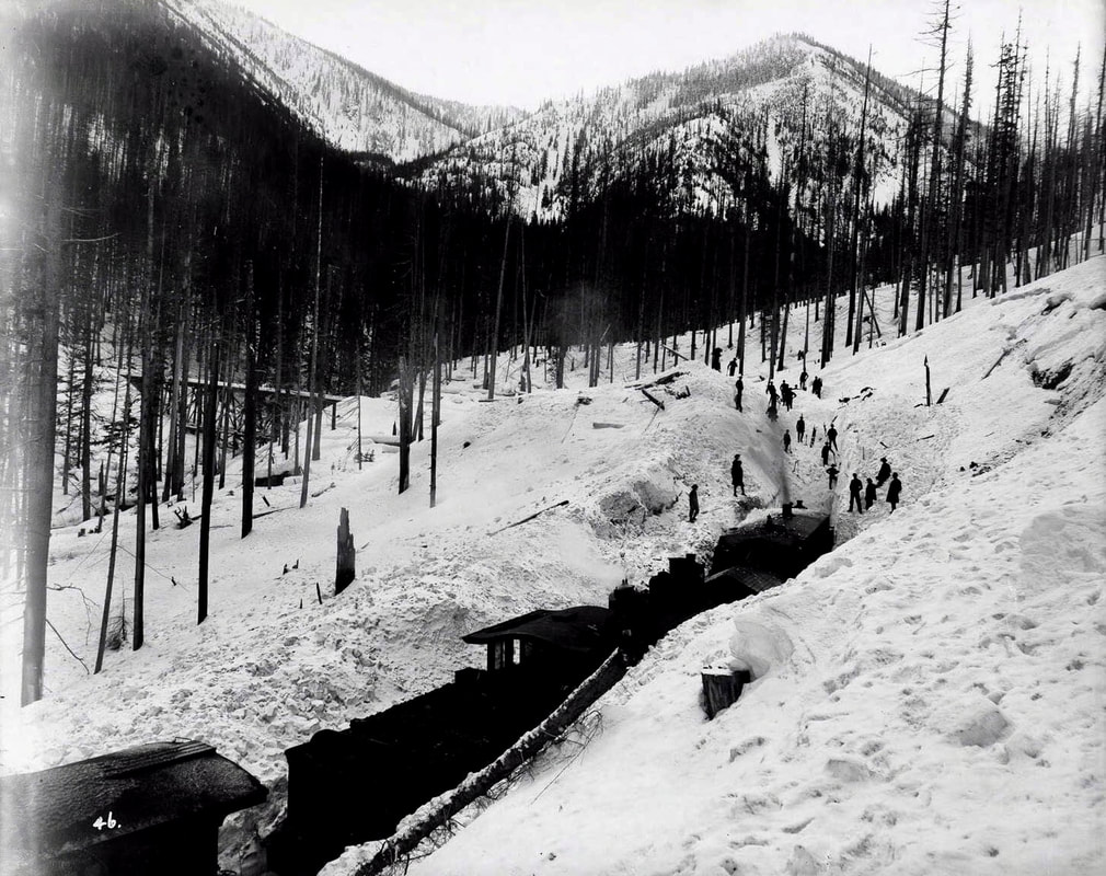
THE GREAT AVALANCHE OF 1903
ALL IMAGES BELOW ARE FROM THE "BARNARD-STOCKBRIDGE PHOTOGRAPHY COLLECTION" AND ARE HOUSED IN THE UNIVERSITY OF IDAHO DIGITAL ARCHIVES. I WOULD LIKE TO THANK THE NORTHERN PACIFIC RAILROAD DEPOT MUSEUM FOR TURNING ME ON TO THE BELOW HISTORY.
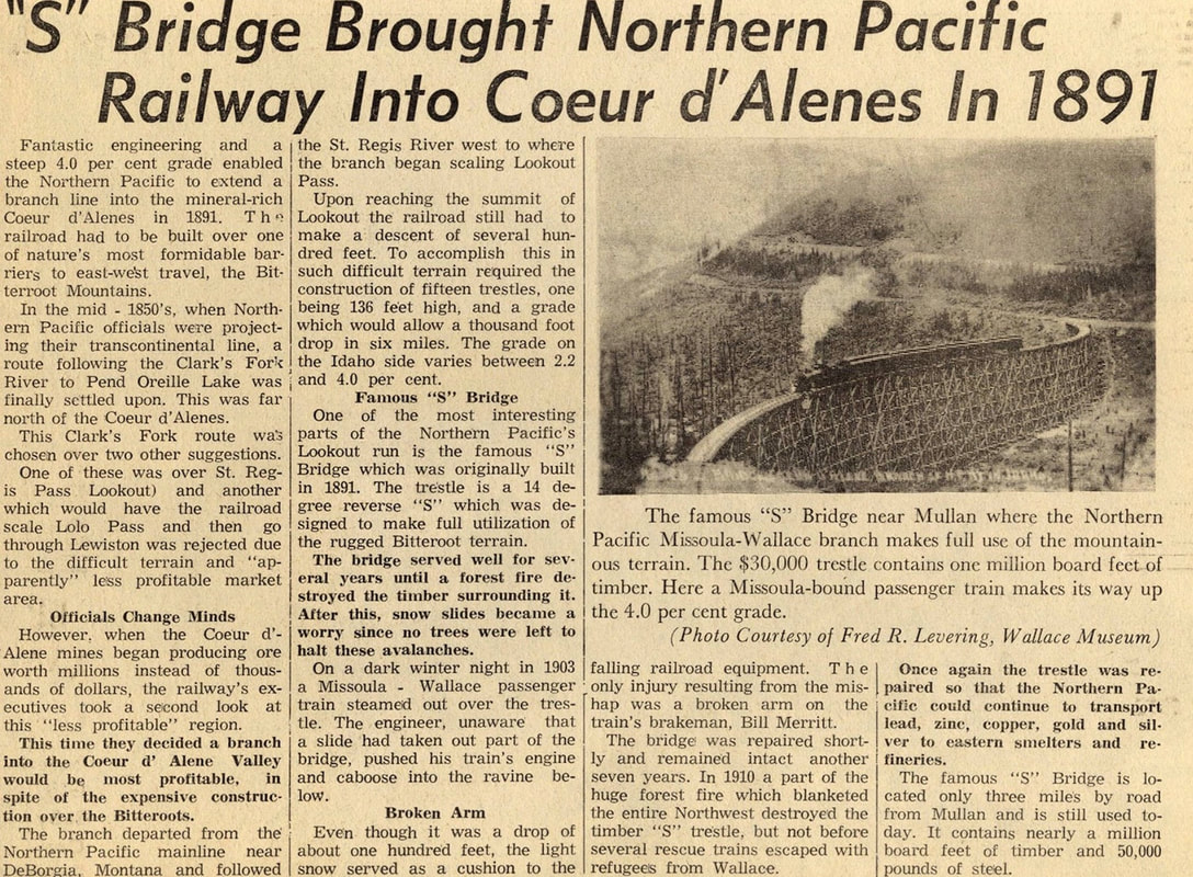
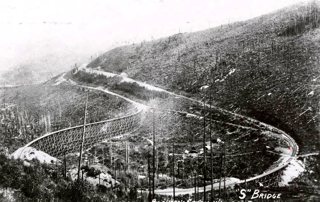
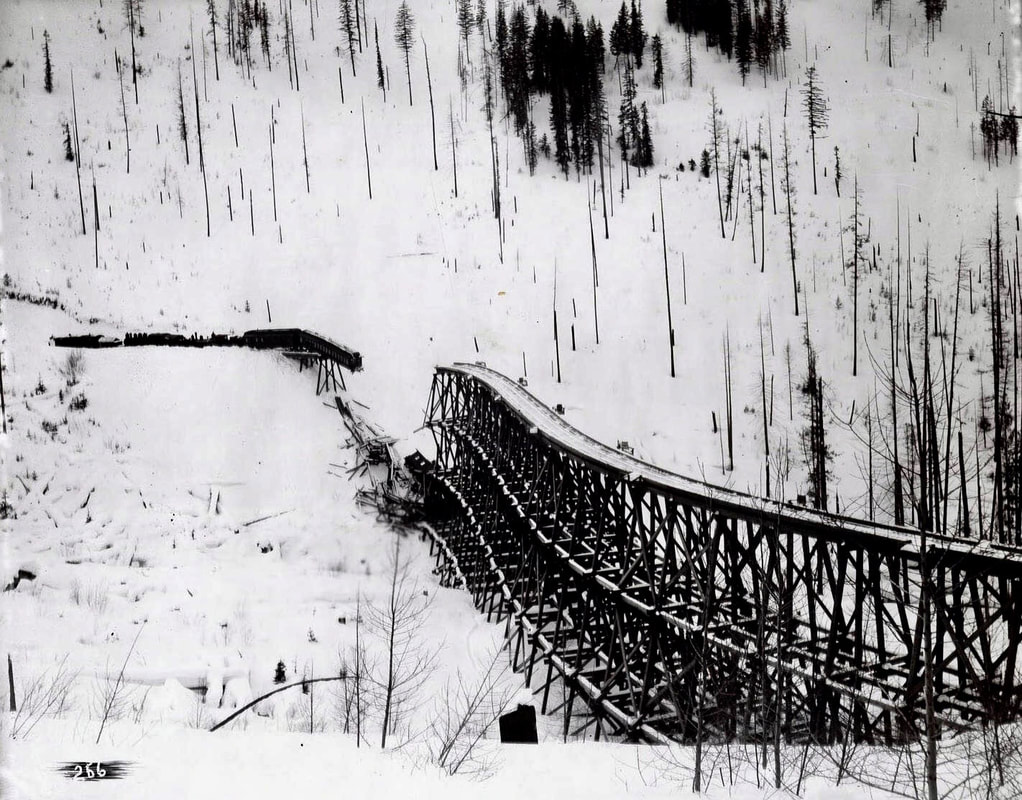
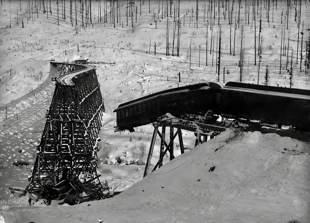
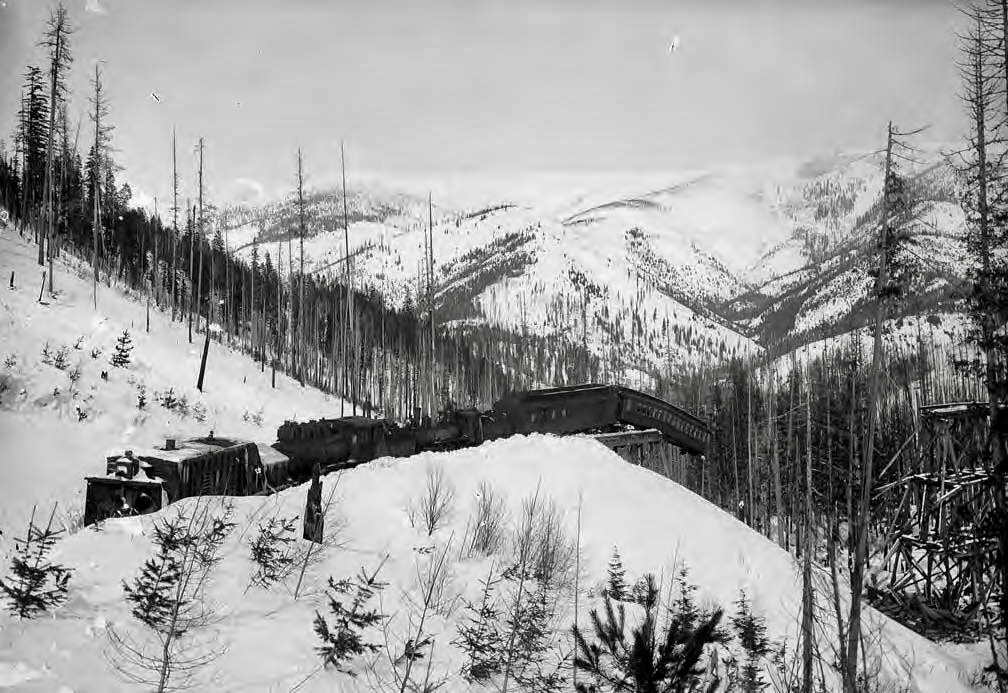
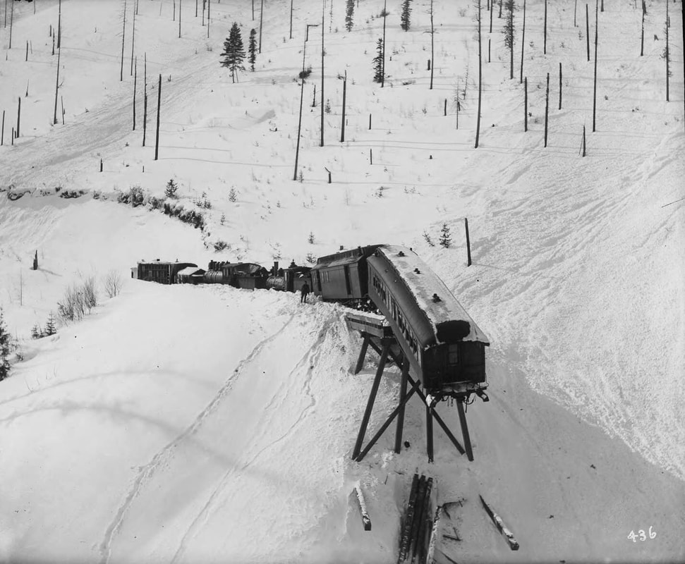
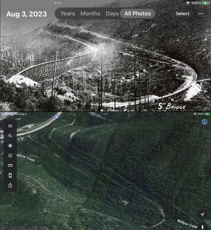
THIS IS AN IMAGE OF THE OLD TRAIN REVERSE "S" SHAPED BRIDGE THAT USED TO BE IN THE AREA OF THE TRAILHEAD FOR STEVENS LAKES. THE CURRENT TRAILHEAD IS MARKED WITH A RED DOT.
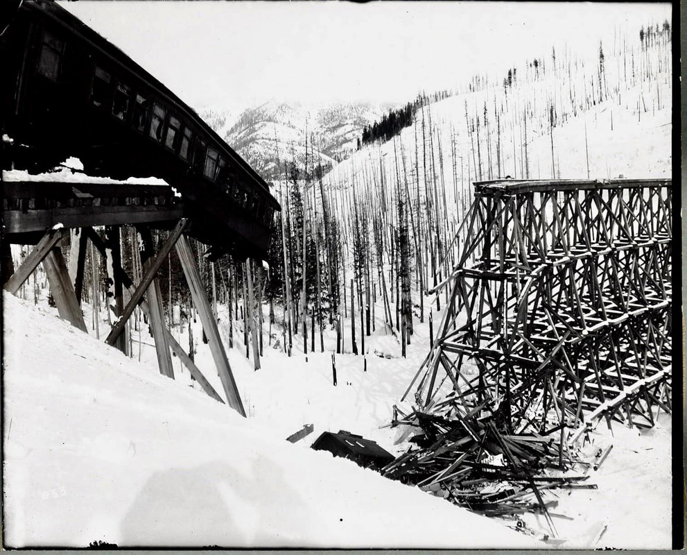
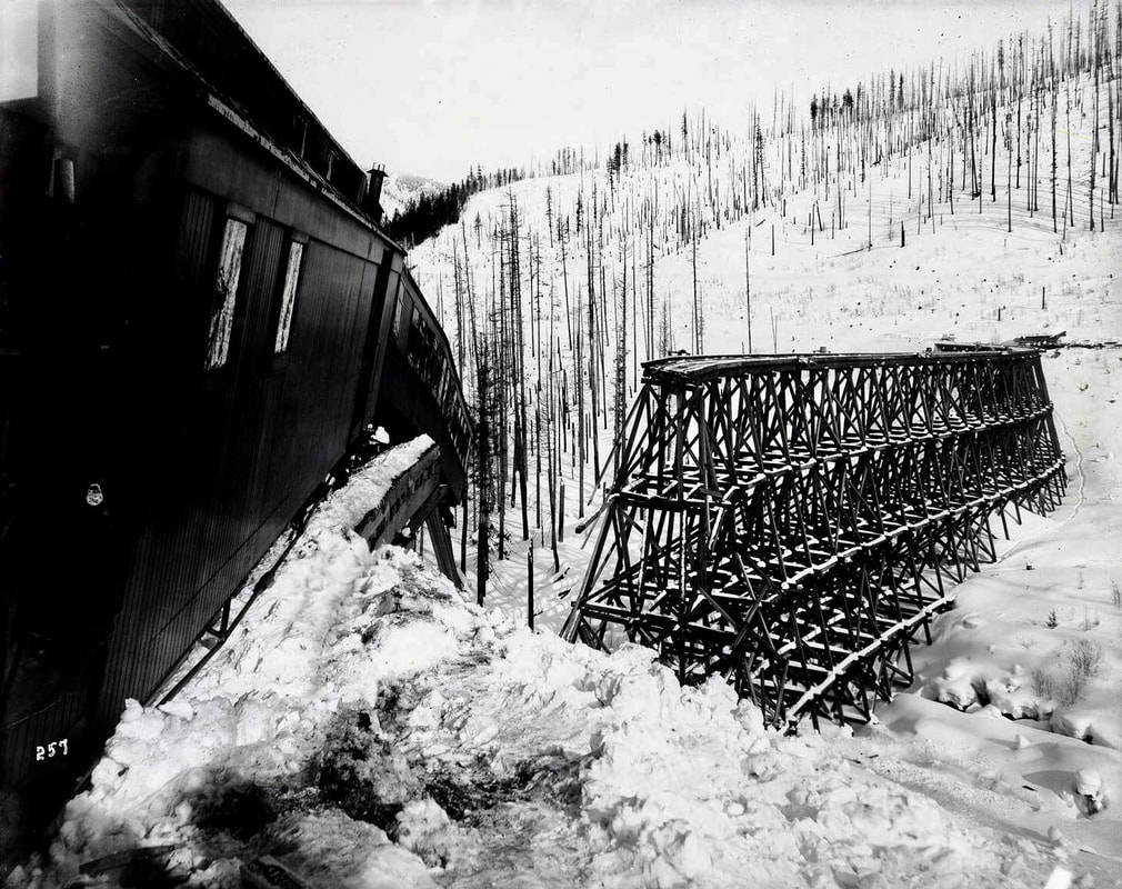
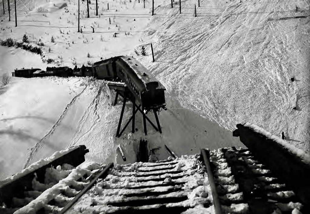
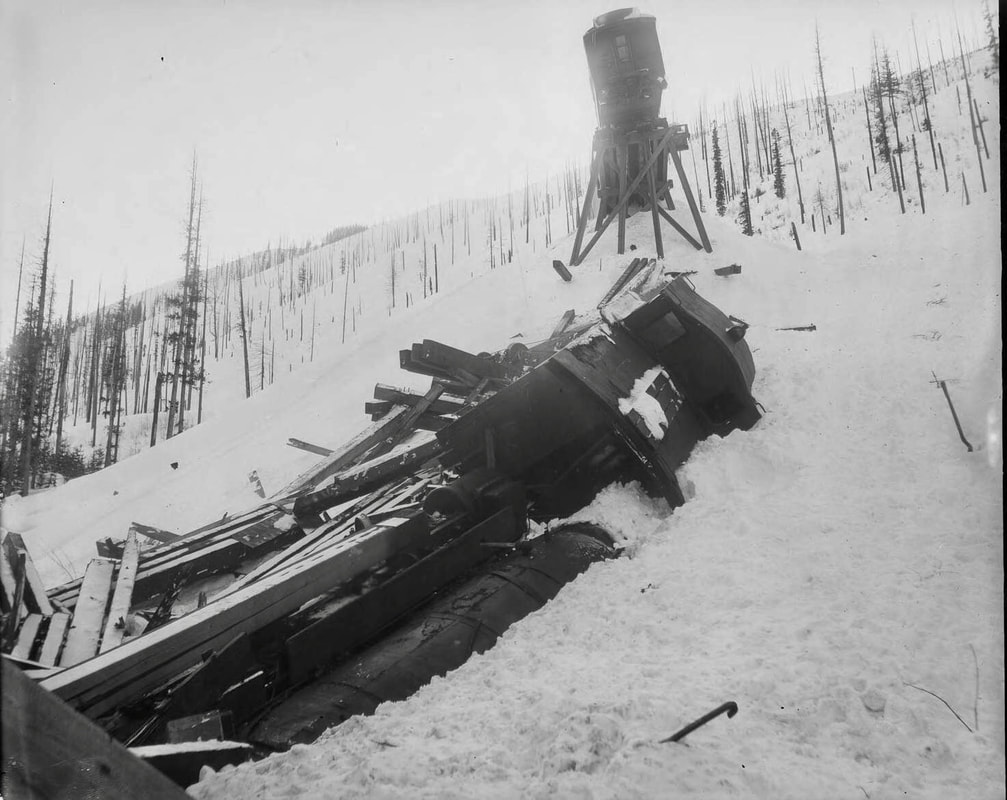
THE ENGINES WERE PUSHING A CABOOS AND A ROTARY PLOW, BUT AS IT ROUNDED THE "S" SHAPED BRIDGE, IT BROKE DOWN, STRANDING SOME CARS ON THE BRIDGE. THEN BEFORE SUNRISE, THE MOUNTAIN’S SNOW ABOVE, SLIDE AND TOOK OUT A SECTION OF THE BRIDGE. THE IMAGES ARE BY NELLIE STOCKBRIDGE, OF THE BARNARD-STOCKBRIDGE COLLECTION. U OF I DIGITAL ARCHIVES. THEY WERE SHOT ON 8X10 GLASS NEGATIVES.
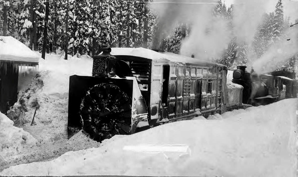
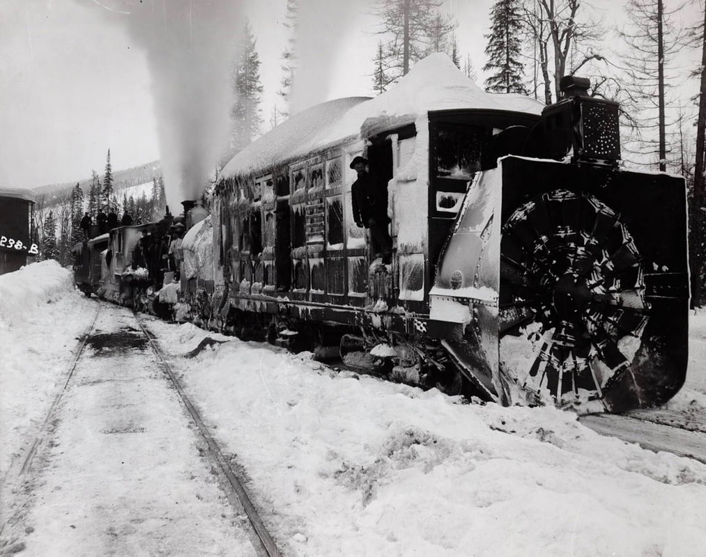
THIS IMAGE OF THE ROTARY SNOW BLOWER, IS TO ILLUSTRATE THE TYPE OF EQUIPMENT USED TO CLEAR THE LINE.
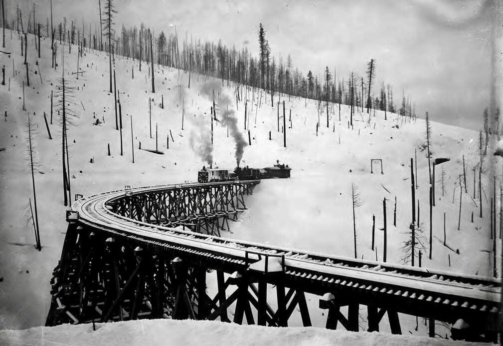
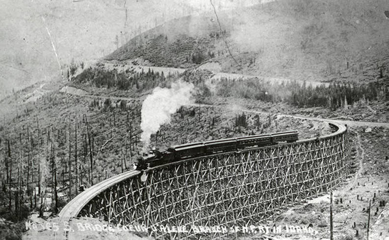
THIS IMAGE IS FROM 1890 AND ILLUSTRATES THE EXTENT OF THE AVALANCHES DEBRIS THAT OCCURRED MANY TIMES ALONG THE NORTHERN PACIFIC RAIL LINE. THE BRIDGE ON THE LEFT IS OVER WILLOW CREEK. IT IS NOW AN EARTHEN BRIDGE THAT YOU CROSS TO GET TO LONE LAKE.
THE FOREST AROUND THE "S" BRIDGE, WAS BURNED IN 1890’S, AND THE “S” SHAPED BRIDGE COMPLETELY BURNED IN THE GREAT FIRE OF 1910
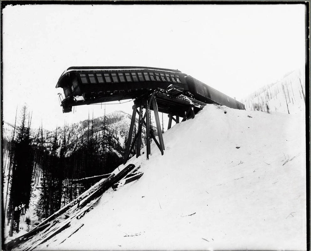
THE ENGINE IS PICTURED BELOW THE TIMBERS, WITH THE CABOOSE IS UP HILL FROM IT
A CLOSE UP OF THE TYPE ROTARY SNOW BLOWER USED TO CLEAR THE TRACKS
THIS IMAGE IS THE LAST PASSENGER TRAIN TO USE THIS ROUTE
I INCLUDED THESE IMAGES TO SHOW YOU THE THEN AND NOW DIFFERENCE IN THE AREA OF THE STEVENS LAKES TRAILHEAD
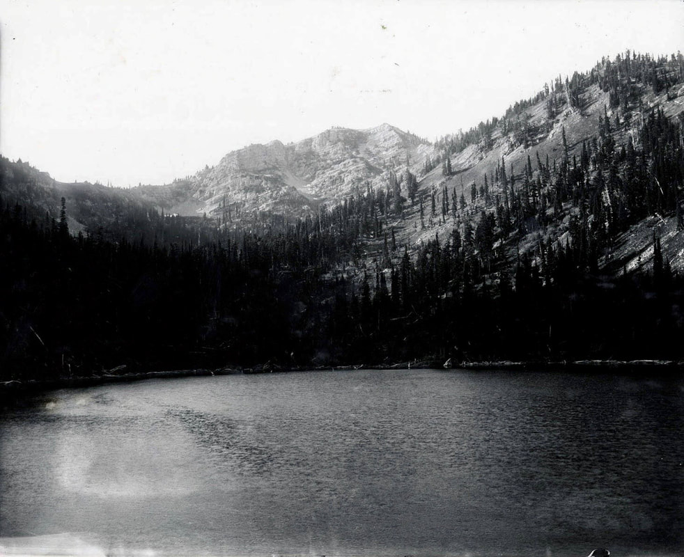
THIS IMAGE IS OF UPPER STEVENS LAKE IN 1920 NOTICE THE LACK OF TREES BY NELLIE STOCKBRIDGE
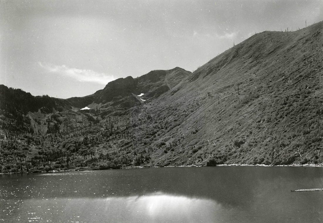
AN IMAGE OF LOWER STEVENS LAKE AND PEAK FROM 1895 THE FIRES OF 1910 & 1923 DESTROYED ALL THE TREES IMAGE BY NELLIE STOCKBRIDGE
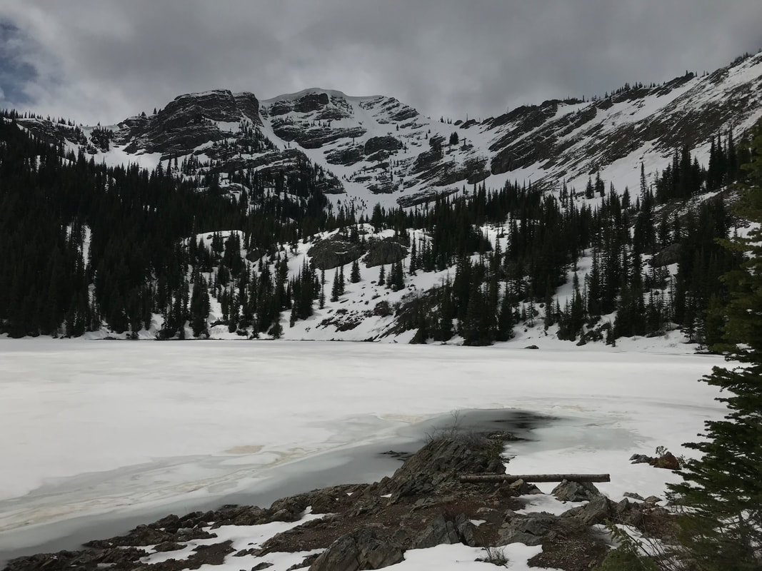
I TOOK THIS IMAGE ON 6.15.2022
COMING SOON IS THE STORY OF THE 12” PIPE YOU SEE WHILE HIKING TO THE LAKES. STAY TUNED