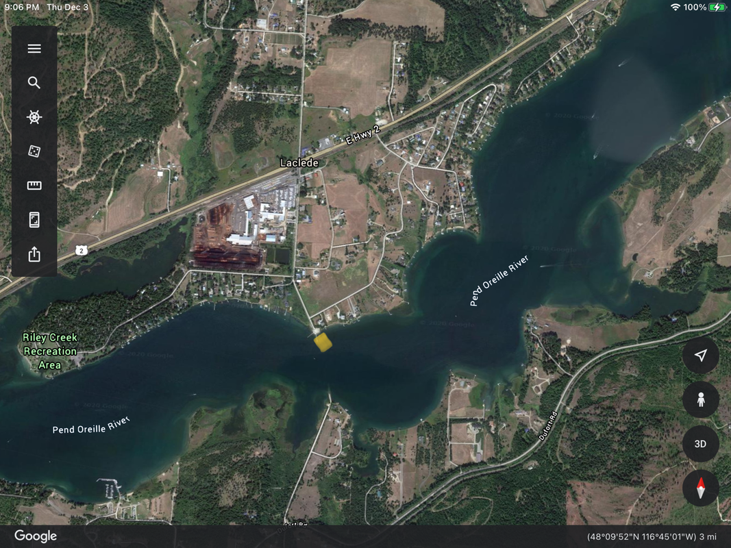
LACLEDE LAUNCH
PADDLE DISTANCE: varies
ELEVATION: 2066’
LENGTH AND ACREAGE: varies
MAPS:
LAUNCH GPS: 48°09’40” N 116°45’15” W
BONNER COUNTY SHERIFF: 208.263.8417
ELEVATION: 2066’
LENGTH AND ACREAGE: varies
MAPS:
LAUNCH GPS: 48°09’40” N 116°45’15” W
BONNER COUNTY SHERIFF: 208.263.8417
DESCRIPTION:
The Laclede Launch is located about 8.3 miles East of the Priest River, just east of the town of Priest River.
And about 13.6 miles west of Sandpoint.
Theres plenty of parking, two docks and a swimming area.
And about 13.6 miles west of Sandpoint.
Theres plenty of parking, two docks and a swimming area.
ATTRACTIONS
Laclede is half way between Sandpoint and Albeni Dam. Riley Creek Recreation Area, Round Lake State Park, Morton Slough, and the Morton Slough Game Management Area,
DIRECTIONS:
From The Priest River, drive east on Hwy 2 for about 8 miles and turn right (south) onto Riley Creek Park Road. Bear left onto Laclede Ferry Road to the launch.
From Sandpoint, drive west on Hwy 2 for just over 13 miles to the Riley Creek Park Road. Bear left onto Laclede Ferry Road to the launch.
From Sandpoint, drive west on Hwy 2 for just over 13 miles to the Riley Creek Park Road. Bear left onto Laclede Ferry Road to the launch.
COOL THINGS CLOSE BY:
Albeni Cove Camp Ground, Morton Slough Game Management Area, and Round Lake State Park.
R & P:
NA


