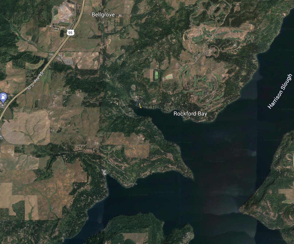
ROCKFORD BAY LAUNCH
PADDLE DISTANCE: varies
ELEVATION: 2128’
LENGTH AND ACREAGE: varies
MAPS: IPNF., Rockford Bay topo
LAUNCH GPS: 47°30’31” N 116°53’59” W
ELEVATION: 2128’
LENGTH AND ACREAGE: varies
MAPS: IPNF., Rockford Bay topo
LAUNCH GPS: 47°30’31” N 116°53’59” W
DESCRIPTION:
The cool thing about this launch, is that it access the southern section of Lake CDA.
After paddling out of the bay, Rockford Point sticks out into the lake.
Further south is Sun Up Bay, Windy Bay
After paddling out of the bay, Rockford Point sticks out into the lake.
Further south is Sun Up Bay, Windy Bay
ATTRACTIONS
The bay is large and will take you out into the body of Lake CDA
DIRECTIONS:
From CDA, drive south on Hwy 95 to the Bellgrove turn off, and continue east on W. Rockford Bay Road, to the Shooters Bar & Grill.
The launch is just past the marina.
The launch is just past the marina.
COOL THINGS CLOSE BY:
Sun Up Bay, Windy Bay, and the Harrison Slough
R & P:
Trails End Brewery, Franklins, Moon Time, Mexican Food Factory


