EVENT TYPE: Day hiking, snowshoeing DISTANCE: 3.3 mile loop to 5.3 mile loop ELEVATION: 630’ DIFFICULTY: easy MAPS: IPNF, Lane Topo GPS: 47°36’55” N 116°4’43” W MANAGING AGENCY: BLM SPOKANE 509.536.1200 KOOTENAI COUNTY SHERIFF: CALL 911 FIRST or 208.446.1300
DESCRIPTION:
WE HAVE ADDED THE AREAS SHERIFF’S EMERGENCY PHONE NUMBERS FOR EACH TRIP WRITE UP UNDER THE RANGER DISTRICT INFO. IF AN EMERGENCY OCURRS, EVALUATE YOUR CIRCUMSTANCES AND CALL ONLY IF NEEDED. This hike is on BLM land and climbs gradually for 1.6 miles to the Caribou Cabin, atop Mineral Ridge. Once at the cabin, switchback east for 1 mile to the Wilson Overlook, (Wilson Mutual Mining and Milling Trail) This overlook looks down on the I-90 and Harrison Exit 97A. Return to the Caribou Cabin and continue on the main trail west to the Silver Tip View Point 2724’ at about 1.5 miles. After spending some time here enjoying the views of Wolf Lodge Bay and the main body of Lake CDA in the distance, the trail drops down the Johnny Jack Trail below the view point, to the south. Way west you will notice Mica Peak, Idaho towering over Casco and Cougar Bays. There are a number of view points and a spur trail along this trail to showcase the mining operations of old. Drop by the BLM office behind Fred Meyers to pick up a detailed brochure. https://www.blm.gov/sites/blm.gov/files/documents/files/media-center_public-room_idaho_mineral-ridge-trail_guide.pdf
DIRECTIONS:
Head east on I-90 to the Harrison exit 97A at the east end of Wolf Lodge Bay. Turn right onto SH 97A for about 3 miles to the Beauty Bay's Mineral Ridge trailhead.
COOL THINGS CLOSE BY:
Wallace L. Forest Conservation Area, Beauty Bay Overlook, Trail #257, Trail 79, Mount CDA
HAZARDS:
In the winter, the trail can be icy, carry traction devises. Some areas along the trail have very steep slopes below. Please use caution.
R & P:
Moon Time, The Mexican Food Factory, Franklins Hoagies, and the Trails End Brewery.
PHOTO GALLERY
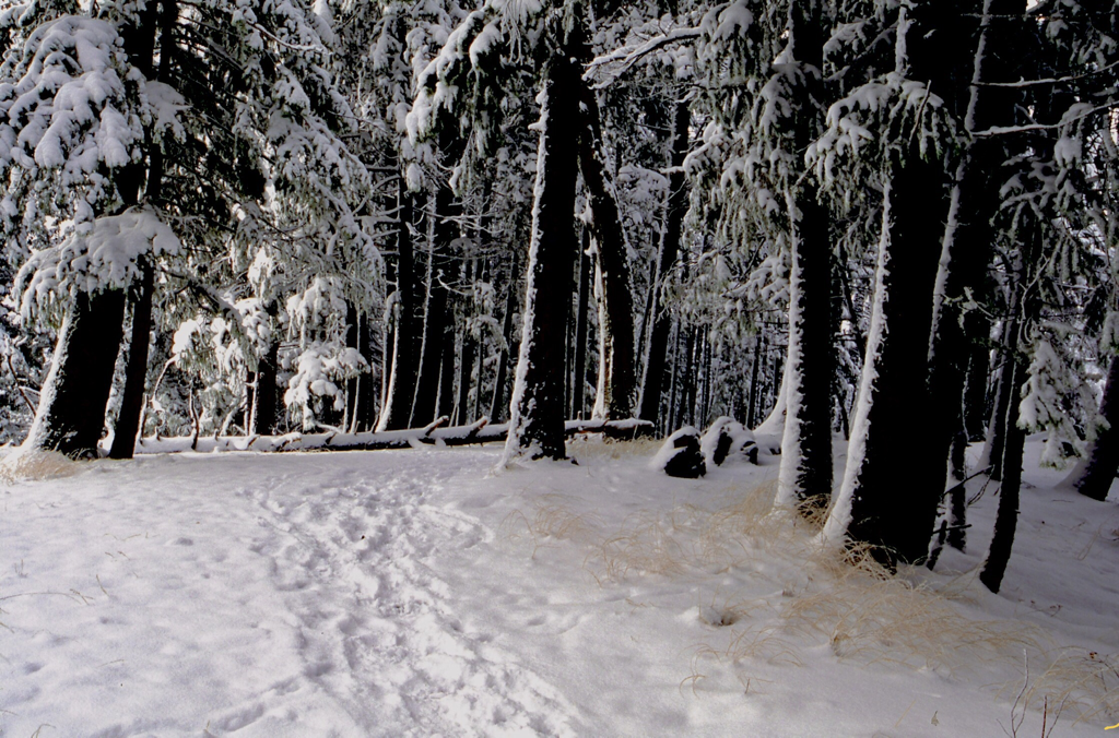
MINERAL RIDGE TRAIL BETWEEN CARIBOU CABIN AND SILVER TIP VIEW POINT
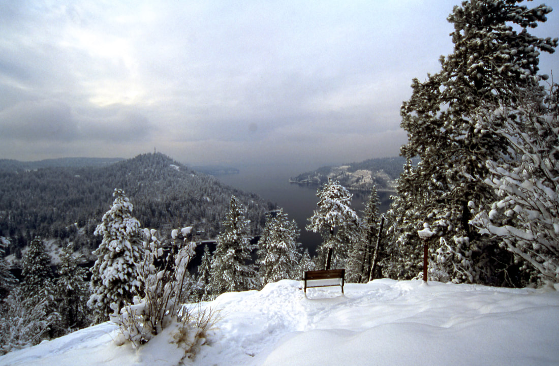
SILVER TIP VIEWPOINT
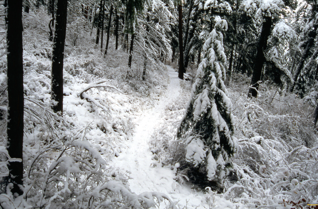
THE WILSON MUTUAL MINING & MILLING TRAIL
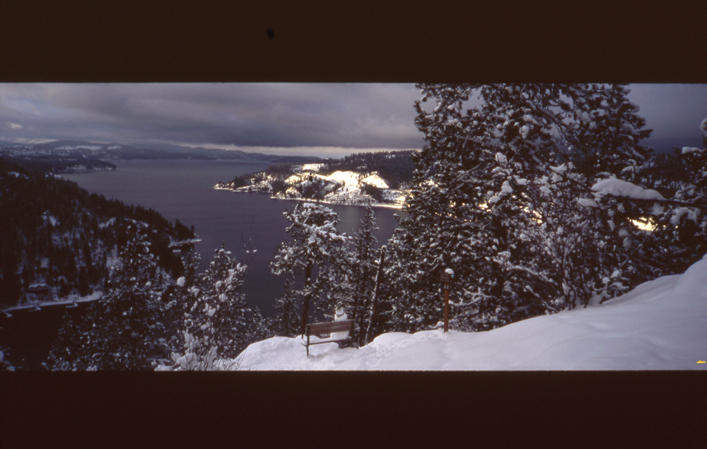
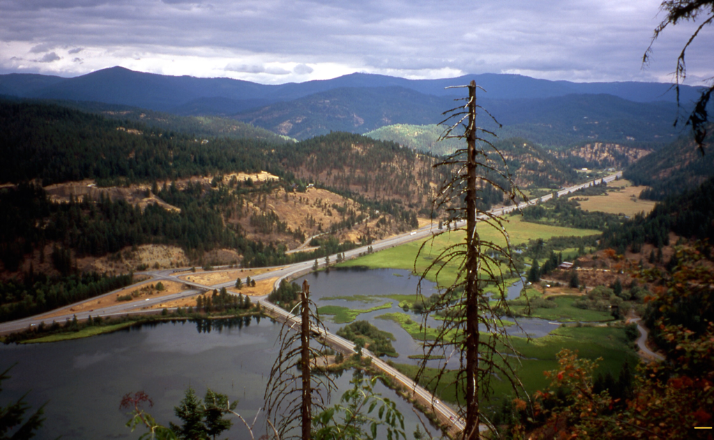
I-90, HARRISON INTERCHANGE FROM THE WILSON OVERLOOK AS VIEWED FROM THE WILSON MM.&M. TRAIL
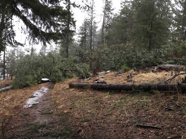
THE WIND STORM FROM 1.2021, THERE WERE 91 TREES DOWN ACROSS THE TRAIL.