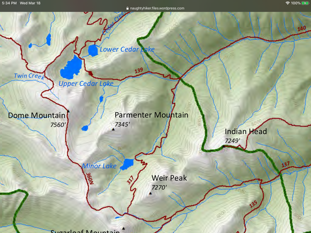
PARMENTER LAKE. TRAILS 140 & 360
EVENT TYPE: Day hiking, backpacking, loop
DISTANCE: 17 miles RT
ELEVATION: 3700 verts
DIFFICULTY: Strenuous
MAPS: K.N.F., Treasure Mt. Topo.
GPS: 48°22’44” N 115°37’44” W
RANGER DISTRICT: Libby Ranger District 406.293.7773
LINCOLN COUNTY SHERIFF: CALL 911 FIRST or 406.293.4112
DISTANCE: 17 miles RT
ELEVATION: 3700 verts
DIFFICULTY: Strenuous
MAPS: K.N.F., Treasure Mt. Topo.
GPS: 48°22’44” N 115°37’44” W
RANGER DISTRICT: Libby Ranger District 406.293.7773
LINCOLN COUNTY SHERIFF: CALL 911 FIRST or 406.293.4112
DESCRIPTION:
If anyone does this trip, please supply Chic with info on the hike in.
DIRECTIONS:
In Libby, at the intersection of Hwy 2 & 37, turn west and go one block. Turn left on a Main Street and go 6 blocks to Balsam Street. Turn right, cross the Flower Creek Bridge , then take the first left and go .4 to the road that bears right up Parmenter Hill. At the top of the hill, take the first right and go just over a mile to the “Y.” Take the unsaved left fork to the trailhead, about 220 yards.
HAZARDS: NA
COOL THINGS CLOSE BY:
Ross Creek Cedars, Cedar Lakes, Dome Mountain, Kootenai Falls, the Proposed Scotchman Peaks Wilderness, Granite Lake, and Leigh Lake.
R & P:
Henry’s in Libby, Pizza Hut, Rosaeurs, Clark Fork Pantry & Squeeze Inn in Clark Fork. Eicharts, Mr Sub, Burger Express, & Jalapeños in Sandpoint
PLAN YOUR TRIP:
Click for Current NOAA Weather Conditions
PHOTO GALLERY