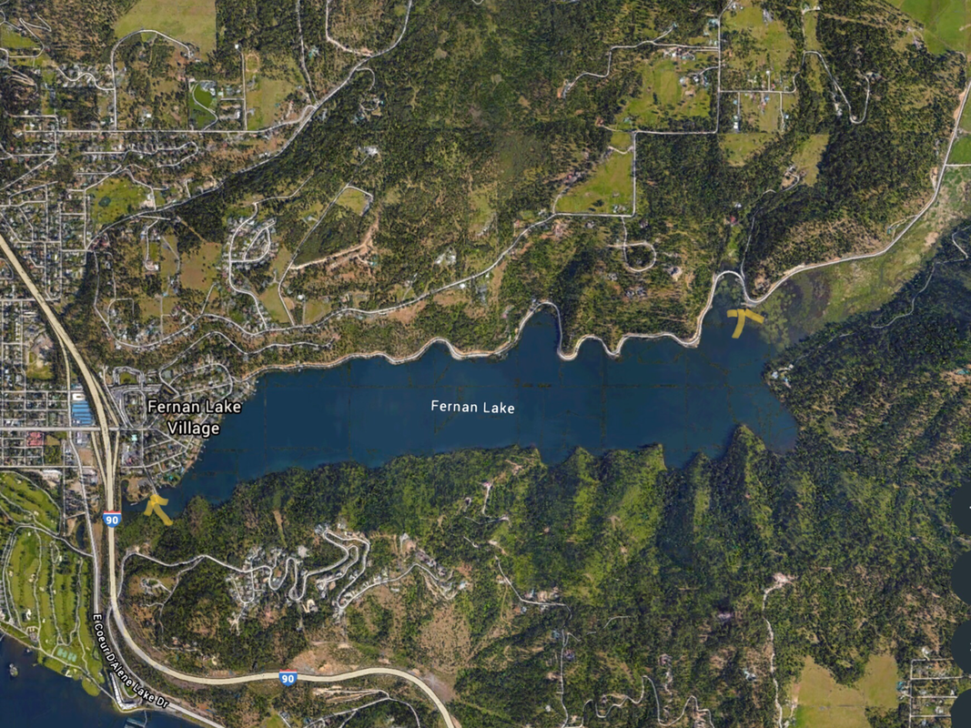
FERNAN LAKE LAUNCH EAST
PADDLE DISTANCE: 7 mile loop
ELEVATION: 2133’
LENGTH AND ACREAGE: 2.3 miles long & 300 acres
MAPS: IPNF, Fernan topo
LAUNCH GPS: 47°40’43” N 116°42’33” W
KOOTENAI COUNTY SHERIFF: 208.446.1300
ELEVATION: 2133’
LENGTH AND ACREAGE: 2.3 miles long & 300 acres
MAPS: IPNF, Fernan topo
LAUNCH GPS: 47°40’43” N 116°42’33” W
KOOTENAI COUNTY SHERIFF: 208.446.1300
DESCRIPTION:
WEST END LAUNCH: The west end has an unusual designation. It's outlet flows in both directions, depending on what time of the year it is.
There are only a few streams in the U.S. that do that.
This is a very busy fishing spot for those without a boat.
PLEASE DO NOT BLOCK THE LAUNCH AREA.
There are only a few streams in the U.S. that do that.
This is a very busy fishing spot for those without a boat.
PLEASE DO NOT BLOCK THE LAUNCH AREA.
ATTRACTIONS
Nice southern shore line to paddle. There are several bays and points to visit.
Fernan is a lake I go to if the winds are up on CDA.
Fernan is a lake I go to if the winds are up on CDA.
DIRECTIONS:
From downtown CDA, drive east on Sherman Street (Main Street thru downtown), under the I-90 overpass east of Lake CDA Drive.
On your right is the IPNF CDA River Ranger District, Fernan Ranger District office. Turn right (S) onto Theis Dr to the launch.
Parking is limited, so stay between the lines, do not park on the sides, grass, or neighborhood.
On your right is the IPNF CDA River Ranger District, Fernan Ranger District office. Turn right (S) onto Theis Dr to the launch.
Parking is limited, so stay between the lines, do not park on the sides, grass, or neighborhood.
COOL THINGS CLOSE BY:
The NEW Fernan Lake Natural Area, Lake CDA Drive to Higgins Point, the Fernan Saddle, Mineral Ridge, and the Wallace L. Forest Conservation Area.
R & P:
Moon Time, Mexican Food Factory, Trails End Brewery, and Franklins.


