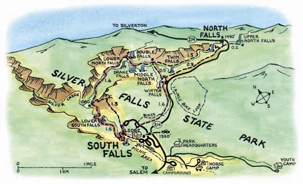
EVENT TYPE: Day hiking, camping, and photography DISTANCE: 6.9 mile loop. ELEVATION: 700 verts DIFFICULTY: easy MAPS: Silver Falls State Park brochure GPS: 44052'40" N 122039'22" Wild Rivers Ranger District: 541.592.4000 MARION COUNTY SHERIFF: CALL 911 FIRST or 541.588.5094
DESCRIPTION:
WE HAVE ADDED THE AREAS SHERIFF’S EMERGENCY PHONE NUMBERS FOR EACH TRIP WRITE UP UNDER THE RANGER DISTRICT INFO. IF AN EMERGENCY OCURRS, EVALUATE YOUR CIRCUMSTANCES AND CALL ONLY IF NEEDED. If you are ever near Salem, Oregon, make sure you spend a day at Silver Falls State Park. The "Trail of Ten Falls" is spectacular. You will feel the wonder of the area.
OPTION #1:
Once you are at Winter Falls, be sure to walk out to North Falls and Upper North falls. Its less than 2 miles RT
OPTION #2:
The State Park has many other attractions to take advantage of. There are 12 other trails to visit, including a horse camp and trail. They also offer a Bike trail, Pet area, Campground, picnic area, several view points, an amphitheater, food is available, an the Historical South Falls Lodge.
DIRECTIONS:
From Salem, take Hwy 22 to the Hwy 214 turn off. From Silverton, take Hwy 214 SE to the park.
HAZARDS:
Some trails may be slippery on days it rains. Please use caution. There is hiking or snowshoeing in the winter, so enjoy this marvelous park year round.
R & P:
South Falls Lodge
PHOTO GALLERY
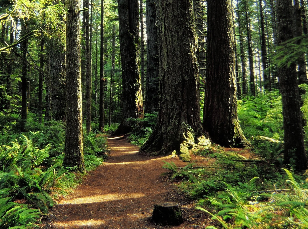
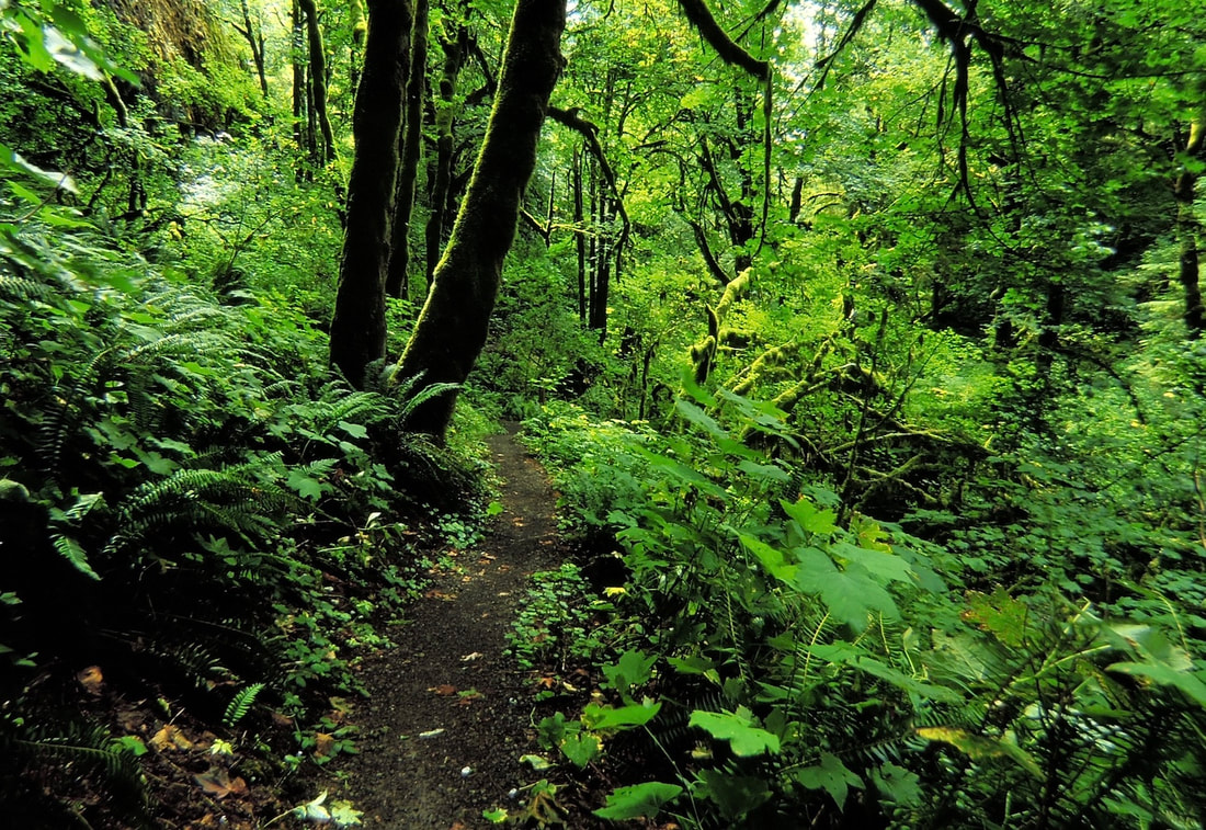
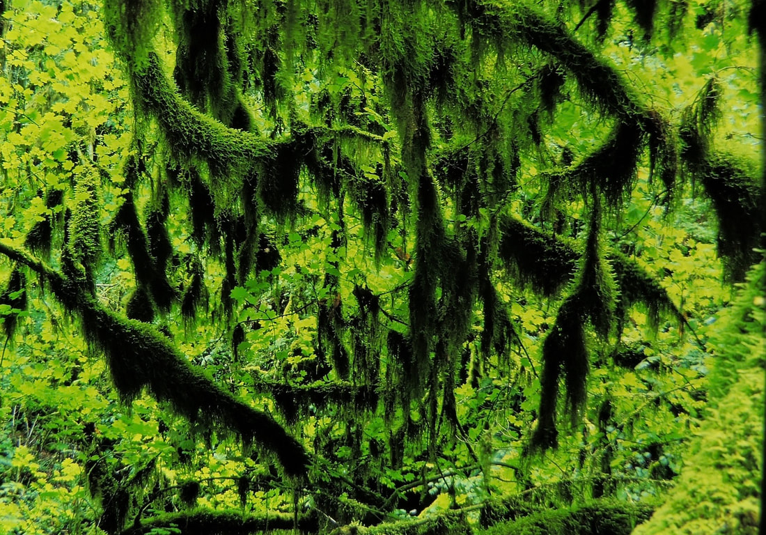
THE TRAIL IN IS ABOUT AS GOOD AS IT GETS
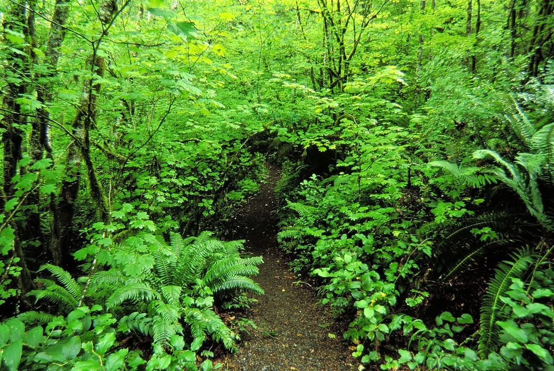
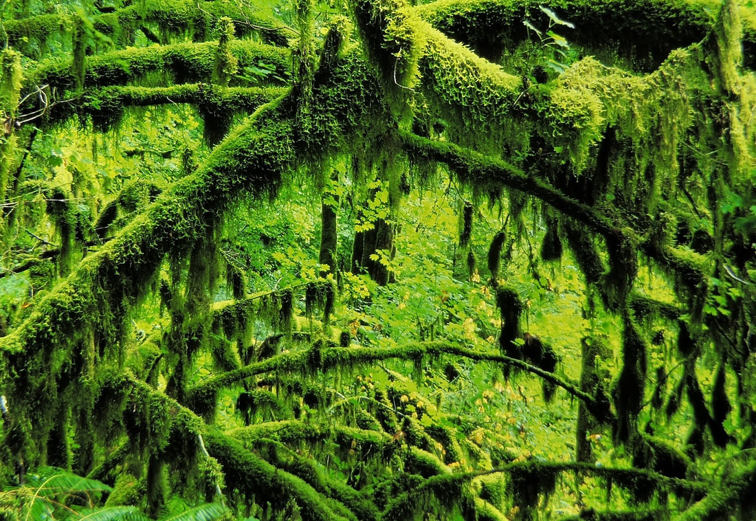
THE LUSHNESS OF THIS AREA ALONE IS WORTH THE WALK
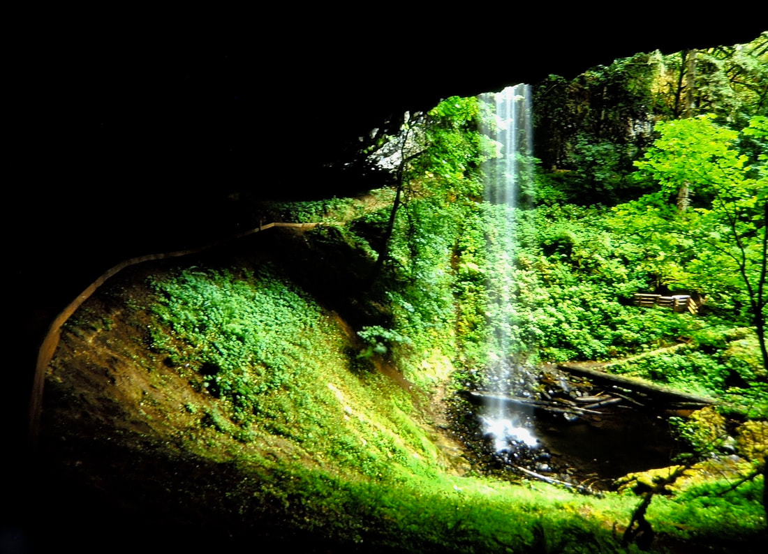
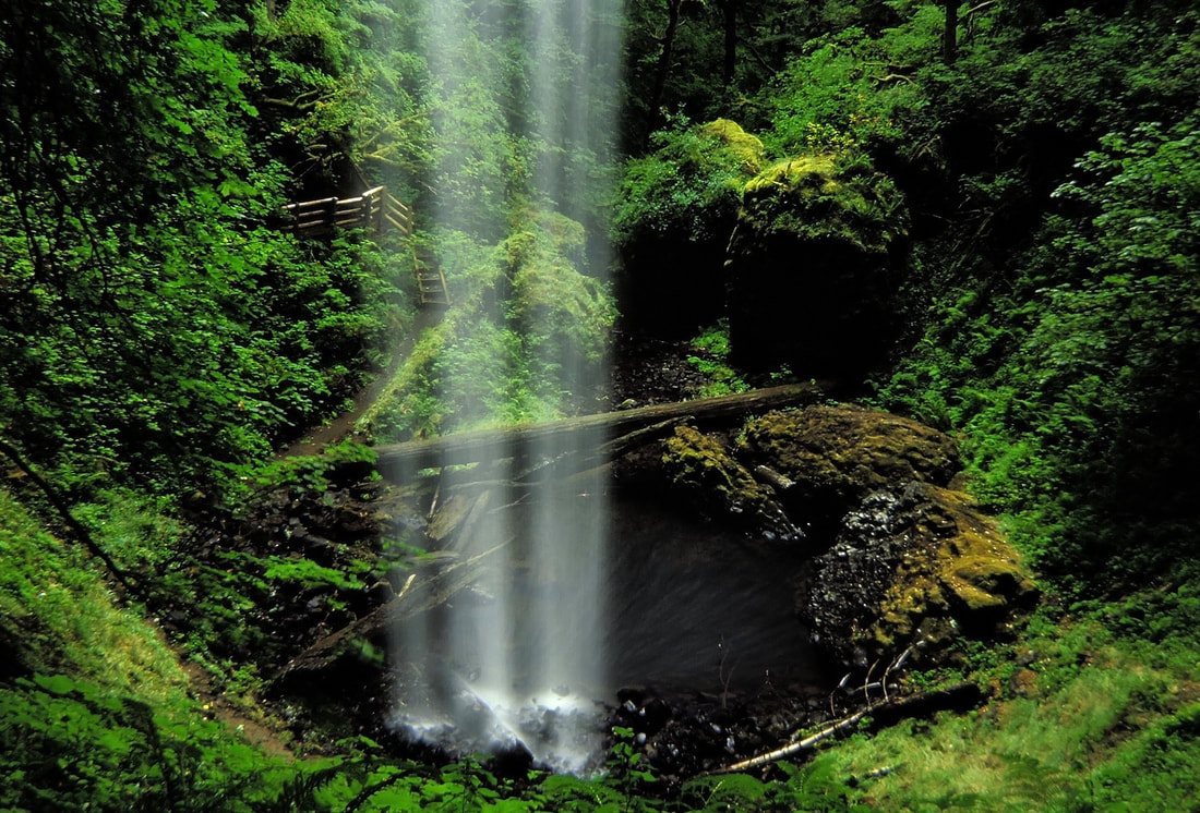
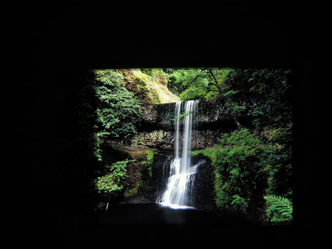
NORTH FALLS 136'
NORTH FALLS LANDING
NORTH FALLS 136'
NORTH FALLS FROM THE TRAIL IN THE ABOVE IMAGE
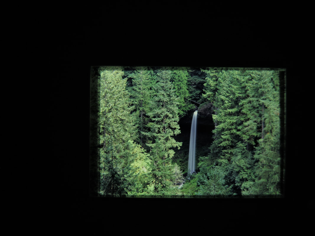
MOST ALL THE TRAIL ARE OUTSTANDING
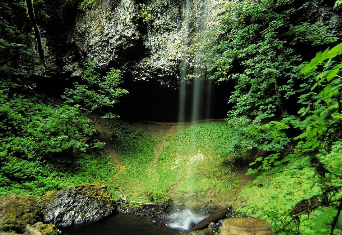
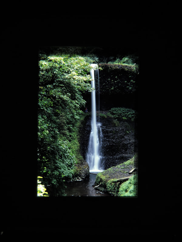
UPPER NORTH FALLS 65'
CLOSE UP OF UPPER NORTH FALLS
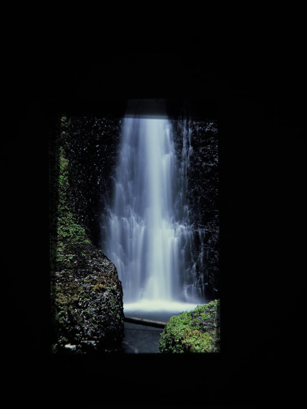
NORTH FALLS 136'
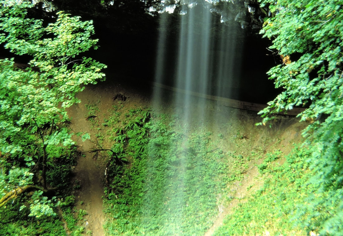
CLOSE UP OF THE BOTTOM OF NORTH FALLS
NORTH FALLS
DID I MENTION LUSHNESS, THIS TRAIL IS EXCEPTIONAL
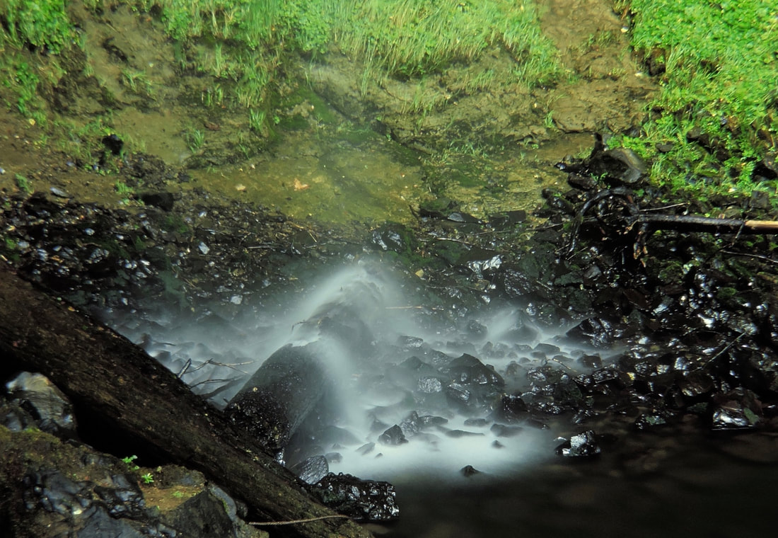
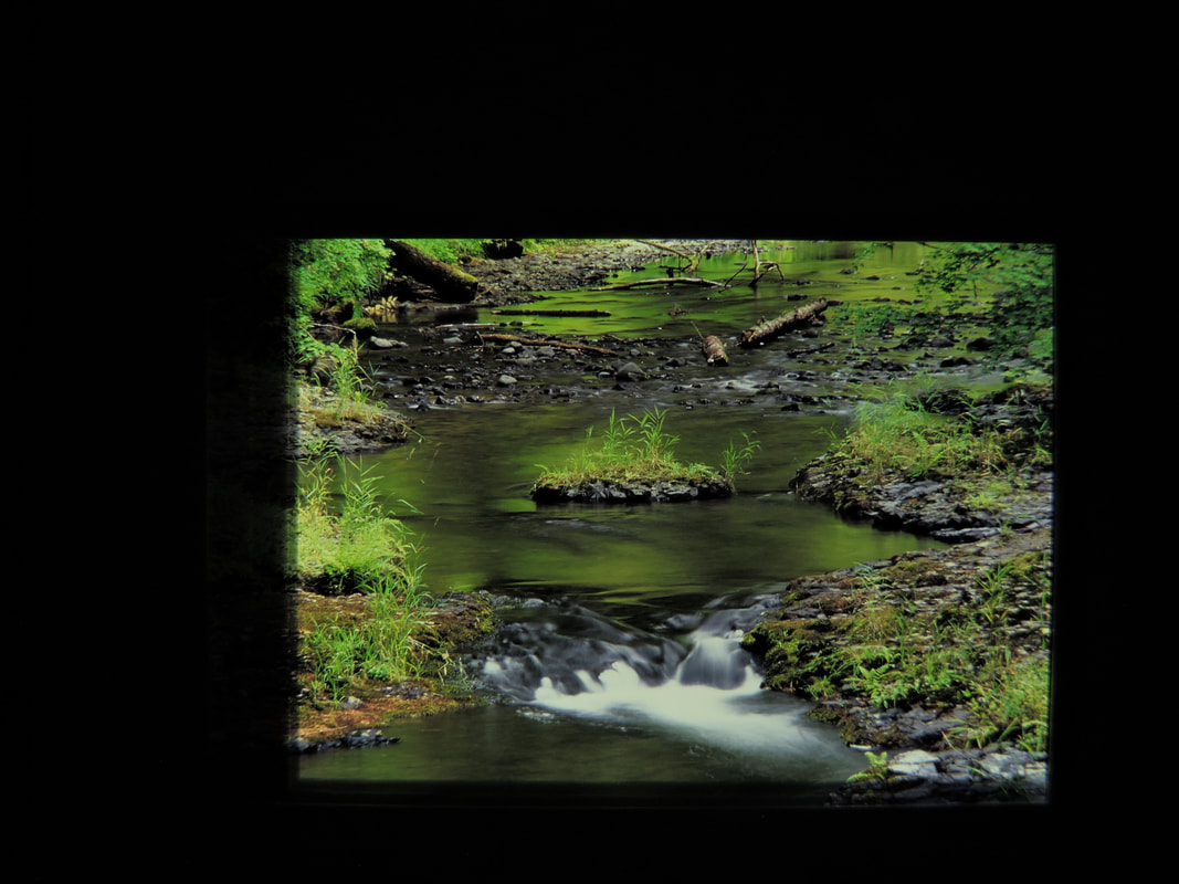
SILVER CREEK
THE AREA DRIPS WITH GREEN
Hike Silver Falls State Park A spectacular canyon with 10 waterfalls About the Hike: The popular trail through Silver Falls State Park's forested canyons visits 10 spectacular waterfalls, five more than 100 feet high. The path even leads through mossy caverns behind the falls' shimmering silver curtains.This loop is suitable for families with beginning hikers because side trails provide shortcuts back to the car. Dogs are not allowed on the trail. Difficulty: The full loop to see all 10 waterfalls (from South Falls to North Falls) is a moderate hike of 6.9 miles, gaining 700 feet of elevation, but the recommended shortcut (omitting Twin and North Falls) trims the loop to 5.1 miles. For a shorter, 2.8-mile loop, turn back after Lower South Falls. For an even shorter 0.7-mile tour, simply loop to the bridge at the base of South Falls. Season: Open all year. The park is usually snow-free even in mid-winter, but the falls are still quite full and the wildflowers are at their best from late March to May. Getting There: From Interstate 5 exit 253 in Salem, drive 10 miles east on North Santiam Highway 22, turn left at a sign for Silver Falls Park, and follow Highway 214 for 16 miles to the park entrance sign at South Falls. Coming from the north, exit Interstate 5 at Woodburn and follow Highway 214 southeast through Silverton 30 miles. In the South Falls parking complex, follow signs to Picnic Area C, and park at the far end of the lot. Fees: A special $3-per-car fee is charged to park anywhere in the state park. Hiking Tips: From the South Falls Picnic Area C parking lot, follow a broad path downstream a few hundred yards to historic Silver Falls Lodge, built by Civilian Conservation Corps crews in 1940. After inspecting this rustic stone-and-log building, continue a few hundred yards to an overlook of 177-foot South Falls. From here take a paved trail to the right. Then switchback down into the canyon and behind South Falls. A few hundred yards beyond South Falls is a junction at a scenic footbridge. Don't cross the bridge unless you're truly tired, because that route merely returns to the car. Instead take the unpaved path along the creek. This path eventually switchbacks down and behind Lower South Falls' broad, 93-foot cascade. Beyond Lower South Falls the trail forks again. If you're wearing down, you can turn right and climb the steepish ridge trail to the canyon rim and parking lot, for a total trip length of 2.8 miles. If you're ready for a longer hike continue straight, heading up the north fork of Silver Creek to 30-foot Lower North Falls. At a footbridge just above the falls, take a 250-yard side trail to admire tall, thin Double Falls. Then continue on the main trail past Drake and Middle North Falls to the Winter Falls trail junction. At this point, turn right for the recommended 5.1-mile loop. This path climbs to a parking area above Winter Falls. From there, keep right on a 1.6-mile return trail through the woods to the South Falls area, the lodge, and your car. History: Silver Falls City, platted here in 1888, was an early center for logging and some fairly unsuccessful homestead farming. Future US President Herbert Hoover surveyed some of the land here while serving as a young engineer. By 1900, June Drake, a Silverton photographer, began pushing for park status. His early photographs of the falls have become classics. An inspector for the National Park Service rejected the area for national park status in 1926, however, because logging had scarred the area with "thousands of stumps that from a distance look like so many dark headstones." After that, the private owner of South Falls charged admission to let people watch as he floated derelict cars over the falls. In 1928 a paying audience watched daredevil Al Faussett canoe over 177-fout South Falls. He had to spend months afterward in a hospital, recovering from his injuries. In 1935 President Franklin D. Roosevelt announced that Silver Falls would be one of his largest Recreational Demonstration Projects. He bought private land and employed young men in the Civilian Conservation Corps to develop park facilities. Since then the forest has regrown so that most visitors do not even notice that the area was once logged. Geology: All waterfalls in the park spill over 15-million-year-old Columbia River basalt. At that time the Columbia River flowed through this area to the sea at what is now Newport. Repeated lava flows poured down the river channel from vents in Eastern Oregon, gradually pushing the river northward. As the lava slowly cooled, it sometimes fractured to form the honeycomb of columns visible on cliff edges. Circular indentations in the ceilings of the misty caverns behind the falls are tree wells, formed when the lava flows hardened around burning trees. The churning of Silver Creek gouged the soft soil from beneath the harder lava, leaving these caverns and casts. By William Sullivan
Silver Falls State ParkNestled in the foothills of the Cascade Mountains, just a short scenic drive from the Willamette Valley, is 9,000 acres of temperate rainforest waiting for you – to explore, play, or simply stop and recharge. Silver Falls State Park, Oregon’s largest State Park, is centrally located in Oregon just east of the State Capital, Salem, and an easy day’s drive from Portland, Eugene, or Bend. Silver Falls’ namesake comes from the 10 unforgettable waterfalls crashing into the canyon carved by the North and South Forks of Silver Creek – five of these waterfalls are over 100 feet and four you can walk behind! Hike through the mist on the Trail of Ten Falls, a National Recreation Trail, or explore miles of trails beyond the falls through quiet, old-growth forest on foot, bike, or horseback. The Silver Falls Historic District, a must for history-lovers, is filled with rustic-style buildings built by the young men of the 1930s Civilian Conservation Corp (CCC) camps which serve today as our South Falls Lodge, Nature Store, and Combination Picnic Shelter, all of which are listed on the National Registry of Historic Places. Many other visitors enjoy the cool waters of the day use area’s swimming area, lounge in the sun while kids play in one of the three playgrounds, or satisfy their curiosity about natural history through the many interpretative programs and special events offered throughout the year. Silver Falls State Park is overflowing with lodging and refreshments options to satisfy any visitor – from the full-service Silver Falls Lodge & Conference Center complete with cabins, meals, a swimming pool, and meeting facilities to the campgrounds with 100 tent/RV sites, cabins, and group camping facilities. Popular for family reunions and weddings, the two “ranches” offer another unique lodging option all under one roof – complete with bunks, full kitchens, and a center fire-pit you won’t soon forget on a chilly evening with your friends. The YMCA camp is reservable outside of the summer season and also has many CCC-era historical buildings along with a swimming pool and full commercial kitchen. Snacks and refreshments are conveniently located in the Silver Creek Grill next to the swimming area’s D Shelter and in the Café in the South Falls Lodge, while meals and seasonal buffets are found in the Silver Falls Lodge & Conference Center. The rangers at Silver Falls State Park have but one word of advice – it is very difficult to take in all that Silver Falls has to offer in one day so plan to stay awhile or come back and visit!
Silver Falls History: A Chronological Story Silver Falls History: A Chronological Story Draft, July 2011) circa 1811: Donald McKenzie and other members of the Pacific Fur Company were probably the first white men to see the Silverton area. They are believed to have followed the beaver up the creeks and eventually discovered Silver Falls. 1865: The Silverton Fire, the largest known in Oregon’s history, burned a million acres including the Silver Falls area. 1882:April 20: Patent issued to W.T. Eaton, one of the first settlers on record in the Falls area, for 160 acres near South Falls. 1886: A forest fire destroyed a large part of the forest on lands that would become Silver Falls State Park. 1888:March 16: The plat map for Silver Falls City was filed with Marion County for the Eaton land, which had been purchased by T.C. Smith. Herbert Hoover is believed to have been on the surveying crew. 1899: A church was built in Silver Falls City and became the center of community activities. 1900: Silverton photographer, June Drake, began advocating for the establishment of Silver Falls as a national park. 1925: September: A destructive forest fire raged near and at House Mountain. 1926:August 7: The 2,746 acres of Silver Creek Falls was proposed to the National Park Service by Senator McNary for establishment as a National Park. The proposal was rejected and the area was recommended as a state park. 1928:July 1: Al Faussett rode a 12-foot homemade canvas-covered canoe filled with 36 inflated inner tubes over the 177-foot South Falls and survived to tell the tale. 1928: Summer: South Burn, a forest fire, damaged the Silver Falls area. 1931:April 3: First park acquisition was 90 acres from George and Anna Parkhurst at the cost of $2,000. 1931:April 30: North Falls became park property. 1931: October 19: South Falls became park property. 1931: December 3: The Highway Commission named the area “Silver Creek Falls State Park”. 1933:July 23: Silver Falls State Park was dedicated. More than 5,000 people attended. At this time, the park was comprised of 1,268 acres. 1934: December 15: Emergency Conservation Work Organization crew commenced work at Silver Falls. 1934:December 31: Federal government established a Recreational Demonstration Area near Silver Falls. 1935: March: The Oregon State Highway Commission signed an agreement with the National Park Service and the US Army to create a master plan with designs and construction drawings for Silver Creek Falls State Park. They also agreed to establish a Civilian Conservation Corps (CCC) program at the park. 1935:March 30: CCC Camp was established near North Falls. 1935: Silver Creek Falls State Park was again reviewed and rejected as a National Park. 1935: March: Oregon State Highway Commission signed agreement with NPS and the US Army to create a master plan for Silver Creek Falls State Park and to establish a CCC program at the park. 1936: Latrine constructed behind Log Cabin. (Fulton, 1998) 1937: CCC Combination Building completed. 1938:September 17: Parks purchased 50 acres on which Silver Falls City was located. 1938: Silver Creek Youth Camp, a boys’ camp, was created. 1938: Log Cabin built. (This building is now occupied by the Friends of Silver Falls Nature Store.) 1939 – 40: South Falls Lodge was constructed. 1940: Smith Creek Camp, for girls, was completed. 1940: Myrtlewood furniture of Concession Building (now called the South Falls Lodge) designed by Margery Hoffman Smith, director of Oregon Art Project under the Federal Works Agency. Smith also designed furniture for Timberline Lodge at Mount Hood, Oregon. 1942: April: CCC Camp closed. 1942: December 5: CCC Camp buildings at North Falls were transferred to the State and remodeled for use as a Youth Camp. 1944: Myrtlewood furniture installed in Lodge. This furniture remains. 1946: The Salem YMCA was granted an ongoing cooperative agreement to operate Silver Creek Youth Camp by the National Park Service. This agreement continues to the present time. (Armstrong, 1965) 1946: May 27: Nohgren’s Restaurant opened in the Concession Building (the South Falls Lodge.)1947 – 49: National Park Service deeded 5,989.58 (6,305?) acres to the State restricted to Park and Recreational use only. The Highway Commission paid $1 an acre. 1951: Overnight camp was constructed. Samuel Boardman succeeded as State Park Superintendent by Chester Armstrong. (Langille, 1953) 1952: Attendance totaled 242,742 day visitors. 1953: Davidsons’ barn was altered to “The Ranch.” 1955: Conservative Baptist Association agreed to construct a pool at North Falls. (Armstrong, 1965) 1956: Recreation hall built at North Falls. (Armstrong, 1965) 1956: South Falls Lodge closed. 1956: Salem YMCA agreed to build a swimming pool at the Silver Creek Youth Camp. (Armstrong, 1965) 1963: Attendance totaled 305,560 day visitors and 12,797 overnight stays. (Armstrong, 1965) 1972: A swimming area and other day use area improvements were added. (Proposed in original NPS master plan of 1940.) 1972: New Ranch built. 1973: Four-mile bicycle trail constructed. 1977: Mother’s Day: Park volunteer Blanche Sweger founds the first annual Mother’s Day Wildflower Show. 1977 – 80: Conference Center was constructed at the site of the declining Smith Creek Camp. 1978: South Falls Lodge reopened after being restored as a visitor and nature center. 1978: December: The first Christmas Festival held in the South Falls Lodge. 1982: Updated Silver Falls Master Plan completed. 1983: 9 acre area including the historic Silver Falls Lodge and South Falls viewpoint listed by the National Register of Historic Places. 1984: The late Leo Cieslak bequeathed 160 acres. 1985: The 1249th Engineer Battalion of the Oregon National Guard completed several projects including the construction a new vehicle bridge and camp loop road (B-Loop), new jogging trail, two playgrounds, and several new buildings in the shop maintenance complex. 1986: The Friends of Silver Falls State Park founded as a non-profit organization with the mission to support the park. 1988: Campground B-Loop completed. 1990:January 1: Oregon State Parks and Recreation Department became independent agency; separate from Oregon State Highway Department—later to become Oregon Department of Transportation. 1992: Updated Silver Falls Master Plan completed. 1992: Mother’s Day: Friends of Silver Falls State Park opens the Nature Store in the South Falls Lodge. 1994: Silver Creek Canyon Trail listed on the Register of National Recreation Trail in perpetuity. (Letter from Secretary of the Interior, July 15, 1994) 1996: A one hundred-year flood early in the year takes out two bridges on the “Trail of Ten Falls.” 1998: Paver path project in South Falls Day use began. 1998 – 99: Cabin Loop cabins constructed. 1998– 99: Lodge restoration. 1999: Picnic Shelters rebuilt. 2000: July: Covered bridge connecting Campground and Cabin Loop completed. 2001: South Falls View Point reconfigured. 2003: New playground installed in Campground B Loop. 2003: Restoration of the Lodge garage complete. 2005: Restoration of the CCC Combination Building begun. 2006: Oregon Parks and Recreation Department purchased 2 parcels of land totaling 365 acres from the DeSantis family, bringing the total acreage to 9,064. 2008: CCC Combination Building rededicated. 2008: In January 2008, Fred Girod of the Oregon House of Representatives sought federal designation of Silver Falls State Park as a national park via a house joint memorial to the United States Congress. The bill died in committee 2009: Updated Silver Falls Master Plan completed. 2009:July 13: Grand opening of the Nature Store in the retrofitted CCC Log Cabin. 2010: Cell tower erected in the Silver Falls forest. 2010: Natural Play Area at North Falls Group Camp begun. 2010: Phase 1 of the Interpretive Plan begun. Includes panels at the Combination Building; kiosks at North Falls, South Falls, and South View Point; and panels at access points of the South Falls Historic District. NOTE:This document is a work in progress and is currently in draft form. Footnotes need to be added and dates cross-referenced. Construction and building dates may reflect the beginning, middle, or end of a project—most projects span
more than one year.Silver Falls History: A Chronological Story(Draft, July 2011) circa 1811: Donald McKenzie and other members of the Pacific Fur Company were probably the first white men to see the Silverton area. They are believed to have followed the beaver up the creeks and eventually discovered Silver Falls. 1865: The Silverton Fire, the largest known in Oregon’s history, burned a million acres including the Silver Falls area. 1882:April 20: Patent issued to W.T. Eaton, one of the first settlers on record in the Falls area, for 160 acres near South Falls. 1886: A forest fire destroyed a large part of the forest on lands that would become Silver Falls State Park. 1888:March 16: The plat map for Silver Falls City was filed with Marion County for the Eaton land, which had been purchased by T.C. Smith. Herbert Hoover is believed to have been on the surveying crew. 1899: A church was built in Silver Falls City and became the center of community activities. 1900: Silverton photographer, June Drake, began advocating for the establishment of Silver Falls as a national park. 1925: September: A destructive forest fire raged near and at House Mountain. 1926:August 7: The 2,746 acres of Silver Creek Falls was proposed to the National Park Service by Senator McNary for establishment as a National Park. The proposal was rejected and the area was recommended as a state park. 1928:July 1: Al Faussett rode a 12-foot homemade canvas-covered canoe filled with 36 inflated inner tubes over the 177-foot South Falls and survived to tell the tale. 1928: Summer: South Burn, a forest fire, damaged the Silver Falls area. 1931:April 3: First park acquisition was 90 acres from George and Anna Parkhurst at the cost of $2,000. 1931:April 30: North Falls became park property. 1931: October 19: South Falls became park property. 1931: December 3: The Highway Commission named the area “Silver Creek Falls State Park”. 1933:July 23: Silver Falls State Park was dedicated. More than 5,000 people attended. At this time, the park was comprised of 1,268 acres. 1934: December 15: Emergency Conservation Work Organization crew commenced work at Silver Falls. 1934:December 31: Federal government established a Recreational Demonstration Area near Silver Falls. 1935: March: The Oregon State Highway Commission signed an agreement with the National Park Service and the US Army to create a master plan with designs and construction drawings for Silver Creek Falls State Park. They also agreed to establish a Civilian Conservation Corps (CCC) program at the park. 1935:March 30: CCC Camp was established near North Falls. 1935: Silver Creek Falls State Park was again reviewed and rejected as a National Park. 1935: March: Oregon State Highway Commission signed agreement with NPS and the US Army to create a master plan for Silver Creek Falls State Park and to establish a CCC program at the park. 1936: Latrine constructed behind Log Cabin. (Fulton, 1998) 1937: CCC Combination Building completed. 1938:September 17: Parks purchased 50 acres on which Silver Falls City was located. 1938: Silver Creek Youth Camp, a boys’ camp, was created. 1938: Log Cabin built. (This building is now occupied by the Friends of Silver Falls Nature Store.) 1939 – 40: South Falls Lodge was constructed. 1940: Smith Creek Camp, for girls, was completed. 1940: Myrtlewood furniture of Concession Building (now called the South Falls Lodge) designed by Margery Hoffman Smith, director of Oregon Art Project under the Federal Works Agency. Smith also designed furniture for Timberline Lodge at Mount Hood, Oregon. 1942: April: CCC Camp closed. 1942: December 5: CCC Camp buildings at North Falls were transferred to the State and remodeled for use as a Youth Camp. 1944: Myrtlewood furniture installed in Lodge. This furniture remains. 1946: The Salem YMCA was granted an ongoing cooperative agreement to operate Silver Creek Youth Camp by the National Park Service. This agreement continues to the present time. (Armstrong, 1965) 1946: May 27: Nohgren’s Restaurant opened in the Concession Building (the South Falls Lodge.)1947 – 49: National Park Service deeded 5,989.58 (6,305?) acres to the State restricted to Park and Recreational use only. The Highway Commission paid $1 an acre. 1951: Overnight camp was constructed. Samuel Boardman succeeded as State Park Superintendent by Chester Armstrong. (Langille, 1953) 1952: Attendance totaled 242,742 day visitors. 1953: Davidsons’ barn was altered to “The Ranch.” 1955: Conservative Baptist Association agreed to construct a pool at North Falls. (Armstrong, 1965) 1956: Recreation hall built at North Falls. (Armstrong, 1965) 1956: South Falls Lodge closed. 1956: Salem YMCA agreed to build a swimming pool at the Silver Creek Youth Camp. (Armstrong, 1965) 1963: Attendance totaled 305,560 day visitors and 12,797 overnight stays. (Armstrong, 1965) 1972: A swimming area and other day use area improvements were added. (Proposed in original NPS master plan of 1940.) 1972: New Ranch built. 1973: Four-mile bicycle trail constructed. 1977: Mother’s Day: Park volunteer Blanche Sweger founds the first annual Mother’s Day Wildflower Show. 1977 – 80: Conference Center was constructed at the site of the declining Smith Creek Camp. 1978: South Falls Lodge reopened after being restored as a visitor and nature center. 1978: December: The first Christmas Festival held in the South Falls Lodge. 1982: Updated Silver Falls Master Plan completed. 1983: 9 acre area including the historic Silver Falls Lodge and South Falls viewpoint listed by the National Register of Historic Places. 1984: The late Leo Cieslak bequeathed 160 acres. 1985: The 1249th Engineer Battalion of the Oregon National Guard completed several projects including the construction a new vehicle bridge and camp loop road (B-Loop), new jogging trail, two playgrounds, and several new buildings in the shop maintenance complex. 1986: The Friends of Silver Falls State Park founded as a non-profit organization with the mission to support the park. 1988: Campground B-Loop completed. 1990:January 1: Oregon State Parks and Recreation Department became independent agency; separate from Oregon State Highway Department—later to become Oregon Department of Transportation. 1992: Updated Silver Falls Master Plan completed. 1992: Mother’s Day: Friends of Silver Falls State Park opens the Nature Store in the South Falls Lodge. 1994: Silver Creek Canyon Trail listed on the Register of National Recreation Trail in perpetuity. (Letter from Secretary of the Interior, July 15, 1994) 1996: A one hundred-year flood early in the year takes out two bridges on the “Trail of Ten Falls.” 1998: Paver path project in South Falls Day use began. 1998 – 99: Cabin Loop cabins constructed. 1998– 99: Lodge restoration. 1999: Picnic Shelters rebuilt. 2000: July: Covered bridge connecting Campground and Cabin Loop completed. 2001: South Falls View Point reconfigured. 2003: New playground installed in Campground B Loop. 2003: Restoration of the Lodge garage complete. 2005: Restoration of the CCC Combination Building begun. 2006: Oregon Parks and Recreation Department purchased 2 parcels of land totaling 365 acres from the DeSantis family, bringing the total acreage to 9,064. 2008: CCC Combination Building rededicated. 2008: In January 2008, Fred Girod of the Oregon House of Representatives sought federal designation of Silver Falls State Park as a national park via a house joint memorial to the United States Congress. The bill died in committee 2009: Updated Silver Falls Master Plan completed. 2009:July 13: Grand opening of the Nature Store in the retrofitted CCC Log Cabin. 2010: Cell tower erected in the Silver Falls forest. 2010: Natural Play Area at North Falls Group Camp begun. 2010: Phase 1 of the Interpretive Plan begun. Includes panels at the Combination Building; kiosks at North Falls, South Falls, and South View Point; and panels at access points of the South Falls Historic District. NOTE:This document is a work in progress and is currently in draft form. Footnotes need to be added and dates cross-referenced. Construction and building dates may reflect the beginning, middle, or end of a project—most projects span more than one year.