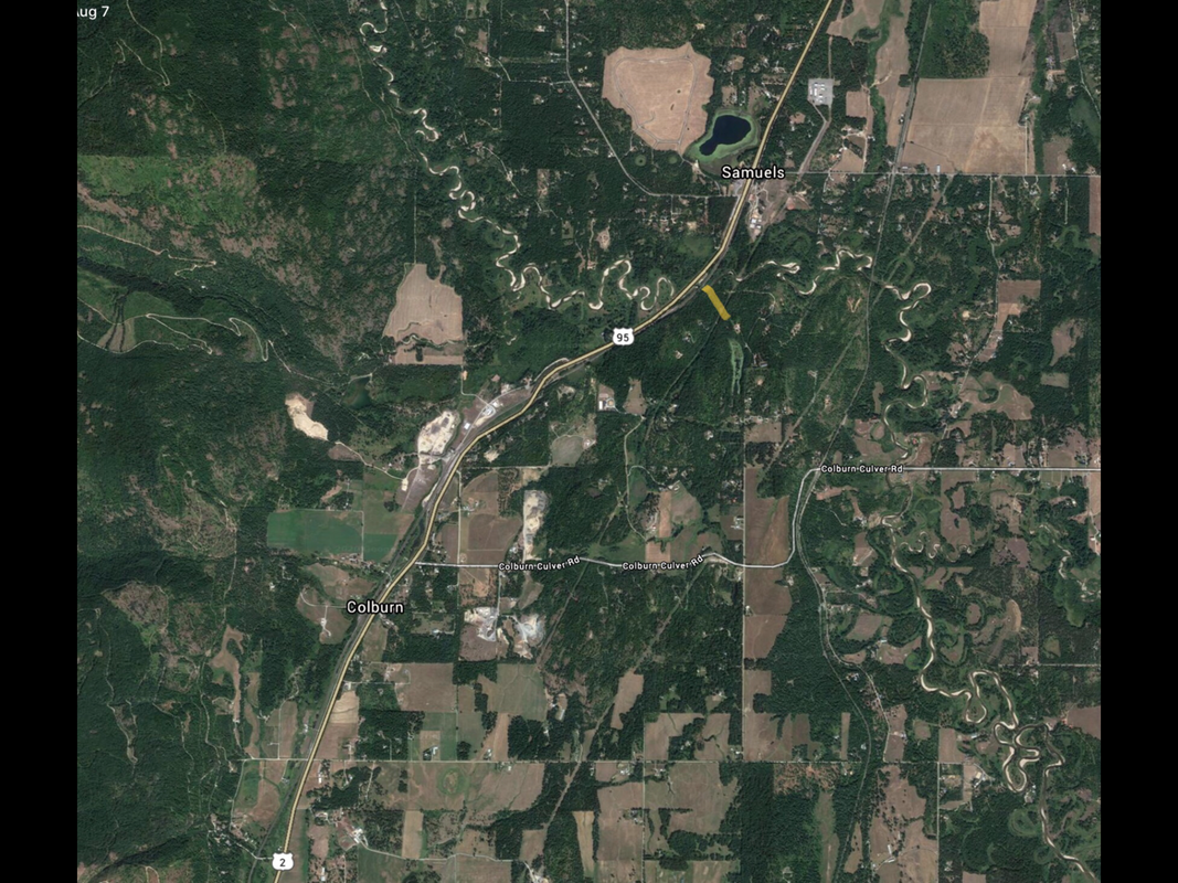
PACK RIVER AND HWY-95 LAUNCH
PADDLE DISTANCE: 22.5 miles of very windy river
ELEVATION: Hwy 95 put in 2106’. P.O.Lake take out 2062’
LENGTH AND ACREAGE: 22.5 miles and takes 8 to 12 hours.
MAPS: Elmira Topo
LAUNCH GPS: put in...48°25’16” N 116°29’57” W take out...48°19’26” N 116°23’04” W
BONNER COUNTY SHERIFF: 208.263.8417
ELEVATION: Hwy 95 put in 2106’. P.O.Lake take out 2062’
LENGTH AND ACREAGE: 22.5 miles and takes 8 to 12 hours.
MAPS: Elmira Topo
LAUNCH GPS: put in...48°25’16” N 116°29’57” W take out...48°19’26” N 116°23’04” W
BONNER COUNTY SHERIFF: 208.263.8417
DESCRIPTION:
From the Hwy 95 put in, the river winds and twists for over 22 miles. Most of this paddle is on flat water from April on. However, there are a few class 1 rapids. The biggest hazards are downed trees, log jams, tight turns, and what are called”strainers”. When a tree falls into the river, it acts like a strainer. Water flows thru it, and they collect debris. AVOID STRAINERS, DOWN TREES AND BE AWARE ON TIGHT TURNS.
Past those hazards, the paddle is more of a float, with some heavy paddling around turns. A few more hazards are moose, elk, beavers, and other small wildlife. Do not leave your lunch unattended.
At the take out, you can paddle out into the Pend Orielle Wildlife Management Area, and the Pack River Flats.
This is an amazing paddle that should not be missed, but I would advise against taking a reckless newby.
At Lightning Creek, there is the Pack River Store, for supplies.
ATTRACTIONS
A gorgeous windy river that will amaze you for hours.
DIRECTIONS:
Drive thru Sandpoint for about 12 miles where 95 crosses over the Pack River. The north launch is on the right near where the river crosses under the RR tracks.
There are three other put ins to make your paddle shorter. They are Colburn-Culver Road, Rapid Lightning Creek , and Hwy 200
There are three other put ins to make your paddle shorter. They are Colburn-Culver Road, Rapid Lightning Creek , and Hwy 200
COOL THINGS CLOSE BY:
Pend Orielle Lake, Hawkins Point, Pend Orielle Wildlife Management Area, and Sandpoint.
R & P:
Mr. Sub, Eichardt’s, Jalapeños, and Burger Express


