EVENT TYPE: Day hiking, climbing, and photography DISTANCE: varies ELEVATION: varies depending on where you start DIFFICULTY: easy to moderate MAPS: IPNF, Post Falls Park & Recreation Map, Post Falls Topo GPS: Spokane Street Bridge 47°42’08” N 116°57’15” W West Riverview Drive. 47°41’45” N 116°58’23” W RANGER DISTRICT: CDA River R.D. 208.769.3000. Post Falls Parks. 208.773.3511 KOOTENAI COUNTY SHERIFF: 911 or 208.446.1300
DESCRIPTION:
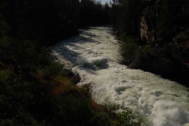
WE HAVE ADDED THE AREAS SHERIFF’S EMERGENCY PHONE NUMBERS FOR EACH TRIP WRITE UP UNDER THE RANGER DISTRICT INFO. IF AN EMERGENCY OCURRS, EVALUATE YOUR CIRCUMSTANCES AND CALL ONLY IF NEEDED.The Q’emiln Park is noted for its outstanding climbing. There are several trails thru the climbing rocks, that eventually leads you to the new Community Forest 500+ acres. At one point, the trail follows the Spokane River just after the Post Falls Dam. It’s quit spectacular to see the river rage down thru a narrow gorge. This river side route leads you out onto the area west of the Avista Generating Station and on to the Community Forest. You can stay along the river for about 2.5 miles to the west end of the park. From the south parking lot on W. Riverview Drive, the trail drops down a bit to where it splits and does a loop, back up to the W. Riverview lot. Your best bet is to stop by the Post Falls City Fall on Spokane Street to pick up a map. Or https://www.postfallsidaho.org/departments/parks-recreation/parks/community-forest
DIRECTIONS:
From Spokane, drive I-90 east to the Spokane Street exit. Turn right (south) at the light. Drive over the Spokane River Bridge, and take the first right (west) into the park. To reach the W. Riverview Drive trailhead, continue past the Q’emiln Park and drive up W. Riverview Drive for less then 2 miles. Watch closely for the parking area across from S. Marion Ct.
COOL THINGS CLOSE BY:
Corbin Park, Mica Peak, Idaho, and along the Signal Point Road, is the Dept of Lands Blossom Endowment Lands.
HAZARDS:
Because Q’emiln Park is dotted with cliffs, extra caution should be use. Anywhere along the Spoken River, is another place to practice extra caution. In the Community Forest, some trails are steep, and or rocky. Pay attention to the parks colored dot system to navigate the area.
R & P:
The White House Grill
PLAN YOUR TRIP:
Click for Current NOAA Weather Conditions
PHOTO GALLERY
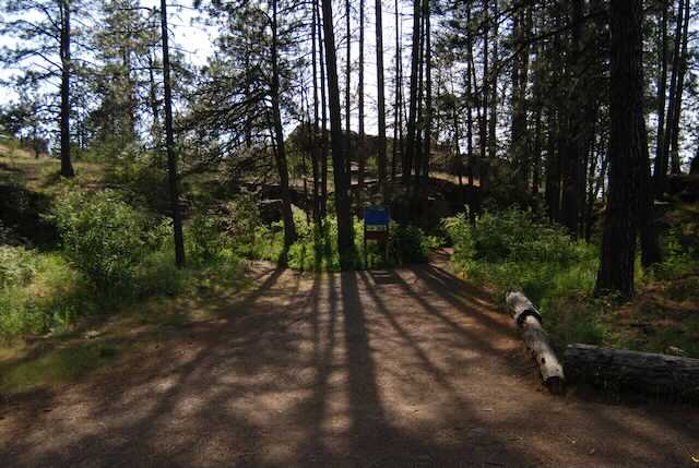
PARKING AREA & KIOSK
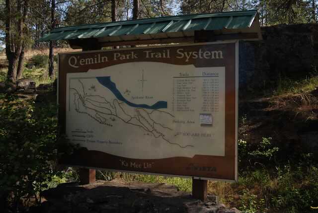
TRAILHEAD KIOSK. NOTICE THE PRONUNCIATION OF THE PARK ON THE BOTTOM
THIS TRAIL SIGN EXPLAINS THE TRAILS AT THE "Y"
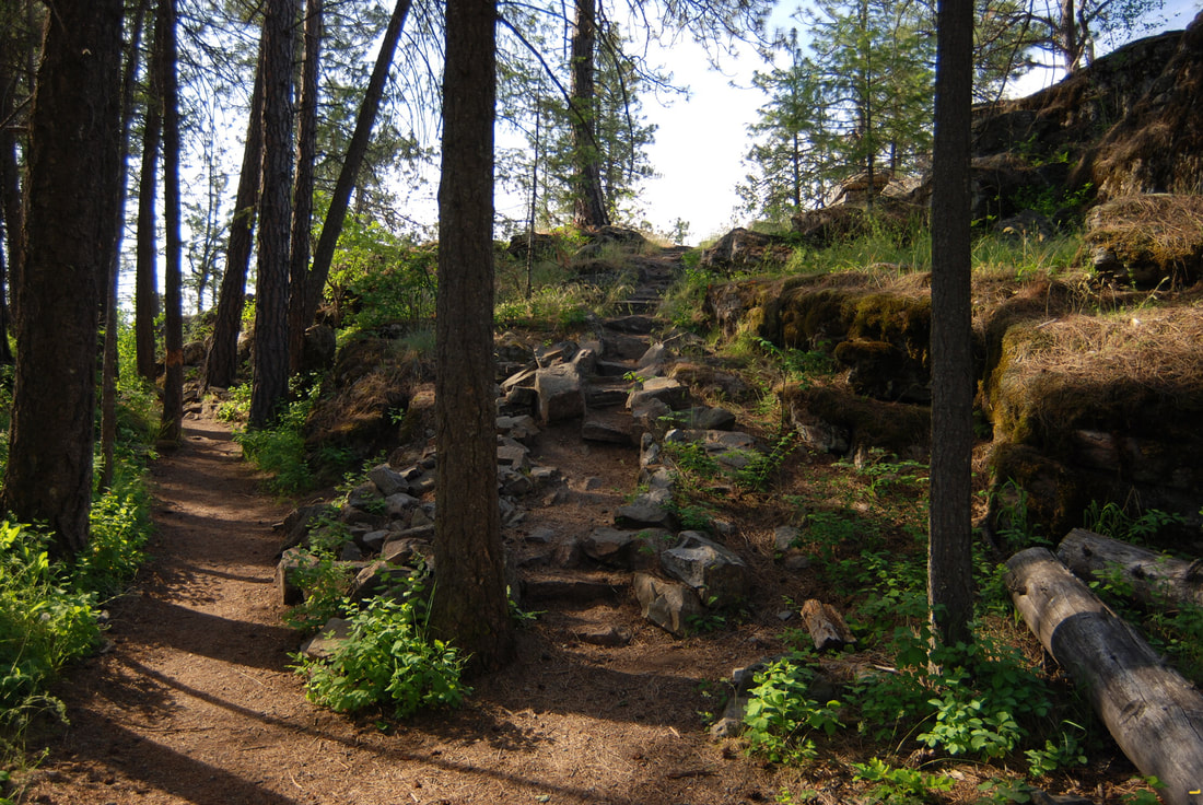
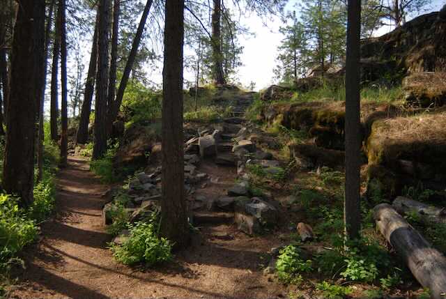
THE NEXT THREE IMAGES ARE THE TRAIL. TO THE CLIMBING AREA
GOING LEFT IS TO THE CLIMBING AREA. GOING RIGHT IS TO THE SPOKANE RIVER
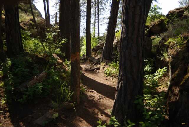
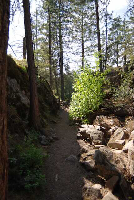
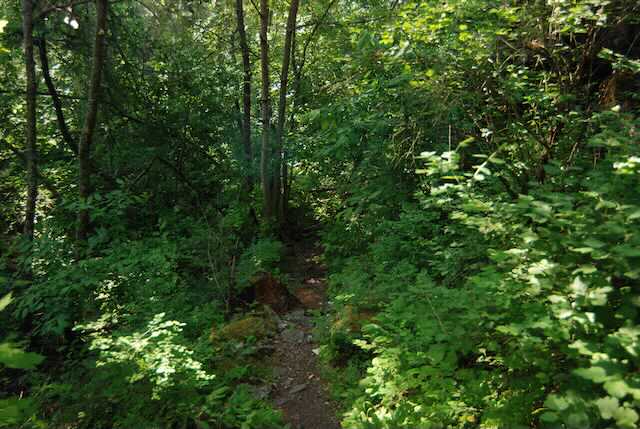
THE BELOW TWO IMAGES ARE FROM THE MAIN TRAIL INTO THE PARK.
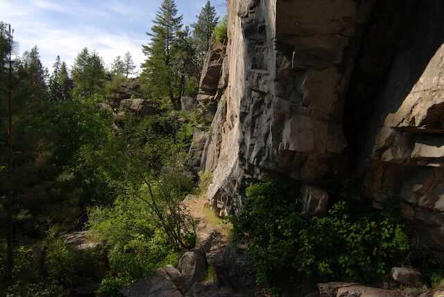
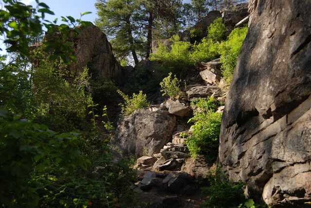
A CLIMBERS TRAIL TO THE CLIFFS
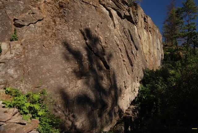
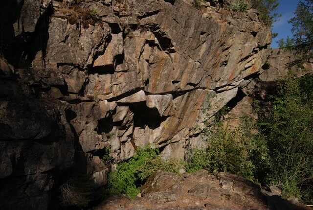
ONE OF MANY QUALITY CLIMBING WALLS
A ROUTE TO ABOVE THE CLIFFS WHERE THE PROTECTION IS DONE
SOME HARD ROUTES
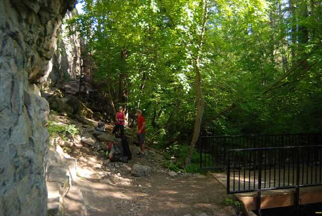
TWO CLIMBERS. ONE IS BELAYING THE CLIMBER ON THE WALL.
SOME OF THE CLIMBERS TRAILS ARE GREAT WALKS. BUT WATCH OUT FOR POISON IVY
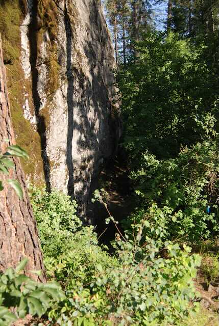
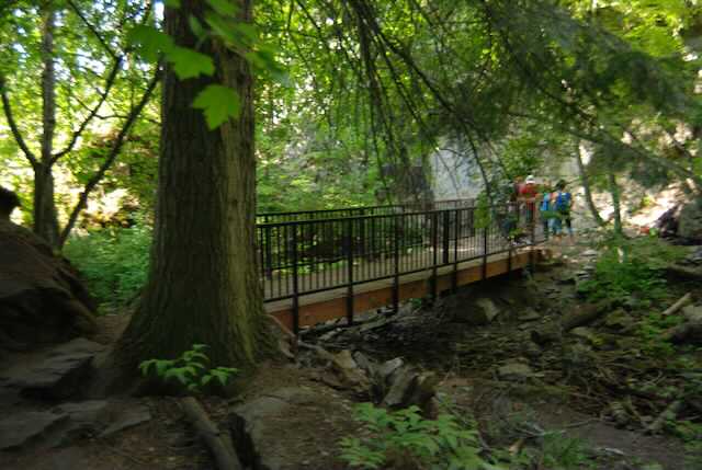
A TRAIL AWAY FROM THE CLIMBING AREA TO THE SPOKANE RIVER
A NEW FOOT BRIDGE TO THE SPOKANE RIVER
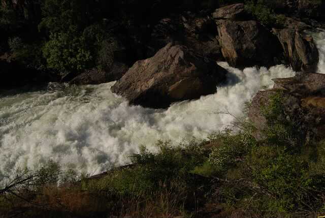
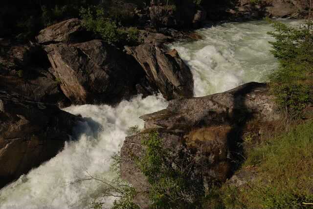
THE NEXT THREE IMAGES ARE OF THE SOUTH CHANNEL OF THE SPOKANE RIVER THE SOUNDS ARE DEAFENING.
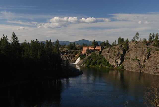
SPOKANE RIVER’S SOUTH CHANNEL AVISTA’S POWER PLANT, WITH INTERMITTENT OVER FLOW WATERFALL