EVENT TYPE: Day hiking, backpacking, camping DISTANCE: 6 milers RT ELEVATION GAIN: 1270 verts DIFFICULTY: Easy MAPS: IPNF, Lolo N.F., DeBorgia South topo GPS: 47°16’31”N 65°22’29”W Superior Ranger District: 406.822.4233 MINERAL COUNTY SHERIFF: CALL911 FIRST or 406.822.3555
DESCRIPTION:
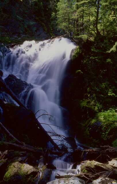
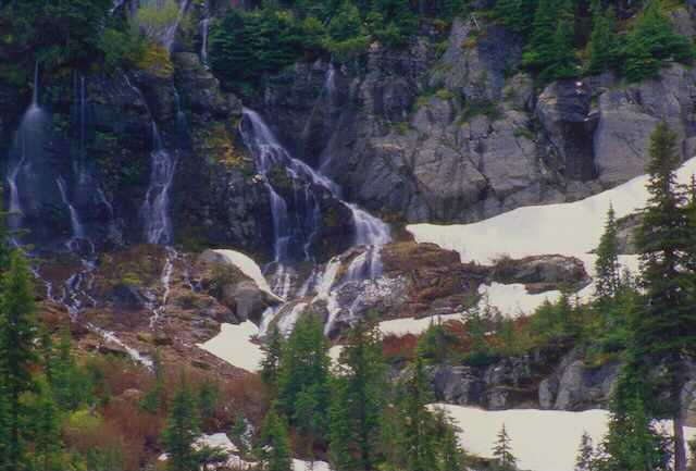
WE HAVE ADDED THE AREAS SHERIFF’S EMERGENCY PHONE NUMBERS FOR EACH TRIP WRITE UP UNDER THE RANGER DISTRICT INFO. IF AN EMERGENCY OCURRS, EVALUATE YOUR CIRCUMSTANCES AND CALL ONLY IF NEEDED. Trail #262 starts on Road 889 and wondered up thru an old growth cedar forest for a little over a mile to the junction with Hazel Lake. Just before the junction look for 60' Dipper Falls below the trail on Ward Creek. When the flow is low, the falls take on the look of it's name sake. Each column splashes off water to the next column, hence looking like a mass of ladles. Trail # 280 climbs for the last mile to Hub Lake. There is a good place to rest and have lunch at the west end (upper)of the lake. After lunch there is an old mine shaft (blocked) that you can go into for about 20 feet. If it’s a hot day, the shaft offers a cool place to hang out. Along the trail to the mine is the trail to the saddle between Ward and Eagle Peaks.
OOPTION #1
Up past the old mine shaft is a faint trail that leads to the saddle between Ward Park and Eagle Peak. From the saddle you can turn right (N) to Eagle Peak 7333' for about .5 miles. From the same saddle, you can turn left (S) to Ward Peak 7312' for about .8 of a mile. Both of these summits are spectacular places to view the surrounding territory as well as distant views of S. Central Idaho Panhandle.
DIRECTIONS:
Head east on I-90 into Montana and exit on 26, Ward Creek Road. Head south up the Ward Creek Road #889 for 6.5 miles to a trailhead just before Ward Creek and a left turn. There is no west bound on ramp, so you have to drive east on I-90 to St. Regis to regain the west bound lane.
HAZARDS:
This trail is pretty easy with no hazards to speak of. The trail above Hub Lake is steep.
COOL THINGS CLOSE BY:
Ward & Eagle Peaks, Lookout Pass Ski Area, the Route of the Hiawatha, and historic Wallace.
R & P:
Pizza Factory, 1313 Club and Muchacho’s Tacos in Wallace
GALLERY
DIPPER FALLS. ALONG THE TRAIL TO HUB LAKE
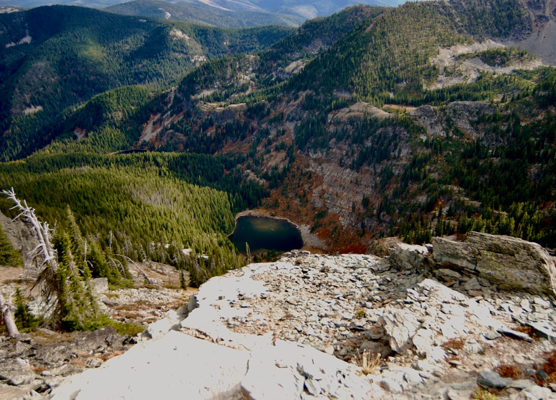
HUB LAKE FROM THE SADDLE BETWEEN WARD & EAGLE PEAKS
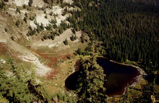
HAZEL LAKE FROM EAGLE PEAKS
A SEASONAL WATERFALL BELOW MARY LAKE, NEXT TO HUB LAKE.
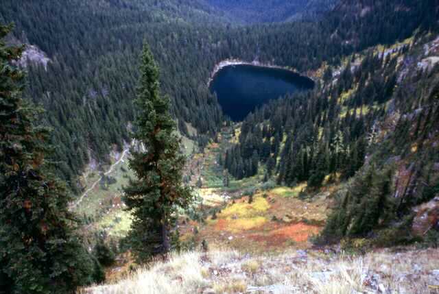
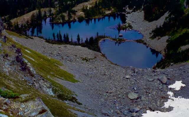
UNNAMED DOUBLE LAKE IS ABOVE THE TRAIL TO HUB LAKE & HAZEL LAKE. SEE WARD & EAGLE PEAK WRITE UP FOR INFO ON THESE LAKES.