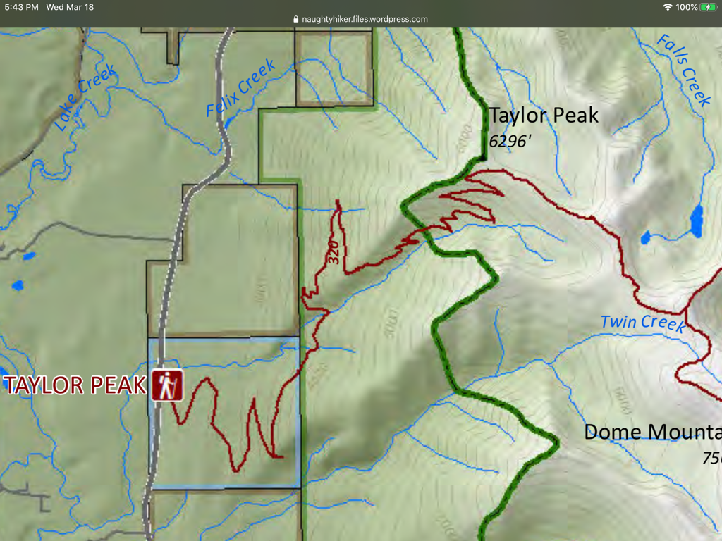
TAYLOR PEAK 6307’ TRIAL #320
EVENT TYPE: Day hiking, backpacking
DISTANCE: 16 miles RT
ELEVATION: 4000’
DIFFICULTY: Strenuous
MAPS: Kootenai N.F., Crowell Creek topo
GPS: 48°23’11” N 115°47’28” W
LIBBY RANGER DISTRICT. 406.293.7773
LINCOLN COUNTY SHERIFF: CALL 911 FIRST or 406.293.4112
DISTANCE: 16 miles RT
ELEVATION: 4000’
DIFFICULTY: Strenuous
MAPS: Kootenai N.F., Crowell Creek topo
GPS: 48°23’11” N 115°47’28” W
LIBBY RANGER DISTRICT. 406.293.7773
LINCOLN COUNTY SHERIFF: CALL 911 FIRST or 406.293.4112
DESCRIPTION:
This trail is yet another steep and seemingly endless ascent. There are about 26 switchbacks before a short rock hop to the summit.
As you near Taylor Peak, a short off trail route will take you to Taylor’s summit.
The views all around are spectacular, with the Bulk of the CMW laid out to the south.
As you near Taylor Peak, a short off trail route will take you to Taylor’s summit.
The views all around are spectacular, with the Bulk of the CMW laid out to the south.
DIRECTIONS:
Near milepost 30 along Hwy 56, look for the Taylor Peak Road #4621 off to the east. Drive about 1.5 miles to the trailhead. Parking is below the trailhead at a switchback.
HAZARDS:
Another 4000’ gain in 8 miles.
No water near the summit.
No water near the summit.
COOL THINGS CLOSE BY:
Ross Creek Cedars, Cedar Lakes, Dome Mountain, Kootenai Falls, and the Proposed Scotchman Peaks Wilderness.
R & P:
Henry’s in Libby, Pizza Hut, Rosauers, Clark Fork Pantry & Squeeze Inn in Clark Fork. Eicharts, Mr Sub & Jalapeños in Sandpoint
PLAN YOUR TRIP:
Click for Current NOAA Weather Conditions


