MEDIMONT LAUNCH
PADDLE DISTANCE: varies
ELEVATION: 2133’
LENGTH AND ACREAGE: varies
MAPS: IPNF, Medimont Topo
LAUNCH GPS: 47°28’40” N 116°35’43” W
SHOSHONE COUNTY SHERIFF: 208.556.1114
ELEVATION: 2133’
LENGTH AND ACREAGE: varies
MAPS: IPNF, Medimont Topo
LAUNCH GPS: 47°28’40” N 116°35’43” W
SHOSHONE COUNTY SHERIFF: 208.556.1114
DESCRIPTION:
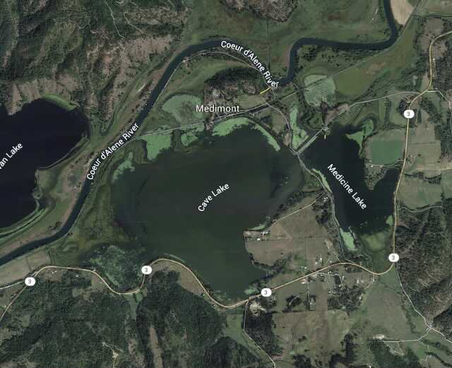
The Medimont Launch services the Cave Lake, and Medicine Lake.
To paddle to Cave Lake, paddle west to the bridge to Cave Lake.
To paddle to Cave Lake, paddle west to the bridge to Cave Lake.
ATTRACTIONS
These side lakes are shallow and have very little power boat use.
DIRECTIONS:
from CDA drive east on I-90 over the 4th of July Pass, and turn right at the Rose Lake & Harrison exit. Hwy 3 continues south down the Chain Lakes. Turn right (S) onto S. Medimont Road, to E Rainy Hill Road to the launch and campgrounds.
COOL THINGS CLOSE BY:
CDA River, Cave Lake, and Killarney Lake.
R & P:
Trails End Brewery, Mexican Food Factory, Franklins, and Moon Time


