PADDLE DISTANCE: about 3.8 miles shore line paddle ELEVATION: 2186’ LENGTH AND ACREAGE: 1.2 miles and 539 acres MAPS: Newman Lake & Mount Spokane topos LAUNCH GPS: 47°46’13” N. 117°01’04” W KOOTENAI COUNTY SHERIFF: 208.446.1300
DESCRIPTION:
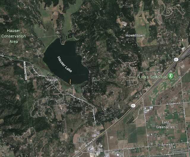
The Hauser Lake Launch is modern with all the amenities including a dock for swimming, pit toilets, and adequate parking. Hauser Lake is relatively small but a nice get away from the crowds.
ATTRACTIONS
Easy access from Hwy 53, several places t get out and swim
DIRECTIONS:
From Spokane, drive East on Trent to the Washington Idaho State lines where Hwy 290 becomes Hwy 53 to Rathdrum. From the state line, drive 1.9 miles to the Hauser Lake Road. Turn left (north) for 1.3 miles to the launch site on your right.
COOL THINGS CLOSE BY:
Hayden Lake, Twin Lakes, Spirit Lake, Hauser Conservation Area, and Newman Lake with the McKenzie Conservation Area
R & P:
Rustler’s Roost for breakfast, the American Food Factory, Franklins Hoagies, and the Trails End Brewery.