WATERFALL : Leigh Creek Falls Trail #132 DROP: ABOUT 100' WATERFALL TYPE: plunge, cascades, fans, blocks, horsetails, tiers, chutes and slides DISTANCE CAR TO FALLS: 1.2 miles MAPS: Kootenai National Forest, Cabinet Mountain Wilderness, Snowshoe Peak topo GPS: 48°13’32” N 115°39’?17” W
DESCRIPTION:
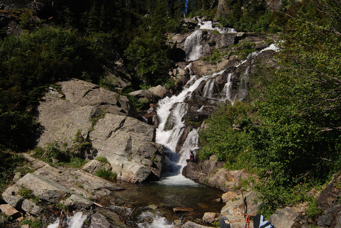
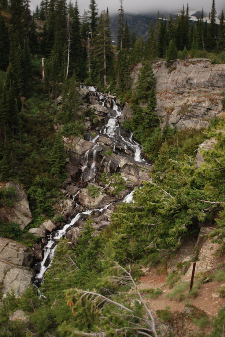
Leigh Creek Falls is one of the most spectacular waterfalls in the Inland Northwest. With a drop of about 100', it is a spectacular sight along a most beautiful trail to one of the most beautiful lakes in our region. After hiking 1.2 miles up Trail #132, you come to a spot that requires you to stop and enjoy its beauty. If you are adventurous, you can scramble up the sides of the falls to photograph many of its numerous drops.
OPTION #1:
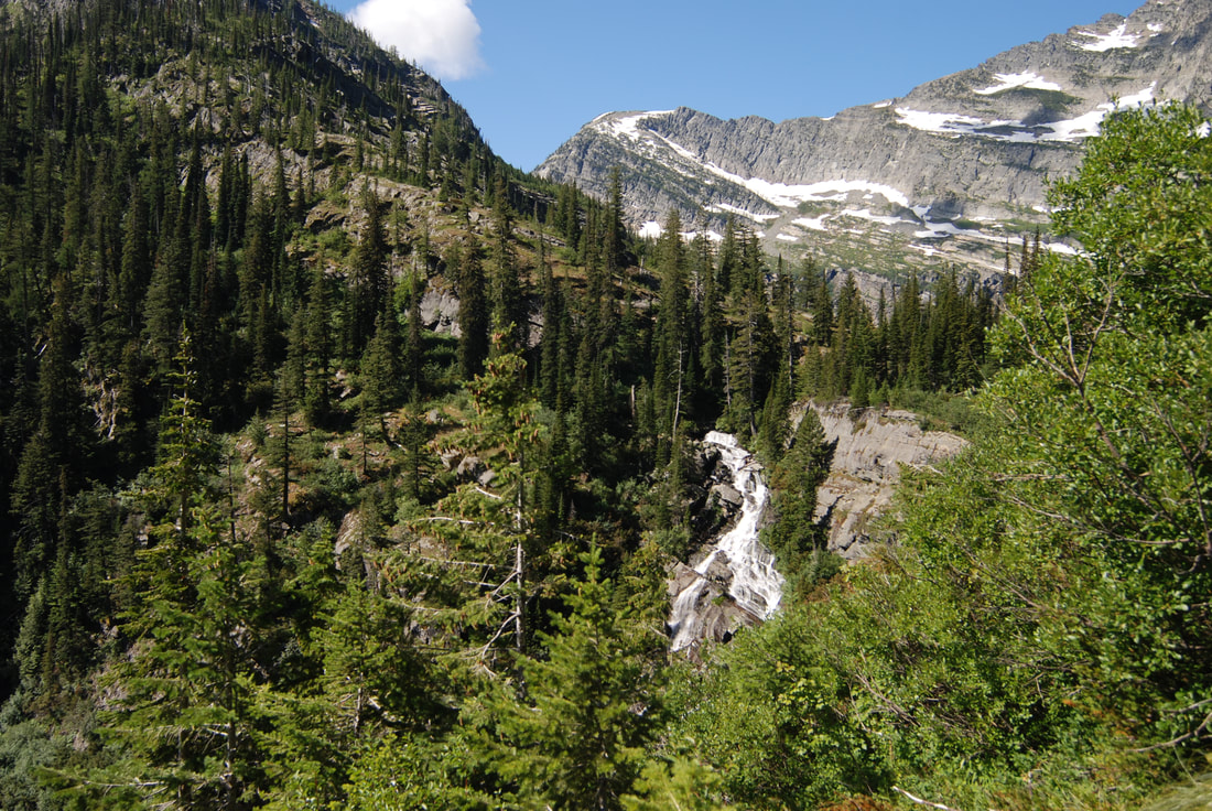
As long as you are in the area, climb the almost 200 vertical feet to the upper trail. Here, as you walk out to Leigh Lake, Leigh Creek Falls is below you for about .1 of a mile. The sounds and views along this section of the trail is well worth the effort to get here.
OPTION #2:
In about .1 of a mile, Leigh Lake stretches out before you. This would be a great spot to have lunch, take a nap and enjoy the spectacular scenery
OPTION #3:
For a closer view of some of the falls along Leigh Lakes shoreline, walk a user created path along the north shore to a rock beach.
DIRECTIONS:
From Libby, drive south on Highway 2 towards Glacier National Park for about 8 miles to the Bear Creek Road #278. Turn right (west) for three miles to FR#867. Turn right (west) for about 5 miles to FR #4786. Drive up 4786 for about 2 miles to the trailhead. Notice along this last stretch of road, that there is pull off to the left to a very primitive campsite. If it’s occupied, you can camp at the parking area.
COOL THINGS CLOSE BY:
Snowshoe Peak 8738', A Peak, Granite Lake, L.& U. Geiger Lakes with Lost Buck Pass & the Cabinet Divide Trail with views of Wanless Lake. The Proposed Scotchman Peaks Wilderness, the Bull River and Lake, and the Clark Fork River.
HAZARDS:
ALL WATERFALLS ARE A HAZARD, DUE TO THEIR SLIPPERY NATURE. ALWAYS BE EXTRA CAREFUL NEAR ANY WATERFALL. Please keep a close eye on your children when climbing the vertical section above the Leigh Creek Falls.
R & P:
Henry"s and The Shed in Libby
PLAN YOUR TRIP:
Click for Current NOAA Weather Conditions
PHOTO GALLERY
LEIGH CREEK FALLS AND YOUR FIRST BREAK
WHEN YOU FIRST SEE LEIGH CREEK FALLS, YOU WONDER HOW FAR UP IT GOES
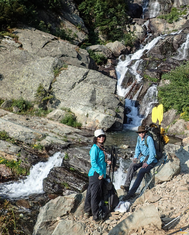
ELITE HIKERS SHUWEN AND TYLER POSE FOR AN IMAGE IN FRONT OF THE FALLS
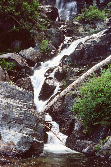
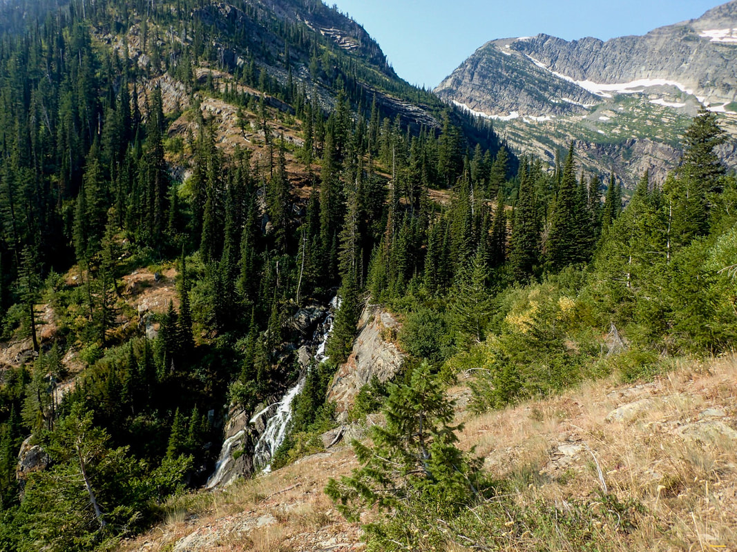
A TELEPHOTO SHOT OF A SECTION OF LEIGH CREEK FALLS
ABOVE THE VERTICAL SECTION OF THE TRAIL IS THIS VIEW BELOW THE TRAIL THE SIGHTS AND SOUNDS ARE WELL WORTH THE EFFORT
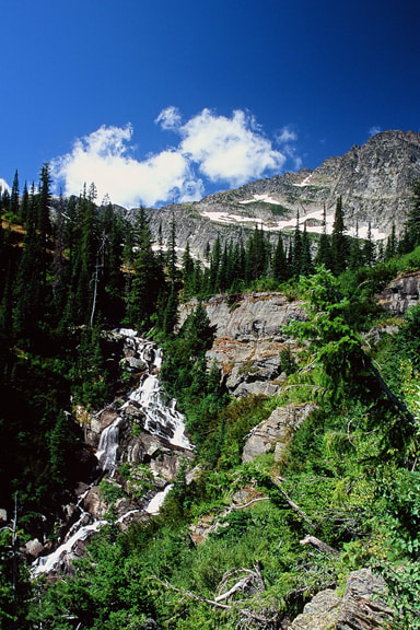
LEIGH CREEK FALLS WITH THE WEST WALL ABOVE THE LAKE
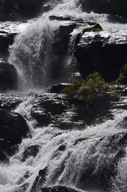
WHAT AN INCREDIBLE VIEW
ALL TOO SOON THE VIEW OF THE FALLS FADES, AND THEN YOU ARE AT THE LAKE
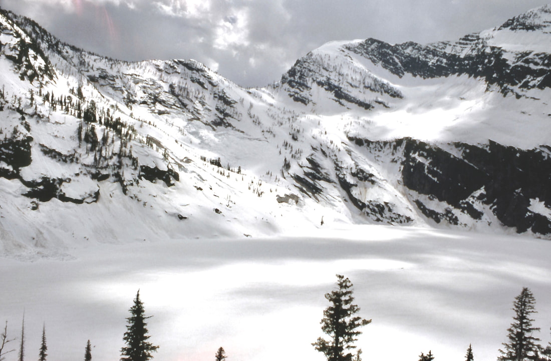
YOU MAY WONDER WHERE ALL THIS WATER COMES FROM ALL THE BENCHES ABOVE THE LAKE HOLD SOME DEGREE OF SNOW YEAR ROUND