A WARNING ABOUT THE ROAD TO THE CLIFF LAKE, ST PAUL PEAK AND ROCK PEAK ROAD. AFTER VISITING THE AREA WEDNESDAY 8.4.22, I WANT TO TELL YOU ABOUT THE ROAD. FROM F.R. 150, F.R. 2741 UP TO THE TRAILHEAD, IS EXTREMELY ROUGH' AND CARS WONT MAKE IT TO THE TRAILHEAD. THE WALK UP THE ROAD TO THE TRAILHEAD IS ABOUT 2.4 MILES. AND WILL SAVE YOUR VEHICLES FROM DAMAGE. PLEASE USE CAUTION
CLIFF LAKE, CHICAGO PEAK 7018’, ST. PAUL PEAK 7714’
EVENT TYPE: Hiking, backpacking, climbing, fishing, photography, and scrambling DISTANCE: Cliff Lake 3 miles RT St. Paul Peak 6 miles RT. Rock Peak is about 10 miles RT. ELEVATION GAIN: Cliff Lake 300 verts gain, with St. Paul Peak at 1970 verts. DIFFICULTY: Easy to Cliff Lake and Chicago Peak and difficult to St. Paul Peak MAPS: Kootenai National Forest, Elephant Peak topo GPS: 48°04’21” N 115°40’42” W RANGER DISTRICT: Cabinet R.D. 406.827.3533 SANDERS COUNTY SHERIFF: CALL 911 FIRST or 406.827.3584
DESCRIPTION:
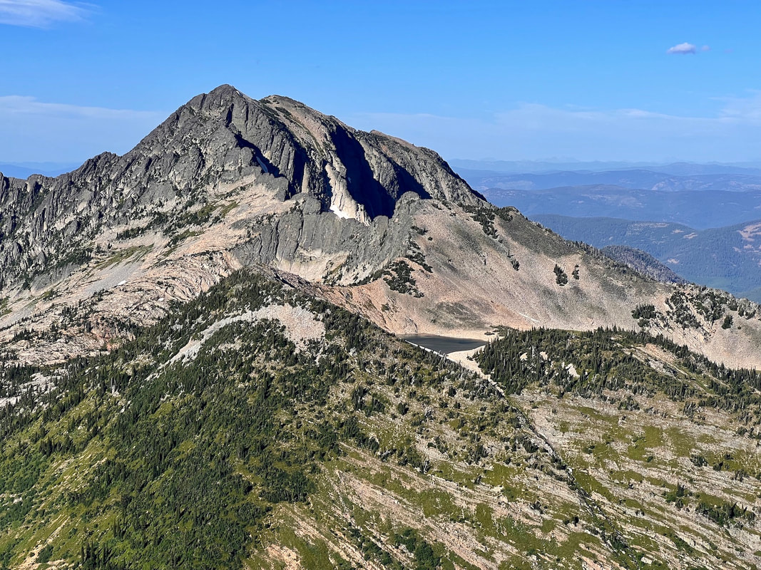
WE HAVE ADDED THE AREAS SHERIFF’S EMERGENCY PHONE NUMBERS FOR EACH TRIP WRITE UP UNDER THE RANGER DISTRICT INFO. IF AN EMERGENCY OCURRS, EVALUATE YOUR CIRCUMSTANCES AND CALL ONLY IF NEEDED. The road to the trailhead is the hardest part of this hike. High Clearance vehicle, and a chainsaw would be advised. When F.R. #150 comes to F.R. #2741, you may have to park here. F.R. 2741 is very rough for about .5 miles. The road improves after that. The wilderness boundary is within minutes of the trailhead. So almost immediately you in awe of your surroundings and the view. As you walk over a small hill, the trail cuts down thru a forest of young (up to 20 years) Sub-Alpine Firs that are only 5-6 feet tall, and look like hula dancers. There are small ponds on the plateau that cause excellent reflection images. Near the south edge of the plateau, the views of infinite amount of climbing walls fills the scene below you. I believe, that an enthusiast could spend their lives here and not climb all the routes. To the NW of the ponds, towers Chicago Peak 7018'. There are some nice scrambles and technical climbs along it's .5 of a mile long face. The peak above and in front of you, is the massive St.Paul Peak. The trail skirts the peak's base, and the edge of Cliff Lake. There are several good camp sites along it's shore line. Behind the lake, St. Paul Peak fills the reflection.
OPTION #1:
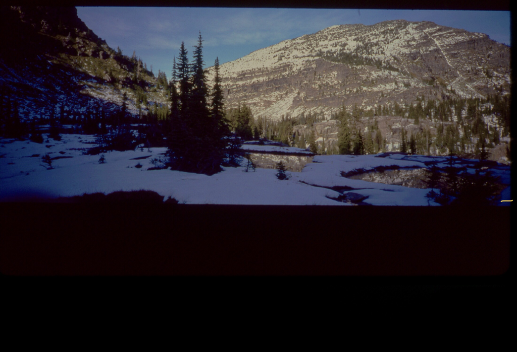
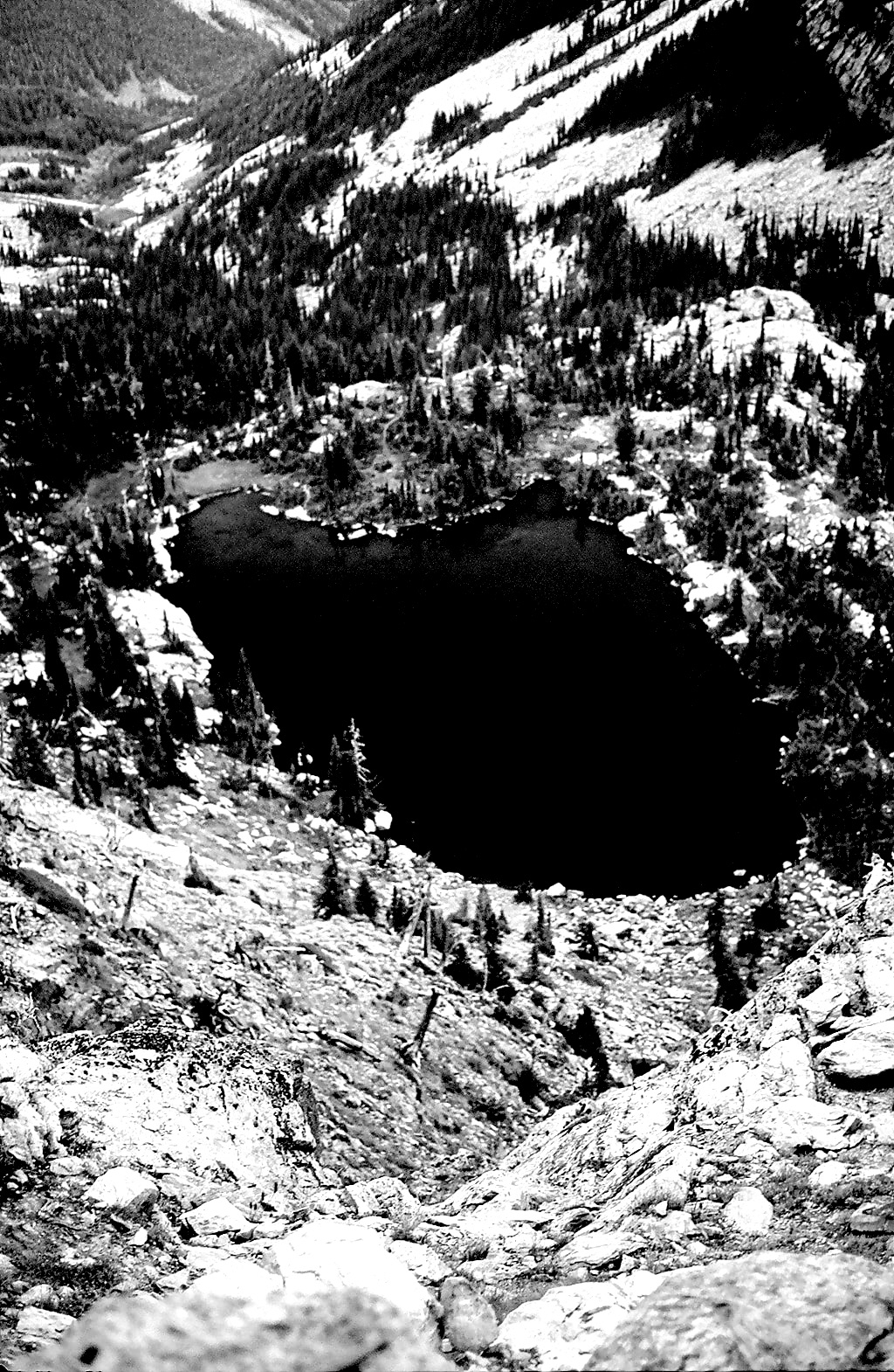
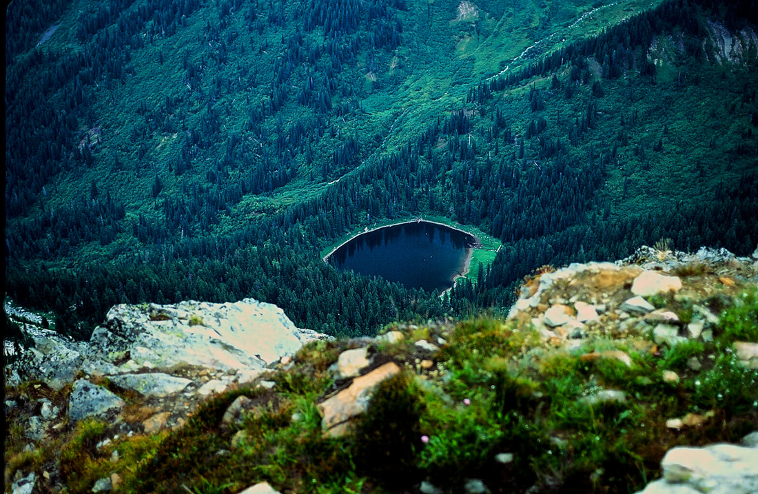
From the south end of the lake, there is a faint trail heading NE and climbs the south face of St. Paul Peak. Don't miss this scramblele. From on top, you have 360 degree views of the Cabinet Mountain Wilderness, and Glacier National Park and the Bob Marshall Wilderness to the east. Below the summit to the NE some 2999' below, is St. Paul Lake. A small round deep lake worth visiting. Retrace your route to get down.
OPTION #2:
From Cliff Lake, head east to a massive cliff/saddle that drops below you. Take a right turn (SE) and follow this ridge across the valley and eventually up the North Face of Rock Peak. Near the north summit. The last 300 vertical feet is on steep loose scree. It can be difficult and dangerous to ascend.
DIRECTIONS:
From Sandpoint, drive east on SH #200 towards Clark Fork and into Montana. Pass SH #56 road and two miles past Noxon, Montana, near milepost 17, turn left (east) onto the Rock Creek Road # 150. After about 400 feet take the right fork for about 8 miles to the Chicago Peak Road #2741. You will pass the Engle Peak turnoff, the Rock Lake turnoff, then come to FR #2741. Turn right for about 7.1 miles. BUT BE AWARE…THIS ROAD IS NOT MAINTAINED FOR CARS OR LOW CLEARANCE VEHICLES, AND IS VERY ROUGH. An Outback could make it, but you will wish you hadn’t. At this turn, you may not be able to get any higher due to rocky and rough road beds. You can park here and hike the 7.1 miles, to the trailhead. My suggestion is…ONLY DRIVE FR #2741 AT YOUR OWN RISK. THE CREATORS OF THIS WEBSITE CAN NOT BE HELD RESPONSIBLE FOR ANY DAMAGE TO YOUR VEHICLE. YOU HAVE BEEN WARNED.
COOL THINGS CLOSE BY:
Engle Peak, Rock Lake, Star Peak, Pillick Ridge, and Wanless Lake,
HAZARDS:
The road to the trailhead, after the FR#2741, eats cars. The towing fee could easily reach 1000$. None to Cliff Lake. Sure footedness and lots of experience should be used going up and down, to reach St Paul Peak. Summitting Rock Peak, take strength, endurance, experience. Do not attempt, unless you are well experienced in near vertical rock hopping.
R & P:
Henry’s & Pizza Hut, in Libby, Clark Fork Pantry, Eicharts, Mr Sub & Jalapeños in Sandpoint
PLAN YOUR TRIP:
Click for Current NOAA Weather Conditions
(THESE SUBALPINE FIRS, SHOWN ANOVE, ARE CALLED “KRUMMLOLZ.” THEY CAN BE WELL OVER 100 YEARS OLD AT ONLY 6’ TALL PNT TREES)
PHOTO GALLERY
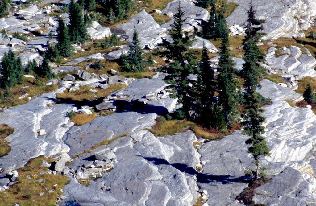
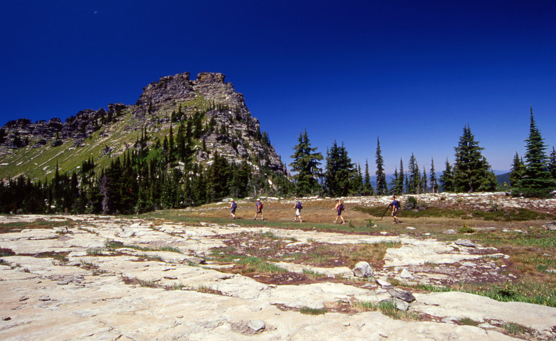
TRAIL ALONG SIDE CHICAGO PEAK IN THE MEADOWS
ST PAUL PEAK IN JUNE IN THE SUN
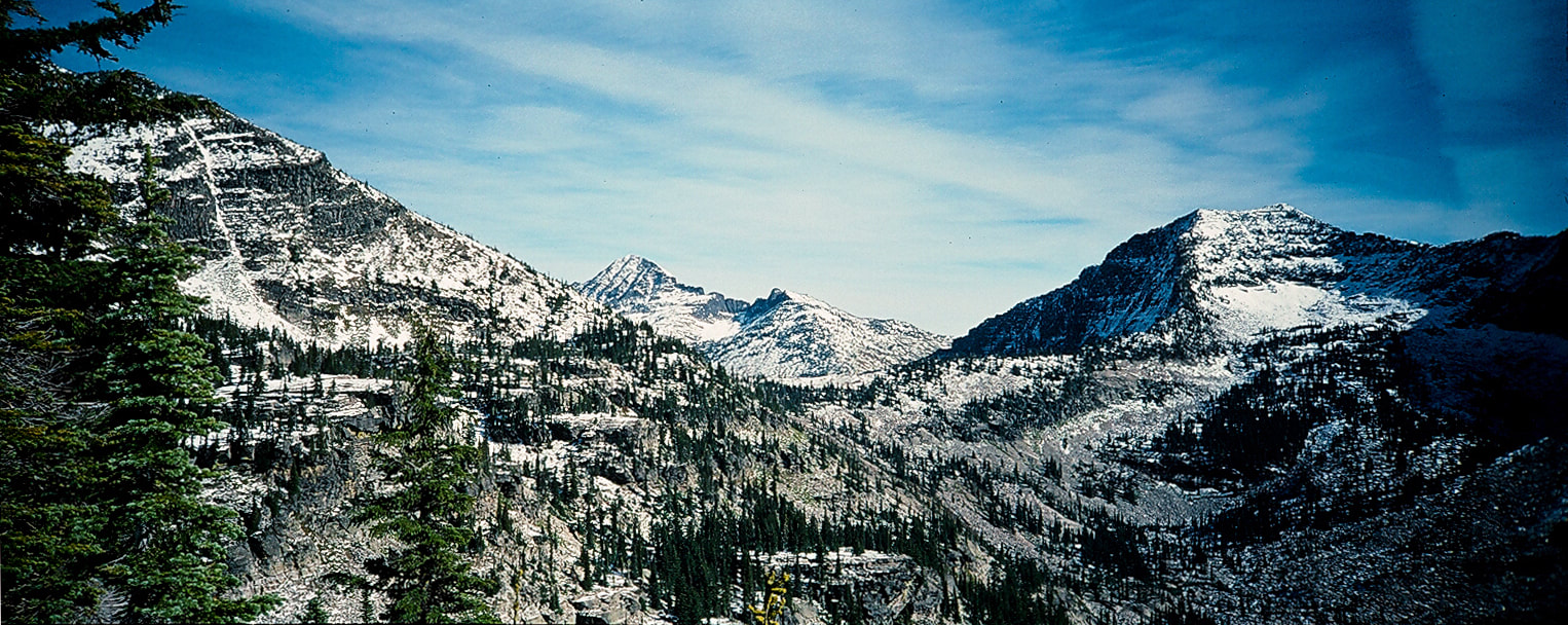
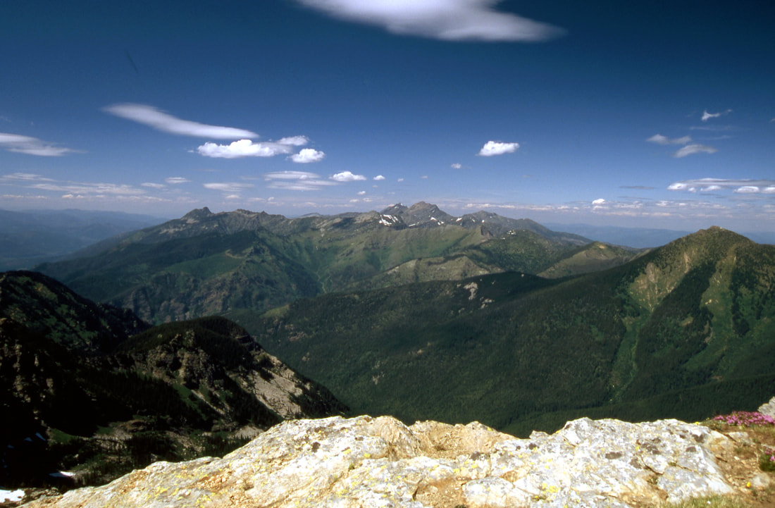
ST.PAUL PEAK ON FAR LEFT, WITH ELEPHANT PEAK IN THE DISTANCE. ROCK PEAK ON FAR RIGHT AFTER THE FIRST SNOW
SCRAMBLING ST. PAUL PEAK WITH ROCK PEAK LEFT HIKER
THE VIEW LOOKING NORTH. DEAD CENTER IS SNOWSHOE AND A PEAKS
CILFF LAKE FROM THE SUMMIT OF ST. PAUL PEAK
CHICAGO PEAK FROM ST PAUL PEAK TOP LEFT ALONG CHICAGO PEAK'S RIDGE IS THE TRAILHEAD JUST OUT OF SIGHT
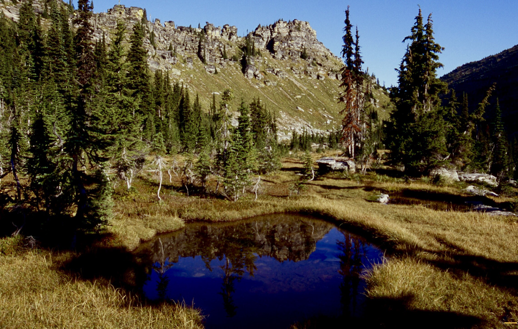
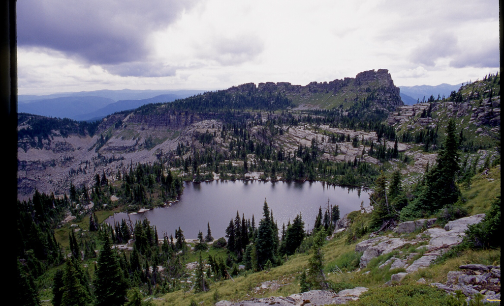
CLIFF LAKE, BELOW ST. PAUL PEAK, CHICAGO PEAK IN BACK
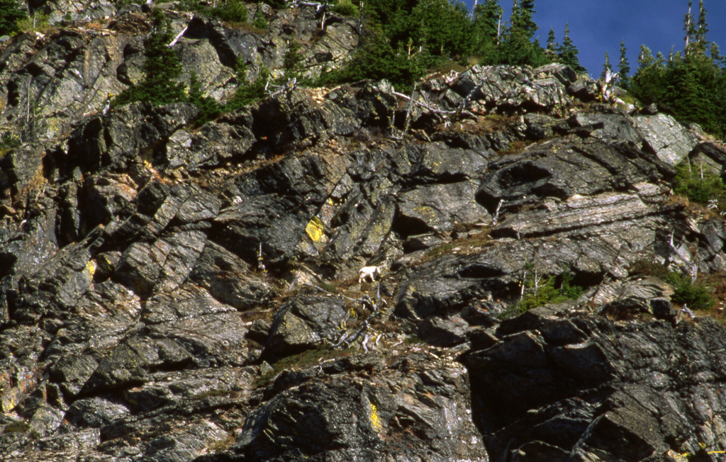
MOUNTAIN GOAT ON THE SW SIDE OF ST PAUL PEAK, ABOVE CLIFF LAKE
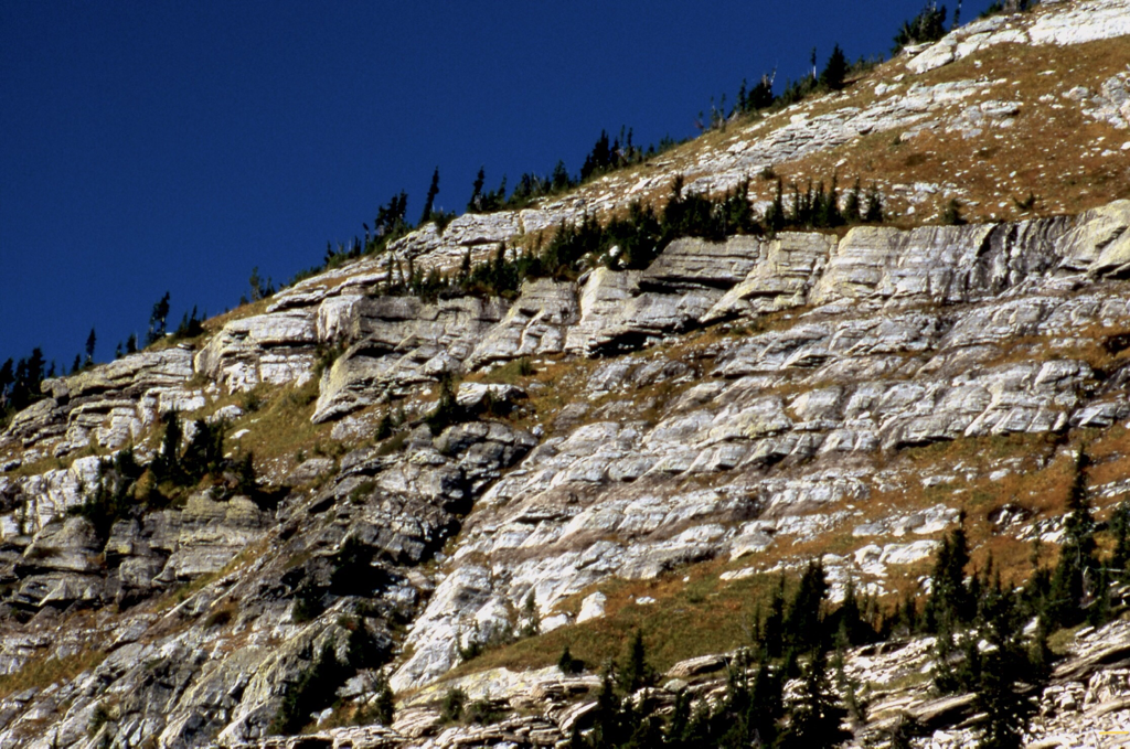
SOUTH FACE ST. PAUL PEAK, ASCENT ROUTE
SCRAMBLING THE S.W. FACE OF ST. PAUL PEAK. ROCK PEAK BACK MIDDLE
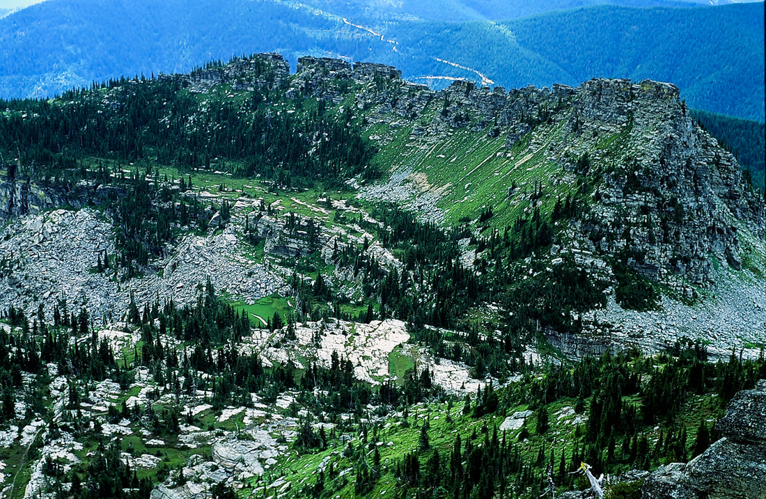
THE ROCK MEADOWS ABOVE ST. PAUL LAKE, SE OF ST. PAUL PEAK
ELEPHANT PEAK 7938’ FROM THE SUMMIT OF ROCK PEAK IMAGE BY CHRIS H. 8.3.2022
ST. PAUL LAKE FROM ST. PAUL PEAK
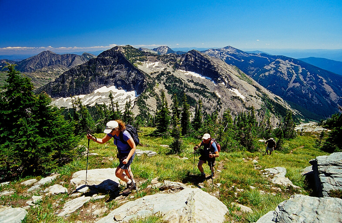
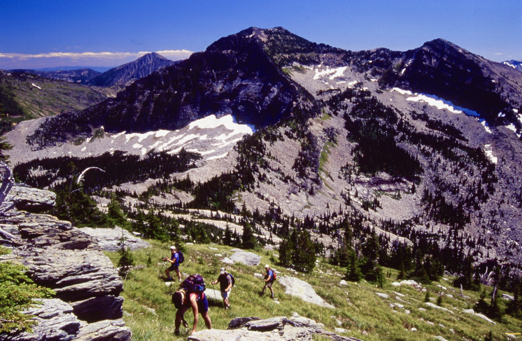
THE SPOKANE MOUNTAINEERS HEADING TO THE TRAILHEAD, WITH CHICAGO PEAK 7018'