JOHN DAY FOSSIL BED NATIONAL MONUMENT
EVENT TYPE: Camping, sightseeing, photography and exceptional beauty.
DISTANCE: Most the units require some walking, but nothing long or difficult.
ELEVATION: minimal
DIFFICULTY: easy
MAPS: J.D.F.B.N.M. Brochures
GPS: Thomas Condon Paleontology & Visitors Center 44° 31'10"N 119° 36'45" W.
John Day Fossil Bed National Monument: : 541.987.2333
WHEELER COUNTY SHERIFF: 541.763.4101
GRANT COUNTY SHERIFF: CALL 911 FIRST or 509.754.2011
DESCRIPTION:
WE HAVE ADDED THE AREAS SHERIFF’S EMERGENCY PHONE NUMBERS FOR EACH TRIP WRITE UP UNDER THE RANGER DISTRICT INFO. IF AN EMERGENCY OCURRS, EVALUATE YOUR CIRCUMSTANCES AND CALL ONLY IF NEEDED.
JOHN DAY FOSSIL BED NATIONAL MONUMENT
When you travel thru north centeral Oregon, you will notice that the upper northern area was effected by the Glacier Lake Missoula catastrophic floods of some 12,000+ years ago.
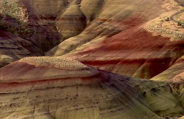
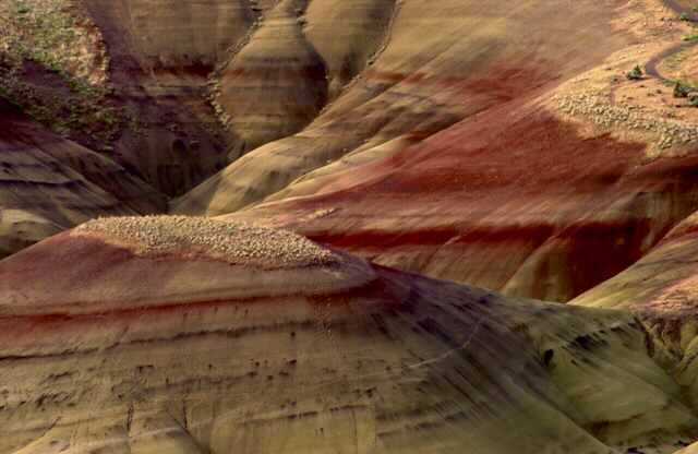
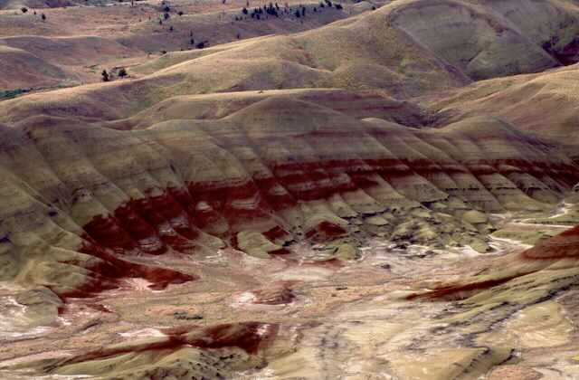
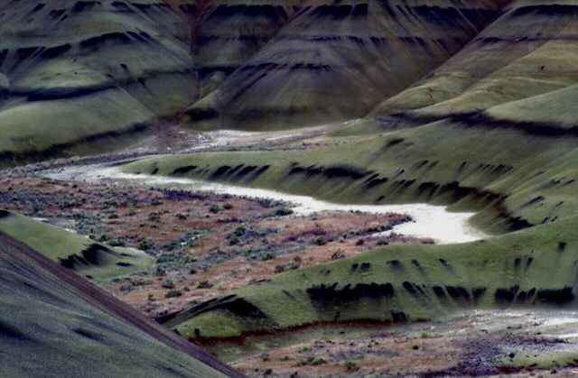
The Painted Hills Unit is like nowhere else in the Pacific Northwest. As you drive into the unit, it looks like you are driving onto a topographical map with relief.
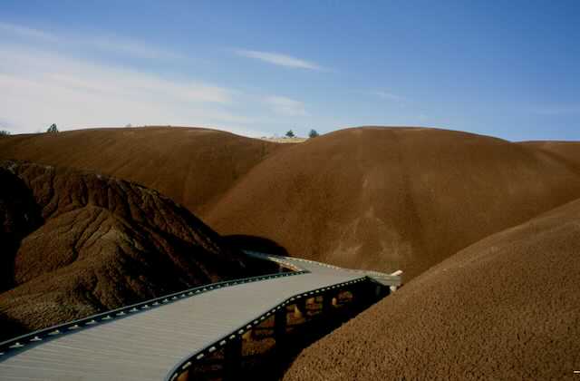
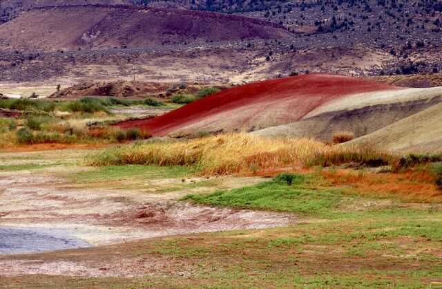
The layers you will see are incredible. Then throughout the area, drips of specific chemical elements run down the faces. Drive up to the parking area below the trail and observation overlook. It’s a short walk to some of the most unusual and out of this worlds views.
Once while on a skis trip to Mt Bachelor, I told a friend that flew down to the area, to fly over Painted Hills on the way home. He and his passenger were blown away. From the air, it looks like you are looking down on a topographical relief map.
The monument management, asked people to never walk off the established trails. From the overlook, you can see foot prints from nearly a hundred years ago. Today, they look just like yesterdays. For that reason, they ask that you respect the unusual terrain, and only look at it, and never walk on it.
You will see by the images below.
OPTION #1:
CLARNO UNIT. 44°54'48" N 119°24'38" W
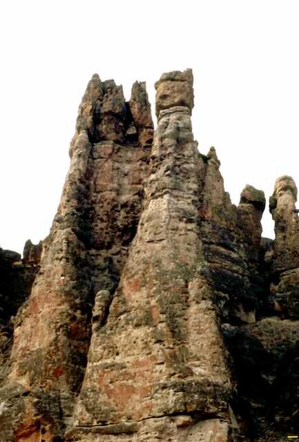
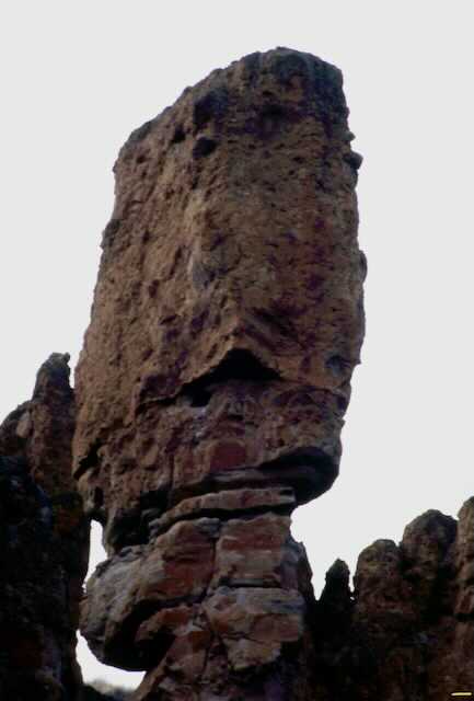
The Clarno Unit is located 18 miles west of the town of Fossil, Oregon. The Palisades are the most prominent
landform and are volcanic lahars, or mudflows, that formed 54-40 million years ago in a lush semi-tropical rainforest environment. Tiny four-toed horses, huge rhino-like brontotheres, crocodilians, and meat-eating creodonts that once roamed ancient jungles are now found in the rocks of the Clarno Unit, has a diverse range of plant life, leaves, fruits, nuts, seeds, and petrified wood from 173 species of trees, vines, shrubs, and other plants have been found here thus far. ,Glimpses of fossilized plants can be seen along the cliff walls.
OPTION #2:
SHEEP ROCK UNIT. 44°32'55" N W19°38'04"
The Sheep Rock Unit is located on Highway 19, between the towns of Kimberly and Dayville, Oregon. Prominant, non-fossil bearing rocks date back as far as 95 million years old. Fossils of plants and animals are found in a number of geological layers dating from 33 to 7 million years ago.
The Sheep Rock Unit is the hub of monument operations, with both the headquarters of the monument (the Cant Ranch home) and the main visitor center located near the namesake peak.
The Blue Basin
The Sheep Rock unit contains an amalgam of colorful strata and complex geology. From Cretaceous conglomerates to the flood basalts, the geologic features in this portion of the monument are spectacle to behold. The predominant exposures of green rock seen on Sheep Rock are a multitude of reworked layers of volcanic ash. The rich green color of the claystone was caused by chemical weathering of a mineral called celadonite. This happened millions of years ago as water moved through the alkaline ash beds under high pressure.
Island in Time (1.3 miles round trip) This gravel trail ascends to an amphitheater carved out of the blue-green claystones of the John Day Formation. The volcanic ash, now turned to stone, contains a rich variety of vertebrate fossils. Interpretive signs and fossil replicas are located along the trail. Blue Basin Overlook (3.25 mile loop) This trail brings you to a spectacular vista overlooking the John Day River Valley. It is dusty in places and may be impassable in wet weather. Moderate to strenuous with over 600 ft. elevation gain (and loss.)
OPTION #3:
THOMAS CONDON PALEONTOLOGY & VISITORS CENTER. 44°43'10"N 119°36'45" W
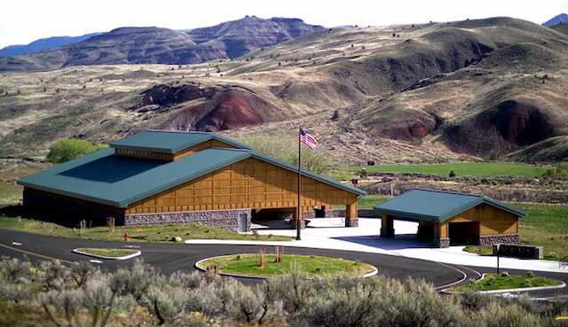
In 2005, the state of the art Thomas Condon Paleontology Center opened to the public. Named after the prominent 19th-century Oregon scientist who first recognized the significance of the fossil beds and did the first scientific collection and study of specimens, the 11,000 square foot center greatly improved the monument's ability to serve both the public and the scientific community. Performing a dual purpose, the Thomas Condon Paleontology and Visitor Center is dedicated to the study and public understanding of the paleontological resources of the John Day region. Colorful murals, fossil displays, and a fishbowl paleontology laboratory are some of the main features for visitors to enjoy.
What can you do at the Center? Before you visit, know the Operating Hours of the center. While you are there, enjoy the 18-minute park orientation film and browse through the Discover Your Northwest Bookstore. Our exhibits display over 500 fossil specimens from the John Day Fossil Beds. Scientifically accurate murals depict the environments in which these plants and animals lived. Speakers in the exhibits provide an audio representation of these extinct species may have sounded like. Viewing windows into the laboratory and collections area allow the public to watch scientists actively studying fossils. (You can also watch our paleo cam on our webcams page.)
Where is it Located? The Center is located in the Sheep Rock Unit of John Day Fossil Beds at 32651 Highway 19, Kimberly, OR 97848. It is approximately 8 miles northwest of the town of Dayville, Oregon and 19 miles south of the town of Kimberly, Oregon. Please visit the photo galleries below to see more pictures from the Thomas Condon Paleontology Center and units.
DIRECTIONS:
From Spokane, drive east on I-90 to Ritzville, and turn SW onto Hwy 395 towards the Tri-Cities.
In Pasco, turn left onto Hwy 730, and drive along the Columbia River into Oregon, and turn left onto O.Hwy 207 to O.Hwy 84.
Head west on 84 to Arlington. Turn left (south) onto Hwy 19 to Fossil, Oregon.
The many Units of the John Day Fossil Bed National Monument are scattered around the area.
Continue south on Hwy 19 to the Thomas Condon Paleontology & Visitors Center.
COOL THINGS CLOSE BY:
Fossil Beds & Picture Gorge near Dayville.
The Umitilla National Forest.
The Columbis River Gorge Abe its waterfalls.
The Strawberry Mountain Wilderness.
The Umitilla National Forest.
The Columbis River Gorge Abe its waterfalls.
The Strawberry Mountain Wilderness.
HAZARDS:
The biggest hazard in the J.D.F.N.M., is that its so incredible beautiful, its hard to concentrate while driving and hiking.
This is also part of the scablands, so be aware of rattlesnakes.
This is also part of the scablands, so be aware of rattlesnakes.
R & P:
NA
PHOTO GALLERY
AS YOU SCROLL DOWN THRU THE MAPS AND IMAGES, KEEP IN MIND, I ONLY USED A POLARIZING FILTER TO BRING THE COLORS UP.
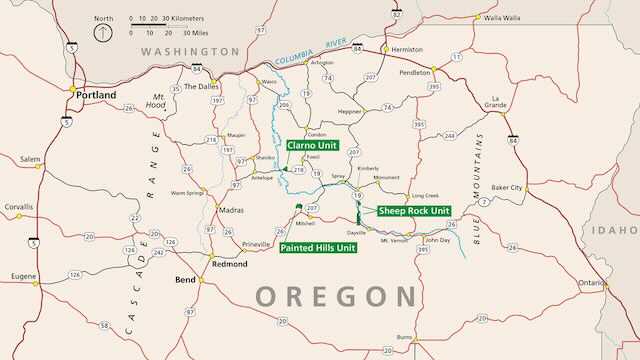
OVERALL MAP OF THE JOHN DAY FOSSIL BED NATIONAL MONUMENT
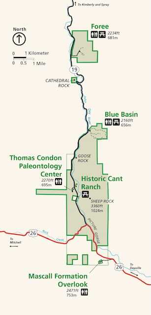
THE BLUE BASIN AREA
THOMAS CONDON PALEONTOLOGY & VISTOR CENTER
THE CLARNO UNIT
THESE COLUMNS ARE SOLID FOSSILS
FOSSIL COLUMNS
THE PAINTED HILLS UNIT
PAINTED HILLS UNIT
PAINTED HILLS UNIT
PAINTED HILLS UNIT
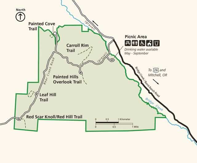
THE LEAF HILL TRAIL & PAINTED COVE TRAIL MAP
PAINTED COVE FROM THE ABOVE TRAIL.
JOHN DAY FOSSIL BEDS INFORMATION
John Day Fossil Beds National Monument's breathtaking scenery is a place where visitors can explore ancient plants and animals.
Within the heavily eroded volcanic deposits of the scenic John Day River basin is a well-preserved fossil record of plants and animals. This remarkably complete record, spanning more than 40 of the 65 million years of the Cenozoic Era (the "Age of Mammals and Flowering Plants") is world-renowned.
Authorized October 26, 1974, and established in 1975, this 14,000 acre park is divided into three widely separated units. The monument's main headquarters is at the Cant Ranch Visitor Center in the Sheep Rock Unit.
One Park, Three UnitsJohn Day Fossil Beds National Monument is comprised of more than 14,000 acres within three separate units located in eastern Oregon: Sheep Rock, Painted Hills, and Clarno. The three units of the monument hold some of the best fossil bearing locations within the larger John Day Fossil Beds, which cover most of eastern Oregon.
You will find no dinosaurs here; this area was underwater during that time. The John Day Fossil Beds preserve plant and animal fossils from most of the Age of Mammals and Flowering Plants, covering a time period from 44 million years ago until 7 million years ago. With such a vast span of time covered in one place, this area provides unparalleled insight into how the world as we know it came to be.
VisitPublic collecting or digging for fossils is never allowed in the monument.All three locations of John Day Fossil Beds National Monument are within a rural area of the state. There is no cell phone service or Internet access within the monument, with the except for public WiFi at the Painted Hills picnic area. Most of the local communities do have cell coverage, but your coverage will vary depending on your carrier. Mitchell has limited cellular service, and there is a functioning pay phone across the road from the general store.
Due to winding roads, actual travel times are longer than those estimated by most mapping programs and GPS units. Visitors should expect to average no more than 45 miles per hour anywhere in the region. The road to the Clarno Unit (Highway 218) is particularly curvy, expect to drive 35 miles per hour while along it.
Even though Oregon is a full-service only state, meaning that you are not permitted to pump your own fuel, in communities with less than 40,000 residents, you may pump your own gas. However, even with the recent changes allowing for self-service after-hours, many local businesses have not installed pumps that can accommodate self-service. It is recommended to fill up with fuel before leaving major highways or urban areas if you will be traveling later than 7:00 pm in summer or 6:00 pm in winter.
There is a fleet (business-use members only) fuel station in Mitchell. There is also a retail pump that is open intermittently. Otherwise, the nearest fuel available from Mitchell is at Prineville (53 miles west of Mitchell), Dayville (51 miles east of Mitchell), Fossil (44 miles north of Mitchell), and Spray (59 miles northeast of Mitchell).
John Day Fossil Beds National Monument showcases one of the world’s best and most continuous records of the Tertiary, the time from about 50 million years to 5 million years ago that is generally regarded as the Age of Mammals. The fossils found in the National Monument’s three units helped define the evolution of horses, cameloids, felines, canids, and other important mammal lineages.The John Day Fossil Beds is a name generally applied to both the national monument—three units totaling approximately 25 square miles in Wheeler and Grant Counties in north-central Oregon—and, more broadly, the more than 20,000 square miles of John Day Basin and adjacent lands that expose fossil-bearing strata of Paleocene to Miocene age.
The fossils of the region were first discovered by soldiers who traveled The Dalles Military Road to the Canyon City area following the discovery of gold there in 1862. They brought the fossil discoveries to the attention of Reverend Thomas Condon, Oregon’s first state geologist and first chair of the Geology Department at the University of Oregon. In the 1870s, other famed paleontologists, including Othniel Marsh and Edwin Drinker Cope, mounted expeditions to the area.
The three units of the National Monument display changes in landscape, climate, and ecosystems through an important time in geologic history. The Clarno Unit, near the John Day River’s Clarno Bridge, includes vast volcanic debris flows and lahars (volcanic mudflows) that are 45 to 50 million years in age. Leaves and whole trees, found as petrified remnants, record a subtropical ecosystem similar to that found in modern Costa Rica or Veracruz, Mexico. Early ancestral bananas, figs, palms, and bald cypress flourished amid a volcanic landscape. Rainfall totaled about eighty inches per year, and atmospheric carbon dioxide was much higher than today’s levels.
The Painted Hills Unit, twenty miles northwest of Mitchell, illustrates the climate shift from tropical to temperate that occurred between 34 and 32 million years ago. Red bands of the Painted Hills were once tropical soils, while lighter colored bands are soils that developed at times of lower temperatures and less precipitation. Overall, as time progressed from 34 to 32 million years, soils became lighter and the climate less tropical. The record at the Painted Hills culminates at the top of Carroll Rim, where soils and fossil plants and leaves indicate a temperate, grassy savannah with oaks and maples that prospered about 30 million years ago.
The headquarters and 2,500-square-foot interpretive facilities of the John Day Fossil Beds National Monument are located at the Sheep Rock Unit, fifteen miles west of Dayville. This area includes the Blue Basin (Turtle Cove), a renowned Oligocene fossil site, as well as Miocene Picture Gorge basalts and strata of the Mascall Formation, which are about 14 million years old. The Thomas Condon Center includes offices and laboratories as well as exhibits of the fossils and ecosystems through time.
