PADDLE DISTANCE: varies ELEVATION: 2067’ LENGTH AND ACREAGE: 65 mikes long, 148 square miles or 88,008 acres, 125 miles of shore line & 1150 feet deep. MAPS: IPNF, Elmira topo LAUNCH GPS: 48°16’46” N 126023’59” W
DESCRIPTION:
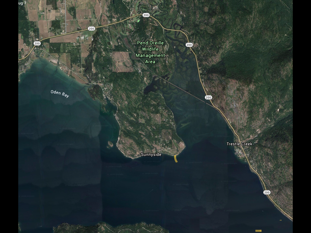
The Sunnyside Launch is located south of the Pack River Flats just west of the Pack River take out. The launch is located on the SE corner of the Sunnyside Peninsula.
ATTRACTIONS
P.O. Wildlife Management Area, the Pack River & Delta, Trestle Creek, the north shore, and Hope, Idaho.
DIRECTIONS:
After crossing the Long Bridge, take the Hwy 200, Clark Fork exit to Hwy 200. Drive 7.1 miles from the Sunnyside Exit. Stay on he Sunnyside Road towards Hawkins Point. The launch is just east oh Hawkins Point.
COOL THINGS CLOSE BY:
Pack River & Delta, Pack River Wildlife Management Area, and Trestle Creek, and 4 Islands to paddle around.
R & P:
Mr. Sub, Eichardt’s, Jalapeños and the Burger Express