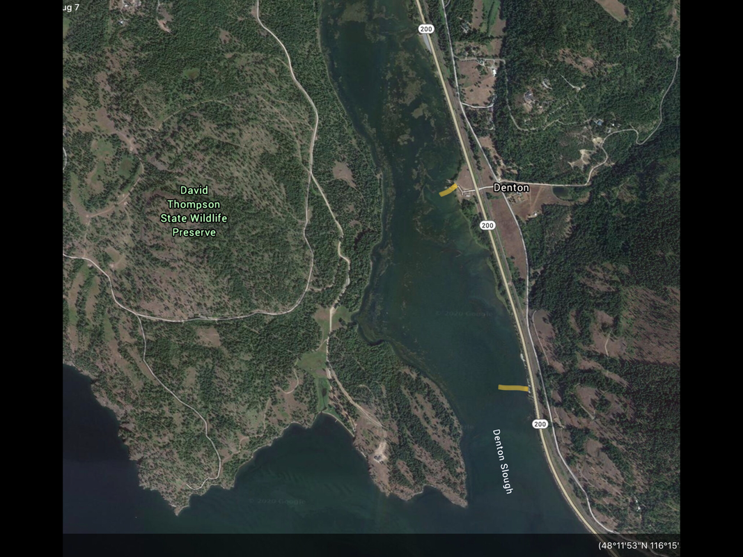
DENTON SLOUGH
PADDLE DISTANCE: varies
ELEVATION: 2067’
LENGTH AND ACREAGE: varies
MAPS:
LAUNCH GPS: 48°12’36” N 116°15’18” W
BONNER COUNTY SHERIFF: 208.263.8417
ELEVATION: 2067’
LENGTH AND ACREAGE: varies
MAPS:
LAUNCH GPS: 48°12’36” N 116°15’18” W
BONNER COUNTY SHERIFF: 208.263.8417
DESCRIPTION:
After putting in at the landing, you can choose your route and destination.
On your right as you paddle out of the slough, is the David Thomson Wildlife Preserve. On the south end of this peninsula is a pictograph you can view from your boat.
Due south just over 3 miles is the Johnson Creek Recreation Area.
On your right as you paddle out of the slough, is the David Thomson Wildlife Preserve. On the south end of this peninsula is a pictograph you can view from your boat.
Due south just over 3 miles is the Johnson Creek Recreation Area.
ATTRACTIONS
Peaceful paddling out to the main body of the lake, Johnson Creek Recreation Area, paddling benieth
DIRECTIONS:
As you drive through Sandpoint, turn right (East) onto Hwy 200, which is known as the Pend Orielle Scenic Byway. Once you pass the Samowen Camp Ground, drive 1 mile to a pullout with a landing on it’s NE end.
COOL THINGS CLOSE BY:
Hope Boat Launch, Samowen Camp Ground, Pend Orielle Wildlife Area, Clark Fork, the Clark Fork River, Johnson Creek Recreation Area, and Scotchman’s Peak
R & P:
In Sandpoint look for Mr. Subs, Eichardts, Jalapeños, and Burger Express.


