PADDLE DISTANCE: varies ELEVATION: 1539' LENGTH AND ACREAGE: varies MAPS: Spokane County Parks LAUNCH GPS: 47°48'51" N 117°46'56'W SPOKANE COUNTY SHERIFF: 509.477.2240
DESCRIPTION:
WE HAVE ADDED THE AREAS SHERIFF’S EMERGENCY PHONE NUMBERS FOR EACH TRIP WRITE UP UNDER THE RANGER DISTRICT INFO. IF AN EMERGENCY OCURRS, EVALUATE YOUR CIRCUMSTANCES AND CALL ONLY IF NEEDED. Long Lake is simply a part of the Spokane River. At the launch it is part of the reservoir above the Long Lake Dam
ATTRACTIONS
The paddle allows for access to Fisk State Park, and McLellan Conservation Area. A side note here....the McvLellan Property used to belong to a past SMI member, who's family sold it to the Conservation Futures in Spokane County.
DIRECTIONS:
Drive thru N. Spokane on N Driswcoll Blvd which becomes Hwy 291. drive north to W. 7 Mile Road which becomes W.4 Mound Road and turn left (W) to N. Wood Road. N. Wood Road becomes W. Charles Road, then W. Long Lake Road. This road travels a short distance under some high power lines. As W. Long Lake Road leaves the power lines.About 400 feet from the turn, take a right (N) turn onto an unnamed road leading to the launch.
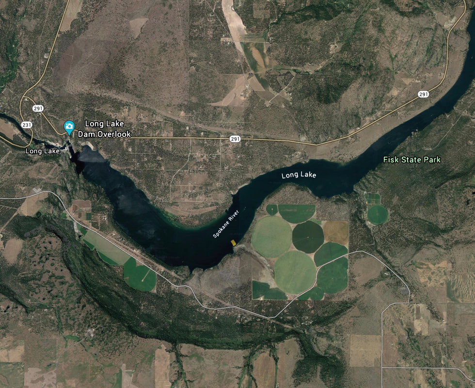
This route is very complicated, so take a Google Earth image to direct you.
COOL THINGS CLOSE BY:
Avista Dam, Fisk StaTE PARK, AND THE MCLELLAN CONSERVATION AREA