BURTON PEAK 6844' Trail #9
EVENT TYPE: Hiking, backpacking, ridge walking
DISTANCE: 5.2 miles RT with more up Cascade Ridge to the west
ELEVATION GAIN: 1724 verts
DIFFICULTY: Moderate
MAPS: IPNF-Kaniksu N.F., Farnham, Moravia, Pyramid Peak
GPS: 48° 43’ 56.1”N 116° 28’ 22.5”W
RANGER DISTRICT: Bonners Ferry R.D. 208.267.5561
BOUNDARY COUNTY SHERIFF: CALL 911 FIRST or 208.267.3151
DESCRIPTION:
WE HAVE ADDED THE AREAS SHERIFF’S EMERGENCY PHONE NUMBERS FOR EACH TRIP WRITE UP UNDER THE RANGER DISTRICT INFO. IF AN EMERGENCY OCURRS, EVALUATE YOUR CIRCUMSTANCES AND CALL ONLY IF NEEDED.
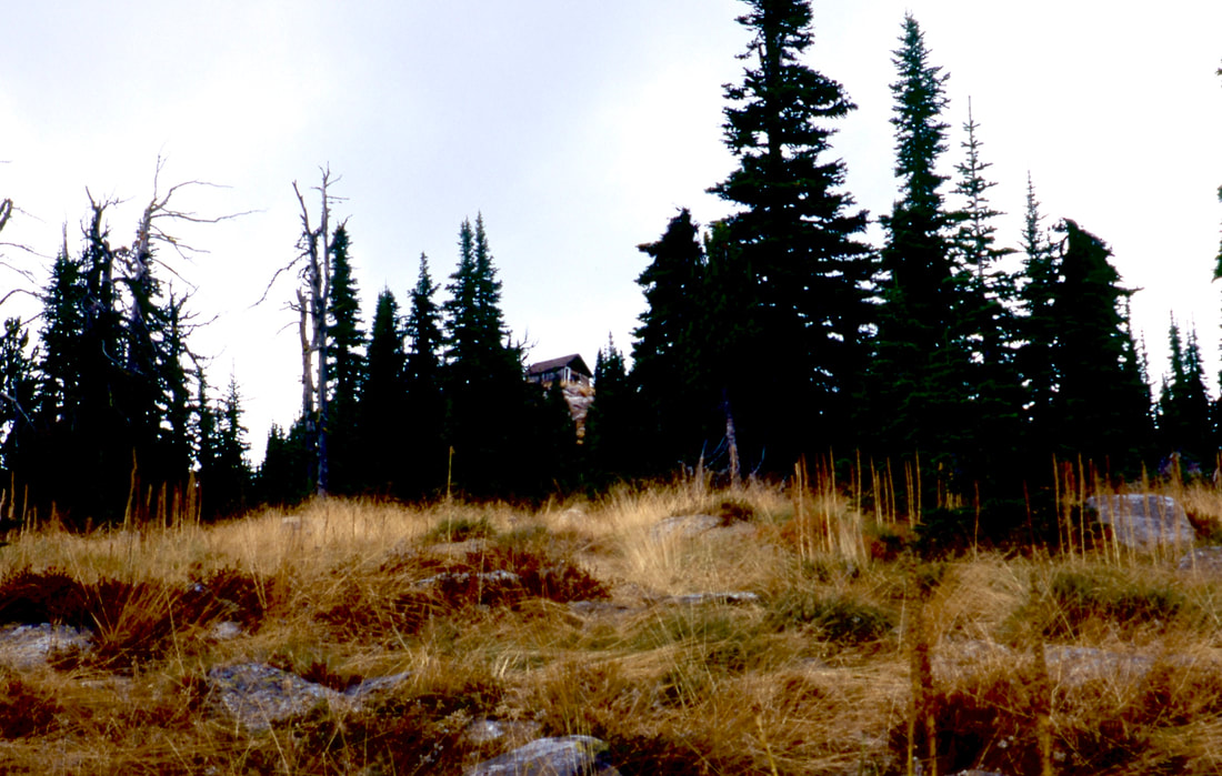
The trail starts out in a forest of old growth Larch, younger Lodgepole Pine and Douglas Fir. As you climb higher, the views of the Myrtle Creek drainage is to the SW. After the switchbacks the trail leads you back to the ridge where the trail opens up. As the trail opens up, there are views of the old lookout cabin high above. In the fall, the grasses that grow around the trail turn yellow and frame the path to the old lookout cabin above. Once at the cabin, walk around it and check out the different weathering of the wood on all 4 sides. If you are looking for a good lunch spot out of the wind, continue further up the Cascade Ridge to the next summit. Off to the right (north) and down off the summit is a bench for lunch, out of the wind.
The trail starts out in a forest of old growth Larch, younger Lodgepole Pine and Douglas Fir. As you climb higher, the views of the Myrtle Creek drainage is to the SW. After the switchbacks the trail leads you back to the ridge where the trail opens up. As the trail opens up, there are views of the old lookout cabin high above. In the fall, the grasses that grow around the trail turn yellow and frame the path to the old lookout cabin above. Once at the cabin, walk around it and check out the different weathering of the wood on all 4 sides. If you are looking for a good lunch spot out of the wind, continue further up the Cascade Ridge to the next summit. Off to the right (north) and down off the summit is a bench for lunch, out of the wind.
OPTIONS #1:
From the old lookout cabin, there are two more summits further west up the Cascade Range. If the winds are up, there is a place on the north side of the second summit on the ridge to eat.
Further west is another summit that is a good spot to view the Selkirks from the east.
Further west is another summit that is a good spot to view the Selkirks from the east.
DIRECTIONS:
From the Kootenai National Wildlife Refuge, drive 1.3 miles to the Myrtle Creek Road #633, and turn left (west) for 2 miles to the junction with FR #2411. Turn right for 6.3 miles to another junction . Turn left (SW) onto FR #2692 for 1.5 miles to the trailhead.
Along the roads up, pull over to each sharp switchback for incredible views of the Purcell Trench, the Kootenai National Wildlife Refuge, and the Northwest Peaks Scenic Area, across the historic Purcell Trench.
Along the roads up, pull over to each sharp switchback for incredible views of the Purcell Trench, the Kootenai National Wildlife Refuge, and the Northwest Peaks Scenic Area, across the historic Purcell Trench.
HAZARDS:
None of note.
COOL THINGS CLOSE BY:
Kootenai National Wildlife Refuge, Myrtle Falls, Snow Creek Falls, the Myrtle Creek Preserve, and Bonners Ferry, Idaho & the Purcell Trench.
R & P:
Jalapeños, Eichardts, Burger Express, Mr. Sub! All in Sandpoint
PLAN YOUR TRIP:
PHOTO GALLERY
THE "AUTO TOUR ROAD" NEXT THE THE CHANNEL, FROM THE ROAD TO BURTON PEAK

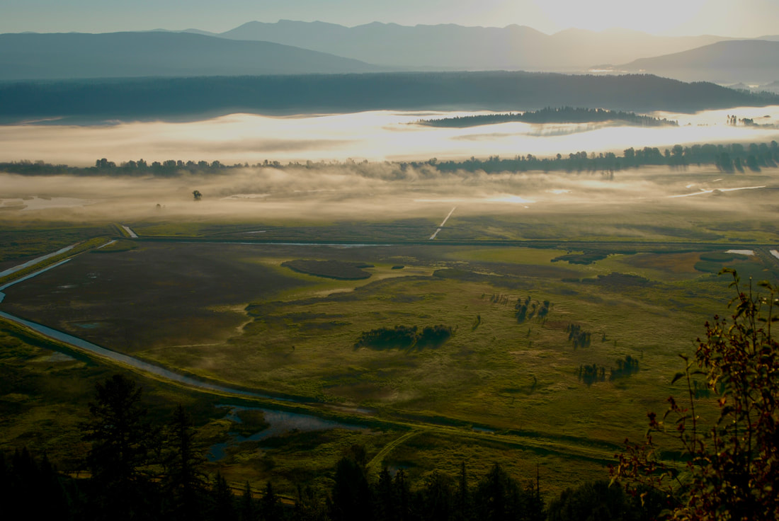
THE KOOTENAI NATIONAL WILDLIFE REFUGE FROM THE MYRTLE PEAK ROAD
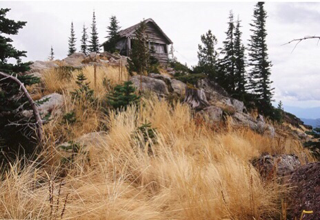
THE OLD LOOKOUT CABIN ON BURTON PEAK
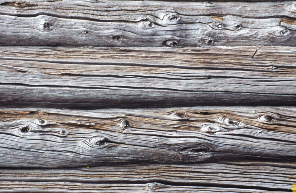
WEATHERED LOGS OF THE BURTON PEAK FIRE LOOKOUT CABIN

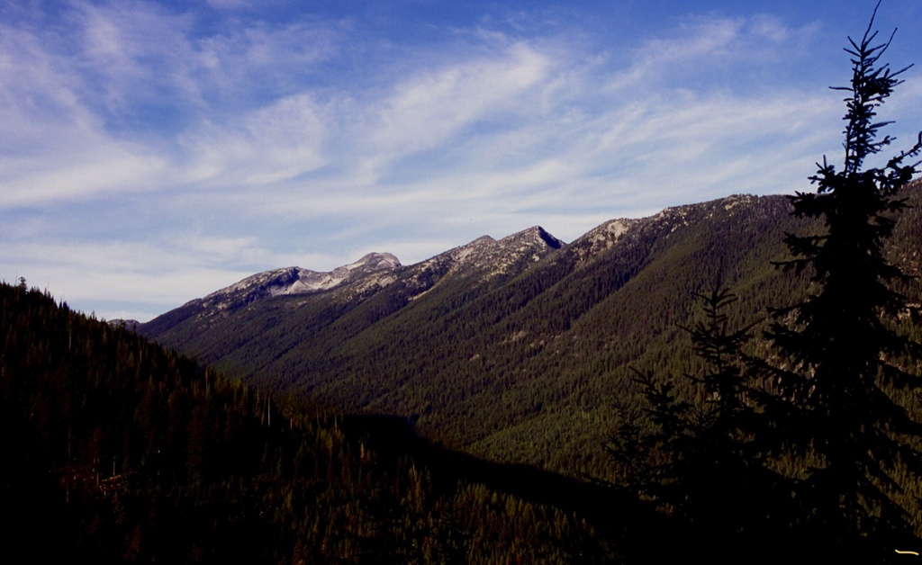
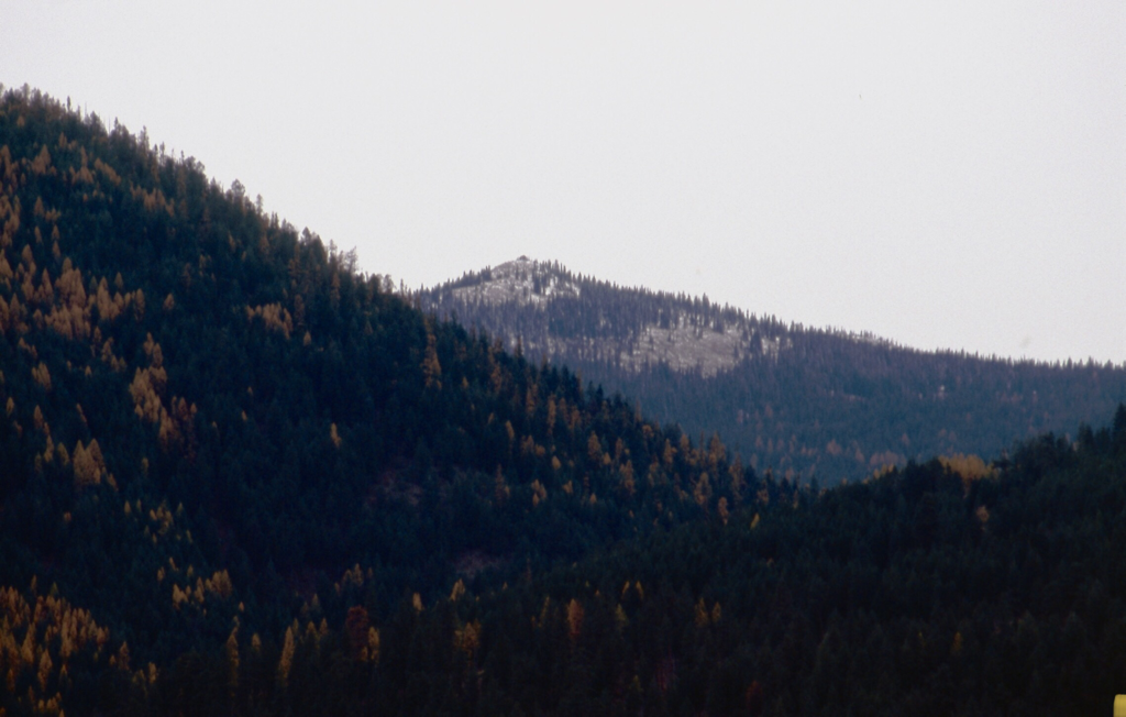
BURTON PEAK FROM FURTHER UP THE CASCADE RIDGE
A GOOD SPOT TO EAT LUNCH
BURTON PEAK FROM THE KOOTENAI NATIONAL WILDLIFE REFUGE AUTO ROUTE