EVENT TYPE: Hiking & scrambling DISTANCE: About 8 Miles RT. (P. Pass 2.7 & 1300') ELEVATION GAIN: 2005' gain DIFFICULTY: Difficult MAPS: IPNF-Kaniksu N. F., USG-Pyramid Peak GPS: 48° 48’ 19.7”N 116° 35’ 57.7”W RANGER DISTRICT: Bonners Ferry R.D. 208.267.5561 BOUNDARY COUNTY SHERIFF: CALL 911 FIRST or 208.267.3151
DESCRIPTION:
WE HAVE ADDED THE AREAS SHERIFF’S EMERGENCY PHONE NUMBERS FOR EACH TRIP WRITE UP UNDER THE RANGER DISTRICT INFO. IF AN EMERGENCY OCURRS, EVALUATE YOUR CIRCUMSTANCES AND CALL ONLY IF NEEDED. Pyramid Peak towered over Pyramid Pass, Long Canyon, and Pyramid Lake. From a distance it look like it's namesake, a steep sided pyramid. From Pyramid Pass, turn left (south) and look for a primitive trail leading to the lower flanks of the peak. Immediately the route (no trail), climbs steeply for about 1/3 of a mile. You have to pick your way up the steep terrain over and around boulders, often times scrambling. But when you see the summit just above you, and summit it, you will be amazed and astonished that you made it, and of the views.
The route you just did is best done up as apposed to down, due to it's steepness. From the summit, the views all around are spectacular, especially looking down Long Canyon. Nowhere else do you get such a great view of the canyon. To descend Pyramid Peak, hike south down a prominent ridge that has one smaller summit on it's way past Pyramid Lake towards Ball Lakes. As you climb slowly up to the distant ridge, Pyramid Lake and it's southern wall are spectacular. When you summit this lesser peak on the SW side of the lake, you will find a granite field, that people over the years have built wind breaks for sleeping. Spend some time here relaxing and taking in the views. Due south of here is Upper & Lower Ball Lake. Due east the trail between Pyramid and Ball Lakes can not be missed. Hike the fall line east to the trail and either go right (south) to Ball Lakes, or left (north) to Pyramid Lake. Ball Lakes are encased in granite boulders with a nice ridge line to the west.
Retrace your steps north on the main trail until you come to the gigantic granite wall above Pyramid Lake. As you make your way down, there are several switchbacks. At the second switchback, CAREFULLY walk to the edge and look down the magnificent south wall above Pyramid Lake. From here the trail takes on a mystical nature as it descends to the lake.
Once at the lake, look at the wall you just descended. It will amaze you.
The trail out leaves the lake on it's NE corner, and is only 1.25 miles to the cars
DIRECTIONS:
From the Kootenai National Wildlife Refuge, head north on the West Side Road for 10 miles to the Trout Creek Road #634. Turn left (west) and drive 9 miles to the trailhead.
HAZARDS:
Because about half of the route is off trail, you must take extra care on this entire route. Be sure to carry your 13 essentials, a water filter, and dress for all weather conditions.
COOL THINGS CLOSE BY:
Long Canyon, Long Mountain Lake & Peak, Russell Mt & Ridge, and Trout Lake & Big Fisher Lakes
R & P:
Jalapeños, Burger Express, Eichardt's, Sandpoint Mr. Sub Sandpoint
PHOTO GALLERY
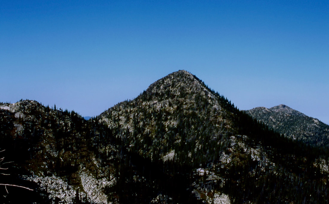
A GLIMPS OF PYRAMID PEAK FROM THE TRAIL TO PYRAMID PASS
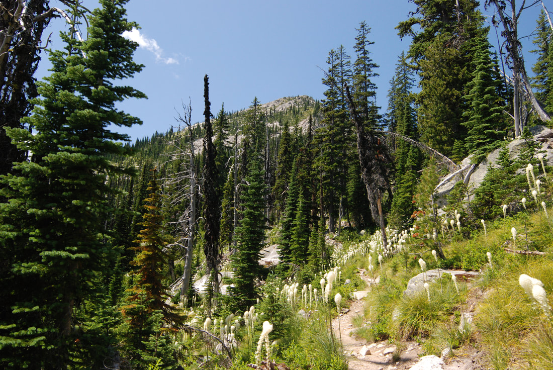
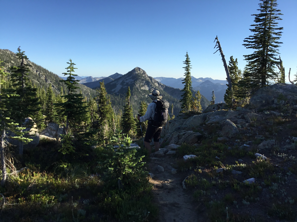
PYRAMID PASS THE ROUTE UP PYRAMID PEAK IS TO THE LEFT FROM MY PACK
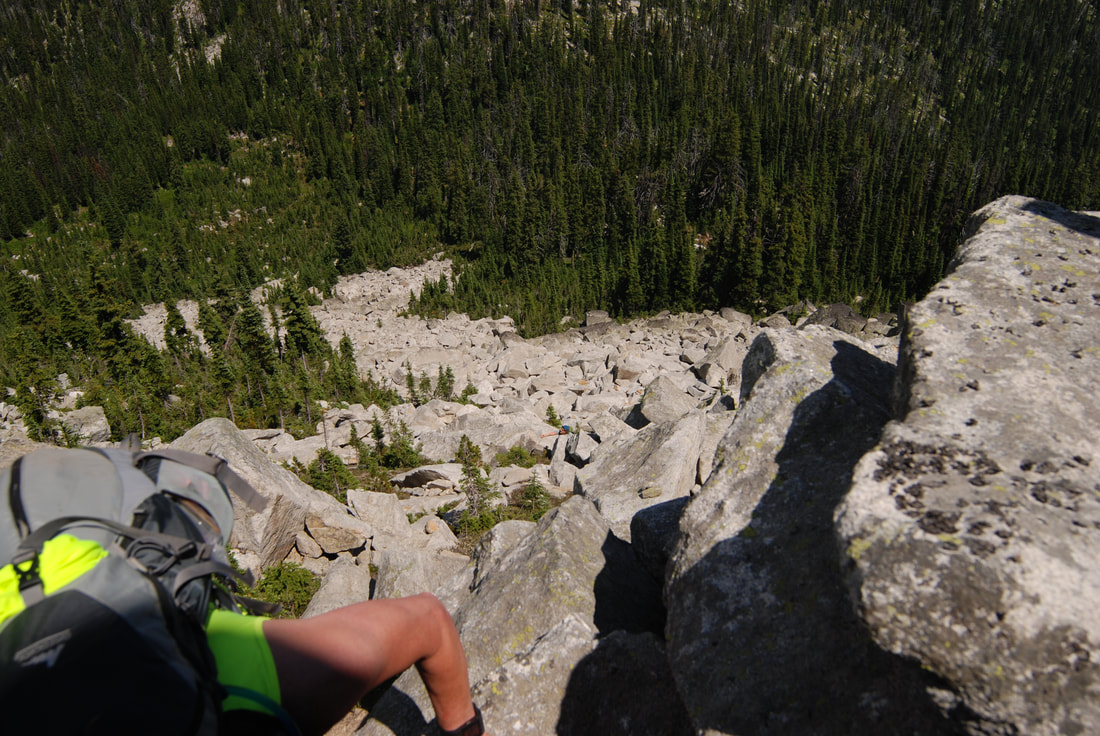
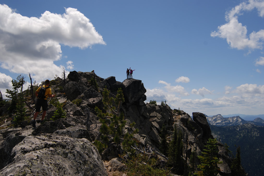
A SCRAMBLER NEAR THE TOP OF PYRAMID'S SUMMIT
TYLER AND SHUWEN CELEBRATING ON THE SUMMIT OF PYRAMID PEAK
PYRAMID PEAK FROM THE PARKER PEAK HIKE, NEAR LONG MOUNTAIN LAKE