ROMAN NOSE LAKES & PEAK 7260’, IDAHO. TRAIL #160 & 165
EVENT TYPE: Hiking, Backpacking, camping, fishing, scrambling, ADA capable. DISTANCE: 3rd lake is 4 miles RT ELEVATION GAIN: Lake # 3 to the high point 6410’, is 535' gain, and drops 215' to Lower Lake DIFFICULTY: Easy to both lakes. MAPS: IPNF, Kaniksu N.F., Roman Nose topo GPS: Roman Nose Lake 48°38’07” N -116 35’ 14” W Roman Nose Peak. 48°37’39”N 116°35’37”W RANGER DISTRICT: Bonners Ferry R.D. 911 or 208.267.5561 BOUNDARY COUNTY SHERIFF: CALL 911 FIRST OR 208.267.3151
DESCRIPTION:
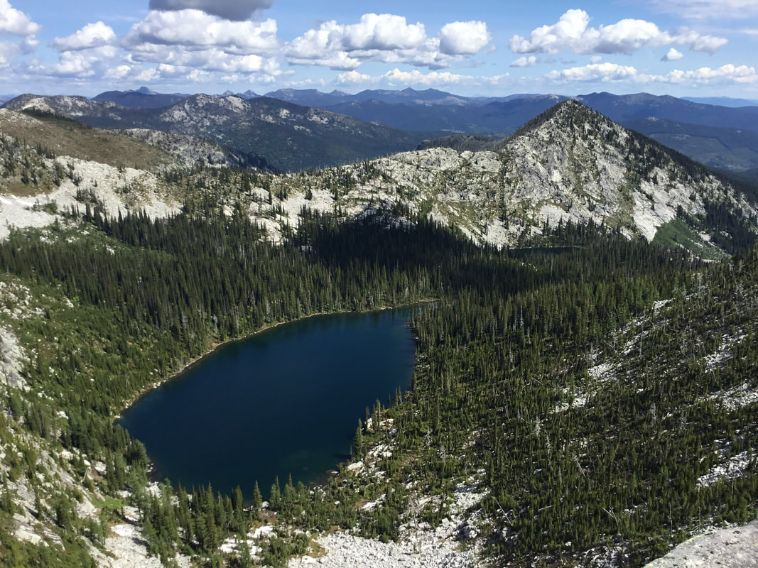
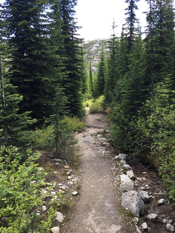
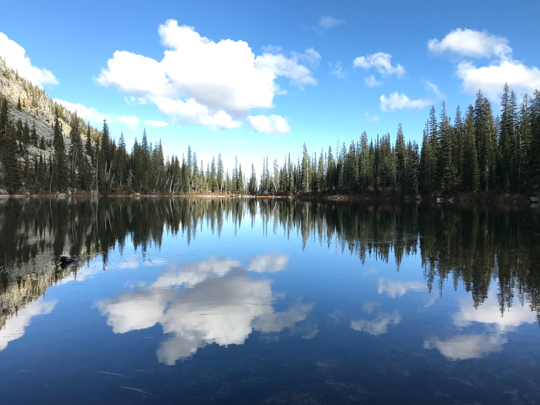
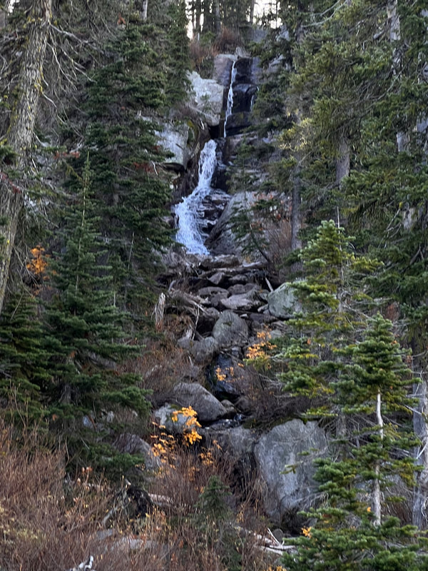
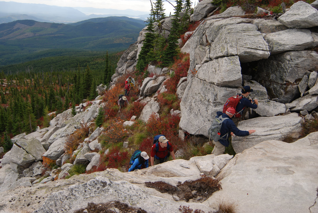
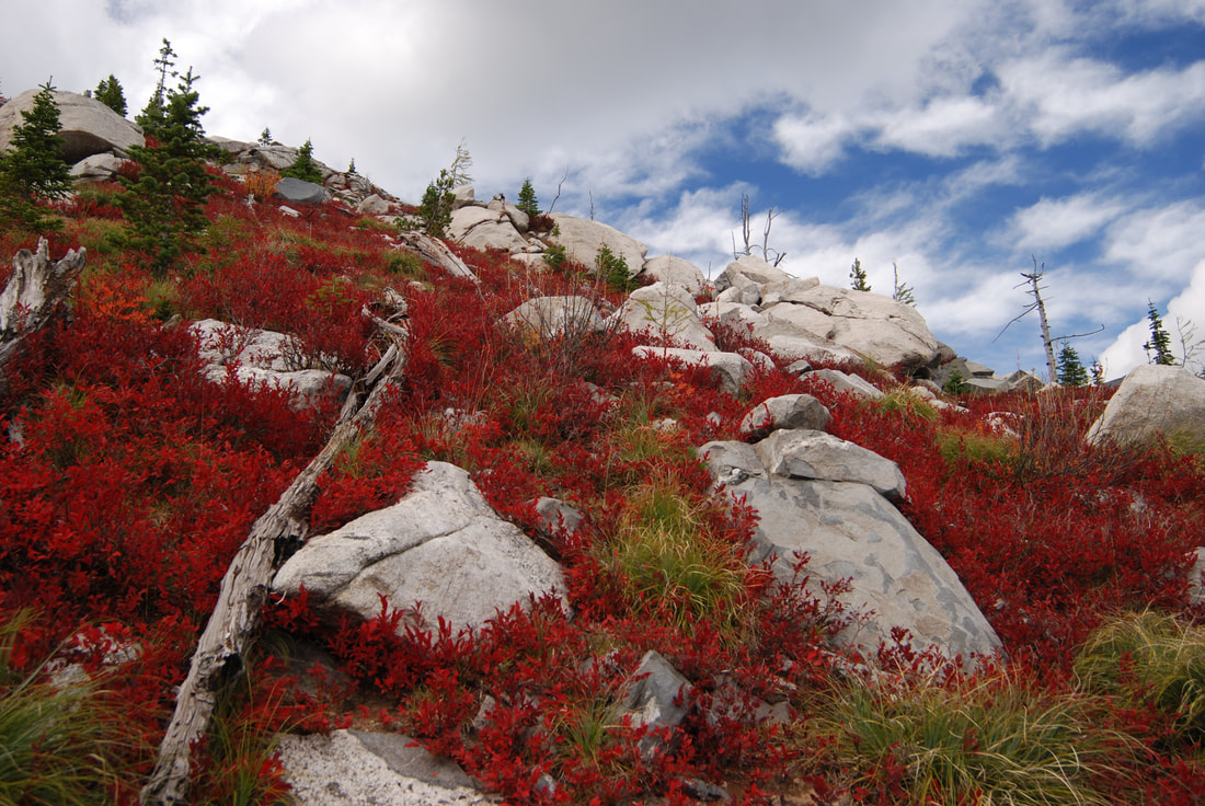
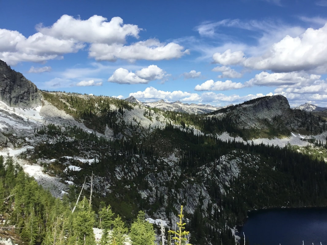
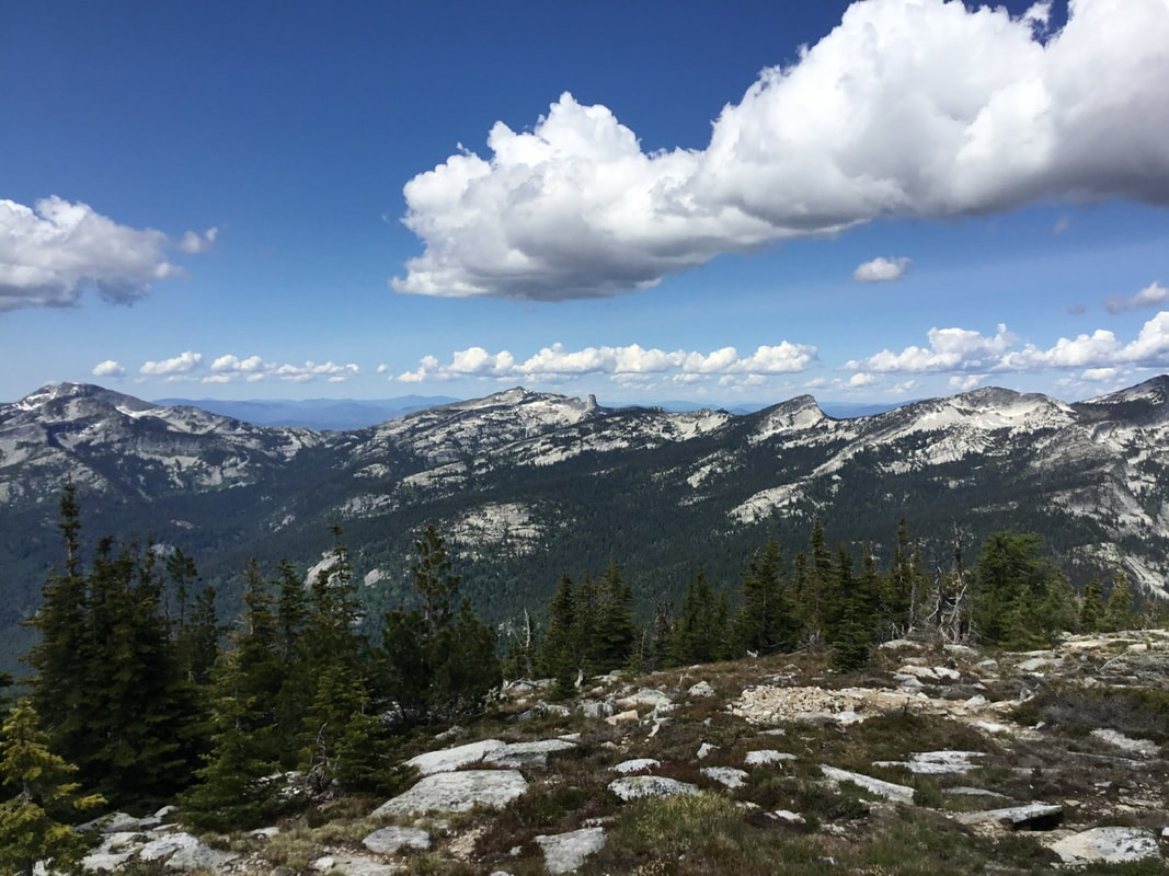
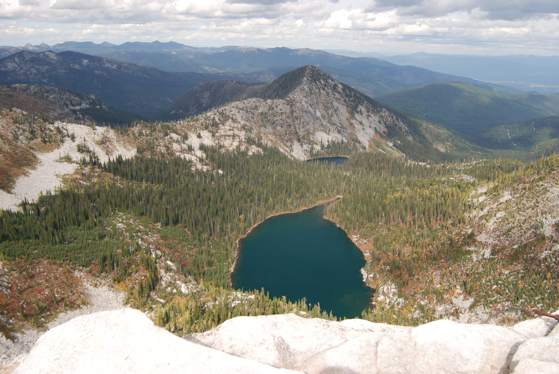
THE VIEWS FROM THE SUMMIT ARE SOME OF THE BEST IN THE AMERICAN SELKIRKS One of the cool things about Roman Nose Lakes is the trailhead is next to Lake #1, and there is an ADA wheelchair accessible boardwalks around part of the lake, as you drove in, there is a campground to the left. Along the trail to the upper lakes is an Interpretive Loop Trail just before the highpoint that is spectacular in every season, especially Spring & Fall. This Nature Trail is a 1 mile loop. If up hillwalking is an issue with you, walk the main trail to near the regular trails summit, and hike down the trail to the trailhead. It's much easier that way. The trail up to the upper two lakes, starts at the lower lake. Because of the 1967 Sundance Fire that burned most of the area, the canopy is low and the views are high. The lower lake sits in a half bowl with tall walls on the south and west. As you approach the west wall, the trail skirts around it and drops down to the upper two lakes. At this high point on the trail, look for the waterfall dropping off the NE end of Lake #2 in the spring. A short distance below the high point, the main trial heads NW to Lake #3. If you continue on the main trail SW, it will take you to Lake #2. Lake #3 is mostly encased in granite and has a good spot to swim and sunbath on the SW end. Because the lakes are so close together, spend some time at each lake enjoying this spectacular area.
OPTION #1:
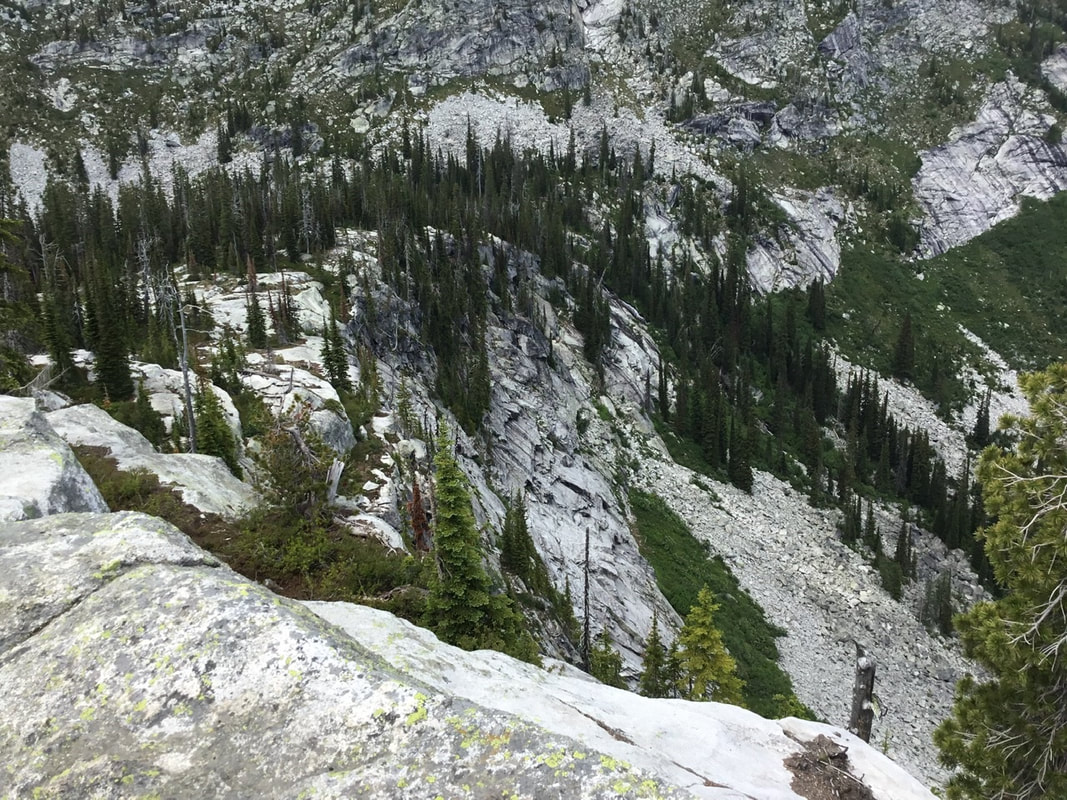
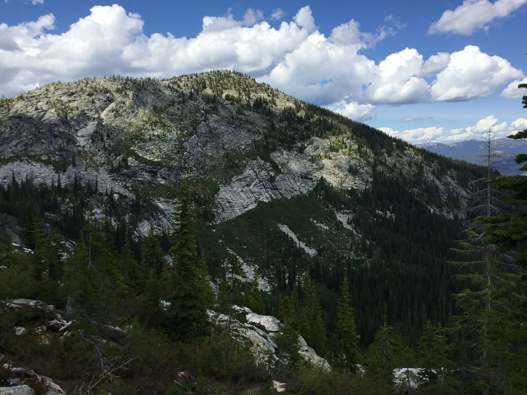
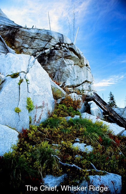
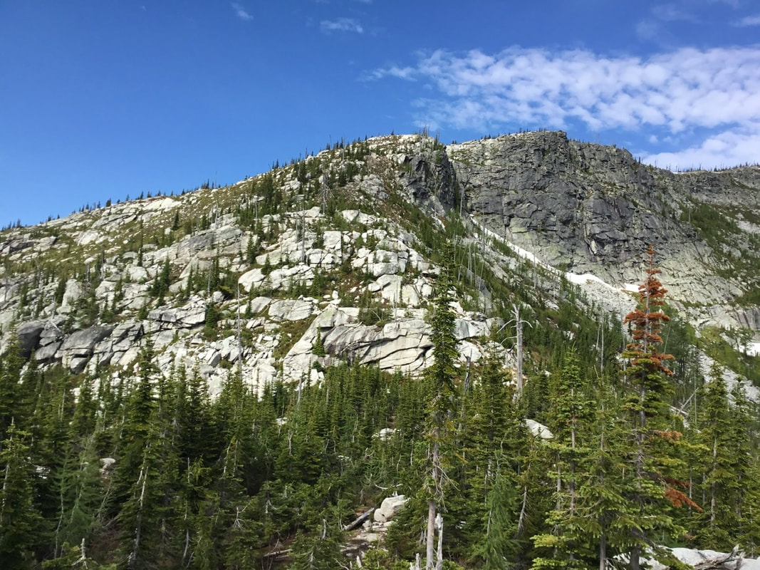
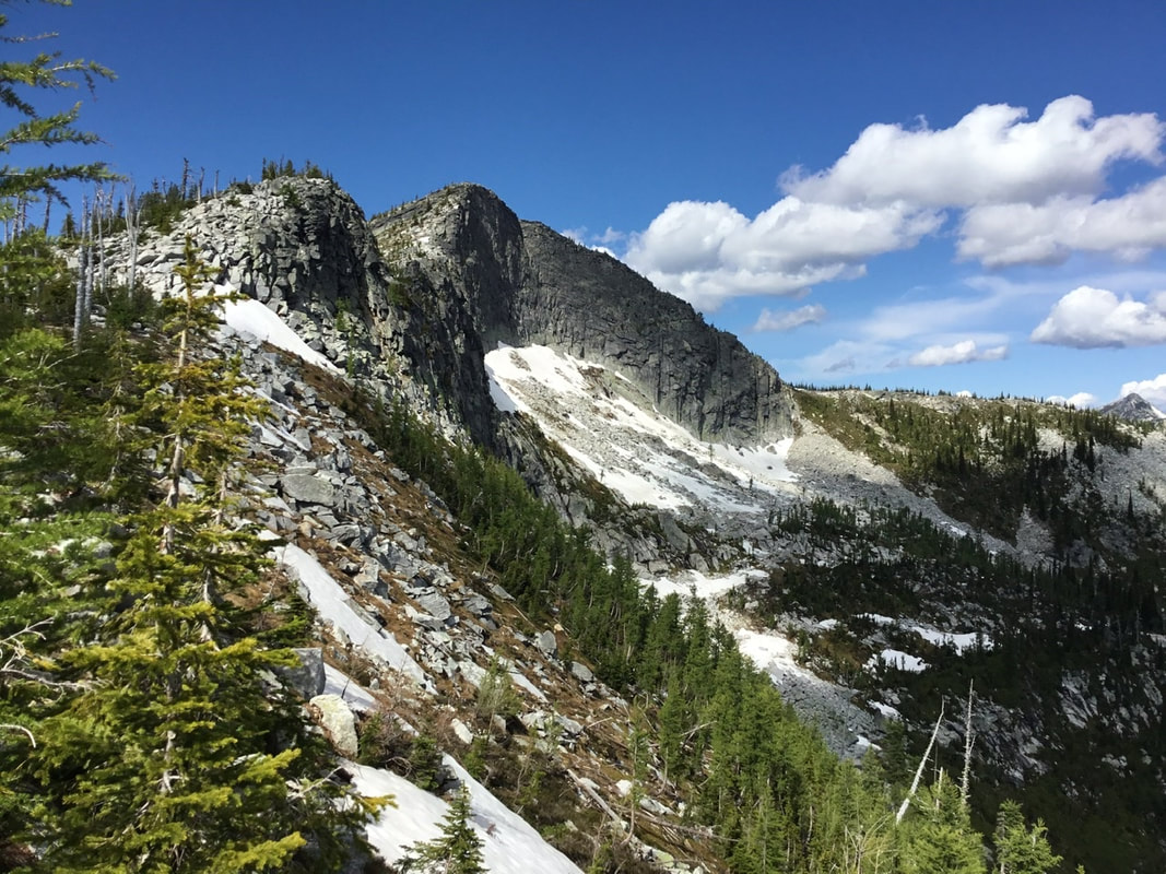
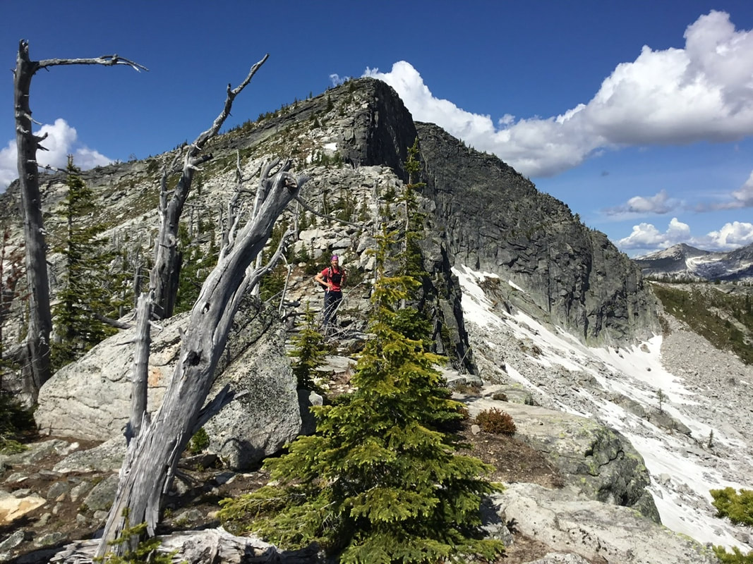
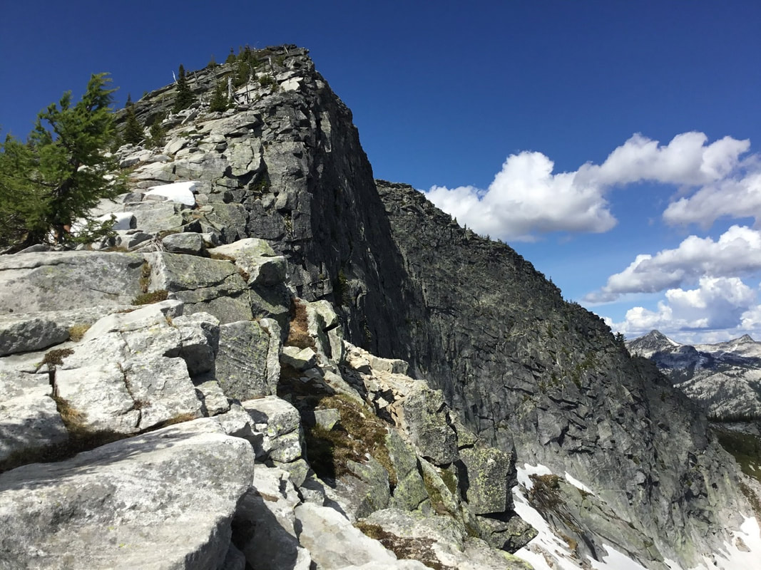
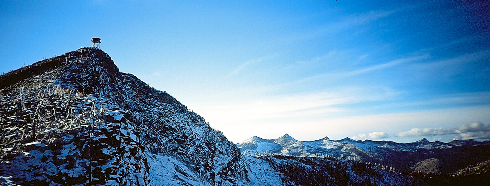
Roman Nose Peak In 1978, I hiked to the peak along the south side of Lake #3 for the first time. It is accessed by going cross country up to the ridge above the lake and the campgrounds. . There is no real trail to the ridge, but it's easy to ascend. Once on the ridge, that I named Whisker Ridge, turn right (WSW) and hike the high meadows to the peak. Along the way, there are hearty small plants that light up the landscape. Large granite boulders dot the ridge and afford tremendous photo ops. Most of the ridge is covered with sparsely spaced white snags (hence Whisker Ridge). Higher up the trail before the final long ascent to the summit, there is some minor scrambling above the dip, or you can walk an old trail for the Fire Lookout, off to the south, way up high. Scrambling is way more fun and you can walk right on the edge of the cliff for optimum views. Years ago a friend and I went to the wall SW of the peak and climbed the face, in winter. We had lunch in the old wood lookout, but left because it swayed about 5' back and forth, in the winds. Three months later, I learned that the tower blew over in a winter storm.. From the top you can retrace your steps, or you can hike around the peak to the NW and work your way over towards Peak 6821. see leading image above. When we are above Lake #2, we will work our way down a chute to the west end of the lake, because there's a nice cascading waterfall to view. This loop is one of our regions great scrambles.
OPTION #2
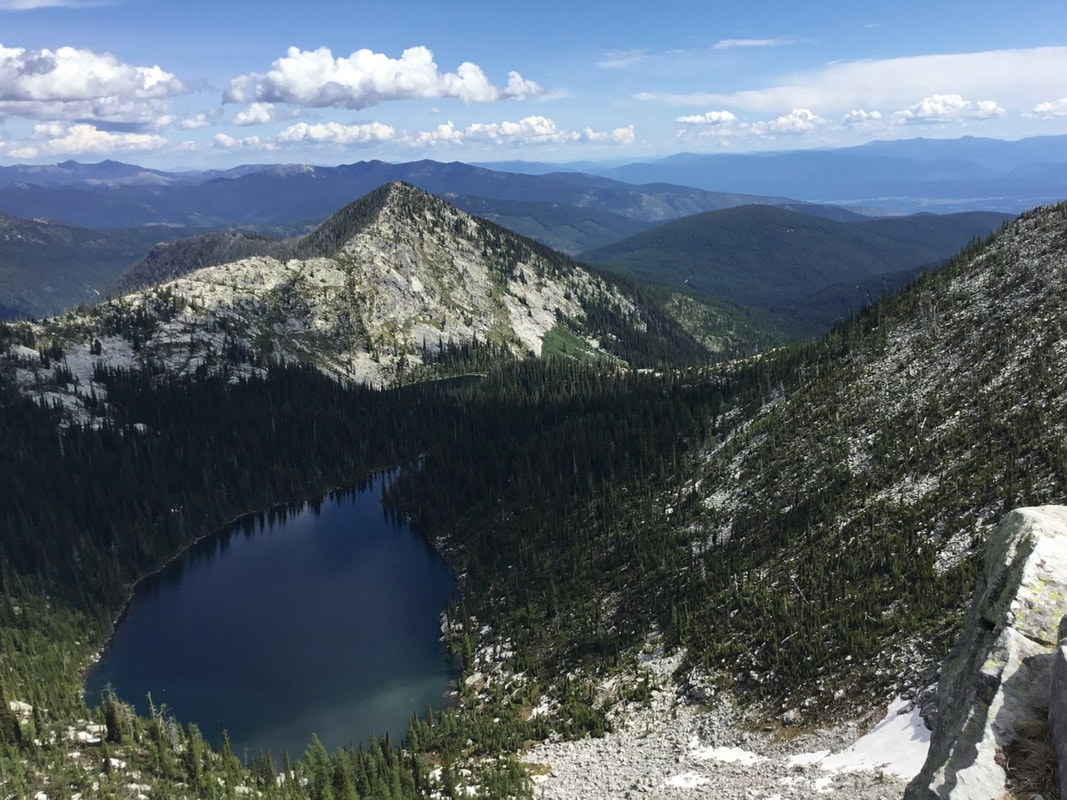
Roman Nose Lake #2 As you hike over the trails summit, you will notice a directional disk that points the direction to Lake #2. As you walk along this trail, step off the trail onto granite slabs that allows for views of Lake's exit stream. In the spring, it becomes a beautiful raging waterfall. The trail to Lake #2 descends almost 300verts down to the lake, but is an easy hike, with a surprise waterfall. Once at the lake, hike the left (S) shore line back to a 50+ foot waterfall tucked back in the trees. The grasses around the west end are photo ops just waiting to be captured. There are several dispersed campsites along this primitive path.
OPTION #3
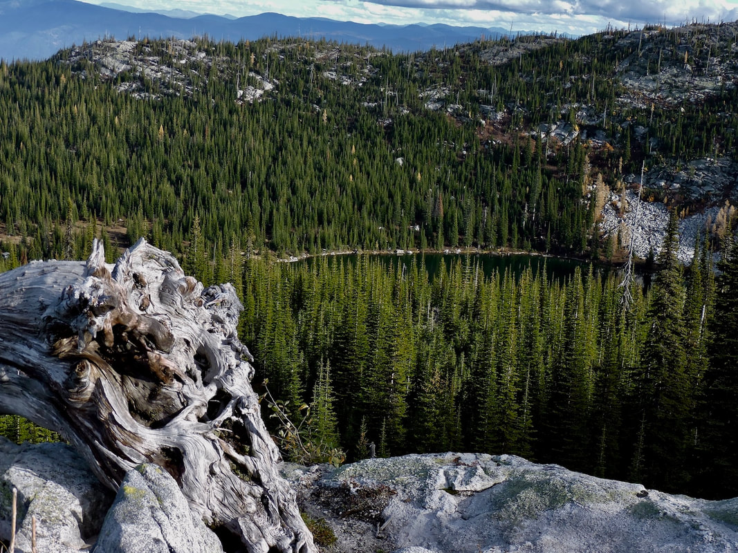
After visiting Lake #2, continue west on the main trail. Here you will come to the Nature Trail marked as LOOP off to your left. Pass by it for now, and hike west to Lake #3. It's a short walk to the NE end of the upper lake. Walk the left SE shore back to the far end of the lake. Along the trail are more campsites. Directly SW of the lake is Roman Nose's summit 7260' Lake #3 is encased in a glacial cirque, with steep walls on three sides.
OPTION #4
As you leave the upper lake to head down, be sure to notice the metal plates that points you to the Nature Trail. This loop trail climbs a bit before the first lake (Lake #3) comes into view. The entire area you will walk down thru is also encased in a glacial cirque. There are many options to find a seat with a view, and have a snack. The trail continues downhill via switchbacks, thru a cool Sub-Alpine Fir forest. It meets up with the original trail.
DIRECTIONS:
Drive thru Bonners Ferry and turn left onto Riverside Street just before the Kootenai River bridge. Head west for about 5 miles to the frontage road 417 (aka F.R. 18). As it veers to the right, turn left (south) for 2.5 miles, and turn sharply to the right onto FR # 402 just before the Lion's Club Picnic Area. Drive 1.1 miles to a sign for the Upper & Lower Snow Creek Falls. After the falls continue up 402 for 16.8 miles and turn right (SW) onto FR # 2667. In .5 miles bear right to the trailhead. If you have a high clearance truck, you can drive down the famous Ruby a Ridge to Moravia.
HAZARDS:
On the normal hike to the lakes and/or Nature Trail, there are no notable hazards. On the Whisker Ridge hike however, you must be careful and sure footed.
COOL THINGS CLOSE BY:
Ruby Ridge, Snow Creek Falls, Bottleneck Lake & Peak, Kootenai National Wildlife Refuge, Myrtle Falls, Pend Orielle Lake and Sandpoint.
R & P:
Jalapeños, Eichard’s, Burger Express, Mr. Sub, Sandpoint
PHOTO GALLERY
THE START OF THE TRAIL TO THE UPPER LAKES. THAT BROWN SMUDGE IS A HUMMINGBIRD.
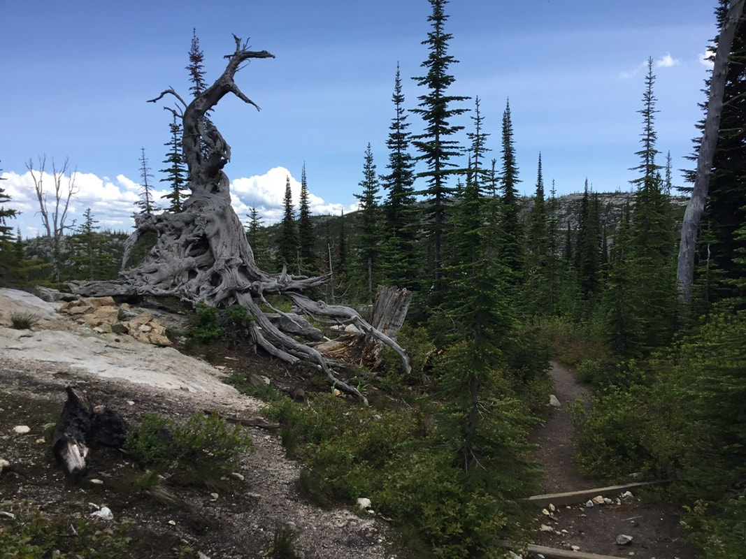
AT THE SUMMIT OF THE TRAIL TO THE UPPER LAKES
A VIEW BELOW LAKE #2. LOOK FOR A WATERFALL HERE DURING SPRING RUN OFF
LAKE N#2 FROM SW END
AN UNAMED MOUNTAIN ABOVE LAKE #2
NICE WATERFALL SW END OF LAKE #2
FALL COLORS AT THE TRAILS SUMMIT
A SHORT SCRAMBLE ABOUT HALF WAY UP WHISKER RIDGE
ABOVE THE SCRAMBLE, IS A SCENIC ROUTE TOWARDS THE SUMMIT OF ROMAN NOSE.
FROM HERE DOWN SHOWS THE UPPER WHISKER RIDGE ROUTE, OPTION #1
THE CHIEF ALONG WHISKER RIDGE
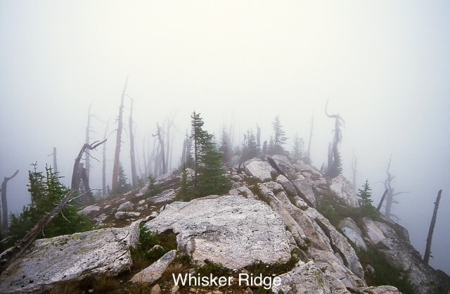
WHISKER RIDGE. THIS RIDGE WAS NAMED BY CHIC TO DESIGNATE THE ROUTE
ALONG WHISKER RIDGE IN THE FOG
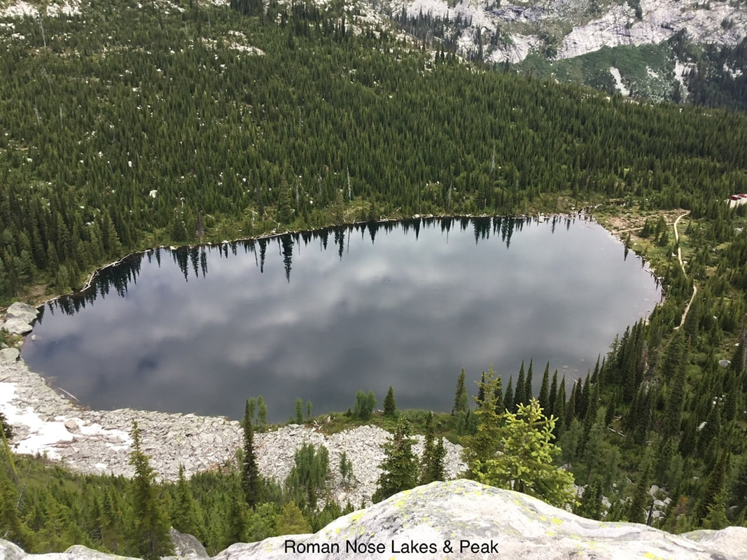
LAKE #3 FROM WHISKER RIDGE. TRAILHEAD ON RIGHT BOARDER
ABOVE WHISKER RIDGE ON THE WAY TO ROMAN NOSE PEAK
TWO FALSE SUMMITS ON LEFT, WITH ROMAN NOSE SUMMIT MID IMAGE
THE SELKIRK CREST PEAKING OUT ABOVE LAKE #3
LAKE #2 & 3 BELOW ROMAN NOSE PEAK WITH UNNAMED PEAK 6921’IN BACK
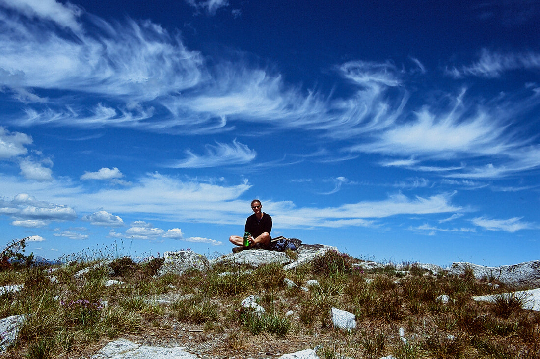
AMY ENJOYING THE TERRAIN OF THE AMERICAN SELKIRKS
THE SECOND OF TWO FALSE SUMMIT ALONG WHISKER RIDGE
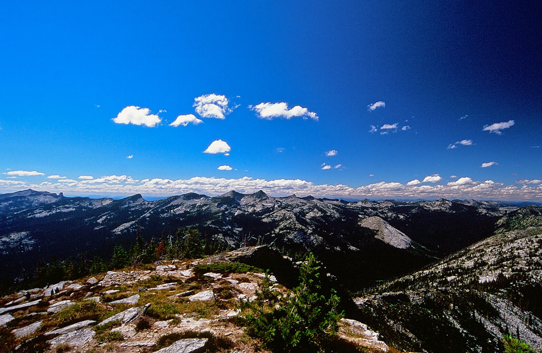
FROM THE SUMMIT OF ROMAN NOSE, SHOWS THE SOUTHERN PART SEVEN SISTERS
THE FULL LENGTH OF THE SELKIRK CREST
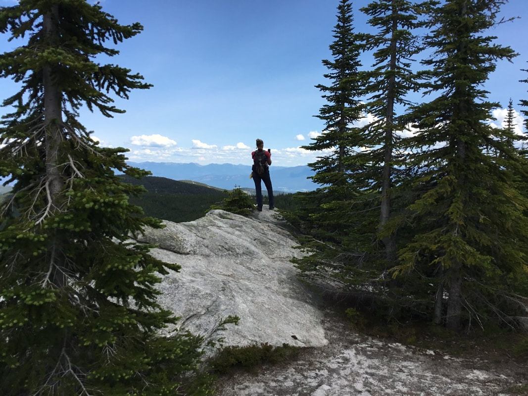
A HIKER ENJOYING THE VIEW FRON ROMAN NOSE SUMMIT
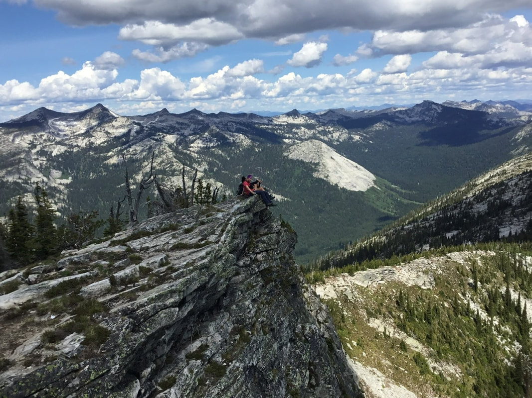
SCRAMBLERS ENJOYING THE VIEWS WHILE SITTING ON THE EDGE
THIS IS THE VIEW THE SCRAMBLERS ABOVE HAD
AMY SHOOTING THE LOWER LAKE
LAKE #3 FROM THE ROMAN NOSE NATURE TRAIL
ROMAN NOSE PEAK & FIRE LOOKOUT TOWER. THREE MONTHS AFTER CLIMBING THE RIGHT RIDGE, AND HAVING LUNCH IN THE TOWER, IT BLEW DOWN IN 2007
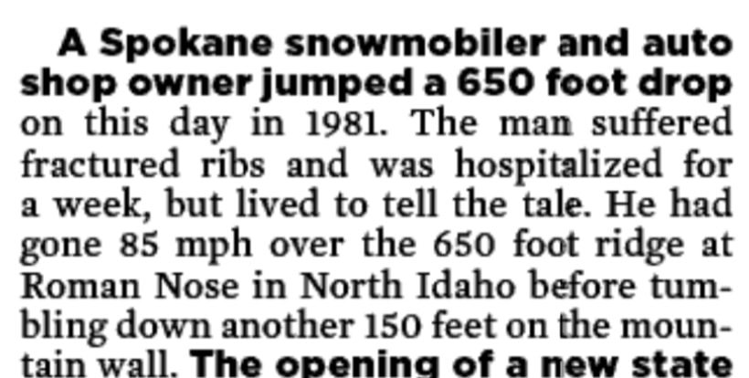
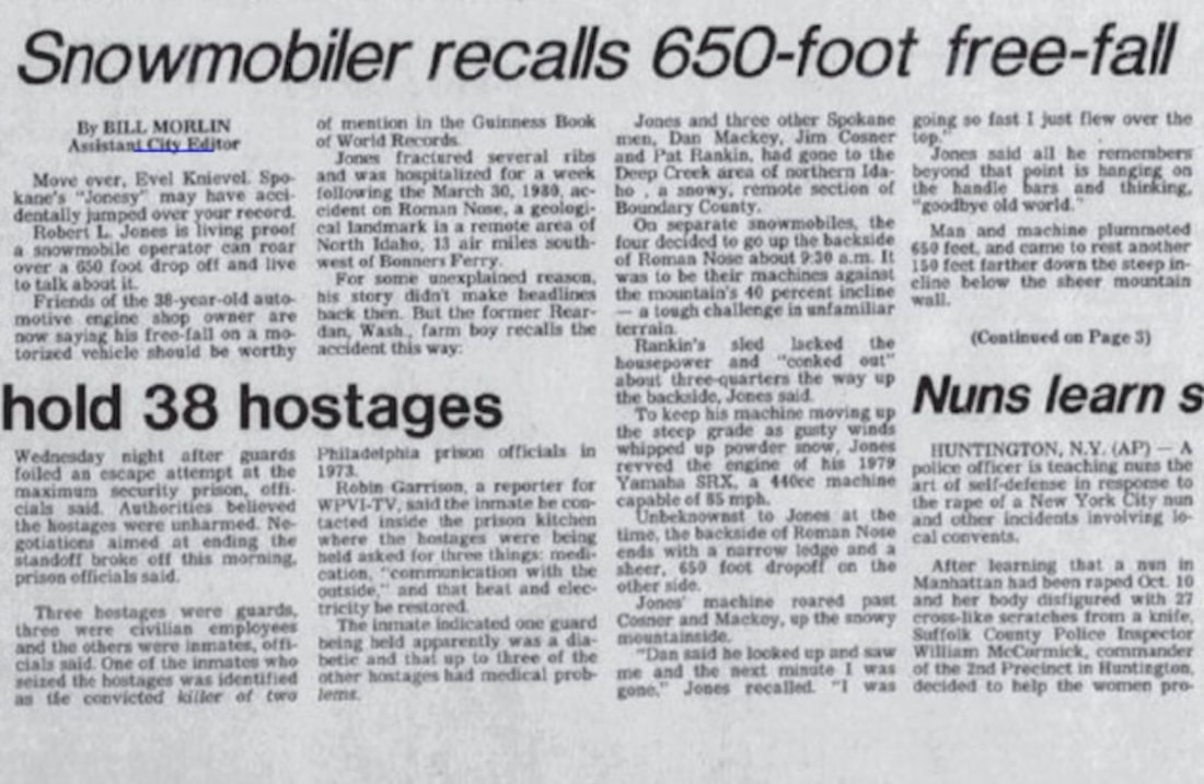
THE FOLLOWING NEWSPAPER ARTICLE IS FROM A 1981 ACCIDENT
CAN YOU IMAGINE WHAT WAS GOING THRU THIS SNOWMOBILER'S HEAD AS HE FLEW 650 FEET
I DIDN'T CROP THIS STORY TO PRESERVE SOME QUALITY
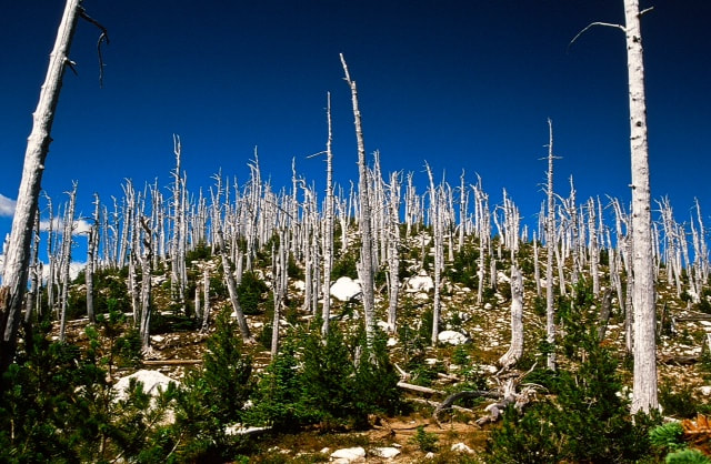
THE HISTORY OF THE SUNDANCE FIRE 9.23.1967
History - The Sundance Fire in the Selkirk Mountains by Bob Gunter The Selkirk Mountains still show scars from the devastating effects of the Sundance fire. The fire started on August 23, 1967 with a lightning strike on Sundance Mountain near the Sundance lookout tower in Bonner County. The mountain is 6,298' high and is located four miles east north east of Coolin on Priest Lake. The initial blaze was contained after burning 35 acres but it was not completely extinguished. One week after the initial blaze the winds increased and fanned the smoldering flames into action. The fire jumped the lines and burned two thousand acres by August 30. When things looked as bad as they could get the worst possible thing happened. The summer had been particularly hot and dry and there had been little or no rain. High winds hit the area and some observers said that it was as if the forest exploded in front of the wind driven flames. The fire moved with such force that on September 1 it traveled approximately sixteen miles in nine hours, destroying over 55 thousand acres of land and about 10 million board feet of lumber. In the Pack River Valley the fire created its own winds causing an inferno known as a "fire storm." The winds were strong enough to snap large trees and enough heat was generated to split large granite boulders. Two thousand men fought the fire with shovels, bulldozers, and planes. Two firefighters died while trying to save a bulldozer and many others had narrow escapes. On September 2 the fire began to slow and the winds changed for the better. Eventually the rains came and the fire was controlled in mid September, but not before it had burned nearly fifty-six thousand acres of land and caused tremendous loss to cattle and wildlife. At the time the Sundance fire was called the most destructive fire in Idaho in 50 years. There were reports that an even more dangerous fire had been avoided. At the same time the Sundance fire was burning there was a second fire burning out of control about 30 miles north of Trapper Peak. There was also a third blaze on Caribou Creek that had been confined to 30 acres. If the Caribou Creek fire had gotten out of control the three fires would most likely have merged and much of North Idaho would not be the place of beauty it is today.