EVENT TYPE: Day hiking, backpacking, hut stays, world class rock climbing. DISTANCE: About 10.5 miles RT to Cobalt Lake. Conrad Kain Hut about 6.2 miles RT, but it takes most of a day, and is very scenic. ELEVATION GAIN: Cobalt Lake, 2297’. Conrad Kain Hut, 2640’ DIFFICULTY: Moderately Difficult and complicated to the hut MAPS: Howser Creek. 82K/10 topo GPS: Conrad Kain Hut 50°44’15” N 116°45’458” W
DESCRIPTION:
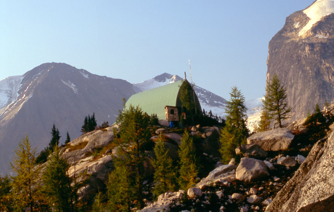
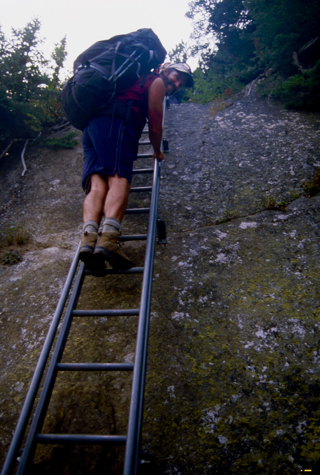
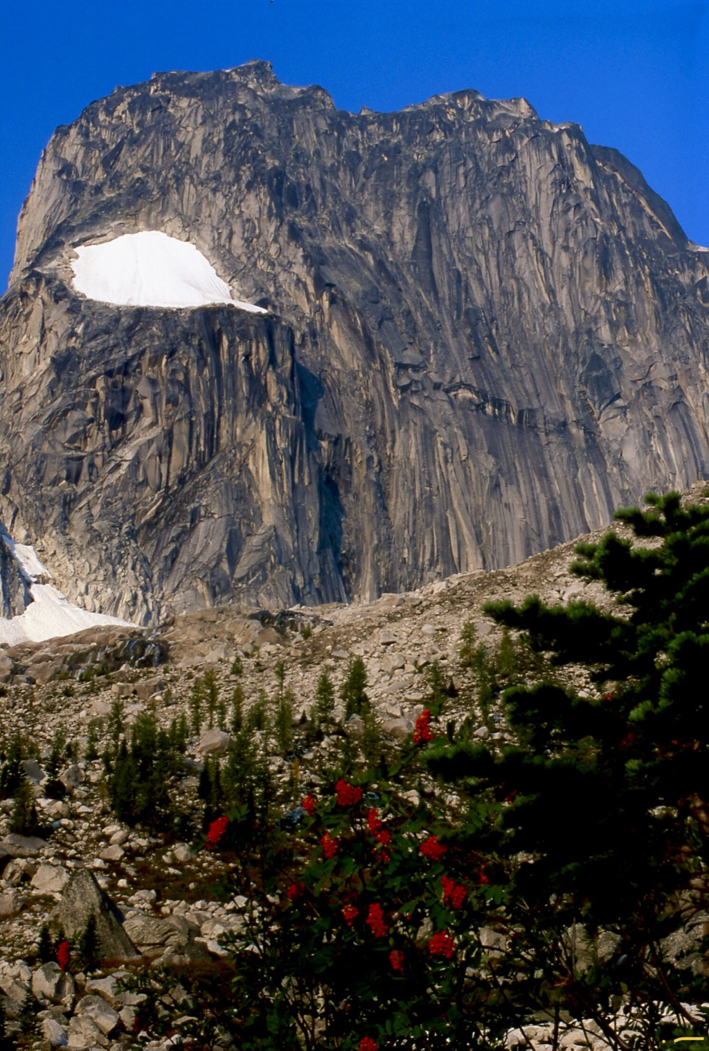
T he Conrad Kain Hut sits on a shelf below the Snowpatch Spire. To the Conrad Kain Hut...This trail starts in the parking lot, that follows the northern lateral moraine of Bugaboo Glacier. The trail is very steep and strenuous , with exposure to steep drop offs as it climbs through granite bluffs. But it’s only 3.1 miles, so take your time and enjoy. Extreme caution should be use along this route. Strong reliable footwear is essential. After a short distance, you will become enamored with this trail. As stated above this trail has some exposure. You will edge along the side of a cliff, protected by chains to use as hand holds. At one point the trail comes to a very sturdy metal ladder drilled into the cliff face. The ladder is so stout, you could put a hiker on each rung, and it would not distort. Further up this trail the views become spectacular. Each creek crossing has some sort of a bridge to make crossings safer. Once you get up towards the hut, you will wonder thru beautiful meadows, filled with small streams and an abundance of wildflowers. Just below the hut, you get your first view of the hut, which sets on the edge of a cliff. Up behind the hut is the Snowpatch Spire.
OPTION #1:
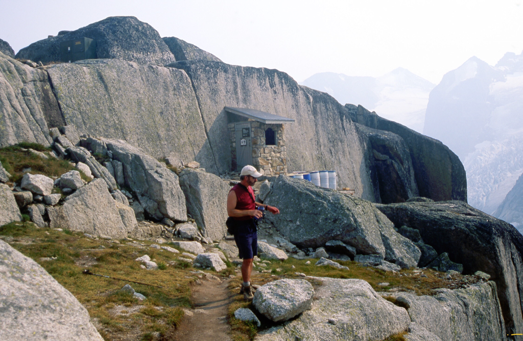
While staying at the Conrad Kan Hut, I asked the hut manager about hiking within the park. He suggested that we hike the area up to the Eastport Spire, where there is a campsite and one of the most beautiful outhouses you will see in the mountains.
OPTION #2:
Another hike we did, was to hike west towards the glacier next to and below the Snowpatch Spire. After dropping down as far as we could, we turn up hill and walked along the stream coming out of the glacier. The photography was incredible. The stream falls rapidly down the scoured rock to the valley below. The stream bounces and splashes on its path, and creates water features you can only see in nature. We walked up along side the stream as it tumbled past us, all the way to the Snowpatch Spire, enjoying lunch along the way. Once at the spire, we hiked a climbers trail back down to the hut. If you go to hike in the Bugs, don’t miss the glacier stream hike.
OPTION #3:
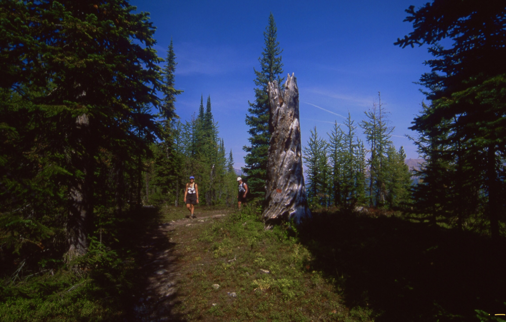
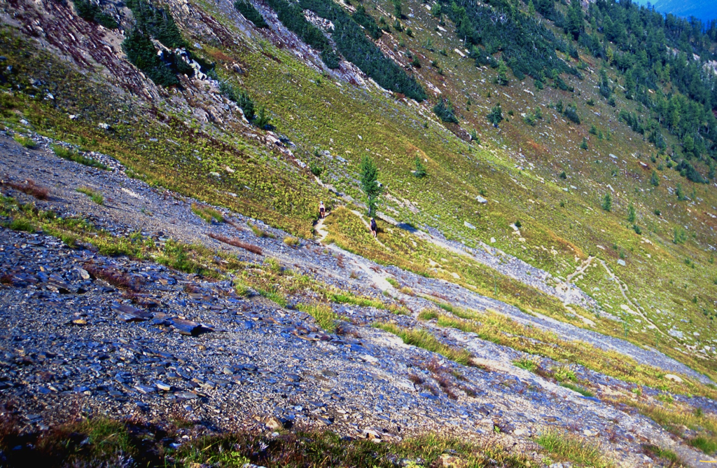
Another hike you should do while at the Bugs, is the Cobalt Lake Hike. The trial to Cobalt Lake starts across the road from the Canadian Mountain Holiday’s Lodge. The trail will enter an Alpine Larch forest that holds many switchbacks, until it wonders thru an open high meadows. After many more switchbacks, the Bugaboo Spires come into view. You are now on the Cobalt Ridge, about 2 miles from the lake. We stopped here for lunch with a view. The next day we were hiking into the Conrad Kain Hut, and one of our hiking partners was pregnant. Even if you only go to the Cobalt Ridge for the views, the hike is well worth the effort.
DIRECTIONS:
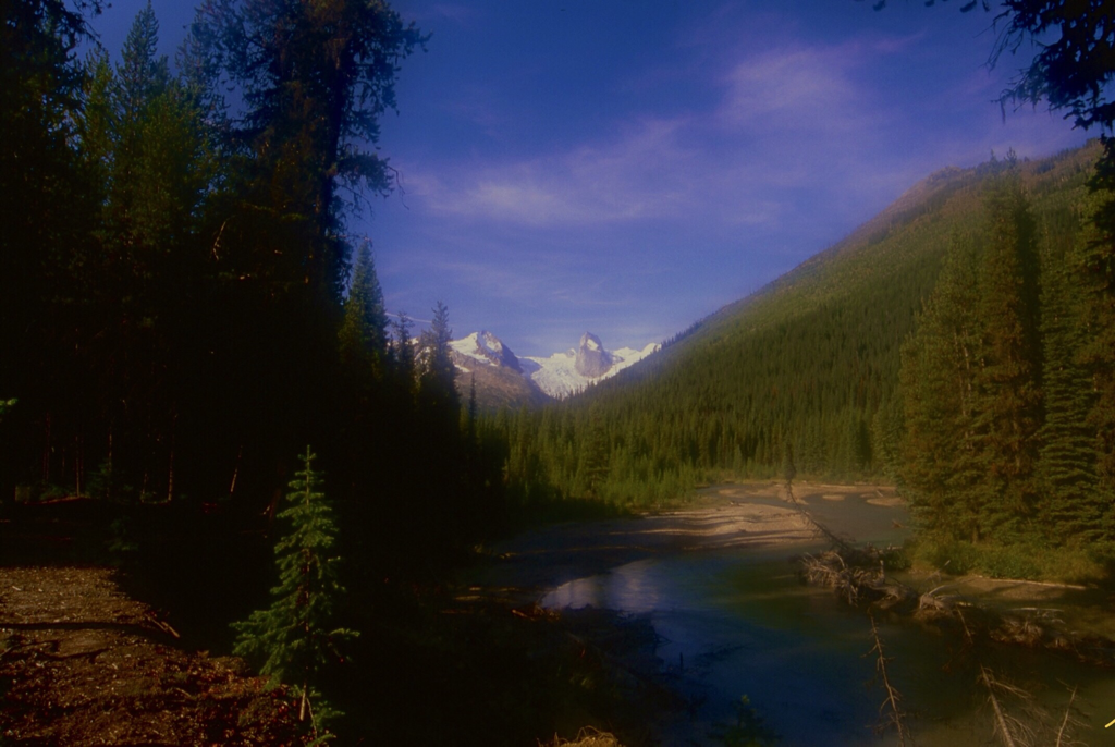
From Radium Hot Springs, drive 17 miles north on Hwy 95 to Brisco. From Brisco, drive .3 miles on the Brisco Road, and turn right at the Brisco Wood Preserver for .2 of a mile where the road turns left, still on Brisco Road. Stay on Brisco Road for 1.4 miles and turn right to Brisco Mountain Road, where you will come to a T where you turn right again, staying on Brisco Road to the Westside Road, where you turn left onto Westside Road. Drive about almost 2 miles to a right hairpin turn, where you turn onto Bugaboo Creek Road. Drive until you come to the Leadqueen Francis Road, where you stay on Bugaboo Creeek Road to the right. Follow the Bugaboo Creek Road to the trailhead. After about 30 miles from Brisco, look for the Bugaboo Creek Forest Road, where you will find the Bagaboo-Septet Recreational Site, and campground just down this road a ways. The trailhead is back on Bugaboo Creek Road about 2.5 miles from camp.
HAZARDS:
THE ROAD TO THE BUGS PARKING AREA IS THE CRUZ OF THIS OUTING. PLEASE USE CAUTION. High clearance vehicles are recommended. DRIVE SLOW AND CAREFULLY. Be aware that this short 3.5 mile trail is steep, rugged and incredible beautiful. Please pay close attention when you are hiking this trail.
COOL THINGS CLOSE BY:
Yoho N.P., Kootenay N.P., Radium Hot Springs, Golden B.C., Lake Louise, Banff, Glacier N.P. Of Canada, and Mt. Assiniboine.
R & P:
NA
PLAN YOUR TRIP:
Click for Current NOAA Weather Conditions
PHOTO GALLERY
SNOWPATCH SPIRE FROM SEPTET CAMPGROUNDS
SHEA, TIA & CHRIS HIKING TOWARDS COBALT LAKE
THE TRAIL TO THE VIEW OF THE BUGABOO
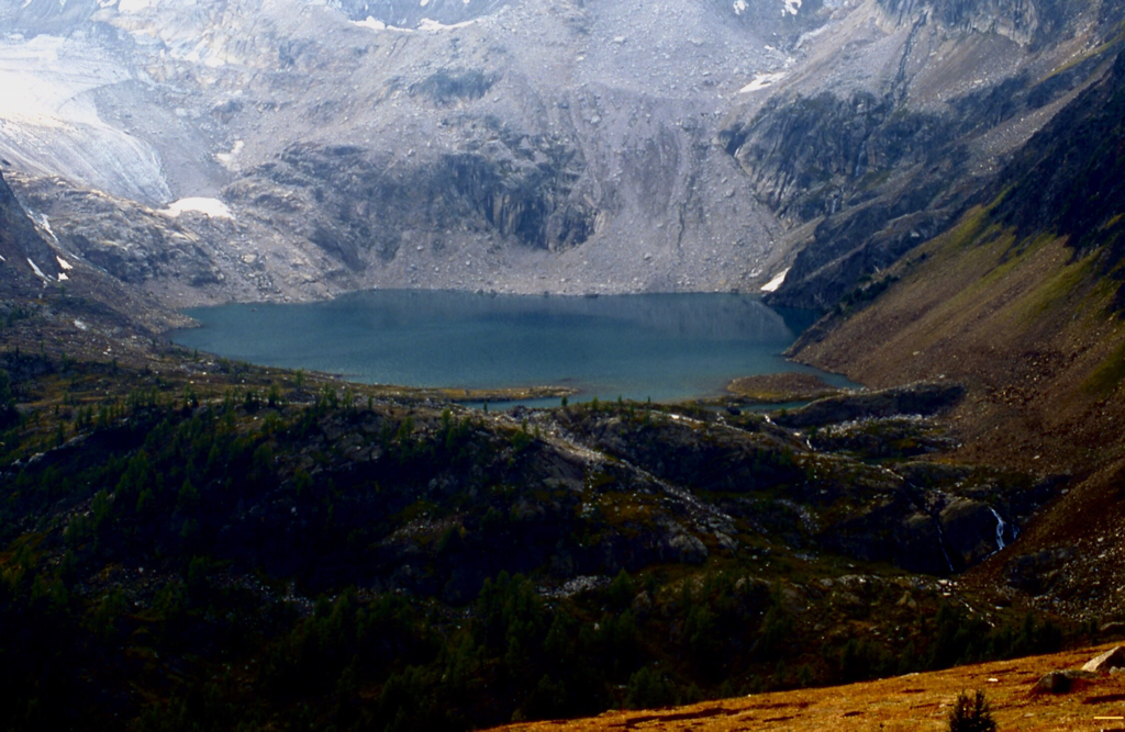
COBALT LAKE WITH THE BUGS IN THE BACKGROUND
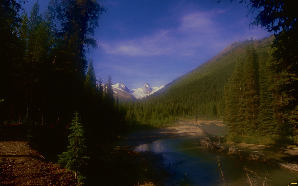
FROM HERE ON IS THE HIKE TO THE CONRAD KAIN HUT
THE BUGS FROM THE SEPTET CAMPGROUND. BE SURE TO PLACE THE PROVIDED WIRE MESH AROUND YOUR CAR, SO THE RODENTS DON’T EAT YOUR WIRING.
CHRIS CLIMBING THE LADDER WHERE THERE IS NO OTHER OPTION
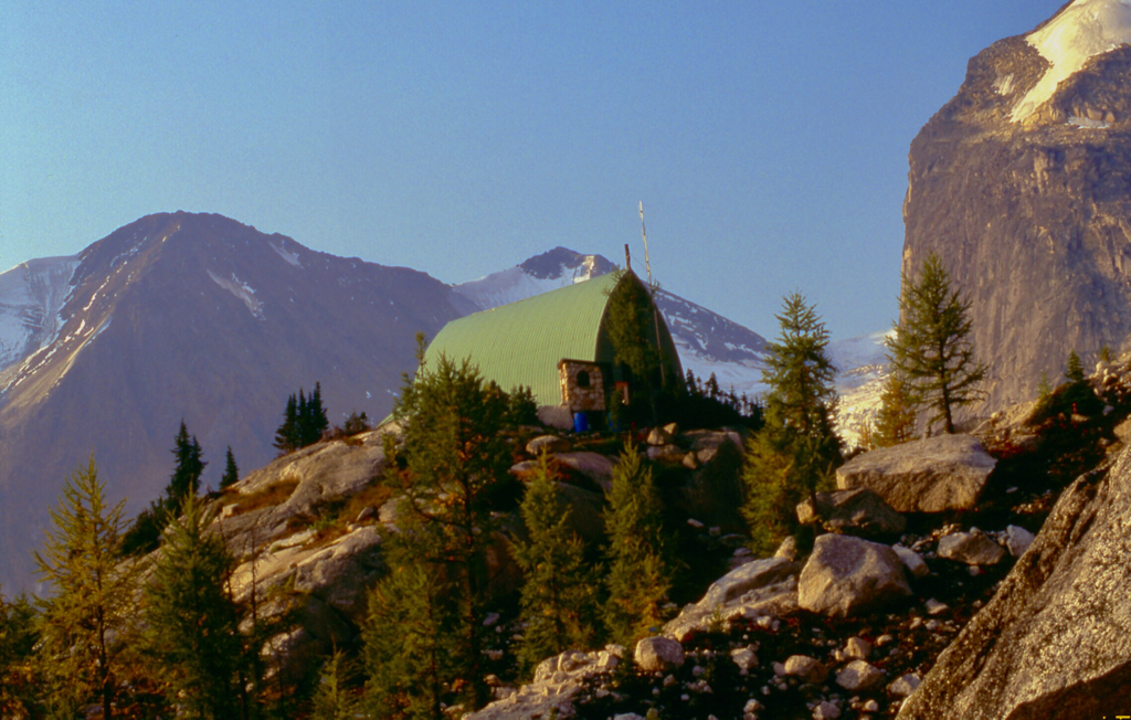
THE CONRAD KAIN HUT
WALKING UP TO THE SNOWPATCH SPIRE
UP HIGH ON THE EASTPORT SPIRE, SITS AN UNUSUAL OUTHOUSE NEAR A CAMPSITE. THE BLUE BARRELS ARE HELICOPTERED OUT IN SEPTEMBER. A POOP WITH A VIEW
ADDITIONAL INFORMATION ABOUT THE BUGS
Bugaboo is a first-class mountaineering region, situated in the rugged Purcell Mountains in the BC Rockies region of British Columbia. This 13,646-hectare park encompasses extensive ice fields, the largest glaciers in the Purcells, and spectacular granite spires, some of which exceed 3,000 metres in elevation. Its challenging peaks in the northern extremity of the Purcell Mountain Range have attracted climbers from around the world since the late 1880s. Particularly popular are the North Howser Tower and the South Ridge of Bugaboo Spire, which are considered to be very difficult. The landscape is certainly breathtaking, but you shouldn’t attempt to hike or climb this region unless you are experienced, well-equipped and in good physical condition. The Purcells, bounded by the Rocky Mountain Trench in the east, are actually ancient compared to the much younger Rocky Mountains, dating back 1,500 million years when the only form of life on the planet was algae. It was not until the dinosaurs era that the Rocky Mountains were born, some 70 million years ago. Heavy snowfall of the ‘Columbia Wet Belt’ continues to support large remnants of the vast alpine glaciers that shaped the rugged Purcell Mountains. This rugged landscape was first explored between 1857 to 1860, when the Palliser Expedition conquered and named the mountains after Goodwin Purcell, the expedition sponsor. Since that time, the mountains have attracted miners, loggers and some of North America’s top mountaineers. Harmon, Longstaff, A. O. Wheeler and the renowned guide Conrad Kain visited the Bugaboo area in 1910. Kain returned with the MacCarthys in 1916 and climbed the North Howser ‘Tower’ and the South Ridge of Bugaboo Spire, which he considered his most difficult Canadian ascent. Thorington mapped the area and climbed with Kain in 1933 on Crescent Spire. In 1938 and 1939 Northpost, Eastpost and Brenta Spires were conquered. Snowpatch, beyond the techniques used in Kain’s time, was finally conquered by Arnold and Bedayn in 1940.
Climbers including Fred Beckey, Ed Cooper and Layton Kor in the late 1950s blazed the first face routes on Snowpatch, Bugaboo and Pidgeon Spires. Chouinard traversed the Howsers in 1965 and Chris Jones pioneered the 600-metre West Face in 1970. Free climbing techniques enable faster ascents, with reduced exposure to the frequent lightning storms. It also continually opens up new lines in areas where the elements of glaciers, major routes on firm rock, significant altitude and violent weather combine to create world-class challenges. Bugaboo Provincial Park is, by its very nature, extremely isolated. People contemplating a visit here must realize that it is pure wilderness without supplies or equipment of any kind. Visitors must be prepared for true outdoor living. Weather conditions can change suddenly in this area and lightning storms with hail and snow are common in summer. Only experienced climbers trained in crevasse rescue and properly roped, should venture onto the snowfields and glaciers. Ice axes, sunglasses, prusiks or ascenders with foot slings are essential. Climbers should check with park rangers before departure. A registry is kept in the Conrad Kain Hut for this purpose – and visitors convenience. The rangers will be pleased to offer assistance or any other information required. Wilderness, backcountry or walk-in camping is allowed, but no facilities are provided. Camping in Bugaboo Park in the Crescent Glacier area is restricted to tent pads situated below the Conrad Kain Hut, at Boulder Camp, and on Mount Applebee. The Conrad Kain Hut is available for overnight accommodation for a maximum of 35 persons. Reservations can be made through the Alpine Club of Canada. Propane stoves and eating utensils are provided. Visitors must bring all other necessary equipment. A nightly, per-person fee is levied during the period June 1 to September 30. Hut accommodation is not available in winter due to avalanche dangers. The Malloy Igloo is a hut that can accommodate a maximum of six persons. No facilities are provided. Climbers are responsible for their own safety, as rescue services are not readily available. Bugaboo Glacier Provincial Park is in a class of its own. Although much of the attraction of the Bugaboos is for hard-core climbers, there are a few hiking trails that cover a variety of distances and terrains, and don’t demand technical mountaineering skills. The Conrad Kain Hut Trailbegins in the parking lot and follows the northern lateral moraine of Bugaboo Glacier. The trail is very steep and strenuous. Cobalt Lake Trail leads up a steep grade to an open ridge and views of Cobalt Lake. A marked route then descends to the lake itself. Malloy Igloo Trail begins at the Conrad Kain Hut and terminates at the Malloy Igloo. Only roped parties should attempt this hike because several glaciers have to be crossed. Alternatively, access to the Malloy Igloo via Malloy Creek is also possible. Bugaboo Provincial Park is located 28 miles (45 km) west of Highway 95 at Brisco, between Golden and Radium Hot Springs. There’s good gravel road access to the park, but the roads are used by logging trucks, so check with BC Parks regarding road use and condition before embarking on the trip.