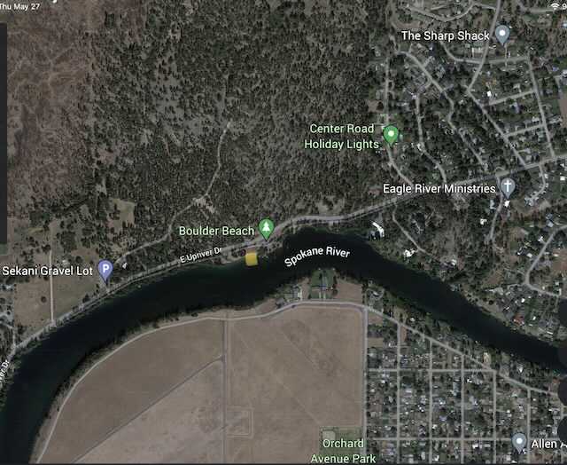
BOULDER BAY LANDING
PADDLE DISTANCE: varies
ELEVATION: 1915'
LENGTH AND ACREAGE: varies
MAPS: Spokane, Spokane County
LAUNCH GPS: 47°41'40" N 117°18'29" W
SPOKANE COUNTY SHERIFF: 509.477.2240
ELEVATION: 1915'
LENGTH AND ACREAGE: varies
MAPS: Spokane, Spokane County
LAUNCH GPS: 47°41'40" N 117°18'29" W
SPOKANE COUNTY SHERIFF: 509.477.2240
DESCRIPTION:
WE HAVE ADDED THE AREAS SHERIFF’S EMERGENCY PHONE NUMBERS FOR EACH TRIP WRITE UP UNDER THE RANGER DISTRICT INFO. IF AN EMERGENCY OCURRS, EVALUATE YOUR CIRCUMSTANCES AND CALL ONLY IF NEEDED.
Boulder Beach is a landing, not a launch. hence you can't unload power boats or jet skis.
The beach is also along the Centennial Trail west of the Camp Sekani Biking Trails.
There is a short path to carry your boats down to the water.
Boulder Beach is a landing, not a launch. hence you can't unload power boats or jet skis.
The beach is also along the Centennial Trail west of the Camp Sekani Biking Trails.
There is a short path to carry your boats down to the water.
ATTRACTIONS
Easy Access and a wide river to paddle.
DIRECTIONS:
EAST: Head north on Argonne to E. Upriver Dr., and turn left for about a mile.
WEST: From the Minnehaha Climbing Area, drive east on E. Upriver Dr. to Boulder Beach
WEST: From the Minnehaha Climbing Area, drive east on E. Upriver Dr. to Boulder Beach
COOL THINGS CLOSE BY:
Spokane River, Liberty Lake, Newman Lake, and Hauser Lake.
R & P:
NA


