SCOTCHMANS PEAK 7009’
EVENT TYPE: Day hiking, backpacking, sshoeing
DISTANCE: 8 miles RT
ELEVATION GAIN: 3700 verts
DIFFICULTY: Moderately difficult to difficult
MAPS: IPNF, Scotchmans Peak & Clark Fork topos
GPS: 48°11’18” N 116°69’16” W
RANGER DISTRICT: Sandpoint R.D. 208.263.5111
BONNER COUNTY SHERIFF: 911 or 208.263.8417
DISTANCE: 8 miles RT
ELEVATION GAIN: 3700 verts
DIFFICULTY: Moderately difficult to difficult
MAPS: IPNF, Scotchmans Peak & Clark Fork topos
GPS: 48°11’18” N 116°69’16” W
RANGER DISTRICT: Sandpoint R.D. 208.263.5111
BONNER COUNTY SHERIFF: 911 or 208.263.8417
DESCRIPTION:
WE HAVE ADDED THE AREAS SHERIFF’S EMERGENCY PHONE NUMBERS FOR EACH TRIP WRITE UP UNDER THE RANGER DISTRICT INFO. IF AN EMERGENCY OCURRS, EVALUATE YOUR CIRCUMSTANCES AND CALL ONLY IF NEEDED.
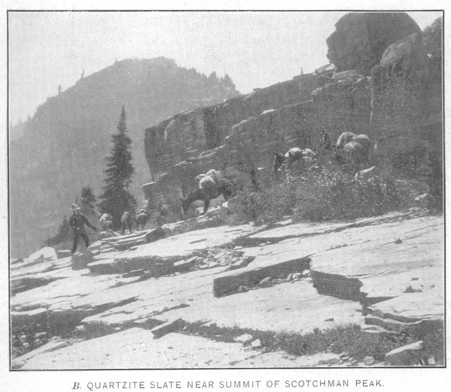
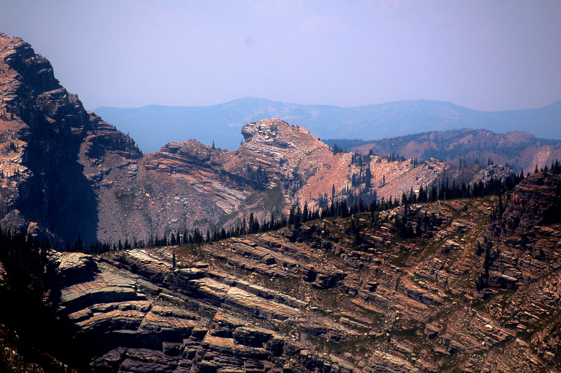
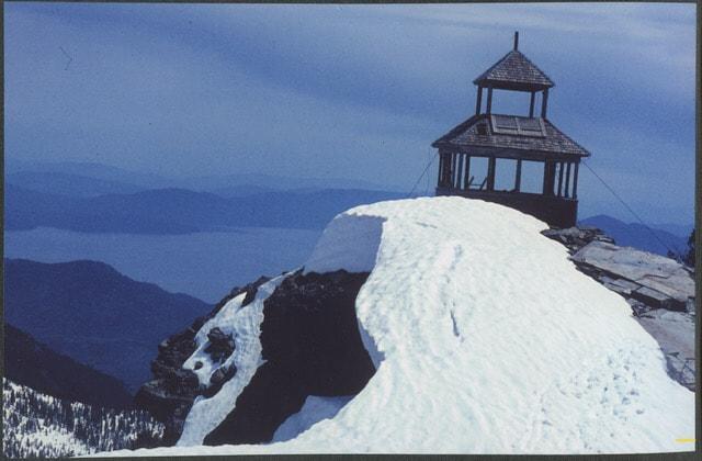
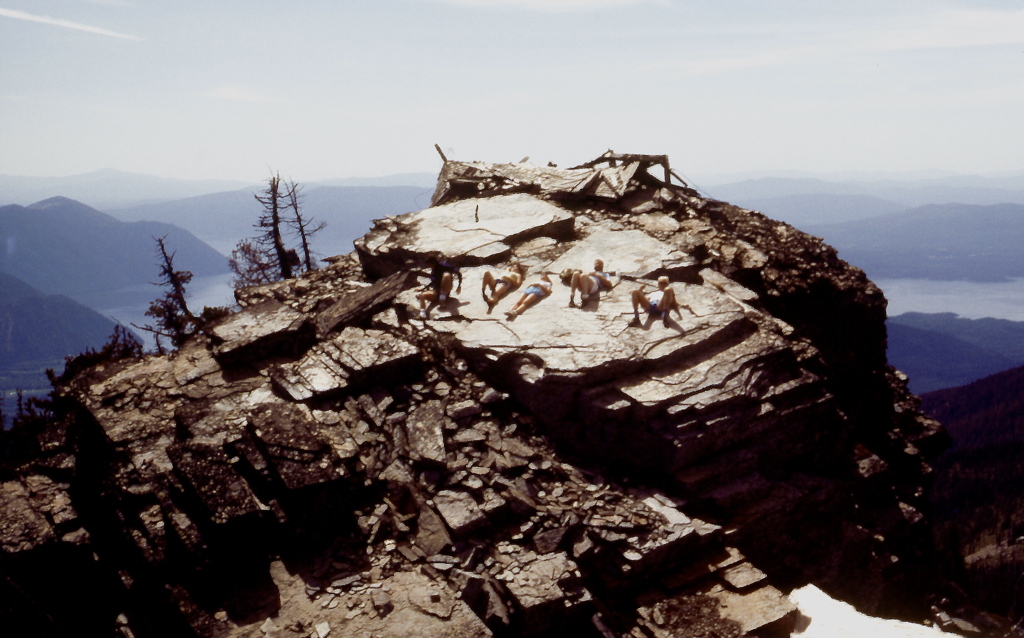
This is the “grand-daddy” of hikes in the Proposed Scotchman Peak Wilderness, and an annual pilgrimage for many local hikers. The trail is a little over 4 miles one-way, with an elevation gain is 3,700 feet. This is a short climb, but strenuous because it is steep. The well worn tread is usually in good shape and leads to the highest point in Bonner County, the top of Scotchmans Peak. Stunning panoramas of Lake Pend Oreille begin at “the meadows”, about two thirds of the way up and they continue to unfold as you reach the summit. The peak looks over, and deep into, the rugged valleys and ridges of the Scotchman Peaks area. Mountain goats are frequently encountered on the surrounding ridges and near the summit. Snow lingers late into the summer of most years.
There are some very aggressive mountain goats that frequent the upper trail and the summit area.
PLEASE, DO NOT APPROACH THE GOATS.
AND IF THEY COME CLOSE TO YOU OR OTHERS, GENTLY USE YOUR HIKING POLES TO HOLD THEM AWAY.
PLEASE, PLEASE, DO NO HARM TO THE GOATS.
AFTER ALL, YOU ARE VISITING THEIR HOME.
THEY WANT TO LICK YOUR LEGS FOR THE SALTS FROM SWEETING.
There are "Trail/Goat Ambassadors along the trail to educate visitors about goat behavior.
DIRECTIONS:
From Sandpoint, drive east on Hwy 200 to Clark Fork turn left (north) at the Chevron Station. Go past the school and continue up Mosquito Creek Road #276 to the junction of Road #2295. Turn right and go a little over a mile. Watch for signs for Trail #65. Turn left on road 2294. Turn left next on 2294A. Follow this road a little over a mile to where the road ends at the parking area. As you pass thru Clark Fork, stop by the Clark Fork Pantry for goodies. They make excellent peanut butter cookies, as well as sandwiches, breads, and have a small store for specialty goods.
HAZARDS:
This is a long, steep trial to the summit. Don't miss it, but be prepared.
Mountain Goats can be hazardous.
Mountain Goats can be hazardous.
COOL THINGS CLOSE BY:
The Clark Fork River, Johnson Creek and the Delta for paddling, Montana, Hwy 56, the Cabinet Mountain Wilderness, Star Peak, Pillick Ridge, and Bull Lake.
R & P:
Jalapeños, Burger Express, in Sandpoint The Squeeze Inn & Clark Fork Fork Pantry, in Clark Fork. This unique store sells bulk food, great sandwiches, and to die for Peanut Butter Cookies.
PHOTO GALLERY
SCOTCHMANS PEAK FROM A SPOKANE MOUNTAINEERS 1985 HIKE, LED BY CHIC.
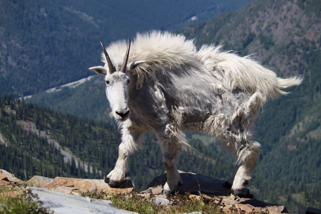
MR SCOTCHMAN
IMAGE BY
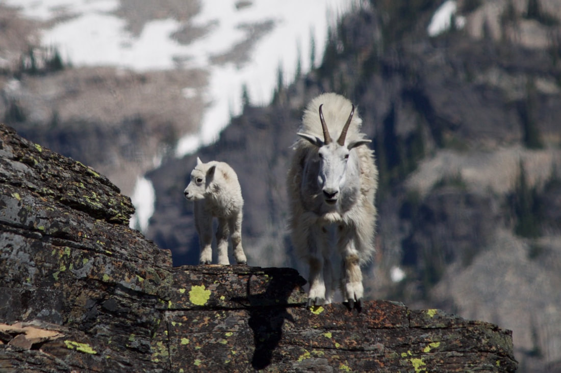
MS SCOTCHMAN
IMAGE BY