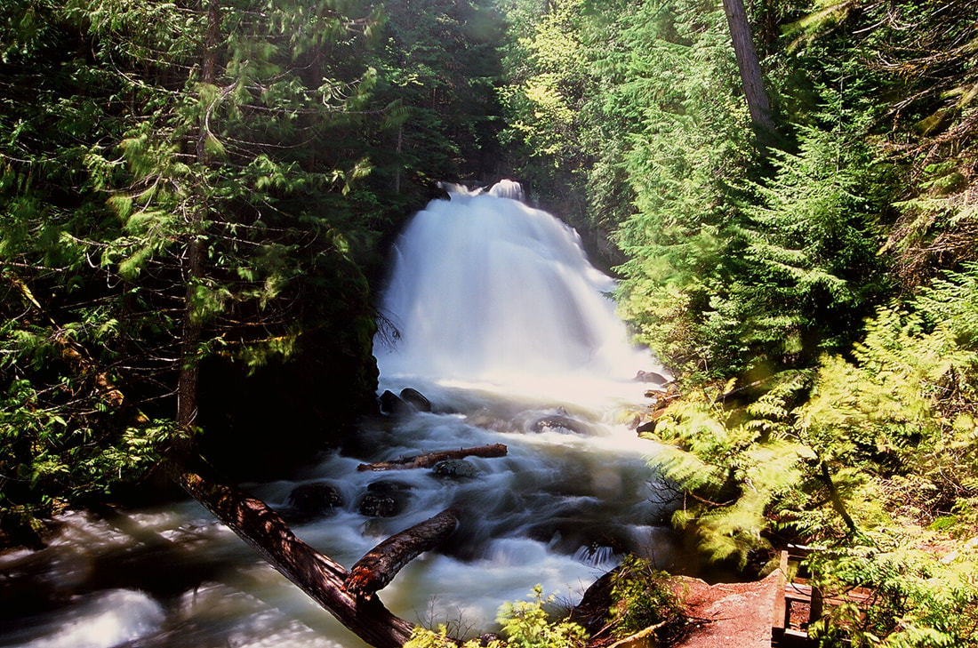
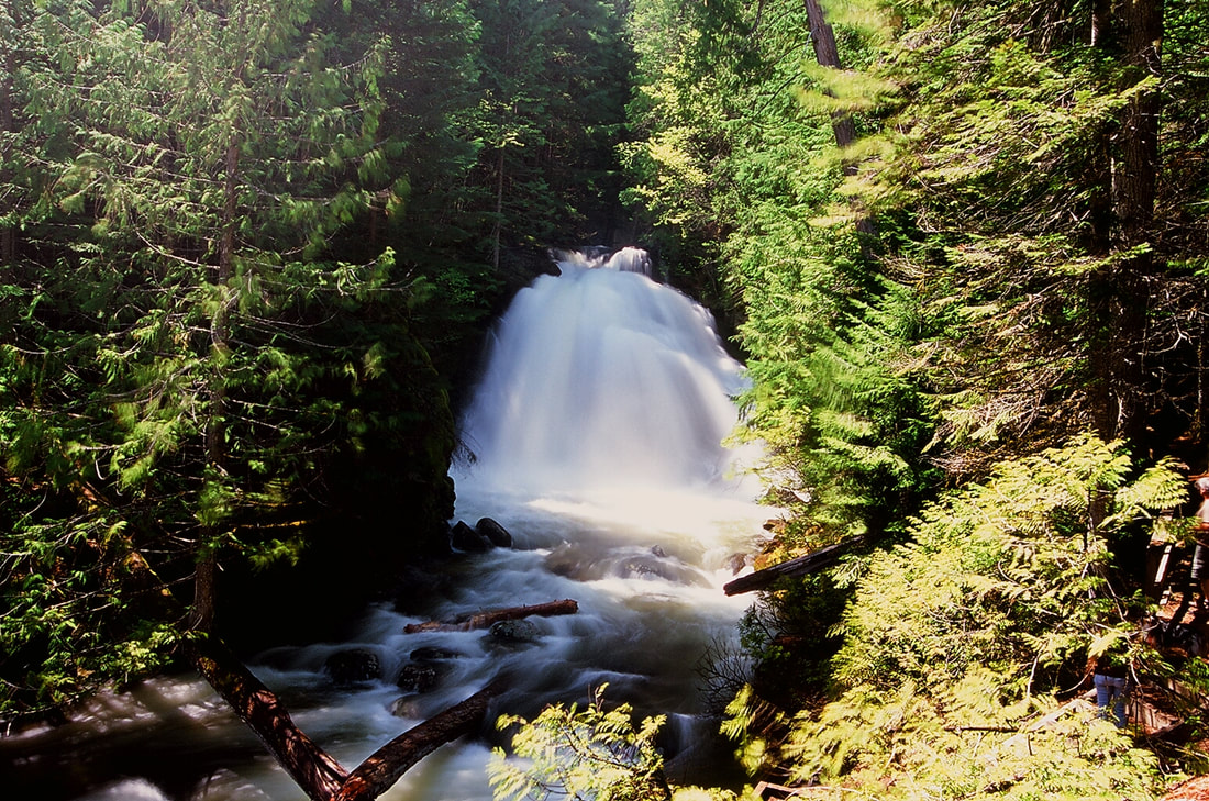
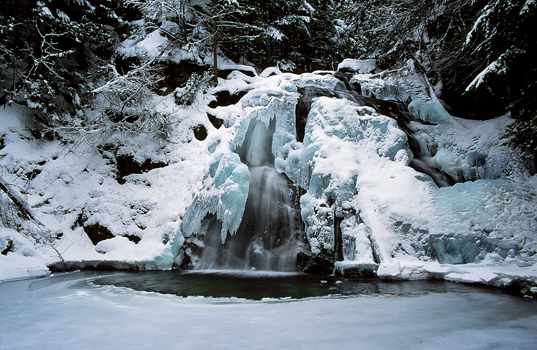
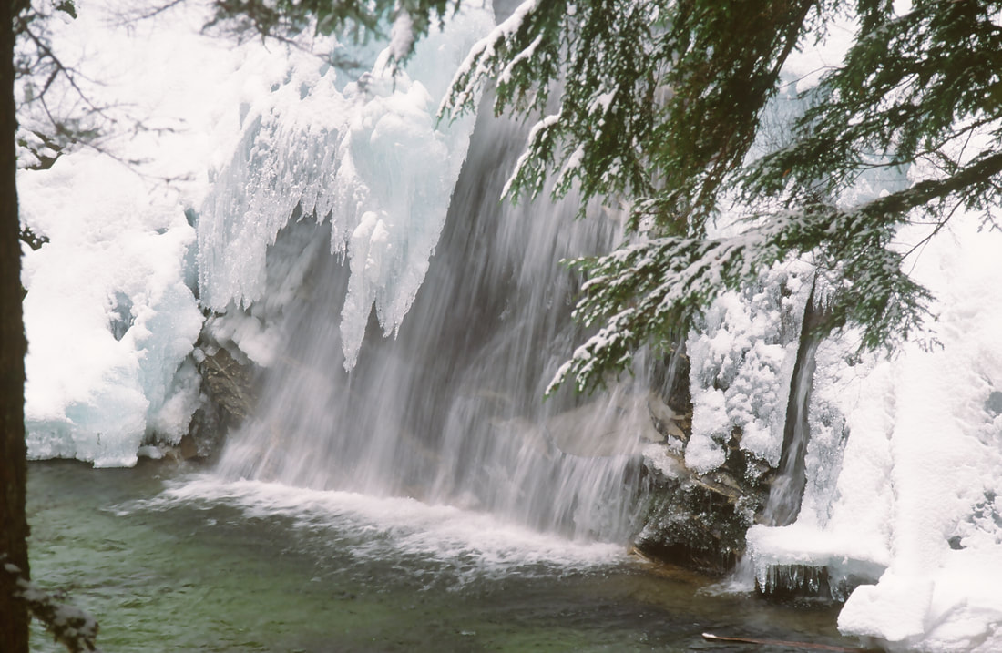
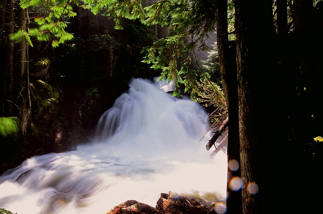
WATERFALL : L.& U. Snow Creek Falls DROP: Lower Falls about 20' Upper Falls about 30' WATERFALL TYPE: Lower is Chute Upper is a Fan DISTANCE CAR TO FALLS: T visit both falls its about 1 mile MAPS: I.P.N.F. Bonners Ferry Ranger District 208.267.5561 Roman Nose topo GPS: Trailhead. 48°??40’12” N 116°25’37” W. Falls 48°40'02" N 116°25'45" W
DESCRIPTION:
THE BEST OF THE BEST WATERFALLS IN OUR AREA.
There are few falls in our area that match the quality and beauty of Snow Creek Falls. Because its such a short walk, you should not miss it when you are in the area.
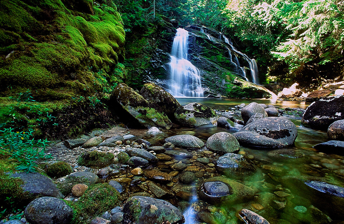
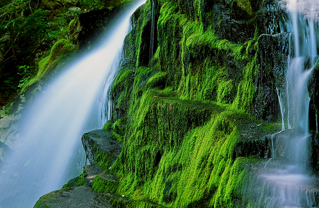
Years ago, I had to Chicwackin thru the woods just to get the falls. The USFS, Bonners Ferry Ranger District, constructed a new trail to the falls, with observation decks at both. The Upper Falls is larger and fans out wide as it drops about 30' The Lower Falls is a bit smaller, but has the same volume of water, so it gushes in a spectacular display. On the trail in, you will walk to a split in the trail. There is a bench here to sit and listen to Quiet Creek. If you go right at the "Y" you will walk a short distance to the Upper Falls. If you go left at the "Y" you will drop slightly to some stairs that lead to the Lower Falls. These falls are excellent falls to photograph in any season. So if you are in the area during winter, do not miss these falls. However, in the spring and early Summer, the creek gushes over their drops and mist is an issue. This also makes the area around the falls very slippery. DO NOT CHANGE YOUR DSLR LENSES ANYWHERE NEAR THE FALLS. PLEASE STAY ON THE DECKS. THE AREA AROUND BOTH FALLS ARE MUDDY AND VERY SLIPPERY.
DIRECTIONS:
The easiest way to get to the trailhead is to drive thru Bonners Ferry on 95. Just before you cross the Kootenai River, turn left (W) onto Riverside Street. PLEASE obey the speed limits here. Continue on Riverside Street which skirt the Kootenai River until it crosses Deep Creek. Theres a restroom here. Stay on Riverside Street until it joins up with F.R #18 (was #418 on older maps). Take a sharp left (S) onto #18, also known as the West Side Road. Drive 2.8 miles to another very sharp right turn, onto the Snow Creek Road. The Snow Creek Falls parking area is a wide spot along this road, and is well signed.
COOL THINGS CLOSE BY:
Roman Nose Lakes & Peak, Bottleneck Lakes & Peak, Snow Lake, Myrtle Lake & Peak, Myrtle Falls & the Kootenai National Wildlife Refuge, Burton Peak, Pyramid-Ball Lakes, Fisher Peak, Smith Falls, Long Mountain Lake, and Parker Peak.
HAZARDS:
ALL WATERFALLS ARE A HAZARD, DUE TO THEIR SLIPPERY NATURE. ALWAYS BE EXTRA CAREFUL NEAR ANY WATERFALL. STEPPING OFF THE OBSERVATION DECKS, CAN BE VERY DANGEROUS. PLEASE STAY ON THE DECKS AND USE EXTRA CAUTION IN WET CONDITIONS.
R & P:
Oriental Gardens, Chic--Chops (no relation), Pizza Factory, and Burger Express,