MT. ROOTHAAN 7326' AND CHIMNEY ROCK 7124' TRAIL #256
EVENT TYPE: Hiking, backpacking, and Climbing DISTANCE: 5+ miles RT Easy, to Roothaan Saddle moderate, SE Face Chimney Rock challenging ELEVATION GAIN: 1235' gain DIFFICULTY: Moderately Easy MAPS: IPNF - Kaniksu N.F., USGS - Mt. Roothaan GPS: 48° 36’ 27.5”N 116° 44’ 08.7”W RANGER DISTRICT: Sandpoint R. D. 208.263.5111 BONNER COUNTY SHERIFF: CALL 911 FIRST or 208.263.8417
DESCRIPTION:
WE HAVE ADDED THE AREAS SHERIFF’S EMERGENCY PHONE NUMBERS FOR EACH TRIP WRITE UP UNDER THE RANGER DISTRICT INFO. IF AN EMERGENCY OCURRS, EVALUATE YOUR CIRCUMSTANCES AND CALL ONLY IF NEEDED. West route to Mt. Roothaan The trail starts on Horton Ridge and climbs slightly into the forest where it gets a little steeper until it breaks out of the forest and skirts the ridge to Mt. Roothaan's Saddle. From the saddle turn right (NE) and scramble up to the high rocky peak for .4 miles in 376 verts.
From the top of Mount Roothaan, the views in all directions are worth the drive and walk. Chimney Rock sits about a mile to the NNE. Gunsight Peak continue the Selkirk Crest to the north. To the west there is a knoll along the ridge that offers good views of Priest Lake.
West route to Chimney Rock From the Roothaan Saddle walk the north edge until a trail appears and drops to the north. From here to Chimney Rock the trail is sparse and very rough over boulders to the base of the rock. To continue the hike, go to the north base of the rock and look for a narrow path around the rock. When the trail emerges from around the rock, set your compass to Mt. Roothaan. Along the east side of the rock, notice the upper top left of the face and the lighter colored rock. A few years ago a huge slab of the monolith broke off and crashed to the basin below.
As you make your way towards Mount Roothaan, the high meadows offer opportunities for wildflower and small cascades. Near Mount Roothaan, the scramble up to the top is moderately easy. To get to the saddle, follow a well used trail down the west side.
East route to Chimney Rock The trail starts on the Pack River and climbs steadily up thru the forest until it breaks out on the granite slabs. Look for cairns to get you to the Chimney. Be sure to look back to see where the trail enters the woods. This trail is 11 miles round trip with 2250 verts.. If your goal is to get to the rock, rock hop the rest of the way. For great views of the rock, find a soft place to have lunch and kick back. Retrace your steps down and pay attention to where the trail enters the woods. On this route, there are 9 switchbacks after you have walked the 1.8 mile long nearly straight stretch. Also be aware, there are 9 creek crossing of note ( not related to the 9 switchbacks). Five will be difficult in the spring and early summer.
OPTION #1:
No matter which trail you come in on, there is a cool circumnavigation around Chimney Rock, that includes the summit of Mount Roothaan. EAST ROUTE: As you get close to Chimney Rock, walk right (north) to the north face of Chimney Rock. Carefully examine the route that circles around the north face. This route requires each hiker to pay close attention to their footings and hand holds. There are enough trees and shrubs to use for support and protection as you walk around the face. In no time, you will be on the west face, and the walking becomes easier for a while. Now the chore is to find a faint “trail” that leads you up to the saddle on the west side. Once at the saddle, look for another faint trail that leads you up to Mount Roothaan. Enjoy the views from Mount Roothaan. Your next route off of Mount Roothaan leads you south, then east around the base of Mount Roothaan. From here you can hike cross country down towards the Pack River, keeping an eye out for the many trail cairns you came up on.
OPTION #2:
WEST ROUTE: As you summit the ridge line trail from Horton Ridge, you will be on a saddle with Mount Roothaan on your right (east). Look for a faint trail heading down to the NW face to Chimney Rock. This trail fades as you enter several boulder fields on your way to the rock. Once at the rock, continue north to the edge. Look carefully for a small trail that eventually leads you around the NNE face of the rock. After circling the NNE face, start your ascent up towards Mount Roothaan. Once on top of Mount Roothaan, stop and enjoy a view of the American Selkirks laid out to the north. From the summit of Mount Roothaan, head NW down to the saddle you started your descent on Trail #256 heads west back to the trailhead.
DIRECTIONS:
West route From Priest River head to the East Side Road and drive 4.5 miles to Hunt Creek Road #24 just across Hunt Creek bridge. Go 4.5 miles to a junction with FR #2, bear left and go 1.6 miles to FR #25. Stay straight for about a mile to a fork and bear right for .3 miles to another fork and bear left. About 2 miles up 25, the road is very rough. Don't try to get a car up it.
East route Drive 10.5 miles past Sandpoint to Samuel. There is a sign and a gas mart on the west side of 95. Turn left (west) up the Pack River Road #231 for 17 miles and turn left (west) onto FR #2653 to the trailhead. The USFS has not replaced the trailhead signs on the Pack River road yet, so consult a Forest Service map.
HAZARDS:
West Route West road from Horton Ridge, to Mount Roothaan’s Saddle to the base of the Chimney Rock, is a serious scree field. East Route More serious scree field East and south of Chimney Rock.
Mount Roothaan Lots of rock hopping, then more serious to summit.
Circumnavigation On any of the routes around Chimney Rock, use extreme caution while walking, scrambling, and especially circling the north face. I would advise against taking small children around the rock. It requires a great deal of concentration and effort. If you do take children on this route, make 100% sure YOU are paying attention to their every move, as well as your own footing. Have them walk in front of you to monitor their walk.
COOL THINGS CLOSE BY:
Fault Lake, Hunt Peak, Gunsight Peak, Harrison Lake & Peak, The Selkirk High Traverse, and Beehive Lake & Dome. Priest Lakes and Priest River, Hunt Creek Falls, Lion Head water slide, and of course, the Pack River itself.
R & P:
Jalapeños, Mr. Sub, Burger Express, Eichardt’s in Sandpoint
PHOTO GALLERY
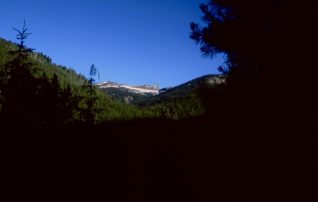
A GLIMPSE OF MOUNT ROOTHAAN & CHIMNEY ROCK FROM THE PACK RIVER ROAD
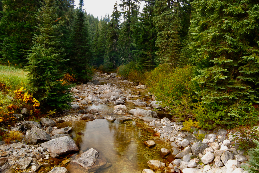
PACK RIVER FROM THE TRAILHEAD BRIDGE
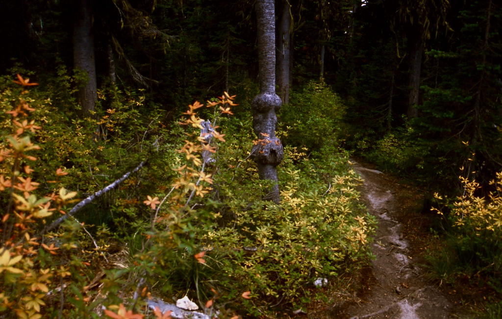
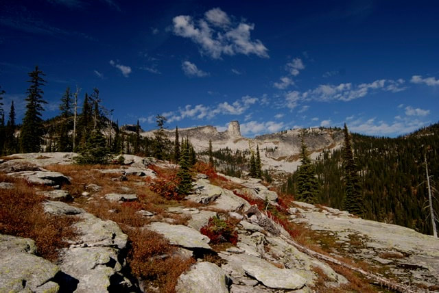
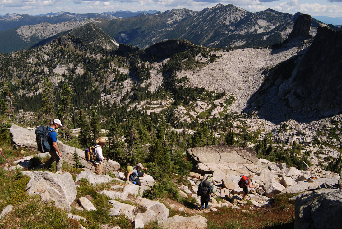
ALONG THE WEST TRAIL TO MOUNT ROOTHAAN
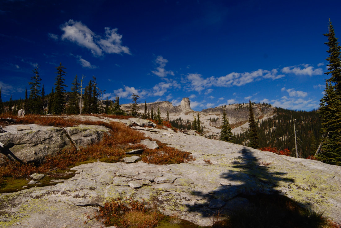
CHIMNEY ROCK FROM THE EASTERN PACK RIVER TRAIL
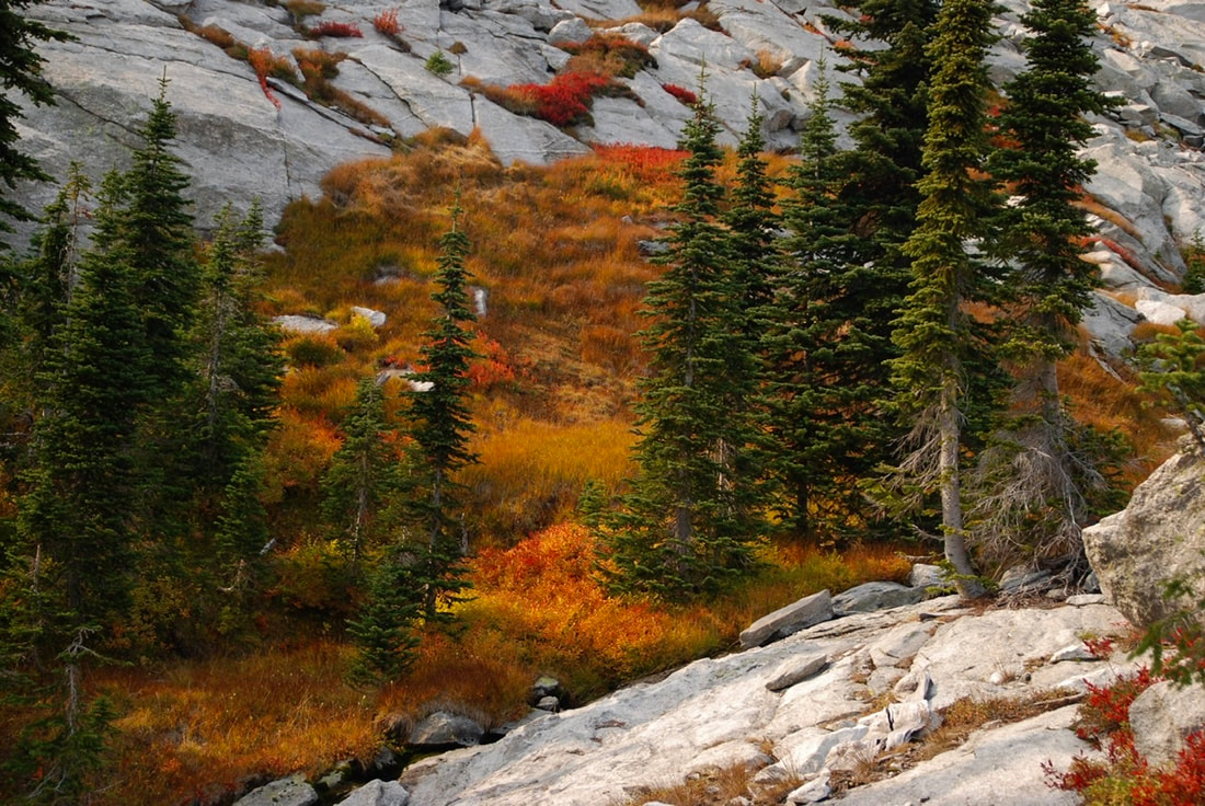
FALL COLORS BELOW THE ROCK, ARE SPECTACULAR
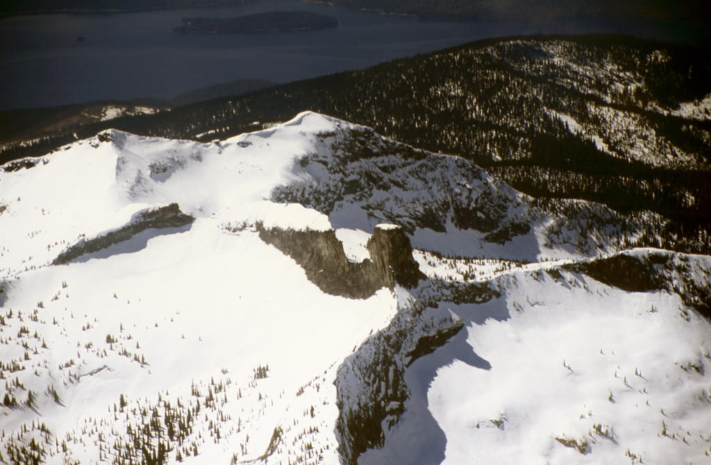
AN AERIAL VIEW OF MOUNT ROOTHAAN & CHIMNEY ROCK FLOWN BY PILOT GALEN
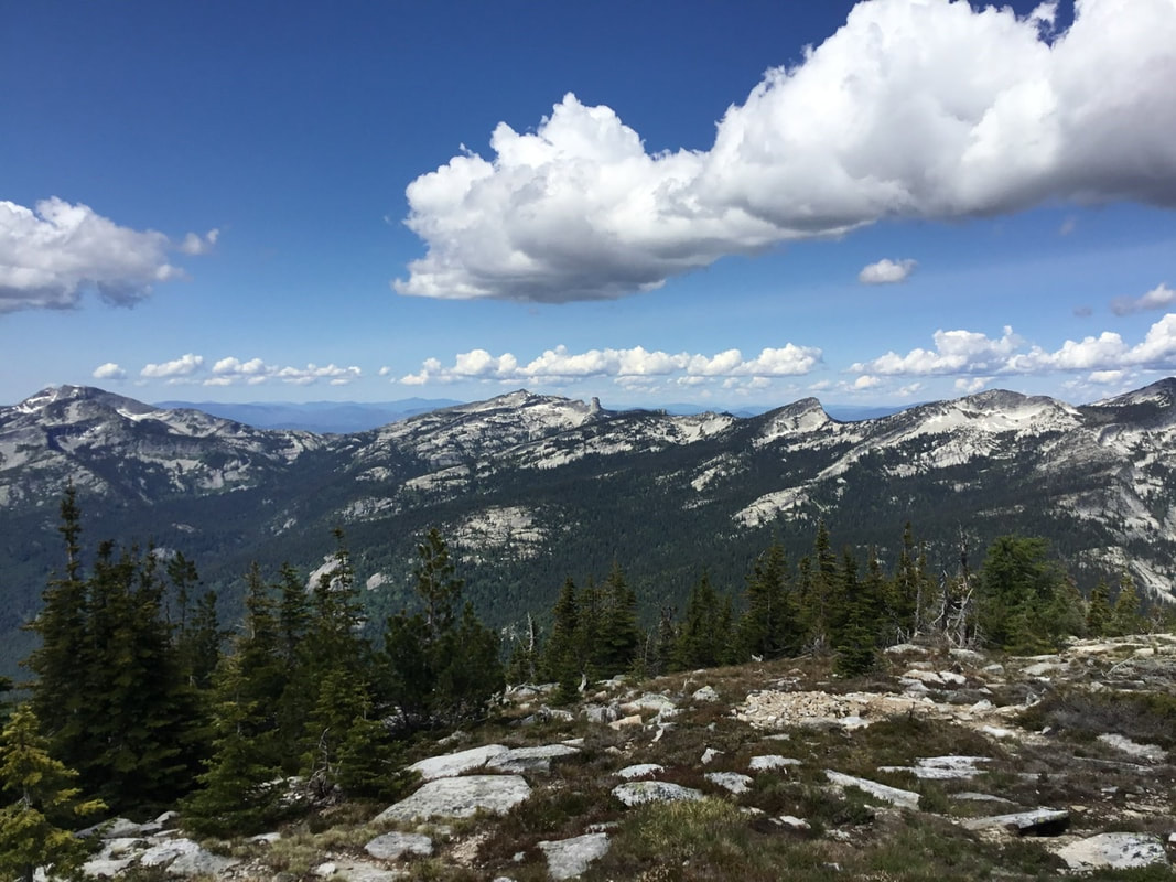
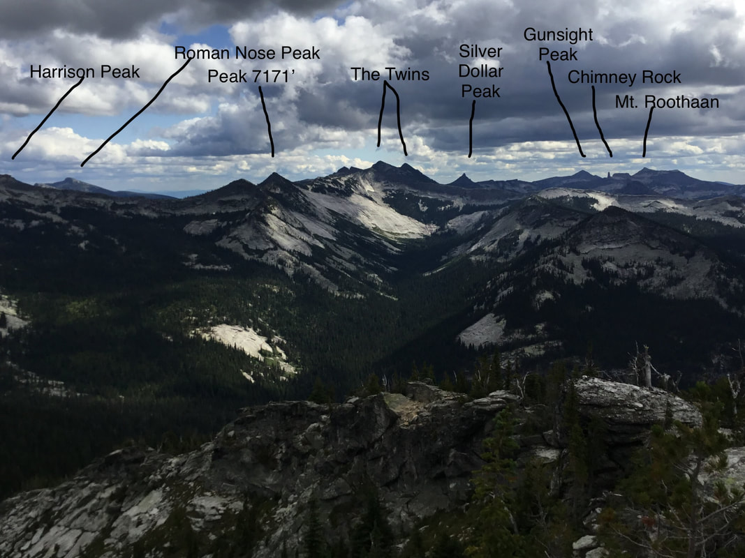
GUNSIGHT PEAK, MT.ROOTHAAN, CHIMNEY ROCK & SILVER DOLLAR PEAK FROM ROMAN NOSE PEAK
THE AMERICAN SELKIRKS WITH MT ROOTHAN AND CHIMNEY ROCK IMAGE IS FROM THE WIGS TRAIL
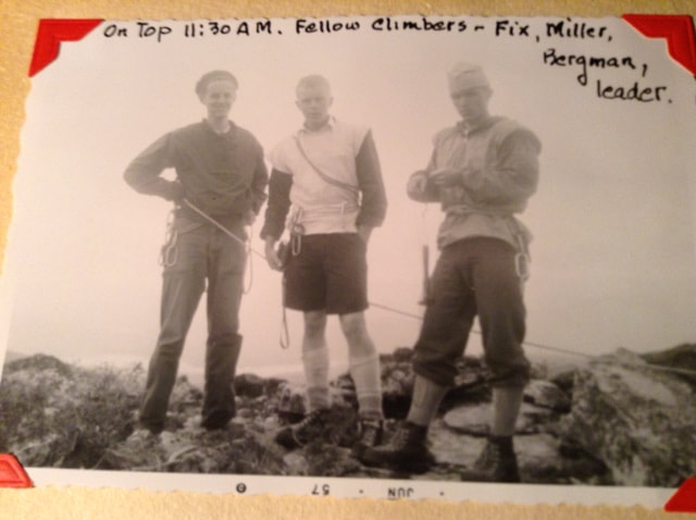
A 1957 SUMMIT OF CHIMNEY ROCK BY SPOKANE MOUNTAINEERS
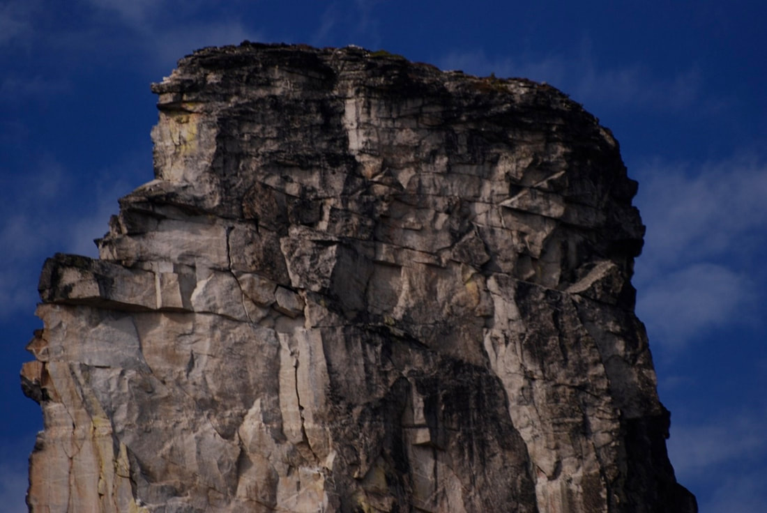
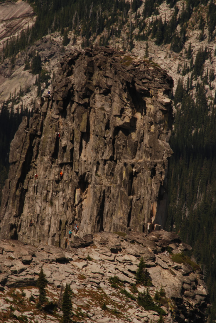
THE EAST FACE OF CHIMNEY ROCK, AFTER THE HUGE ROCK SLAB FELL
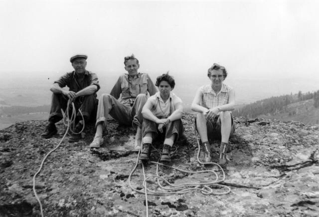
SPOKANE MOUNTAINEERS, FRANK HEFFERLIN, BILL FIX, NA, HELEN STOWELL IN 6.1958
A SPOKANE MOUNTAINEERS CLIMBING PARTY HEADING TOWARDS CHIMNEY ROCK
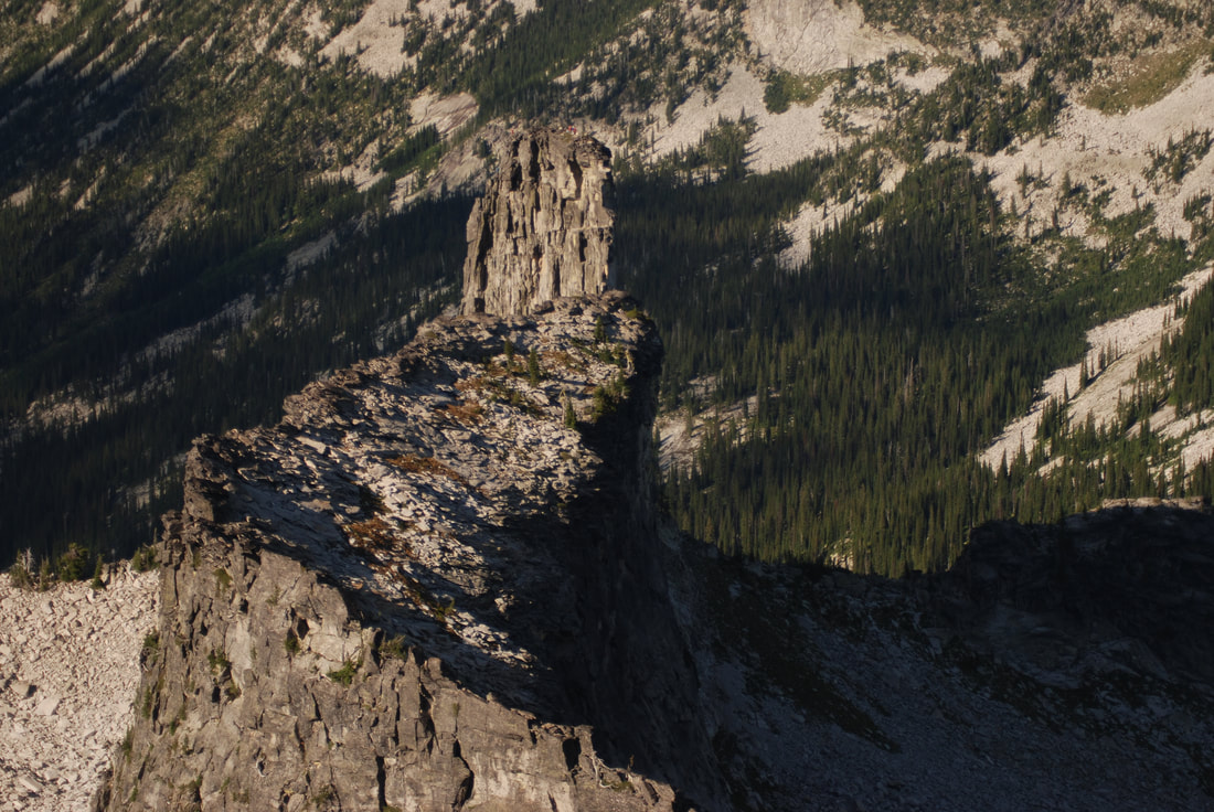
CHIMNEY ROCK FROM MOUNT ROOTHAAN
A SPOKANE MOUNTAINEERS CLIMBING PARTY HEADING TO THE SUMMIT
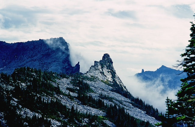
FROM ALONG THE SELKIRK CREST HIGH TRAVERSE, CHIMNEY ROCK & MT. ROOTHAAN IN BACK