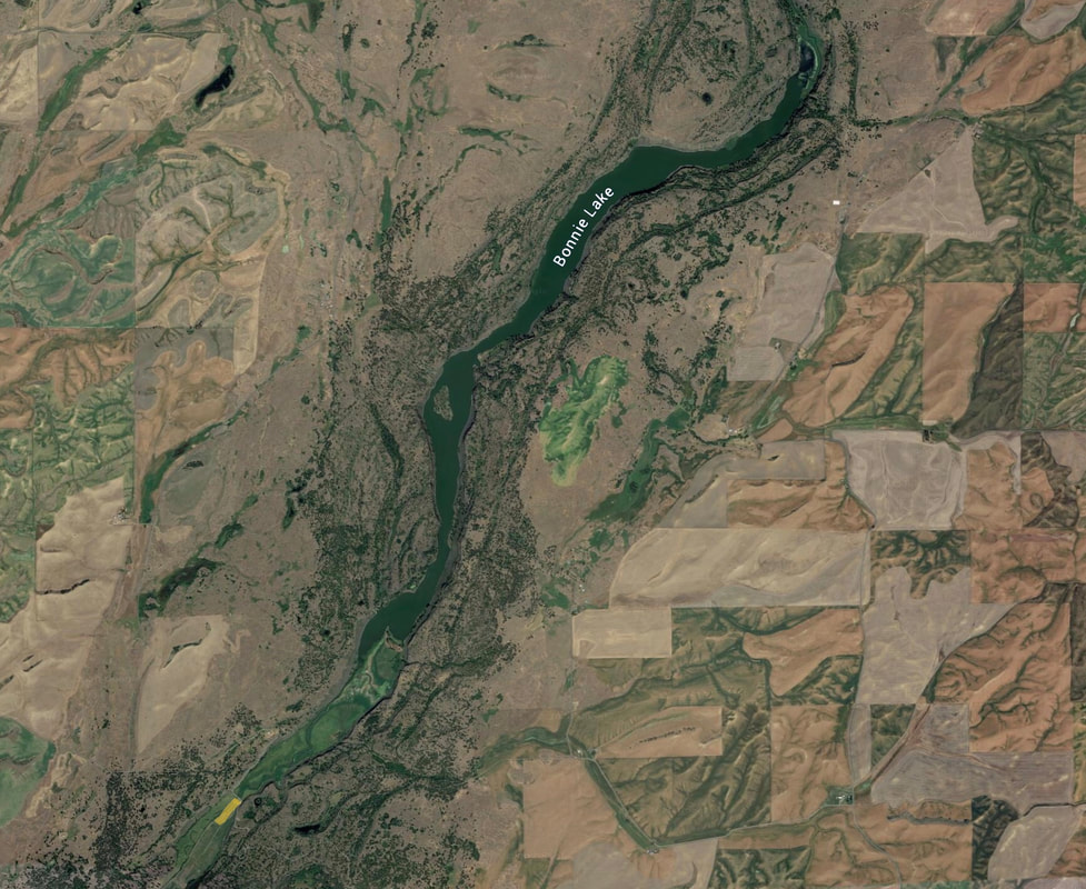
BONNIE LAKE LANDING
PADDLE DISTANCE: 5.4 includes Rock Creek paddle
ELEVATION: 1798’
LENGTH AND ACREAGE: 5.4 miles long. 5,127 acres
MAPS: Chapman Lake, Pine City, Rock Lake topos, Spokane & Whitman County Maps
LAUNCH GPS: 47°14’22” N 117°35’45” W
SPOKANE COUNTY SHERIFF: 911 or 509.477.2240
ELEVATION: 1798’
LENGTH AND ACREAGE: 5.4 miles long. 5,127 acres
MAPS: Chapman Lake, Pine City, Rock Lake topos, Spokane & Whitman County Maps
LAUNCH GPS: 47°14’22” N 117°35’45” W
SPOKANE COUNTY SHERIFF: 911 or 509.477.2240
DESCRIPTION:
WE HAVE ADDED THE AREAS SHERIFF’S EMERGENCY PHONE NUMBERS FOR EACH TRIP WRITE UP UNDER THE RANGER DISTRICT INFO. IF AN EMERGENCY OCURRS, EVALUATE YOUR CIRCUMSTANCES AND CALL ONLY IF NEEDED.
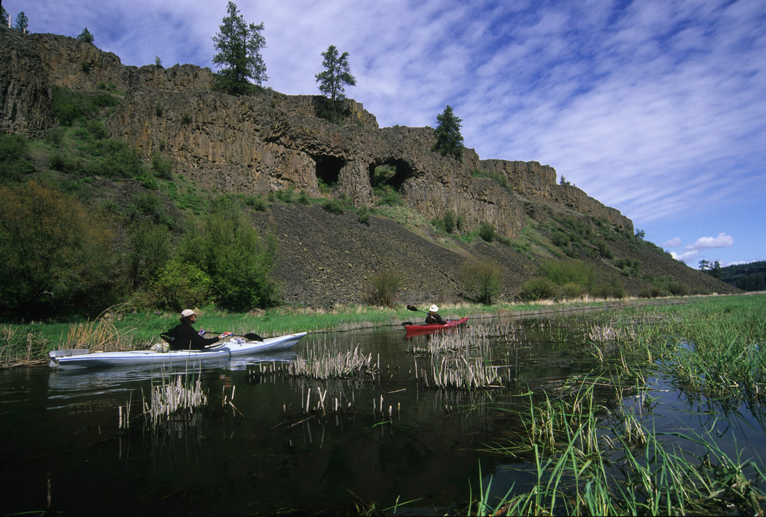
Bonnie Lake is a long lake with an island about 2/3rds the paddle distance. This island has a camp ground and the only area that is public accessible, except a one square mile section surrounding the island. Please be aware, all other land around the lake is privately owned. Do not trespass.
Bonnie Lake is a long lake with an island about 2/3rds the paddle distance. This island has a camp ground and the only area that is public accessible, except a one square mile section surrounding the island. Please be aware, all other land around the lake is privately owned. Do not trespass.
ATTRACTIONS
As you paddle up Rock Creek from the put in at the bridge, look for a natural arch almost to the lake.
You will notice some of Bonnie Lakes shore lines have 600 to 800 foot walls.
As you paddle the lake, look for Turkey Vultures early in the morning sunning and warming themselves up on the rocks.
When they start to fly, you will notice that Turkey Vultures are incredible flyers. Take a moment and observe these ugly but very graceful birds in flight.
DIRECTIONS:
From the south end of Cheney, Washington turn onto the Cheney-Plaza road. After about 15 miles the road splits into Rock Lake Road going forward and the Cheney-Plaza Road going left. Continue on Rock Lake Road and turn left on Belsby Road. Continue on Belsby Road for about four miles. The road drops down into the canyon and the creek can be seen at the bottom. The put in is at the far end of the bridge on the right side. The landowner asked that people park on the wide turn at the bottom of the hill before the bridge because they have big trucks that pull out of the fields. Parked cars have blocked them in at times. Unload your gear at the bridge and park at the turn.
COOL THINGS CLOSE BY:
Rock Lake, Turnbull National Wildlife Refuge, Sprague Lake, in Sprague drive downtown and look at Dave's Antique Truck Museum.
R & P:
Lenny’s in Cheney
PLAN YOUR TRIP:
PHOTO GALLERY